Good evening, everyone. Our overachieving snow is now a thing of the past, but the overall pattern isn’t slowing down. We have some big winds and more snow chances on the way this week into the coming weekend.
The snows even went above and beyond what I thought across the northeast where some 4″ amounts were reported. Old Man Winter is in a mood and will likely overachieve anytime he gets the chance right now.
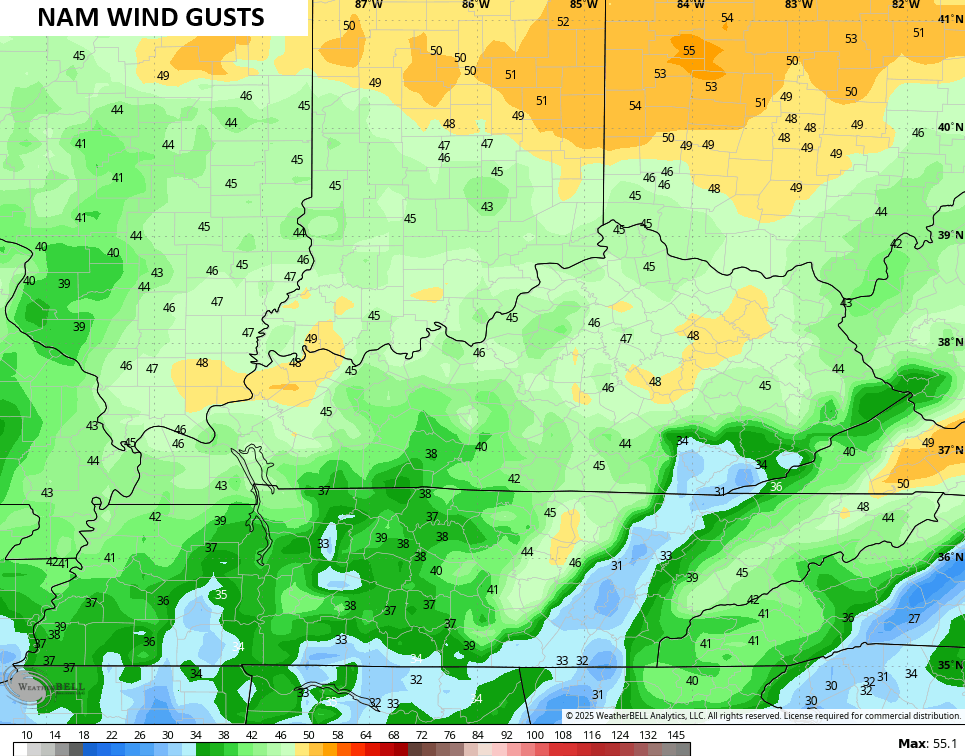
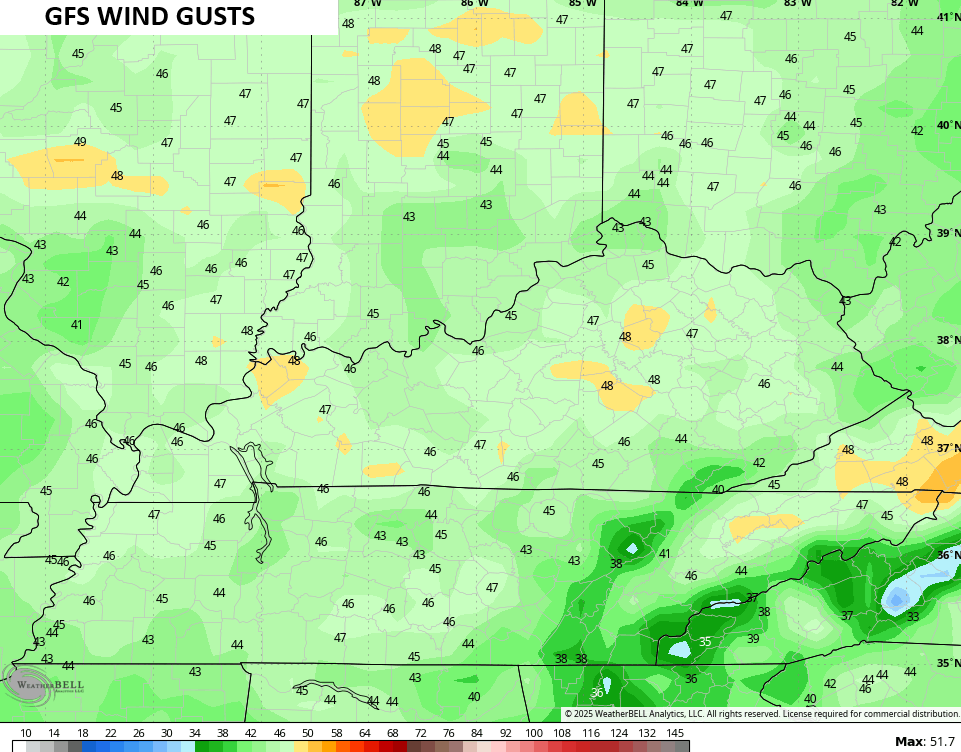
Before he has another chance to do so, we get some big winds in here later Tuesday into Wednesday. 40mph-50mph wind gusts are a good bet for much of the region ahead of an arctic front arriving Wednesday…
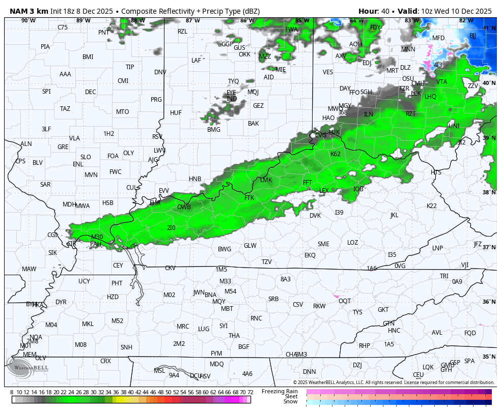
That boundary has a line of VERY gusty showers ahead of it with snow showers and a few snow squalls behind it. You can see this transition on the future radar from the Hi Res NAM that starts Wednesday morning, but only goes through 1am Thursday…
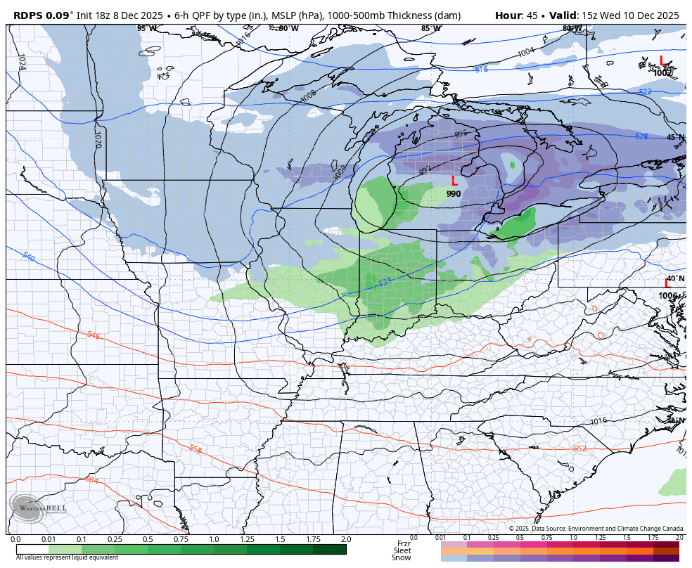
The latest from the Short Range Canadian shows the snow showers and a few squalls getting a booster shot from Lake Michigan. This also gets to the beginning of the Thursday night/Friday light snowmaker…
That’s a system that will likely put down accumulating snows into Friday. It will then be followed up by the chance for a bigger system on Saturday and Saturday night. All the models are seeing this, but vary greatly on what to do with it.
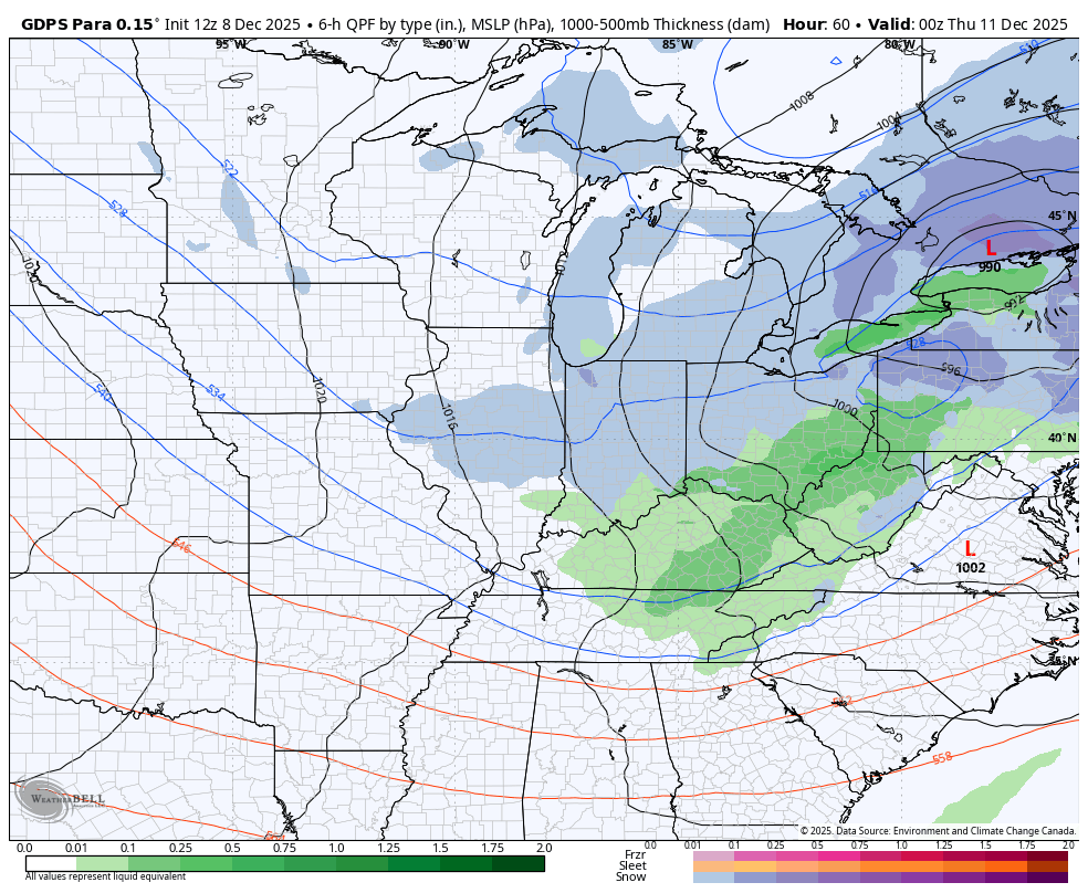
The Parallel Canadian gives us a look at all three systems from Wednesday through Sunday…
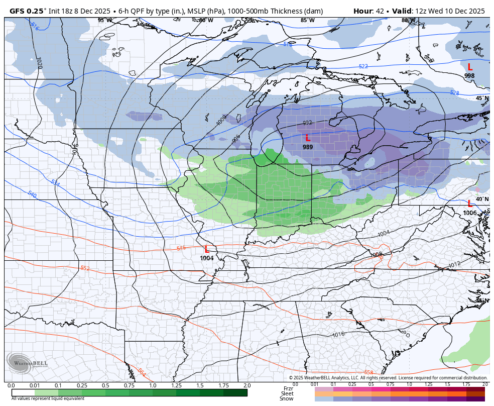
The GFS is seeing the first two well, but is lighter with the weekend system…
Don’t be surprised if we don’t see more of a phased solution showing up over the next few days.
The full update comes your way later tonight. I’ll also have a few updates on my Meteorologist Chris Bailey Facebook Page
Until then, here are your tracking tools for the day…


Make it a great evening and take care.
