Good Tuesday, everyone. We’re getting ready for a super windy period taking shape tonight and Wednesday. That wind is ahead of another arctic front that has snow showers and a few squalls behind it. From there, things get interesting for Thursday night and Friday then again over the weekend.
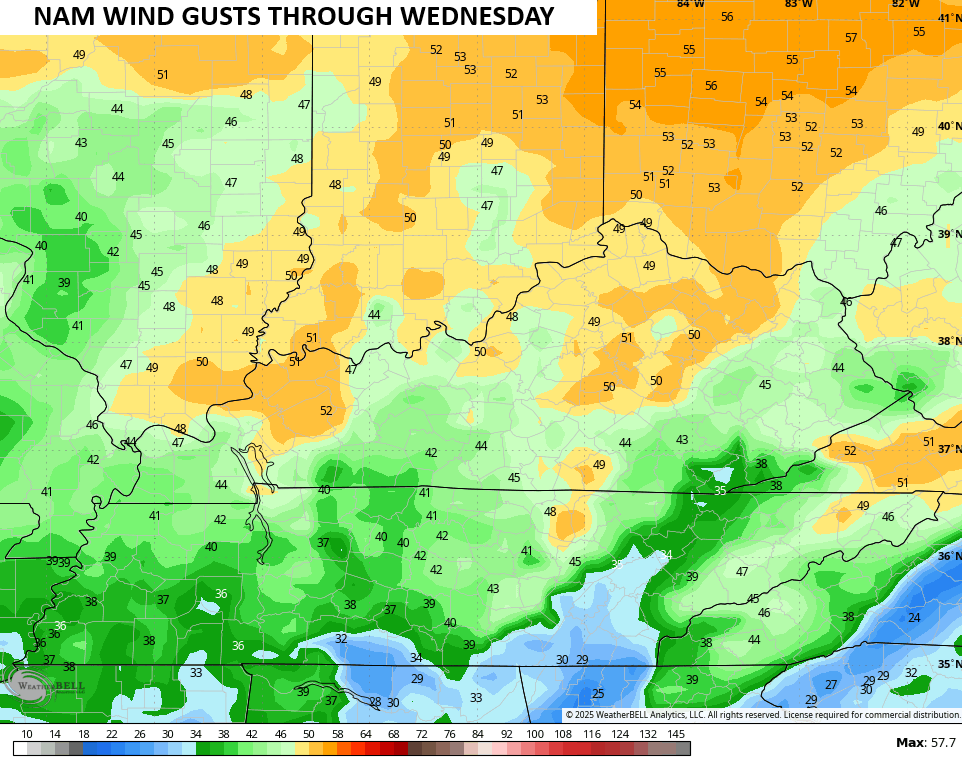
This strong southwest wind should crank as the day wears on with gusts tonight and early Wednesday cranking better than 40mph. Most of the models suggest the potential of gusts approaching 50mph at times.
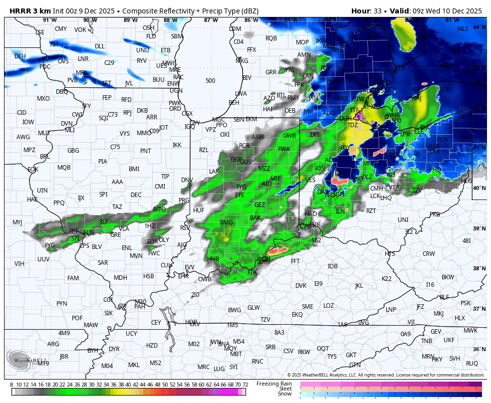
That cold front moves in on Wednesday with gusty showers ahead of it and snow showers and the chance for a squall or two behind it. Lake Michigan may even send a little snow toward the southeast and into parts of our region Wednesday night and early Thursday.
The future radar from the HRRR only goes through 7pm Wednesday and shows what I’m talking about…
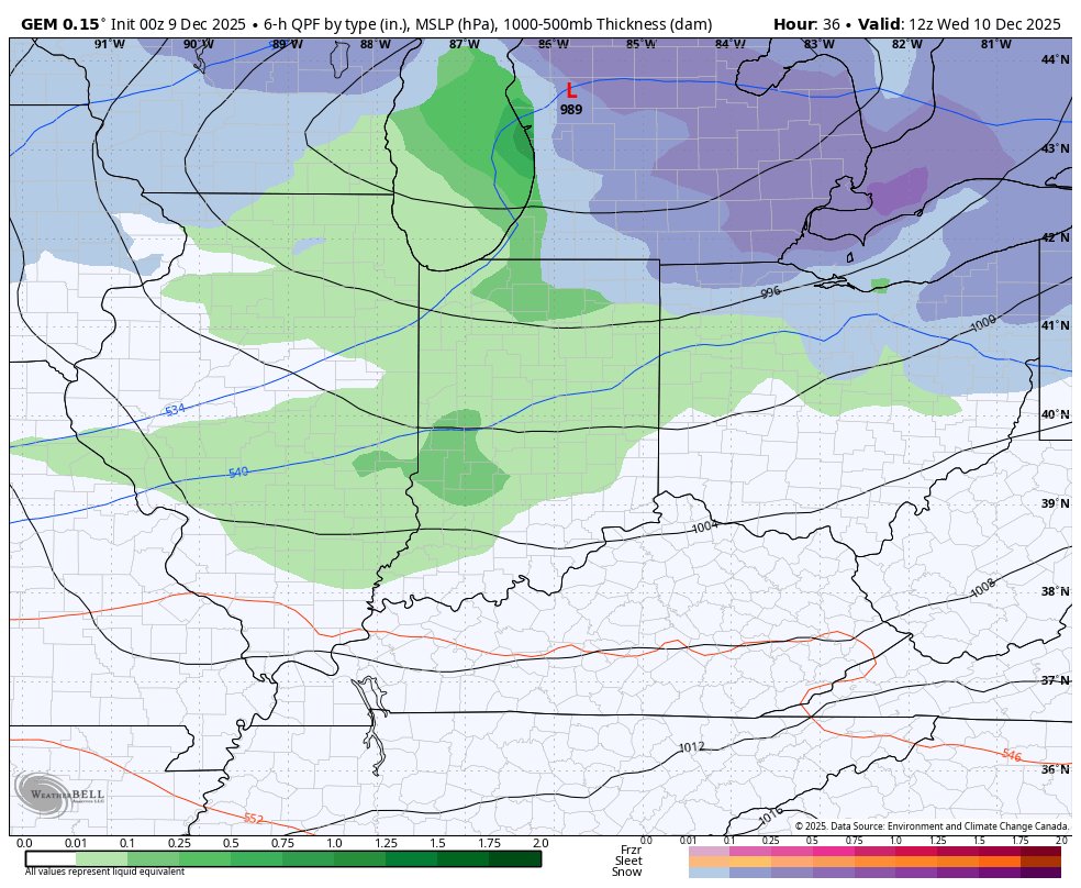
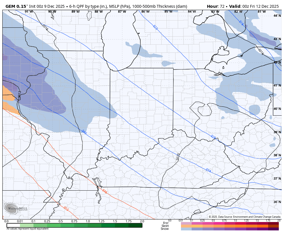
The Canadian is picking up on this pretty well…
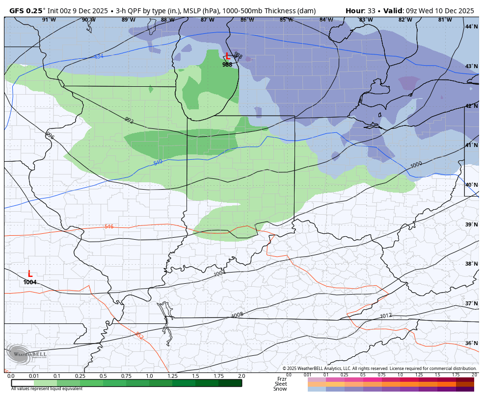
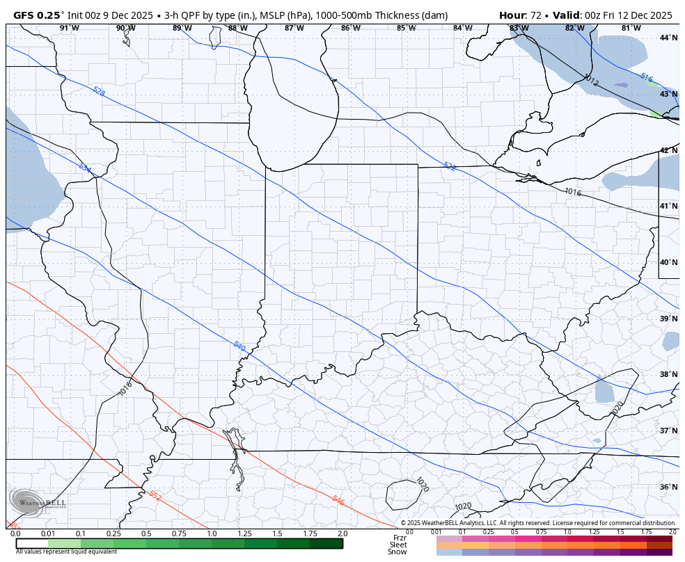
Even the lower resolution GFS is seeing some of this into Thursday…
The potential for a swath of healthy snows is increasing for Thursday night and Friday. The system rolling in from northwest to southeast has some really nice lift with it and that should fire up a nice band of snow across our region.
All models now agree on this, but they differ on the exact placement. At first glance, this looks like a 2″-4″ snow producer with the chance to overachieve.
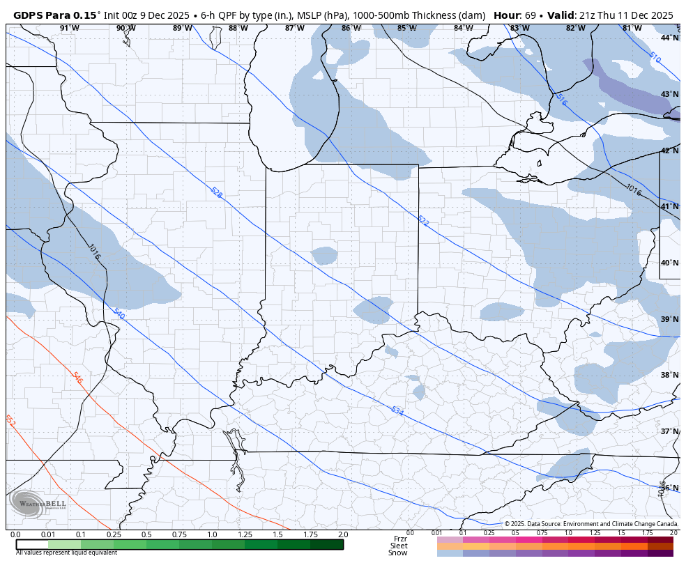
The GFS has been seeing this system in some form or fashion, then losing it, then seeing it in a different fashion. Right now, it’s streaking this system across Kentucky…
The Canadian family has a more widespread band of snow, but they even disagree a bit on the placement. The regular Canadian looks like this…
The Parallel Canadian is farther south, heavier and more widespread…
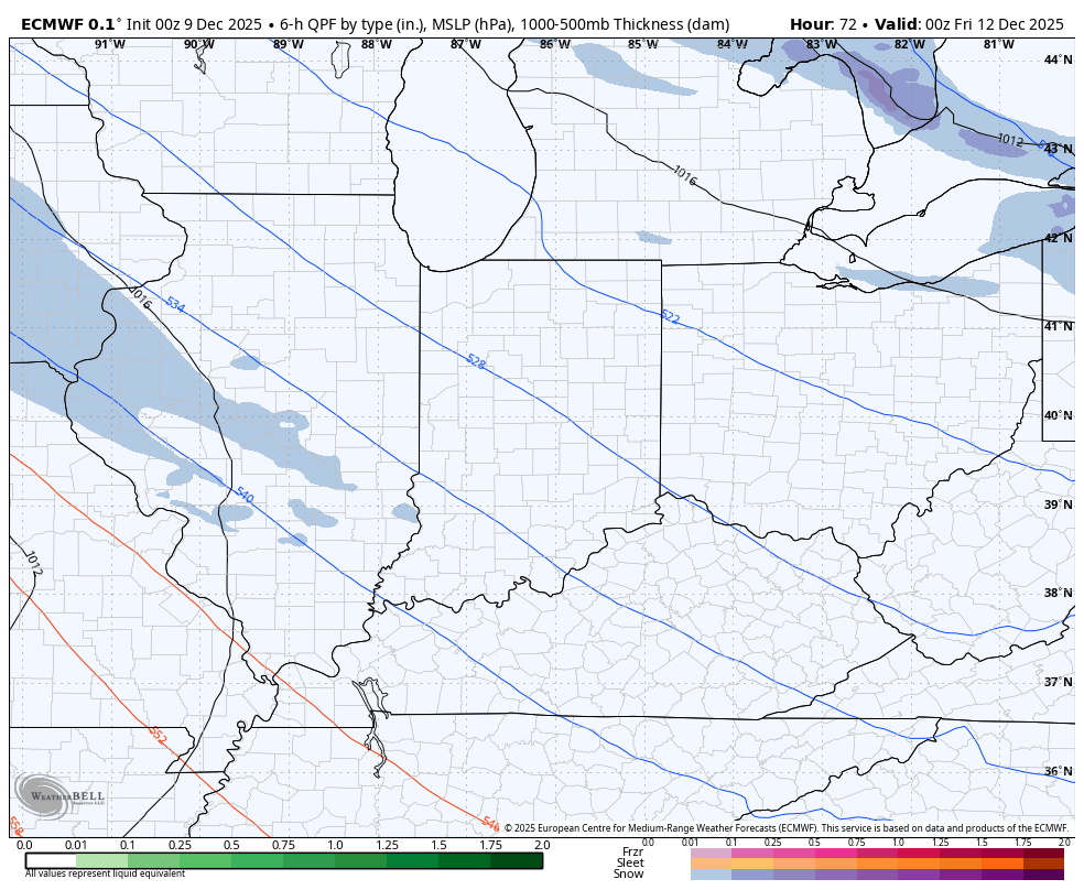
The EURO also sees the potential…
It’s been a while since we’ve had a system like that to track, especially in December. I seem to recall a few of those back in December of 2010 and December of 2000. Both were on my analog list for the winter forecast.
As that scoots through Friday, the arctic boundary continues to settle into the Ohio Valley with a bigger storm possible over the weekend. I talked about how the models should start to see this soon and they’re doing just that. Once again, they are struggling with where to track the system and how strong to make it.
Two things to keep in mind that the models usually don’t catch on to until very close to the event: 1. Arctic air often pushes storm tracks farther south. 2. A heck of a snowpack is in place across the Ohio Valley and Great Lakes that will also help guide a storm track farther south.
The Parallel Canadian is starting to sense that…
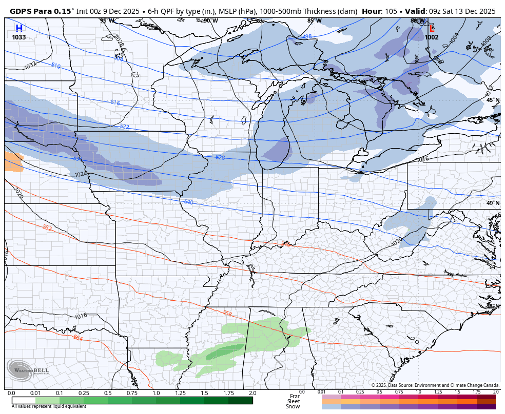
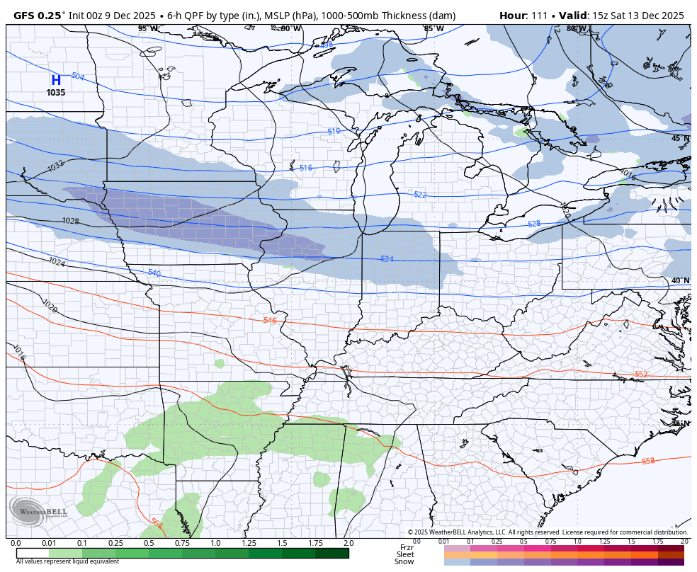
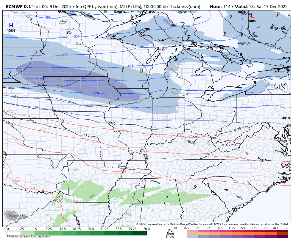
The GFS and EURO are getting closer…
GFS
EURO
As you can see, we have a lot to track in the coming days and that’s exactly what we will do here on KWC. I mean… Isn’t it always? 🙂
Updates will come your way later in the day. I’ll also have a few updates on my Meteorologist Chris Bailey Facebook Page
Until then, here are your tracking tools for the day…


Make it a terrific Tuesday and take care.

Thanks for the update Chris. Not liking the strong Southwest winds. That will just add to a drought situtation, but it may get ridded of the high pressure stagnation ( gloom ) we have had here lately.
This is the same weather pattern we had back in December, 2008. Cold and dry, with just a few Snow Flurries flying around every few days. That finally changed in 2009 to one of the worse Ice Storms I’ve ever seen in my 74 years.
A forecast is out, that a long warming trend may occur starting mid – month. We shall see, as always.
Here’s the latest on the recent Snowfall across the CONUS : )
https://climateimpactcompany.com/u-s-early-notes-plenty-of-snow-and-very-cold-weather-central-and-east-well-into-next-week-northwest-storminess-extended-range-warm-up-2/