Good afternoon, everyone. Winds are beginning to crank and will continue to do so into tonight and Wednesday. That’s ahead of an arctic front set to bring another blast of winter behind it late Wednesday and Thursday. Another snowmaker follows that up Thursday night and Friday then we watch the weekend.
It’s a busy time so let’s get after it.
We know about the winds. Yada Yada Yada.
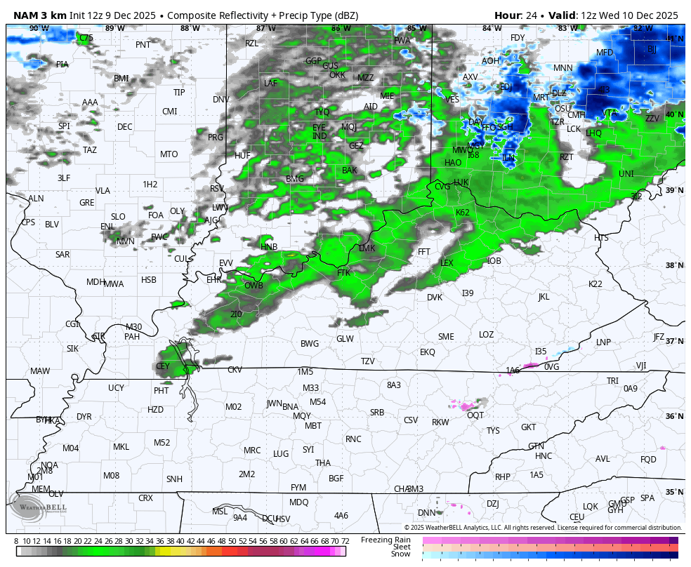
A line of showers will show up ahead of our front late tonight and early Wednesday. Some of this could even be in mixed form before colder air crashes in during the day. By late afternoon and evening, periods of light snow, snow showers and snow squalls develop from northwest to southeast.
The snow showers and squalls continue into Thursday on a strong northwest wind flow.
The future radar from the Hi Res NAM isn’t perfect, but it’s has the trend right…
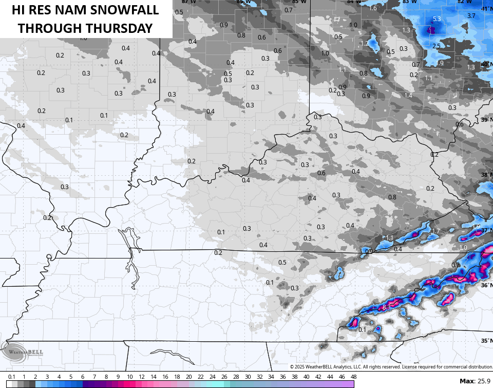
These setups get a booster shot from Lake Michigan and can have streaks of up to an inch or snow with higher amounts in the mountains of southeastern Kentucky. The Hi Res NAM is picking up on that…
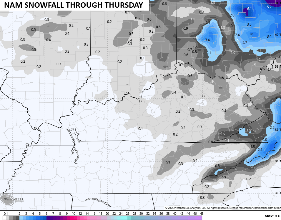
So is the NAM…
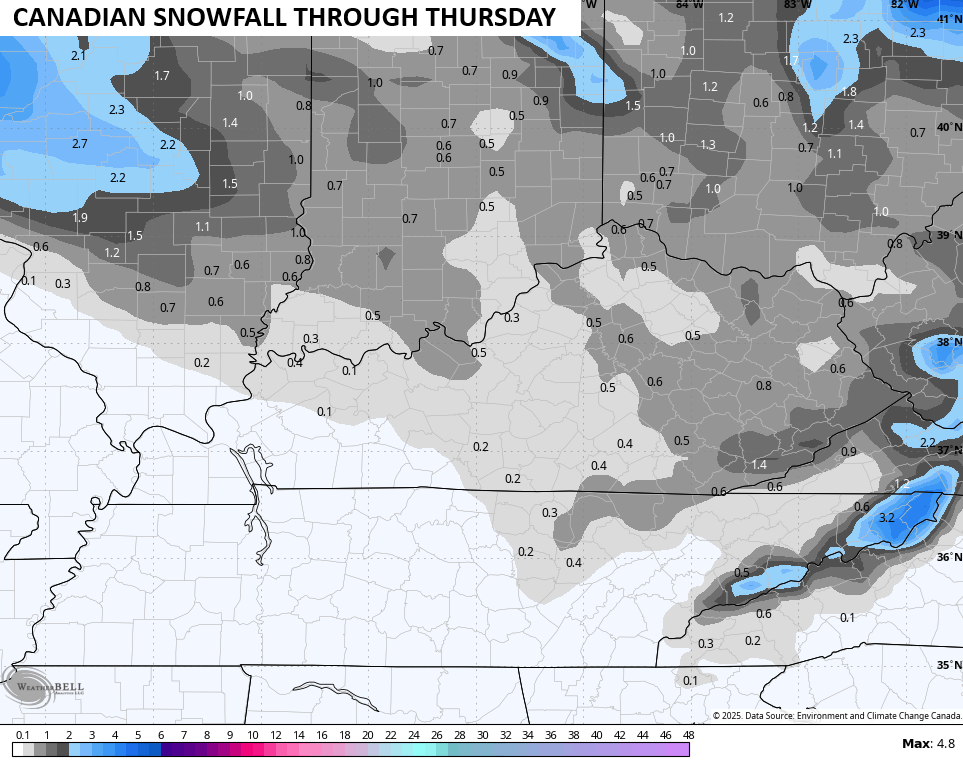
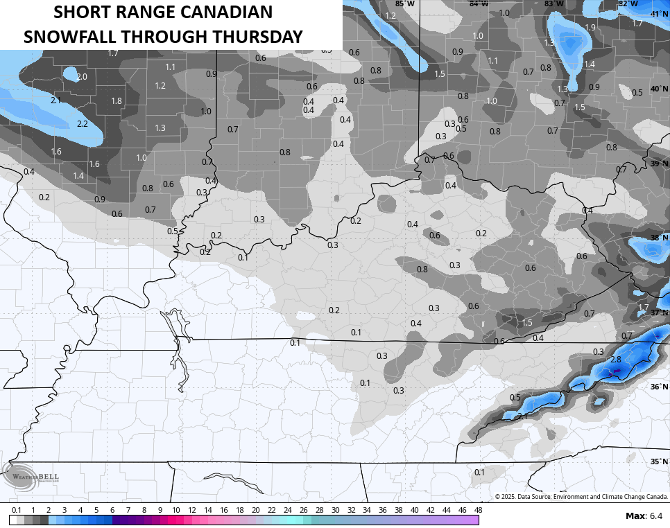
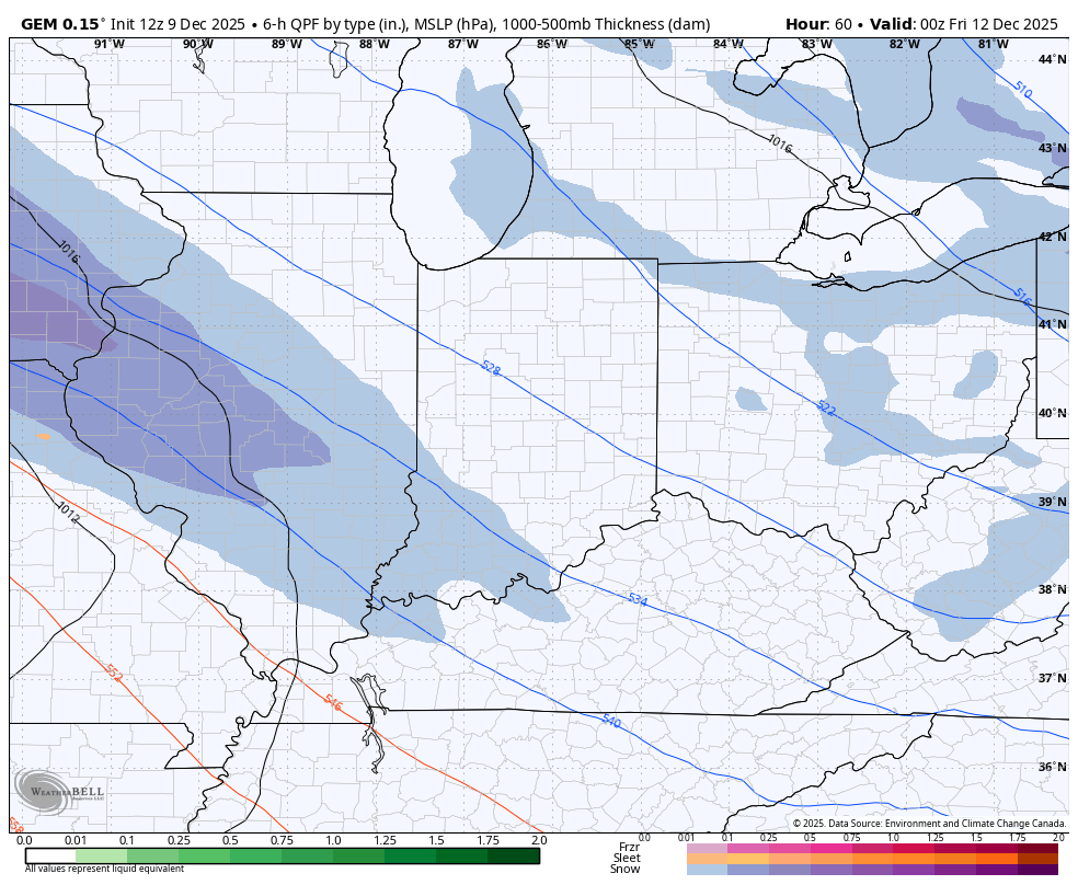
The Canadian Family is, too…
With temps in the 20s from Wednesday evening into much of Thursday, slick roads will be an issue. I fully expect some snow days for Thursday.
A more widespread swath of snow then dives in from northwest to southeast Thursday night and Friday. The exact placement of this swath is a work in progress, but my thinking is that a fairly extensive swath of 2″-4″ shows up with this.
The Canadian is more in line with my placement of where this goes…
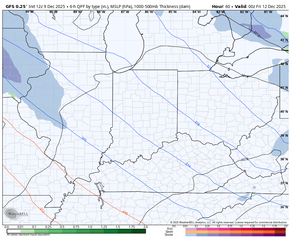
The GFS isn’t too bad, but it’s a tad too far north for my taste…
Lots of snow days are likely Friday!
The models still don’t know what to do with the weekend system, so expect more twists and turns with that.
I’ll have the latest on WKYT-TV starting at 4pm and I’ll go in depth on the First Alert Weather Show at 6:30pm on the CW Lexington and streaming on WKYT+. I’ll also have a few updates on my Meteorologist Chris Bailey Facebook Page
Until then, here are your tracking tools for the day…


Make it a terrific Tuesday and take care.

As usual W.Kentucky is left out again
with clippers that’s common
A Clipper System is just the negative part of a storm. To make a real complete storm you need the positive part supplied by the Subtropical jet stream, which is absent or weak in La Nina Winters. The negative ( cold air ) phases with the positive ( warm moist air ) to make a widespread real Snowstorm or Blizzard. It’s that way with every living thing on Earth.
El Nino is coming, sometime in 2026. The question is : Will the PDO ( Pacific Decadal Oscillation ) phase to the positive ? The last time it was positive was in 2014 – 15. That Winter we had widespread Snowstorms from West Kentucky to East Kentucky. If the PDO stays negative, El Nino will not react with the atmosphere in the Pacific, and there will be another ” lack luster ” Winter here in Kentucky.
Here’s the article from the Climate Impact Company : )
https://climateimpactcompany.com/
Here’s the entire article link : )
https://climateimpactcompany.com/december-2025-enso-outlook-la-nina-shifts-to-neutral-phase-early-2026-el-nino-in-2026-is-likely-2-2/