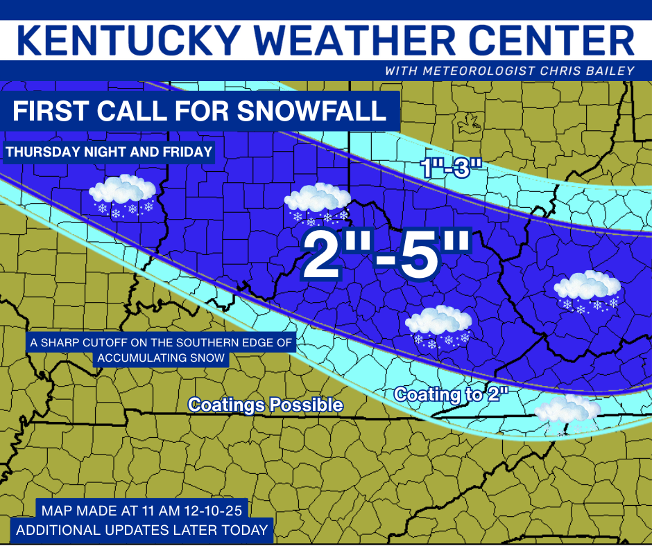
Good afternoon, everyone. Our harsh winter pattern continues as we now go into Winter Storm THREAT mode for Thursday night and Friday. Several inches of snow roll across many areas of Kentucky. A similar system follows that up late Saturday and unleashes bitterly cold air.
For those new to KWC, I put out a Winter Storm THREAT to heighten awareness to the possibility of snow and some ice and that’s what we have here. There is the potential for a few spots to push the 4″ criteria. As we get closer and confidence increases, we upgrade to a Winter Storm ALERT. If confidence goes the other way, we stand down and wait for the next one.
Before we get there, let’s talk about the snow showers and squalls kicking in later today into early Thursday. A Winter Weather Advisory is already out for this across several counties into southeastern Kentucky…

You could easily add all the eastern Kentucky counties into that and even some counties back to the Bluegrass Region. These snow showers and squalls will have a decent impact on roads during this time as temps drop into the 20s and stay there. Widespread coatings to an inch show up with higher amounts in the mountains of the southeast.
Streaks of overachieving snows will be possible, and you can definitely see these streaks showing up on the future radar from the Hi Res NAM. This starts around 5 today and goes through 1pm Thursday…
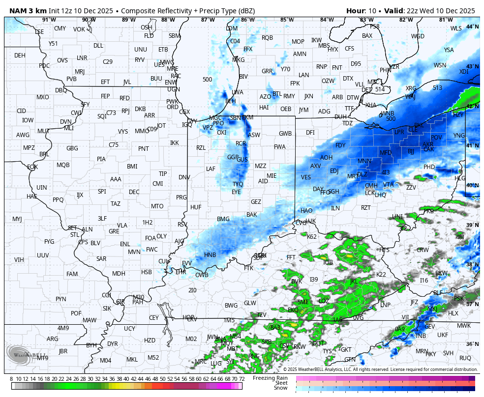
Check out that snow stream coming all the way from Lake Michigan into eastern Kentucky and West Virginia. BTW, the mountains of West Virginia are under a Blizzard Warning.
This brings us to our Winter Storm THREAT Thursday night and Friday. This is a stout system that puts down a thumper of a snowfall from northwest to southeast. The exact track of our low pressure dropping in will be the determining factor on where the lines of heaviest snows set up. But, this system is behaving itself on the models, so far.
Here’s your First Ca
ll For Snowfall…
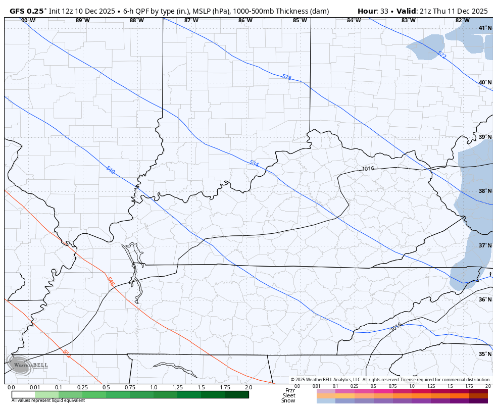
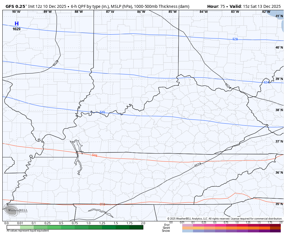
Here’s the GFS showing this system moving in from the northwest to southeast…
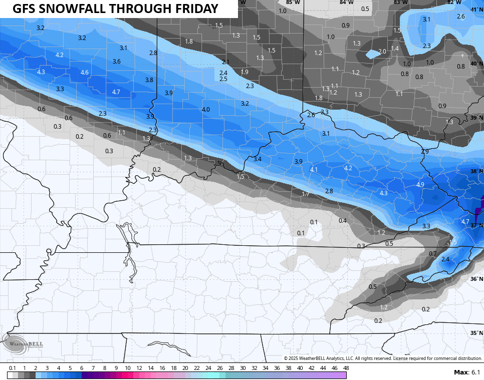
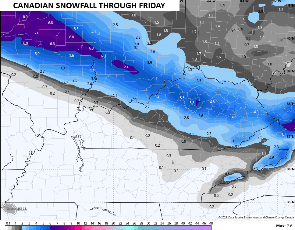
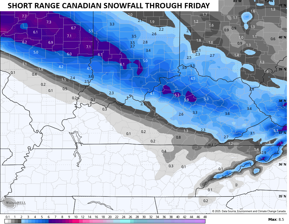
And the snowfall forecasts from the various models are similar…
The next system coming in behind it late Saturday into early Sunday continues to sink a little farther south and may wind up similar to the system coming in Thursday night. Here’s the GFS…
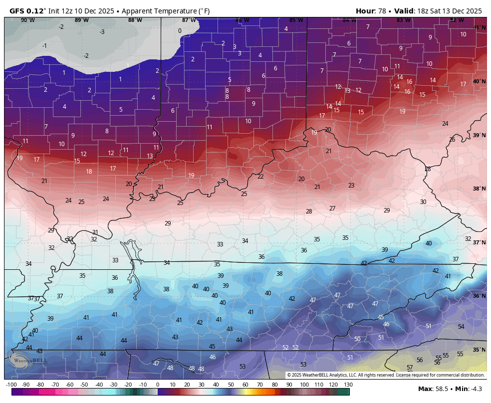
Bitterly cold temps come in behind that and may send temps to near 0 Sunday morning and Monday morning. Highs Sunday will be in the low and mid teens.
Wind chills will be brutal. Wind chills go well below 0. This GFS Wind Chill animation goes from Saturday afternoon through Sunday morning…
I’ll have updates on WKYT-TV starting at 4pm today and then on the First Alert Weather Show on the CW Lexington and streaming on WKYT+. Another update comes late today and I’ll also have a few updates on my Meteorologist Chris Bailey Facebook Page
Until then, here are your tracking tools for the day…


Make it a Wonderful Wednesday and take care.

It’s currently 40.1°F at my PWS near Bowling Green, and I’ve recorded a peak wind gust of 36.4 mph. The barometer is starting to recover after falling from a high of 30.01 in/Hg to a low of 29.67 in/Hg, in a 14 hr time span.
Anyone who suffers from chronic joint pain can testify to that relatively rapid pressure change!
A miss for WKY
The pattern going have to change for any snow chances here WKY.
Hopefully it will