Good evening, everyone. We are slowly thawing out and that thaw will kick into high gear in the coming days. This is ahead of a powerful cold front sweeping in on Thursday with rain, wind, a big temp surge, then a quick-hitting round of winter.
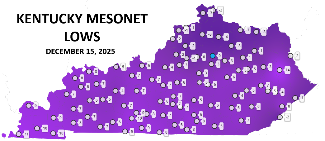
Speaking of winter, this morning was the coldest morning so early in December in 36 years here in Kentucky. Lows bottomed out in the -5 to 5 above range for many areas…
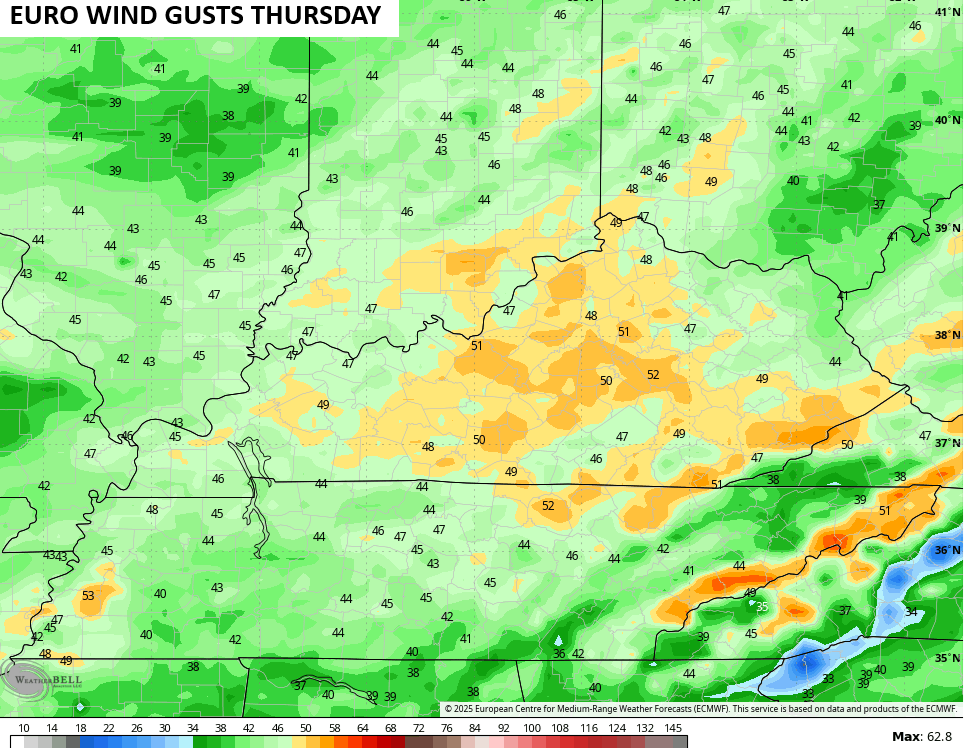
Temps come up on a stout southwesterly wind. There is the chance for a shower on Wednesday, but that chance is fairly low. Thursday into Thursday night can turn super windy with gusts of 40mph-50mph possible…
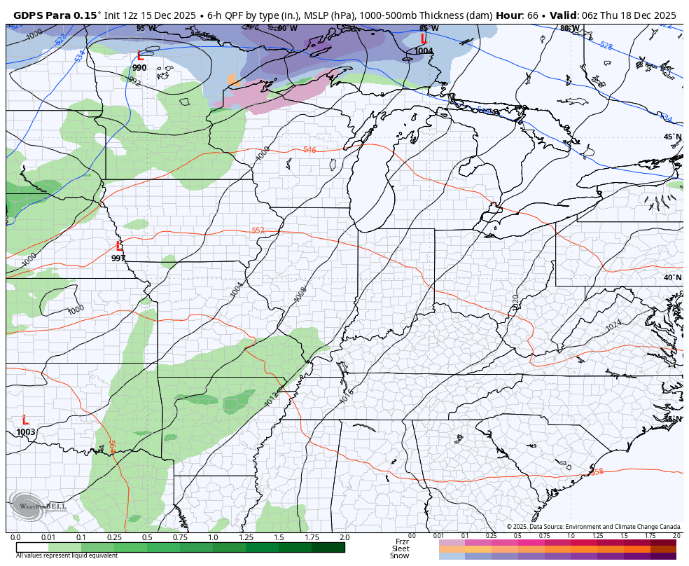
That boundary crashes in with rain ahead of it and some flakes behind it Thursday night and Friday morning…
Temps hit the 50s ahead of this on Thursday then may not get out of the upper 20s on Friday. This animation goes from 7pm Thursday to 7pm Friday…

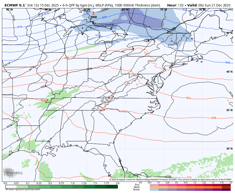
Looking into Christmas week, the big warm ridge centered across the southern Plains will flex some, but the cold air across Canada is going to try to send shots sliding into the northeastern half of the country. Some of these may graze our region and the operational models are starting to see this…
Enjoy your evening and take care.
