Good evening, everyone. A potent cold front is racing into the region, bringing showers and thunderstorms through the area. Once that moves through, it’s a quick-hitting blast of cold and snow showers late tonight and Friday.
The Storm Prediction Center is back to having a Marginal Risk for severe storms with the action out there this evening…

Local wind damage is possible, but this isn’t anything that’s overly concerning to me.
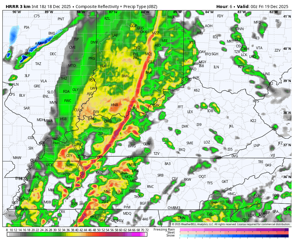
As the squall line races through, temps tank with a second front racing through in the middle of the night. Snow showers and a few snow squalls then roll through here into the first part of Friday. The future radar from the HRRR shows this action well. Our animation goes from 7 this evening through Friday afternoon…
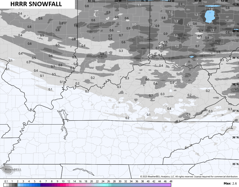
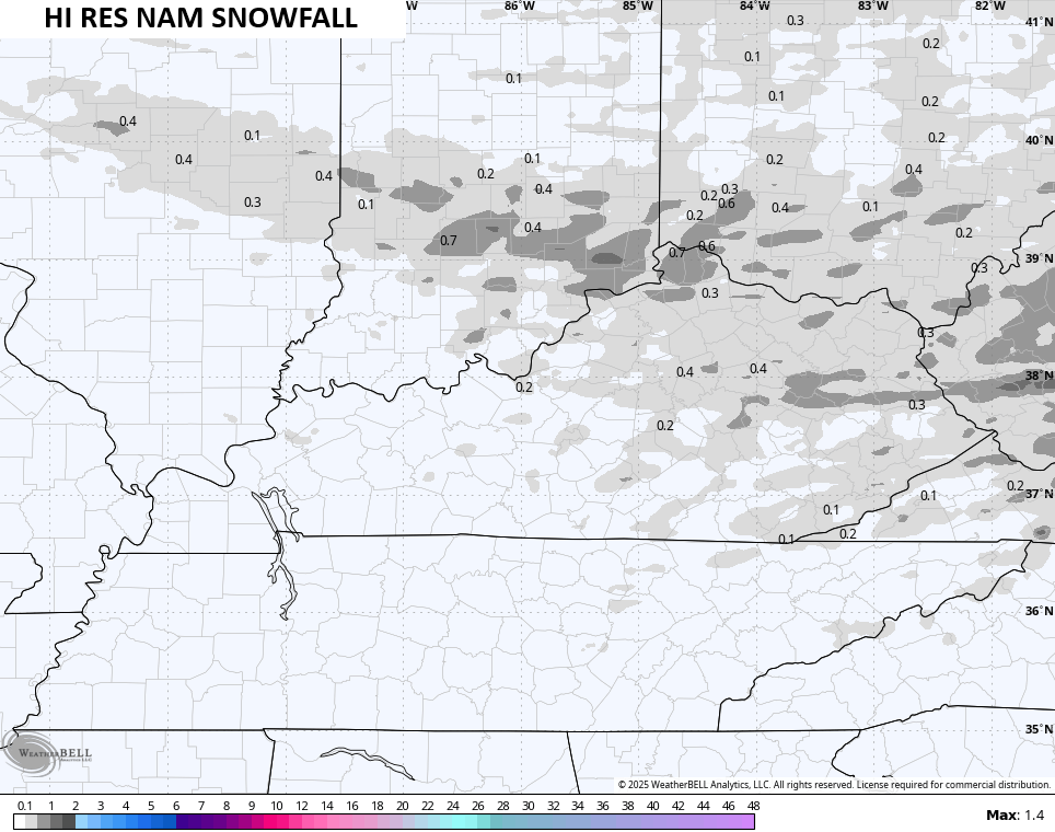
Light accumulations will be possible and there’s the chance for slick roads into Friday morning. Some of the short-range models are seeing the light accumulations…
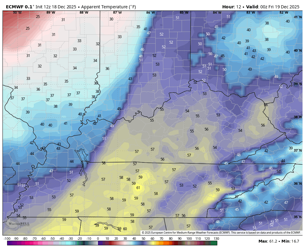
Wind chills turn brutally cold by Friday morning with some single digit wind chills showing up. This animation takes us through 7pm today through 9am Friday…
I’ll have the full breakdown later tonight. Until then, here are all the storm tracking tools you need to start the week…


Current watches

Possible Watch Areas

Make it a great evening and take care.
