Good Sunday, everyone. A shot of seasonable cold is into the region today, but it’s not going to hang around very long. The Grinch is set to steal our traditional Christmas week weather, replacing it with warm temps and some showers.

Yes, you, ya bozo!
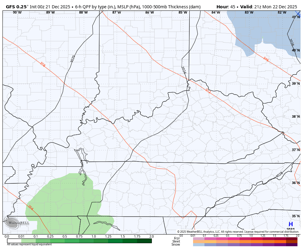
Temps out there today are generally in the upper 30s to middle 40s with gusty winds making it feel colder. Skies are partly sunny.
Southwest winds kick in overnight into Monday as milder air fights back in. That air brings some showers along for the ride but those won’t get in here until the evening. Once we get in on the showery setup, it looks to be with us in on and off fashion through Christmas…
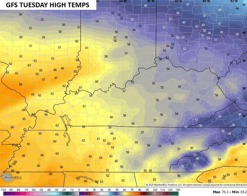
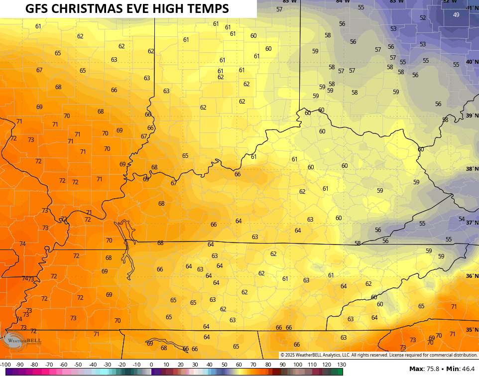
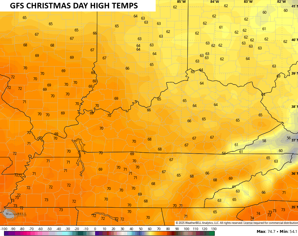
The temperatures are the big story with highs hitting the 60s with the chance for 70 in the west. Take a look at some of the forecast highs from Tuesday through Christmas Day…
That’s beyond absurd and further illustrates how our weather swings from one extreme to the other with very little in between.
The milder than normal temps likely continue through the start of next weekend, but a big blast of cold air looks to finally knock that down. The models continue to see this cold blast better and better as we get closer.
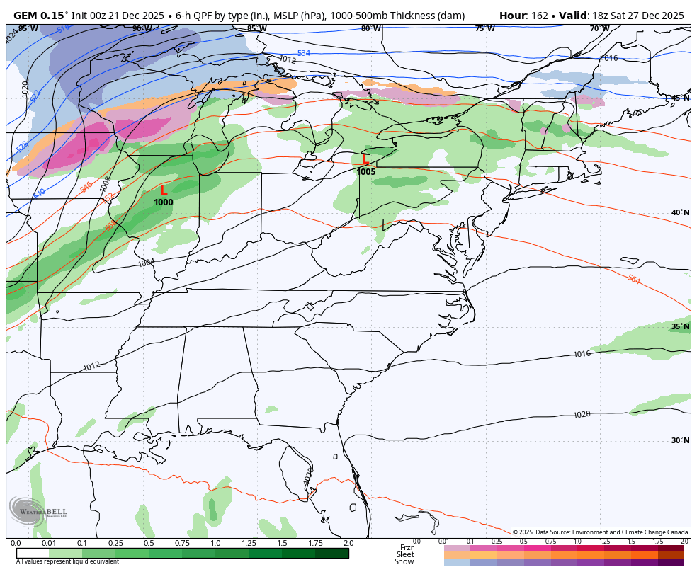
The Canadian even tries to bring a rain to snow setup…
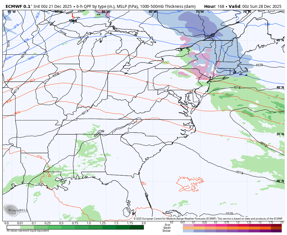
The EURO doesn’t go that far, but it sees the blast of cold air…
Have a great Sunday and take care.

Hear me out. I feel like this is a good sign. What may end up happening is that we experience all of this warmth in/around Christmas/New Year, only for the flip to switch again as we enter to January…. I guess it’s never really bothered me if Dec isn’t cold and snowy because most of my life, the real winter didn’t start until Jan/Feb…. so when if it’s super cold/snowy in Dec, it makes me paranoid the switch will flip and winter will be over.. You never really know what’s going to ultimately happen until March is over. We could literally go through now and through all of January being warm… then Feb/March have huge snows.
Curious, how much was your last power bill? Mine was $225 which ended on the 18th. All electric single story house and keep the heat on 65
I do remember in the early 70’s one Christmas day it hit 80 that day here in Kentucky
Mark, from 11 / 08 / 25 to 12 / 08 /25, my electric bill was $ 144.40, but I have a cooperative electric company, and I live in a very rural part of Taylor County. My Log home is not large, but it has two stories, and is very well insulated. I have two heat pumps, one for upstairs, and one for downstairs. I also have a full basement. I keep my thermostats set at 67 degrees.
Winter starts at 10 : 03 AM, ET today. It may look like Winter, but it certainly doesn’t feel like Winter. I have live now on this Earth for 74 years, and have come to the conclusion here lately that there is NO CLIMATE CHANGE. We, in this part of the Country have always had a few Winters that were very Cold and Snowy, and many Mild Winter’s without much Snow.
Climate cycles on its own.
Primarily, Solar cycles are the main drivers of weather. A Solar minimum is on tap for 2030. I can hardly wait LOL…
I for one am beyond grateful that we are entering a mild spell. My newest KU bill is just under $94.
Beautiful Snow scene at a Ski resort in the Northwest US : )
https://www.ventusky.com/webcam-844060209