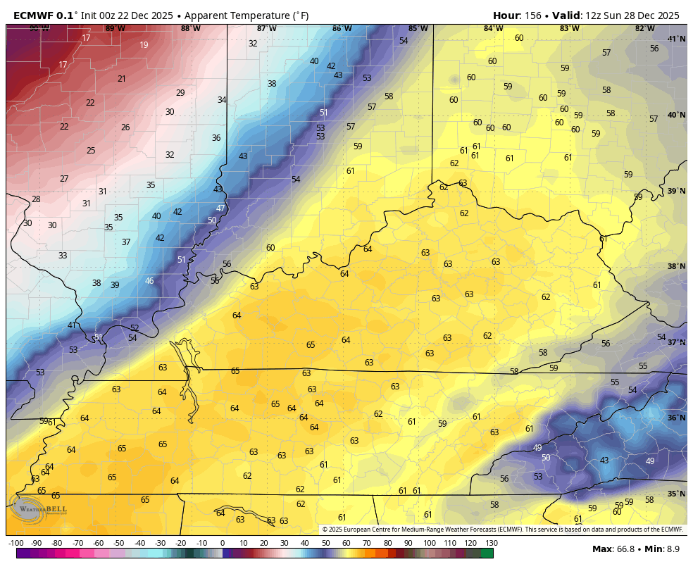
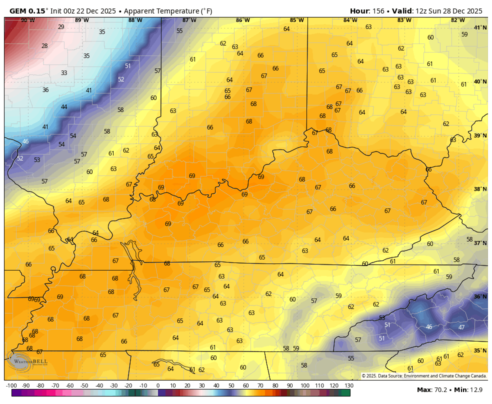
Good Monday to one and all. It’s a full-blown Heat Miser ALERT this Christmas week as much warmer than normal temps settle in. This will also bring periodic showers along for the ride with winter staging a comeback by this time next week.
Allow me to introduce our villan…
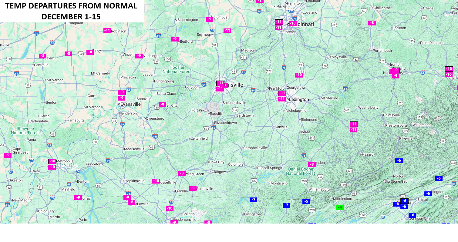
This well above normal temperature setup will do everything in its power to offset one of the coldest first halves of December we’ve ever had here in Kentucky. Look at those temperature departures from normal for the first 15 days of the month…
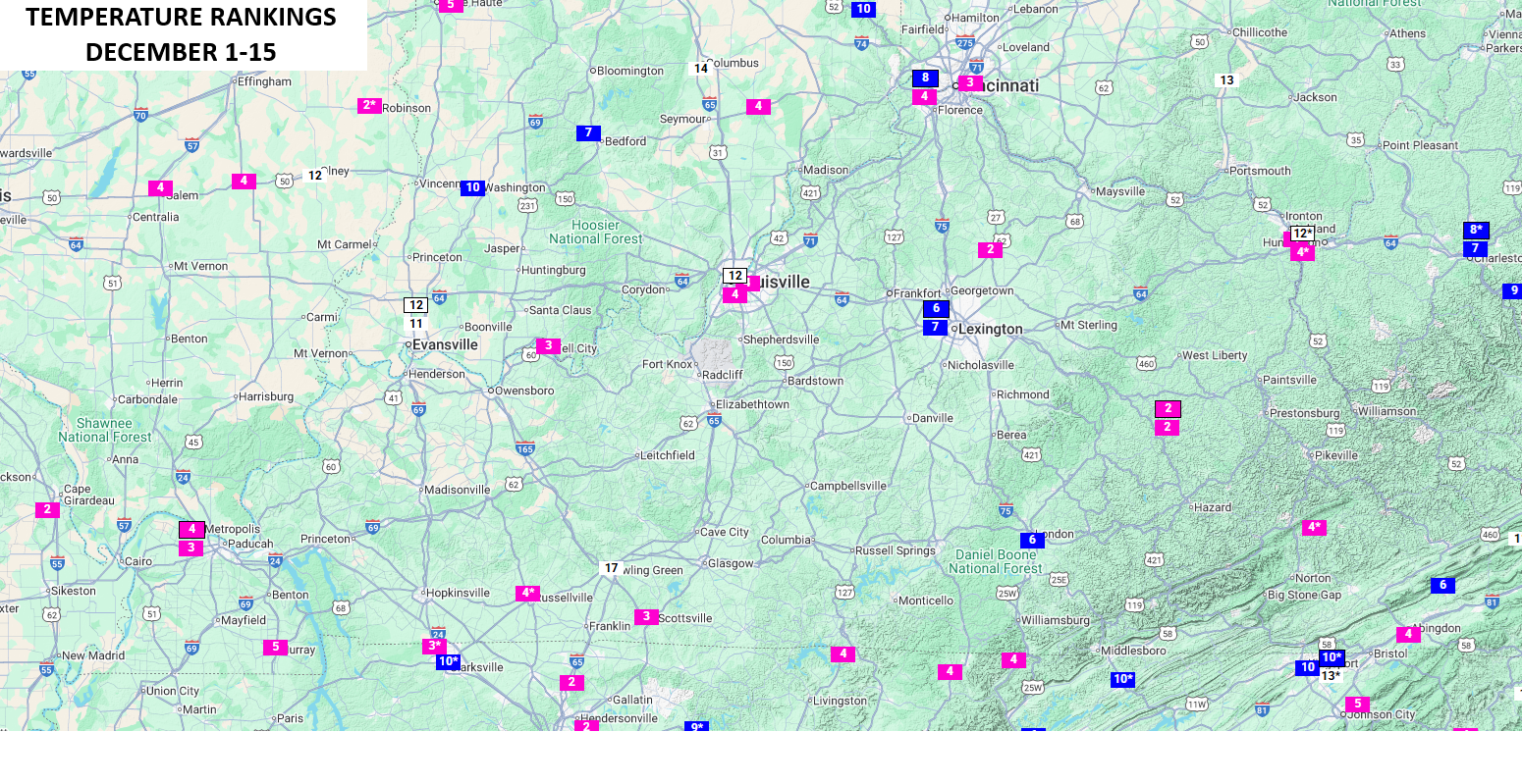
Where does that rank historically? Every location in the state ranked inside the top 10 coldest December 1-15 time periods on record…
While this week is warm, the Euro isn’t quite as warm as other models for Christmas Eve and Christmas Day. This animation goes from 7pm Christmas Eve to 7pm Christmas Day…

That’s still plenty warm, but you can see the cold high to the north edging just a bit to the south, setting up more of a gradient.
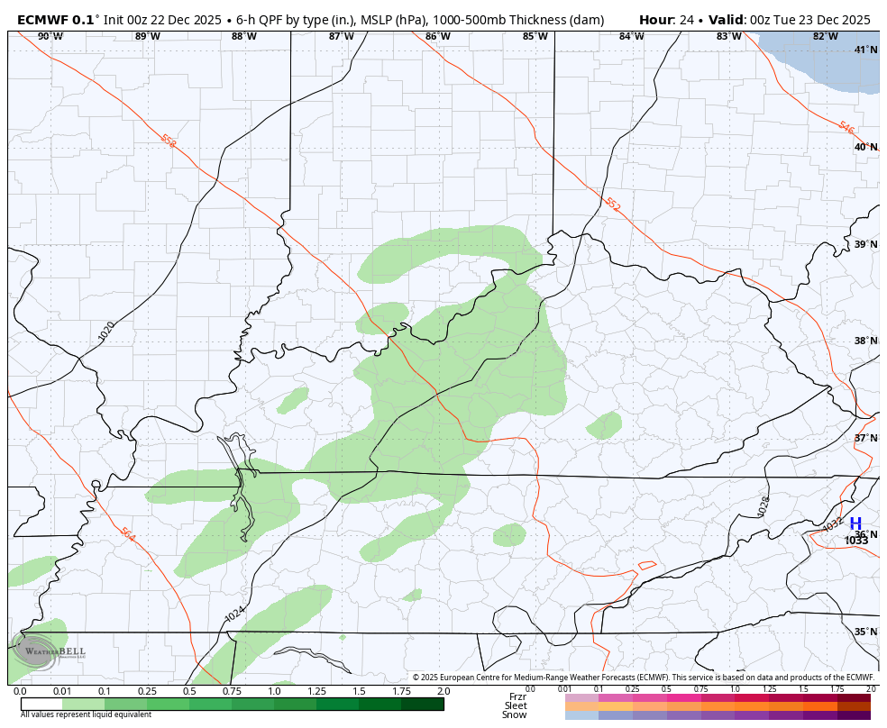
On and off showers are likely this week and those kick off later this evening. Here’s the Euro from this evening through Friday…
Winter comes crashing back in with a strong cold front that arrives late this weekend. Showers and storms along and ahead of this boundary look to be a good bet…
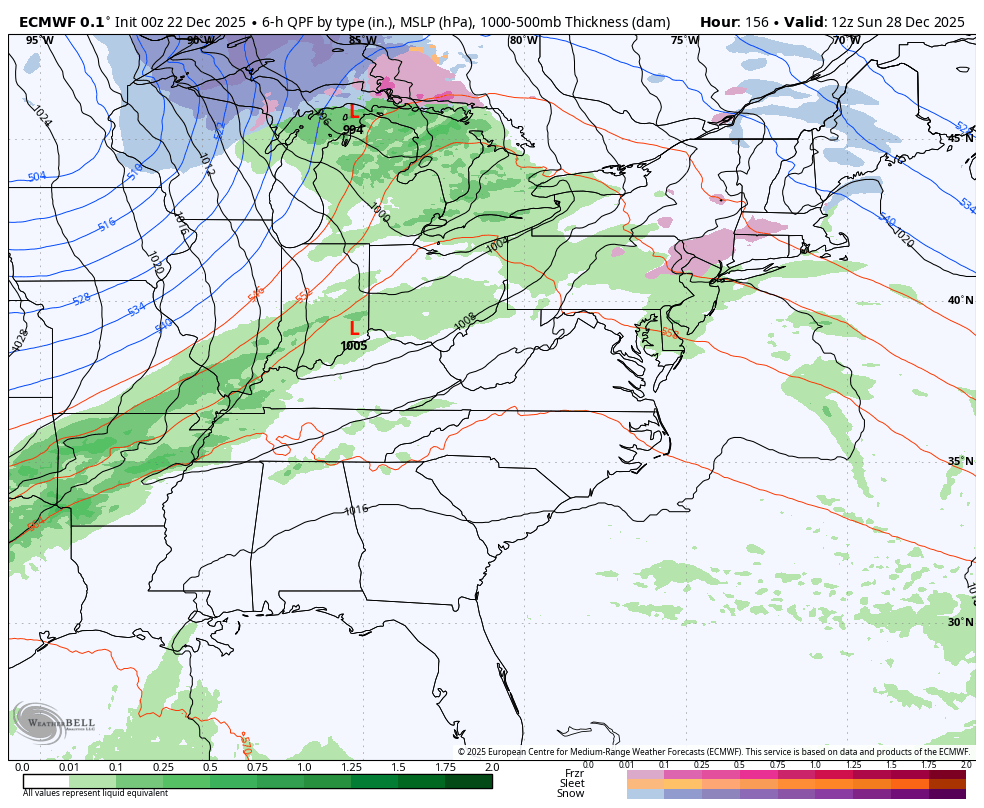
That’s one deep trough coming in behind that and it brings arctic air in here to close out the year. Check out the wind chill forecast from the EURO from Sunday morning through Monday morning…
Yes, that shows temps going from deep in the 60s to single digit wind chills in less than 24 hours.
The Canadian is even stronger with this whole setup…
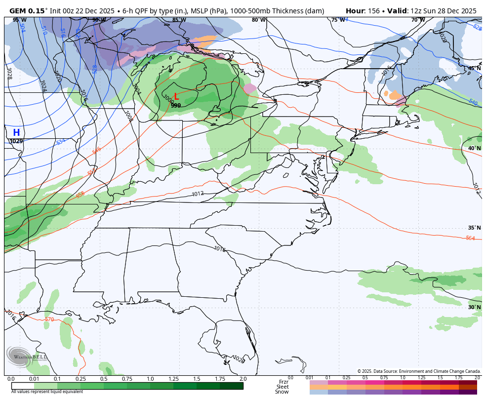
The Canadian Wind Chill animation from Sunday morning through Monday morning…
That’s pretty wild but that’s what you get when Barney shows up…

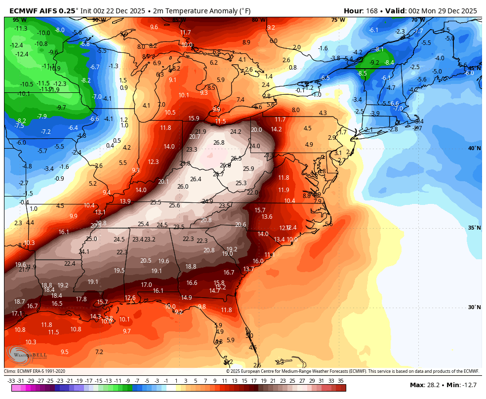
The AI version of the EURO is beginning to see all this as well…
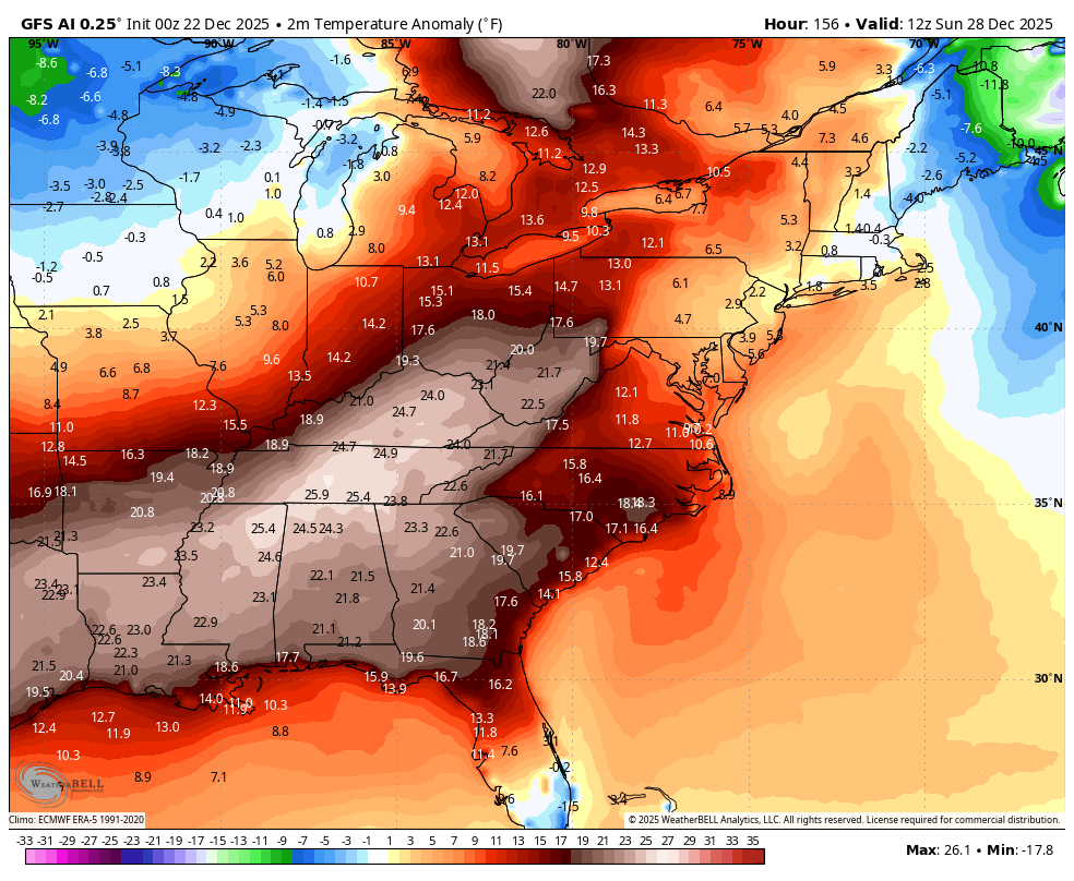
The GFS has no clue about any of this, but the brand new AI version of the GFS is just now seeing it…
Another update or two comes your way later today. I’ll also have a few updates on my Meteorologist Chris Bailey Facebook Page
Until then, here are your tracking tools for the day…


Make it a magnificent Monday and take care.

Thanks Chris. Hoping that we just get back to normal temperatures and precipitation for the rest of the Winter, and into the Spring months. Will it happen ? Most likely NOT until there is a dramatic change in the Pacific to the positive. The much below normal temperatures earlier this month, was likely triggered by a period of intense Solar activity. Would be very rare if the intense cold returns.