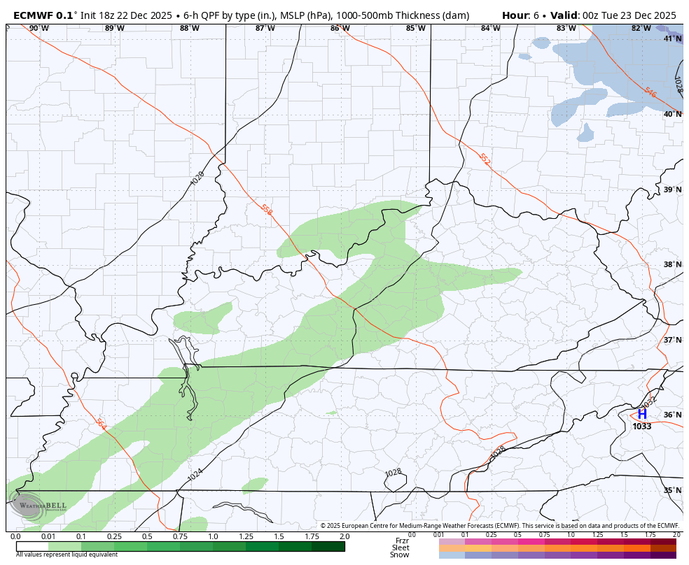
Good evening, everyone. We continue to see showers and milder temps overspread the state. These will hang tough into the start of the weekend before a massive change blows in behind a true arctic front.
The showers are already out there and will be off and on through Christmas and into Friday…
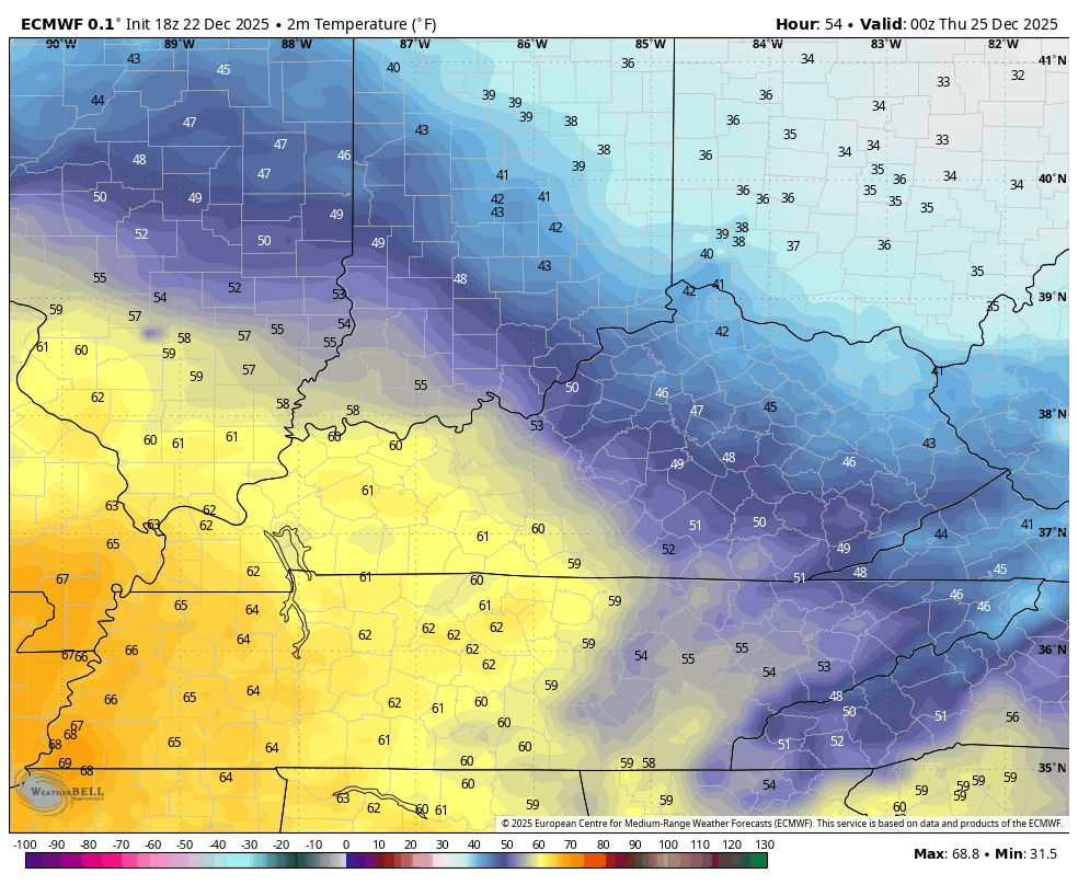
Remember the boundary I’ve been talking about setting up shop across our region this week? The models are just now seeing this and the impact it will have on temps, especially Christmas Eve and Day.
The trend has temps down from prior forecast runs with this boundary setting up from northwest to southeast, setting up a stout temp gradient. Check out the EURO temps from 7pm Christmas Eve through 7pm Christmas Day…
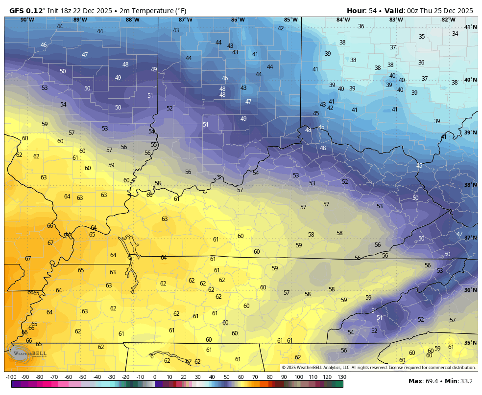
The GFS is beginning to see this…
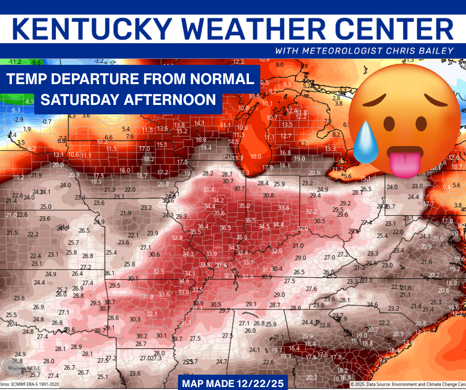
The warmest day of this entire period will be Saturday as a strong southwest wind kicks in ahead of the approaching arctic front. Look how far above normal we go…
That front crashes through on Sunday as temps go straight to Barney late Sunday into early next week…
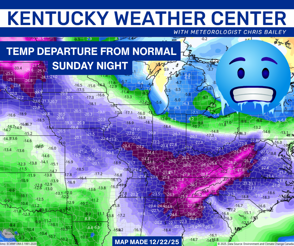
That’s absolutely wild, folks.
It gets even wilder when you ask the models show you the feels like temps from Saturday afternoon to Monday morning. 70s to below zero show up on the Canadian…

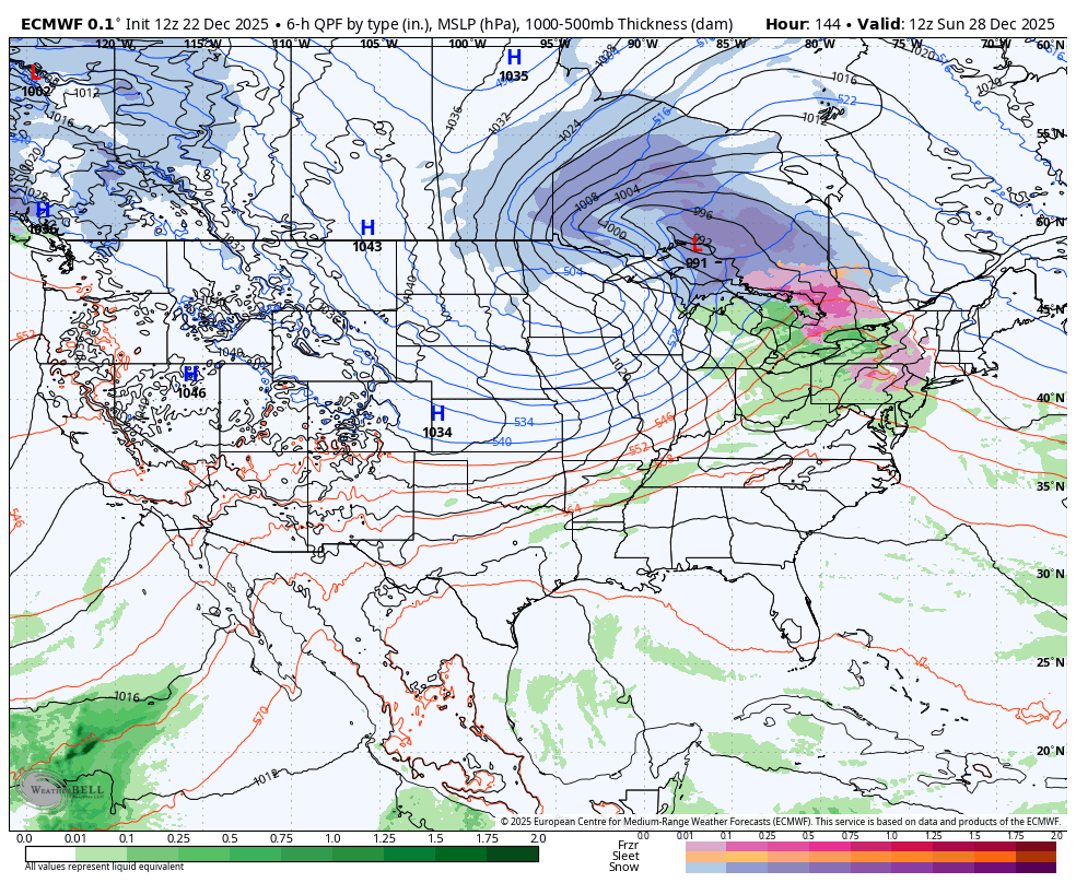
Now that the models are finally seeing this arctic shot, they’re seeing a pattern shift back toward what we were seeing before. The EURO through early January…
I’ll have a full update later tonight and I’ll also have a few updates on my Meteorologist Chris Bailey Facebook Page
Until then, here are your tracking tools for the day…


Make it a great evening and take care.
