Good Tuesday and Merry Christmas Eve Eve. We are nearing the big day as the warmest air since way back in mid-November moves in, bringing some rain along for the ride. This mild then turns wild with an arctic outbreak arriving late this weekend and early next week. Can it bring some snow along for the ride? Maybe.
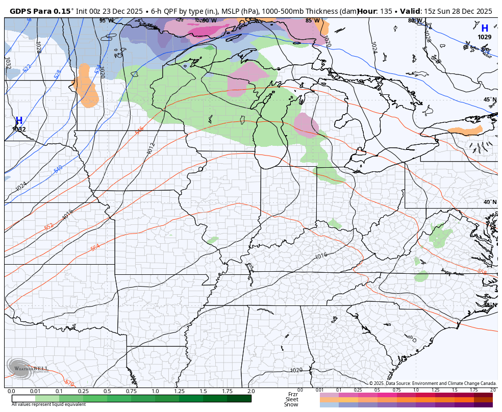
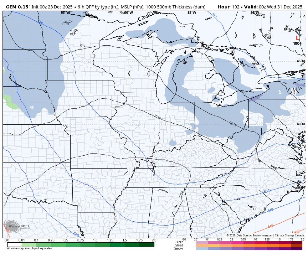
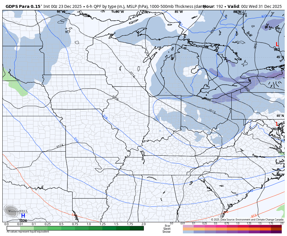
Temps are well above today with a few showers. Those showers will then be noted through Friday with some local half inch amounts or higher showing up…
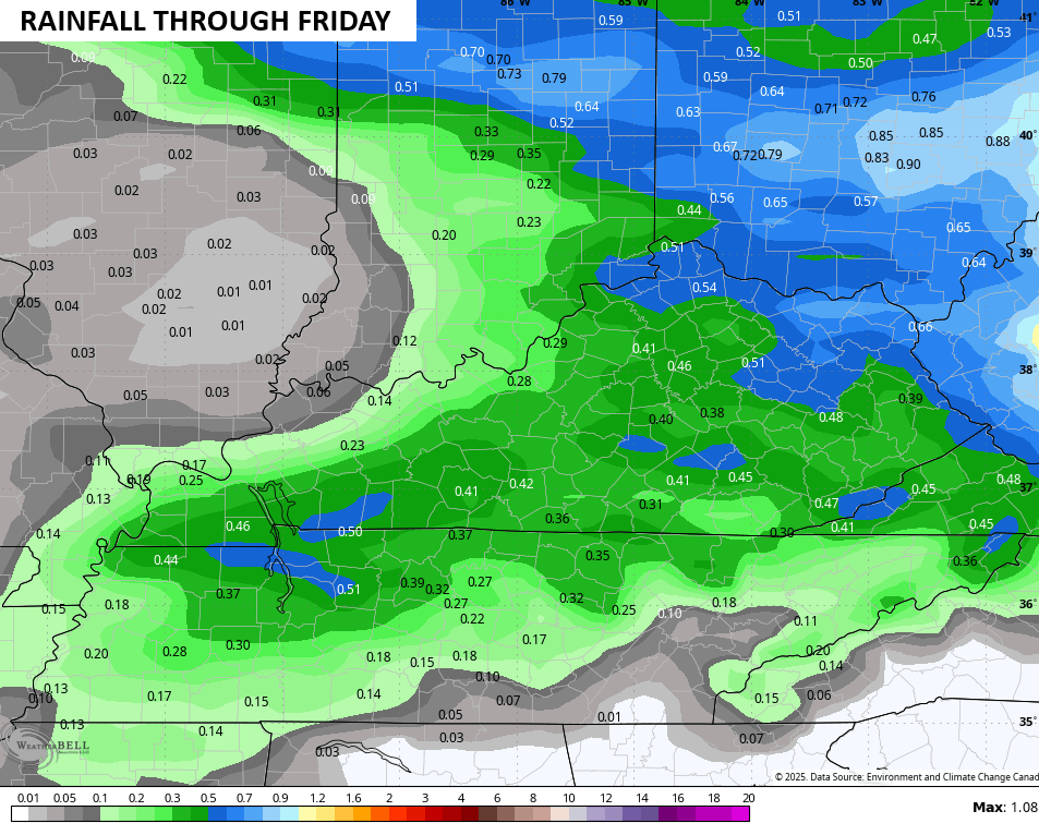
No, it’s not raining all the time. These are showers we’re dealing with along a stalled boundary oscillating north-south across our region through Christmas. This should set up a healthy temp gradient from north to south across the region and the state for Christmas Eve and Christmas Day.
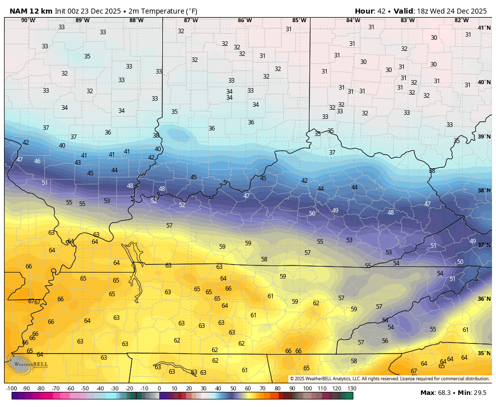
The NAM has a bit more of a southward push of the chillier air Christmas Eve into Christmas Day…
The GFS is just a bit north with the boundary compared to the NAM, but is way cooler than earlier runs of the model…
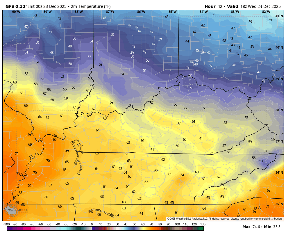
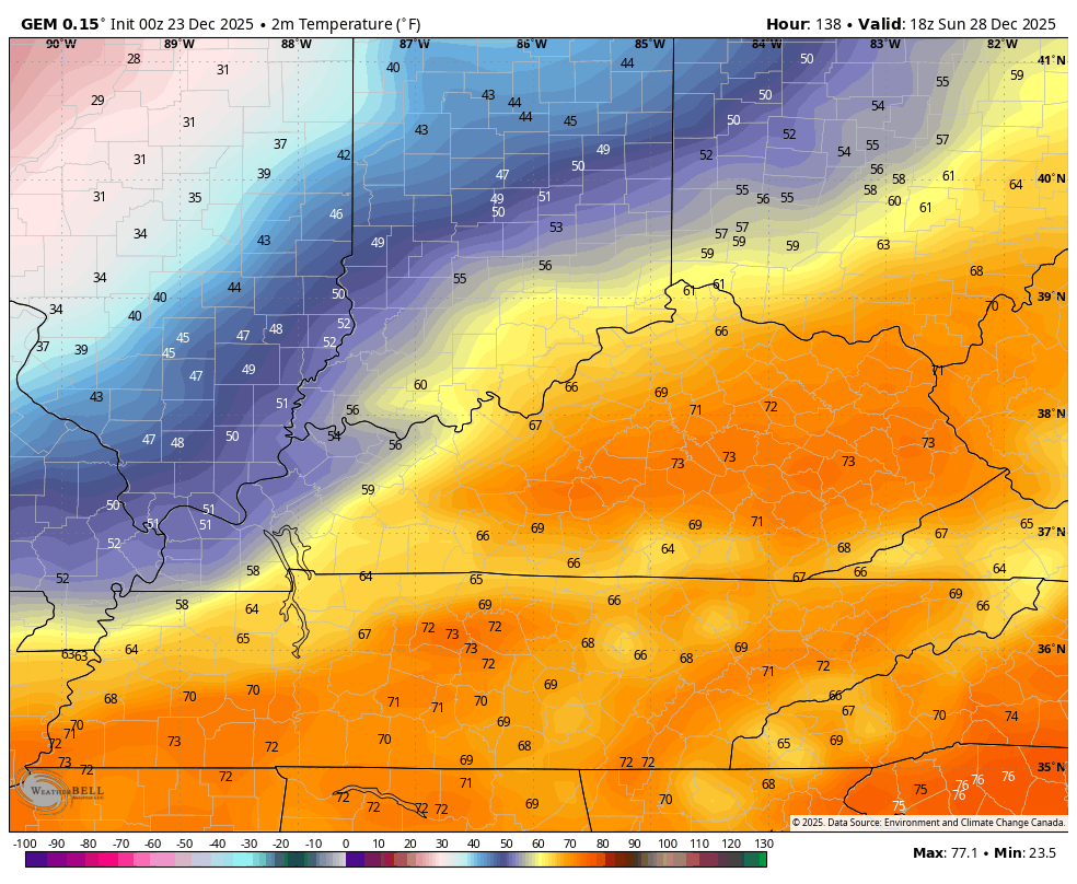
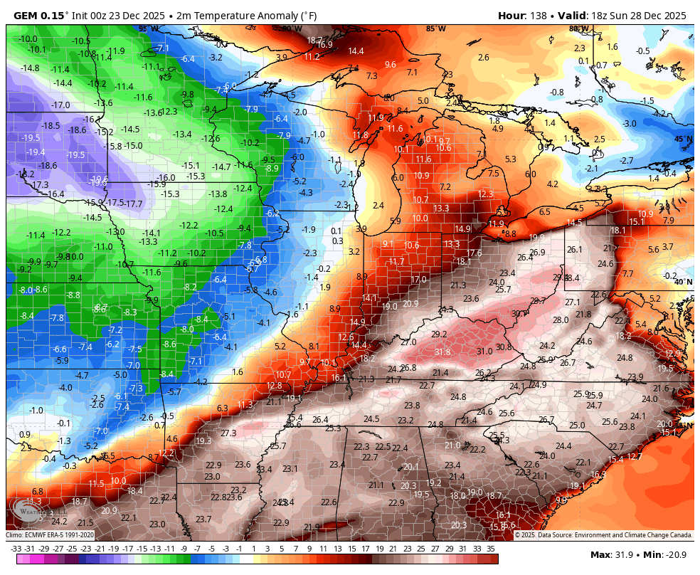
Make no mistake that those numbers are very warm for this time of year, but they’re not even close to the record highs the model had up until recently.
I continue to maintain that the warmest day is Saturday when a strong southwest wind kicks in ahead of an arctic blast arriving at some point Sunday or Sunday night. The signal for this has actually been there for a while with the models only seeing a small part of it until recently.
The Canadian was the first to see it and the model is adding something else into the mix. A few runs of the EURO and Canadian have been trying to pop a wave of low pressure along the arctic front as it sweeps across Kentucky. The latest Canadian really popped it…
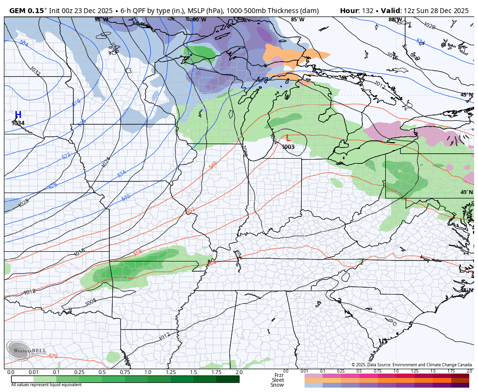
The Parallel Canadian is doing a little popping, too…
Well, that’s interesting, but I’m certainly not sold on it.
I am sold on the massive temperature crash coming in behind this front. We have a legit shot at 70 ahead of the boundary with a legit shot at below zero wind chills behind it.
This animation from the Canadian shows the actual air temp from 1pm Sunday to 1pm Monday…
What’s the 24 hour temp change during that time? Wow…
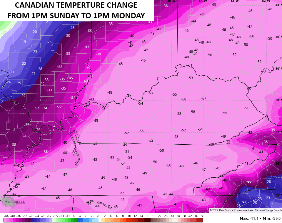
That may be a little too extreme but you get the idea. Other models have a temperature change of “ONLY” 40-45 degrees colder.
Throw in the wind chills and the difference is even more staggering. The Canadian takes us from 70 to below zero wind chills in under 24 hours…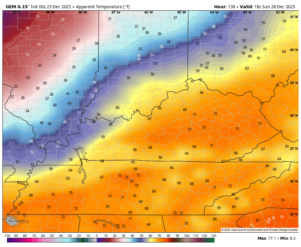
Another arctic shot will likely follow that up to end the year and begin 2026. The Canadian again likes the extreme look…
So does the Parallel Canadian…
Barney shows up with both of the shots of arctic cold…
While we shouldn’t be using any model for specific details from this far out, y’all better put some respect on the Canadian family of models. They’ve kicked the shivers out of the other models on numerous occasions already this winter. Just like all models, they will change some from run to run, but they have the overall theme of the forecast right and they were the first to do so.
Another update or two comes your way later today. I’ll also have a few updates on my Meteorologist Chris Bailey Facebook Page
Until then, here are your tracking tools for the day…


Make it a terrific Tuesday and take care.

I won’t bow at the altar of any model.
Thanks Chris. Here’s some more models to decipher. The models suggest a return to a colder pattern, but no organized Snowstorms to track, as the subtropical jet is overwhelm by High Pressure to our South and West. In other words ” same ole same ole weather pattern. ” ( La Nina ) has plagued our area since 2019. I hope there’s a change to ENSO / neutral before Winter is over. That change would increase our chances for one of those Heavy Wet Snowstorms, maybe in February or March, but will also increase are chances for Severe Weather ( Tornado Outbreaks. )
https://climateimpactcompany.com/u-s-medium-range-forecast-colder-northeast-east-u-s-medium-range-forecast-2-2/
Right now, a strong Polar Vortex is in place, which in combination with a weak La Nina is resulting in above normal temperatures across much of the northern hemisphere. Despite the occasional outbreaks of artic air, the predominate trend is normal to above normal temperatures for much of winter. La Nina is forecasted to phase into ENSO Neutral in late winter, which based on the abundance of colder than normal sea surface temps in the equatorial Pacific won’t begin for at least 4 to 6 weeks. What could weaken the PV would be the appearance of a ridge driven by the warmer than normal seas in the northern Pacific, which could produce a shift in the jet stream, funneling polar air into North America. Right now, that appears to be a 50-50 possibility, and even more unlikely is the prospect of a switch to El Nino conditions throughout 2026.
https://www.ospo.noaa.gov/products/ocean/sst/anomaly/
Joe, a few weeks ago, the Climate Impact Company said that an El Nino would make it’s appearance sometime before the beginning of Autumn 2026. Here lately, I haven’t read any articles, or seen any forecast on what may happen in Nino 3.4, so I guess it’s not happening. We will probably have another La Nina next Fall and Winter, as the PDO is to remain negative. Last month, however the PDO made a run towards the positive. Waiting on the December reading of the PDO ?