Good afternoon, everyone. It’s Merry Christmas Eve Eve or, for those who celebrate, Happy Festivus! It’s a warm day out there and that’s a sign of what’s to come through Christmas into the start of Christmas Weekend. Two big arctic blasts are still on target to impact us starting late Sunday.

There are no changes to the overall forecast as a boundary hangs across the region through Friday. This sets up a healthy temperature swing from north to south as scattered showers remain.
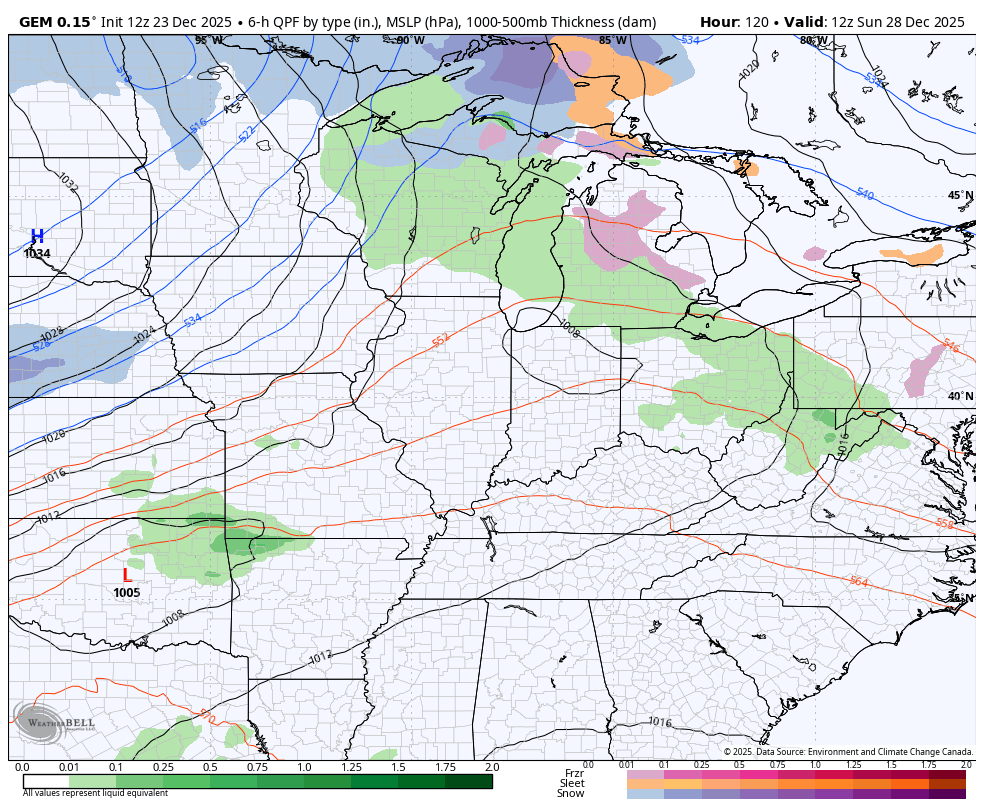
I still maintain that Saturday is the warmest day of the bunch with 70 a possibility on a strong southwest wind ahead of an arctic front dropping in late Sunday into Monday. This will have a wave of low pressure along it, but I’m not too jazzed up about much in the way of snow with this.
The Canadian continues to show the chance for some light snow and snow showers behind the front and I think that’s a possibility…
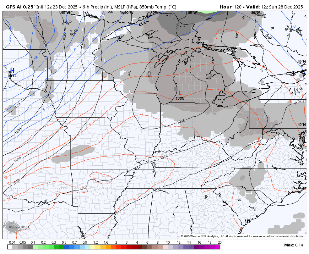
The AI version of the GFS doesn’t show precipitation types, but is trying to do the same…
Temps tank behind this boundary with wind chills pushing zero or below by Monday morning. That’s going to be a shock to the system.
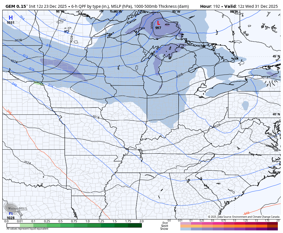
Another arctic shot blows in by New Year’s Eve and Day and this one has the chance to produce some snow around here.
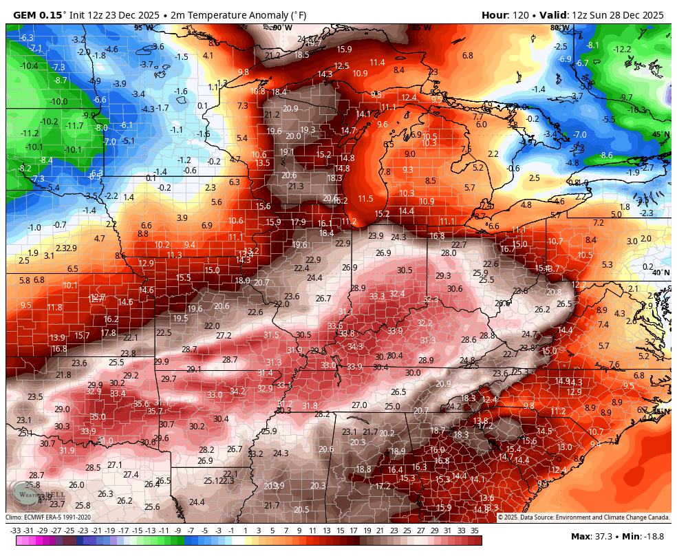
The Canadian has some…
So does the EURO…
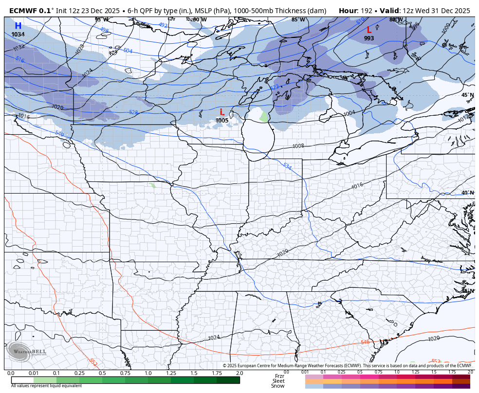
That’s a strong blast of arctic air behind it that should be able to open up the Great Lakes for some snows reaching all the way into the southern Appalachian Mountains.
Barney shows up behind each of these blasts…
To those who doubt and troll…

The full update comes your way later tonight. I’ll also have a few updates on my Meteorologist Chris Bailey Facebook Page
Until then, here are your tracking tools for the day…


Make it a terrific Tuesday and take care.
