Good Wednesday and Merry Christmas Eve! It’s one of the mildest Christmas Weeks on record for our region as a few showers join in on the warm weather party. This is ahead of another pattern change as arctic air arrives by late Sunday and Monday as our pattern starts to revert back to where we were.
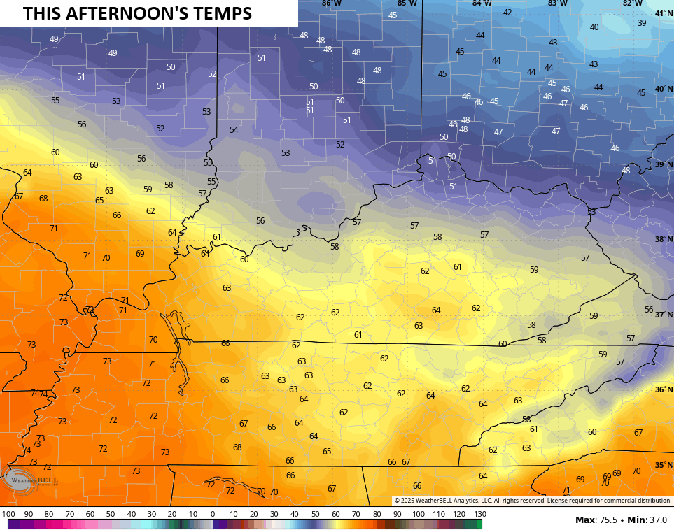
Let’s begin with our Christmas Eve and roll forward. A cold front drops into the state from the north and northeast, setting us up with one healthy temperature gradient Areas in the north and northeast may stay in the upper 40s while the west hits the low 70s, breaking some records out there.
Here’s the gradient I’ve been pointing to…
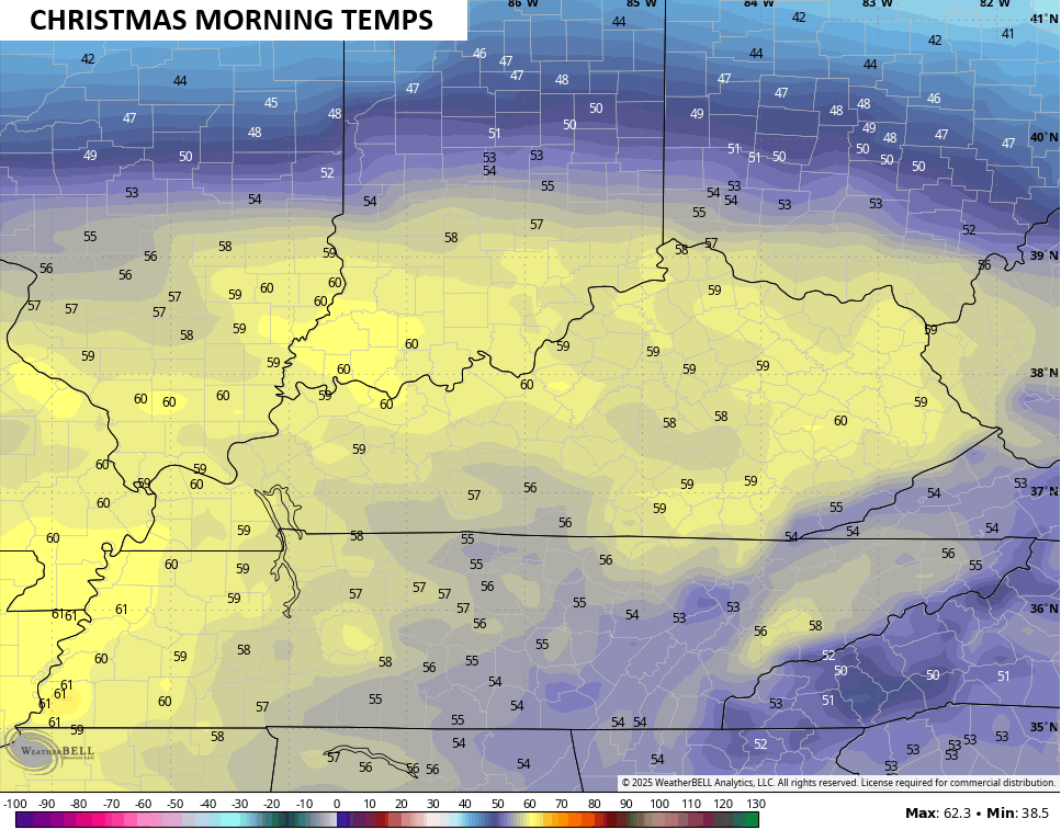
Southwest winds push that boundary to the north tonight, setting us up with a very mild Christmas morning with temps around 60…
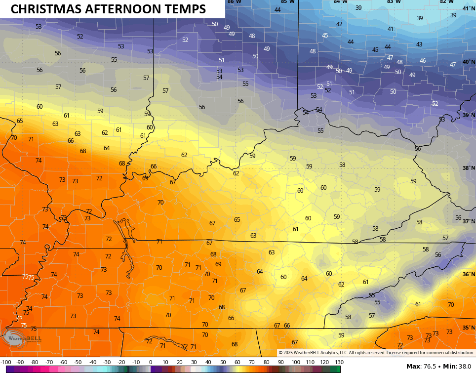
Another big temp gradient sets up Christmas Day, but this one is a bit farther north than the one today. Low and middle 70s may show up in the west…
A few showers will be noted from time to time, but nothing looks terribly widespread.
Another system races through Friday with a better shot for some showers. That weak front may knock the numbers down some by Friday night and early Saturday but another strong southwest wind kicks in late Saturday into the first half of Sunday. This one may boost temps to 70 for the entire state.
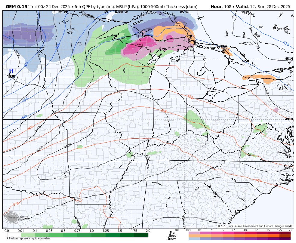
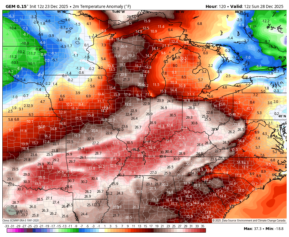
This is ahead of a significant arctic blast arriving late Sunday into Monday. This boundary drops in with gusty showers and some thunder ahead of it with the chance for some snow showers and flurries behind it. This animation from the Canadian starts Sunday morning and goes through Tuesday…
That will be followed by another arctic front New Year’s Eve and Day…

Both of those unleash the Barney back into our region and into the eastern half of the country as temps go well below normal…
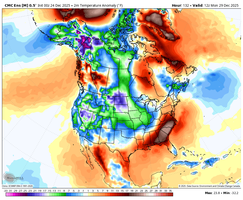
These arctic cold shots look to originate toward Alaska and the Yukon and dive southeast from there, similar to what we just went through earlier this month. The Canadian Ensembles see this into the first week of the new year…
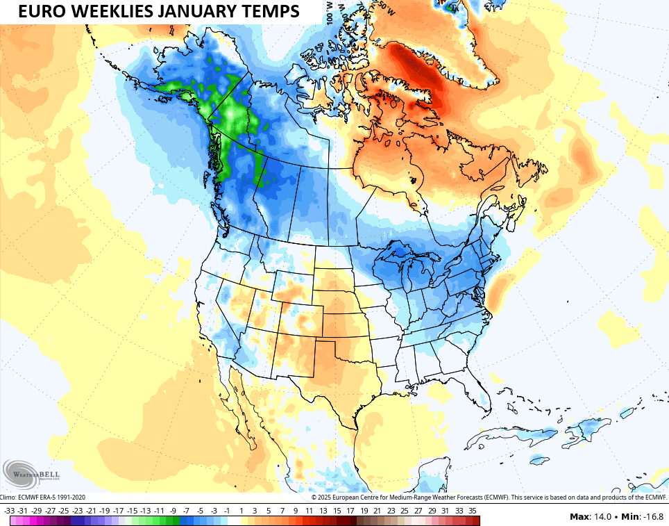
Looking farther down the road with the EURO Weeklies, they’ve had some issues of late, but they’re getting things squared away finally. The temperature map for January shows a familiar pattern with colder than normal temps from Alaska and the Yukon stretching southeastward into the eastern half of the country…
I should have another update later today so check back. I’ll also have a few updates on my Meteorologist Chris Bailey Facebook Page
Until then, here are your tracking tools for the day…


Make it a Merry Christmas Eve and take care.

With the cold shots coming, will the cold substain long enough for snow chances. I hate it when its back and forth with temps
No, because the Subtropical jet stream is not active, due to strong high pressure to our South. The two air m*a* sses battle it out through the period. Maybe wet when it’s warm, and dry when it’s cold. Most of the Winter weather will be in the Northern States, where you have an active La Nina jet stream, and lower pressure. Exactly what we had earlier this month. Some light Snows in East Kentucky from Clipper Systems. That’s the way I see it. Those Snows from Clipper Systems are very dry, and not like the ones that come from a phased Colorado Low or Texas Panhandle Low pressure, with a lot of moisture from the Gulf. Maybe, we will have one of those wet Snowstorms latter in the Winter season ?
Outlook from the Climate Impact Company. Showing various Maps : )
https://climateimpactcompany.com/u-s-medium-range-cold-6-10-day-forecast-increases-aerial-coverage-extended-range-is-intriguing-2-2/
Also looks like the weeklies trying to pop a +PNA around middle of January give or take a few days..Need something to wake up southern stream..Maybe a +PNA will shake things up..