Good evening and Merry Christmas Eve. This deep south Christmas weather rolls on across our part of the world and it will stay pretty darn toasty through the weekend. That’s ahead of an arctic front dropping in and ushering in a major pattern change.
It’s a holiday evening, so let’s hit the high notes.
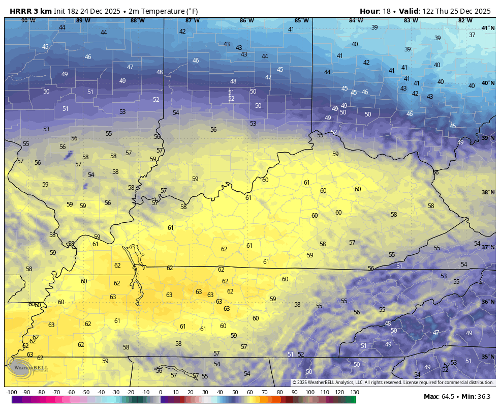
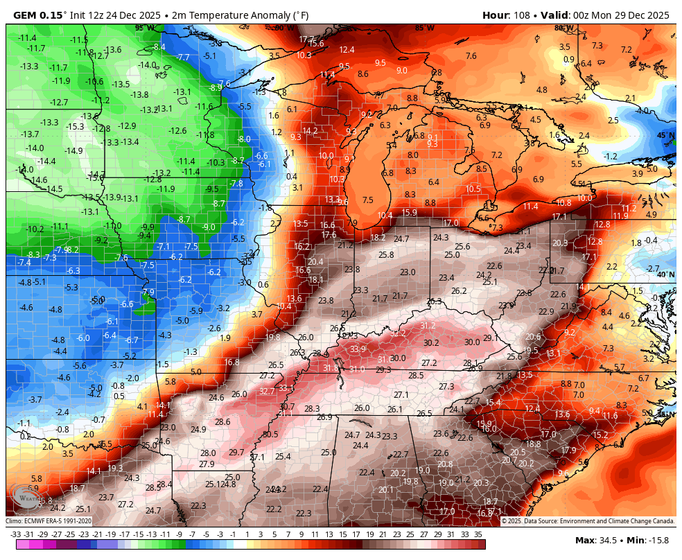
Temps for our Christmas Day will likely flirt with or set records in the west and southwest. The rest of the state enjoys much above normal temps, but that stubborn boundary that was evident today will be back with us tomorrow.
This animation from the HRRR shows the 7am to 11pm temps…
Temps drop behind a weak front late Friday and early Saturday then soar late Saturday and Sunday. That’s on a strong southwest wind ahead of the approaching arctic front that arrives Sunday night. Gusty showers and some thunder will be ahead of this boundary with tanking temps and snow showers and some flurries behind it on Monday and, perhaps, Monday night…
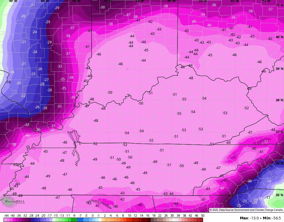
The temp drop from Sunday into Monday is absolutely amazing with the Canadian showing 50 degree+ 24 hour temperature drop…
The Parallel Canadian isn’t as stout but it’s in the ballpark…
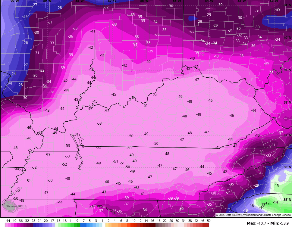
So is the EURO…
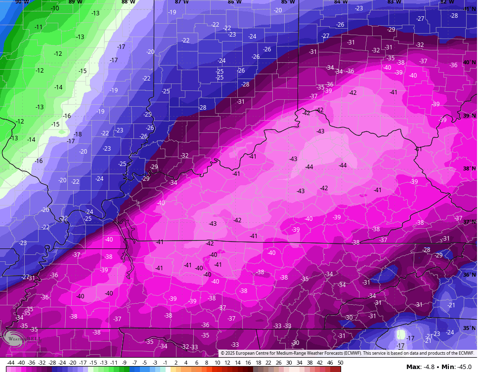
That’s a major shock to the system with wind chills making it feel 60-70 degrees colder from the peak Sunday temps to the wind chills of late Monday.
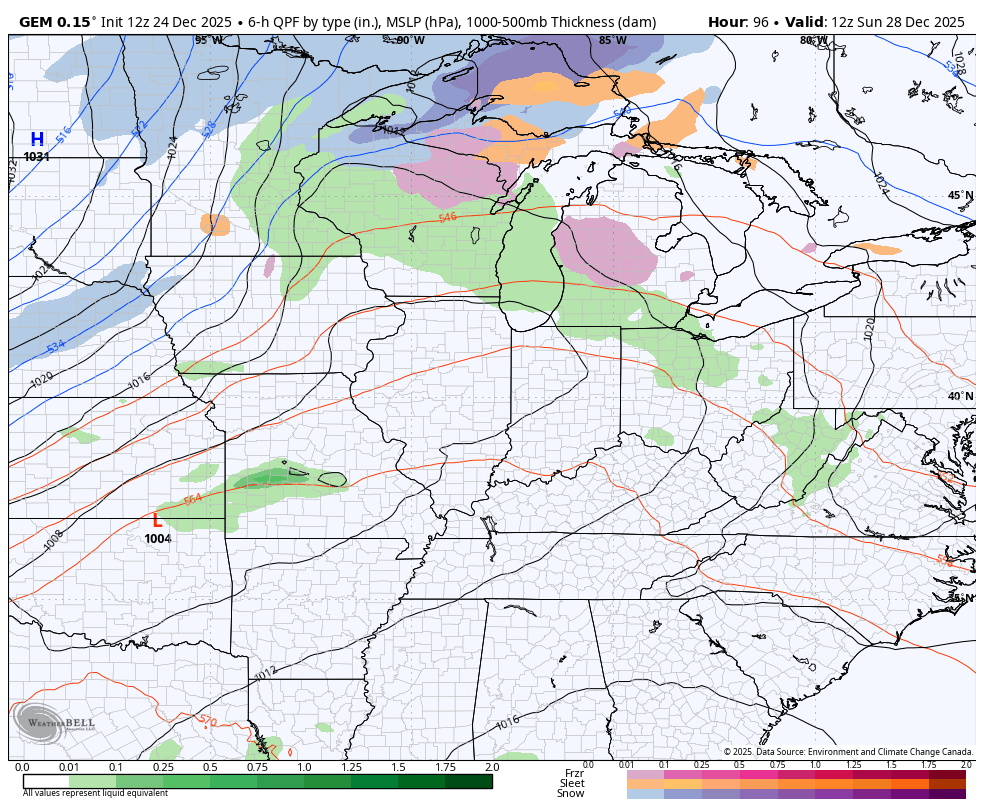
Another arctic front will drop in here New Year’s Eve and Day and may very well have a band of light accumulating snow with it. The Canadian is leading the charge on this with other models showing it then losing it then showing it again…
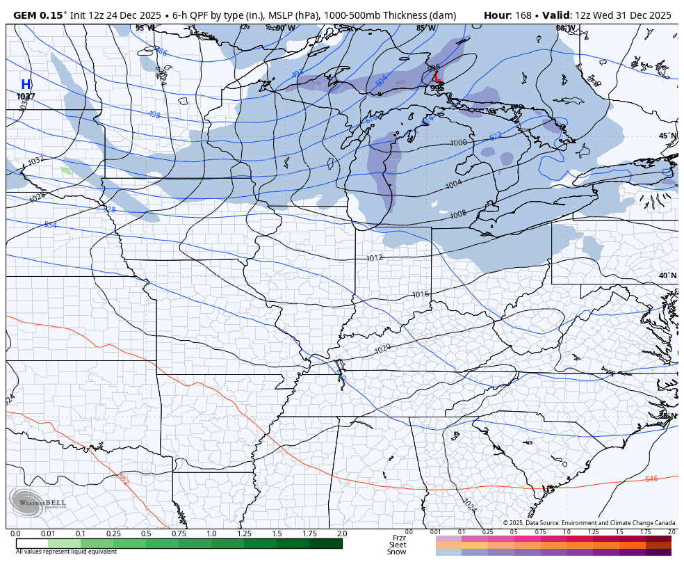
That unleashes another blast of Barney into our region to start the new year. Here’s a look at both Barneys…
Your normal full update comes your way later tonight. I’ll also have a few updates on my Meteorologist Chris Bailey Facebook Page
Until then, here are your tracking tools for the day…


Make it a Merry Christmas Eve and take care
