Good Thursday and Merry Christmas, everyone. Here’s hoping this update finds each of you enjoying the best Christmas ever. If not, hang in there, better days are ahead for you! As far as the weather goes, it’s warm and it’s ugly. This warm air hangs through the weekend before arctic air slaps it silly.
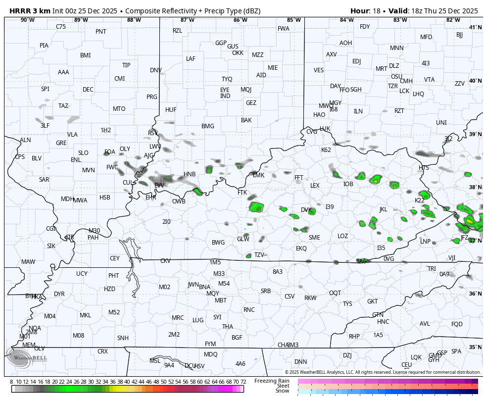
Our Christmas Day features another big temp gradient from north to southwest. Areas of southwestern Kentucky make a run at 70 again while the north and northeast likely stay in the 50s. That’s because of a weak boundary that will also kick off a few showers. This action increases a bit tonight into central and eastern Kentucky and that carries us into Friday…
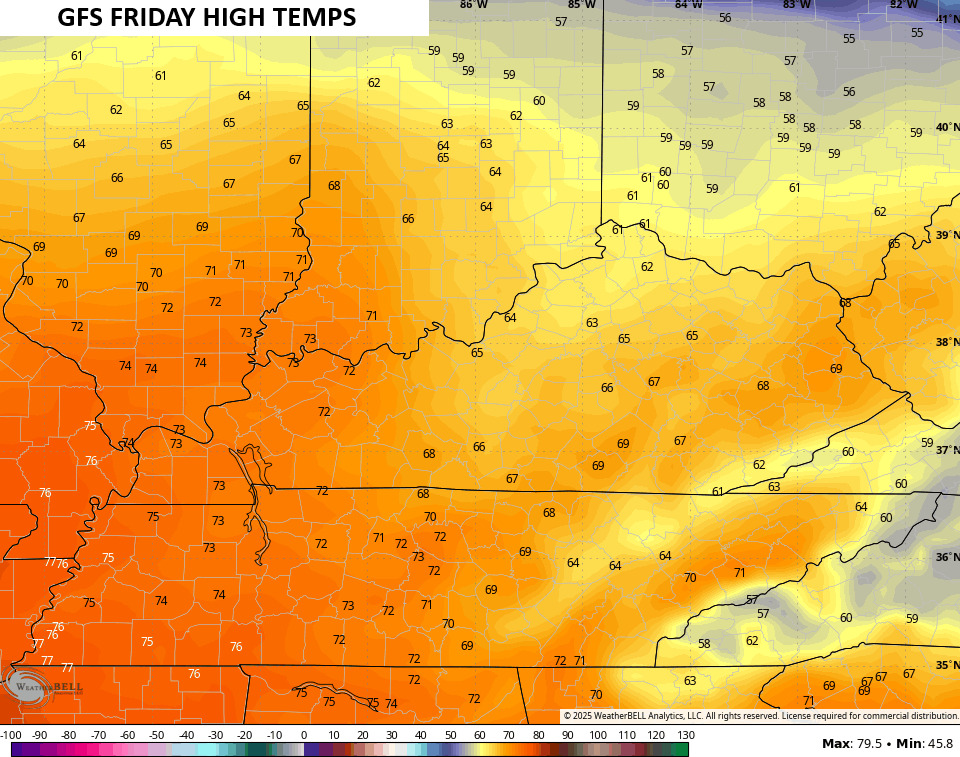
Temps on Friday jump deep into the 60s for the entire state on a gusty southwest wind. 70s are likely in the west with some areas of central and eastern Kentucky pushing the 70 mark…
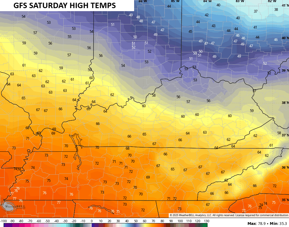
That boundary slides a bit south for Saturday with high temps coming down some…
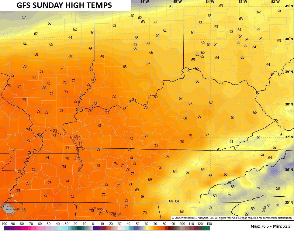
That boundary then shoots back to the north ahead of the approaching arctic front. Temps on Sunday have a chance to hit the 70s for the entire state, giving us one of the warmest late December days on record…
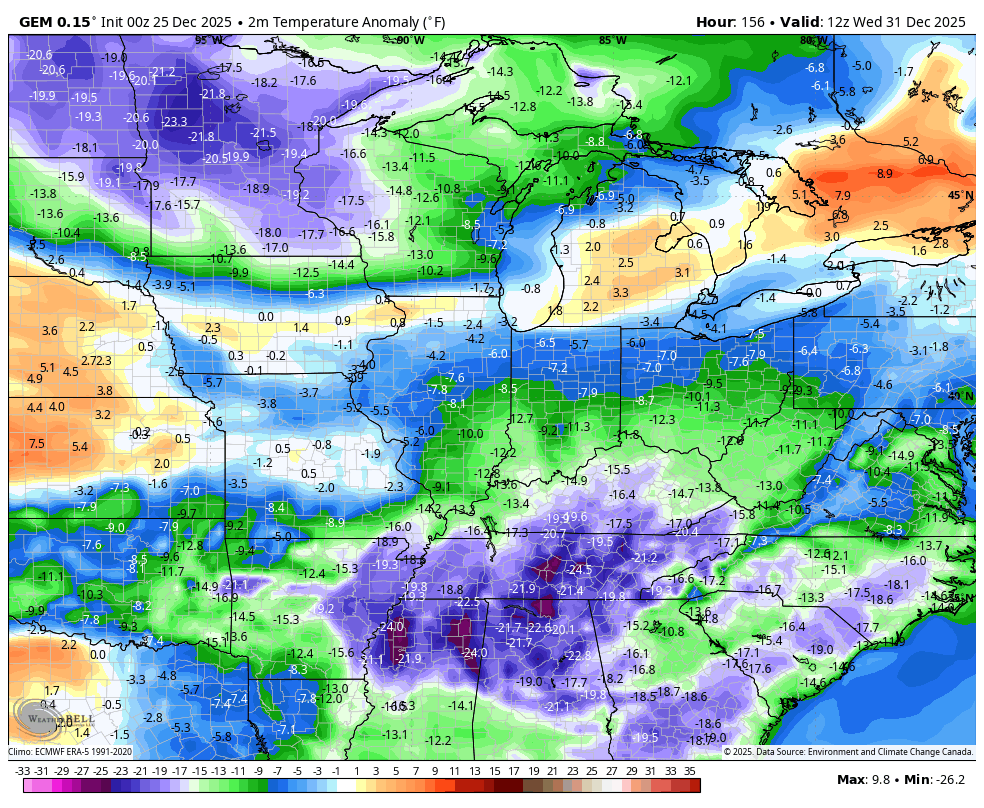
The warmer Sunday is because of the slightly behind schedule arrival time of the arctic front. This now slams in here Sunday night and Monday with 40mph wind gusts, showers and some thunder ahead of it, a major temp crash with snow showers and flurries behind it.
Most of the medium range models are slowly trending toward the Canadian…

With cranking winds and arctic air behind this, it’s going to be a major shock to the system. The “feels like” temp goes from near 70 Sunday afternoon to single digits by Monday afternoon and evening…

From one extreme to the other… There’s literally no normal in our weather nowadays.
From there, we watch another blast of arctic air arriving to close out 2025 and usher in 2026. This will likely be accompanied by a period of snow, though the exact arrival time is a work in progress. The Canadian keeps on keepin’ on…

Barney time follows…
While I think the Canadian has the overall right idea, the timing on that may be just a bit too fast.
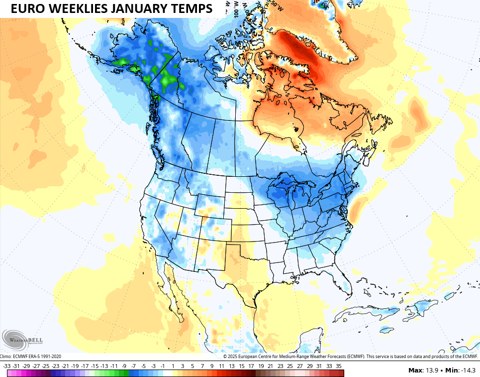
The EURO Weeklies continue to grow colder and snowier for January. Knowing a thing or two about how the models operate, expect the model to trend colder and colder…
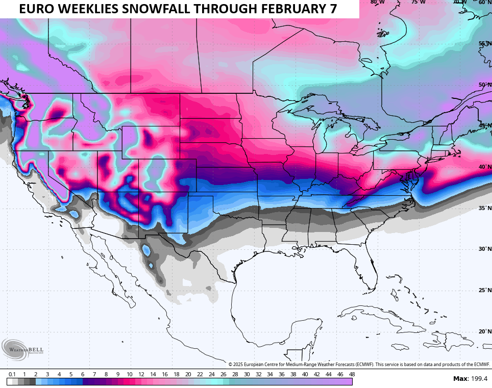
The snow map is also playing catch up…
I should have another update later today so check back and will be on WKYT-TV this evening. I’ll also have a few updates on my Meteorologist Chris Bailey Facebook Page
Until then, here are your tracking tools for the day…


Make it a Merry Christmas and take care

Thanks Chris, and Merry Christmas to you and your Family. I know that it’s not Christmas weather, but Christmas is not about the weather type. I’ve experience a lot of mild to warm Christmases in my lifetime, and some very cold ones, but more mild ones than cold ones. My best ” White Christmas ” was in 2004. The climate in this part of the country has always been the same. I haven’t seen any changes in my 74 years.
Merry Christmas to All, and be Safe Everyone !