Good evening and Merry Christmas. Our warmer than normal pattern rolls on and will be with us through the weekend. Beyond that, Old Man Winter shows up in a big way with an arctic blast eo end the year with another on the way to start the New Year.
Today’s temps were, for some cities, the top 10 warmest on record for Christmas Day. These numbers jump even more for Friday with some showers around as a weak front slides back in from the northwest. This front heads back to the north later Saturday with near record highs for many on Sunday.
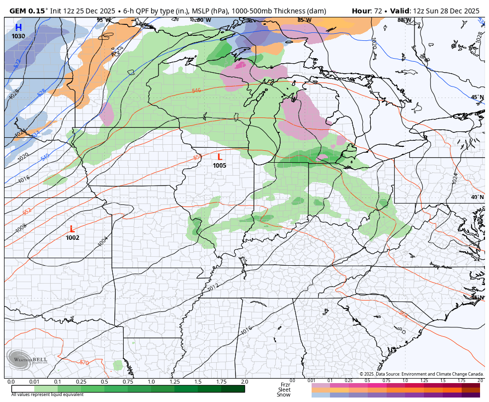
This is ahead of an arctic front slamming in here Sunday night and Monday. Gusty winds and showers and thunderstorms will be along and ahead of this boundary. Once it slides by, snow showers and flurries kick in Monday and last into early Tuesday.
The Canadian continues to be the model of choice…
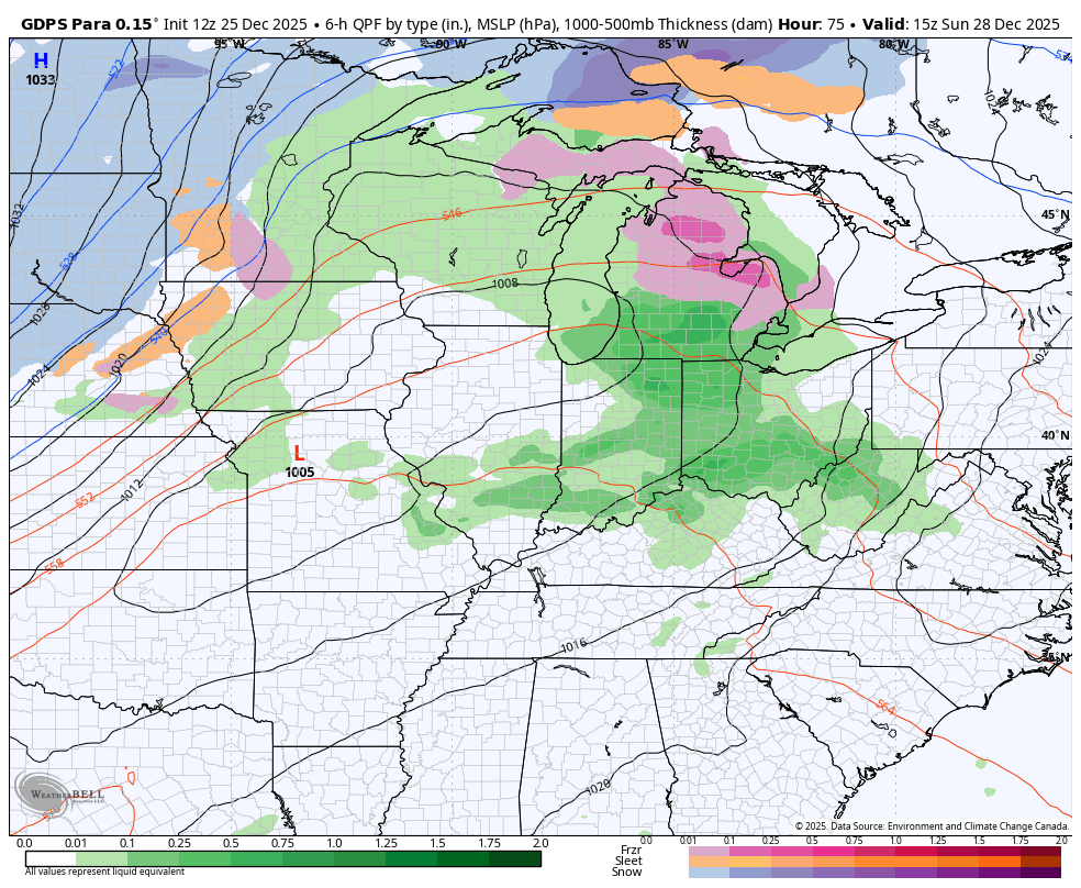
The Parallel Canadian is similar…
Temps Sunday may reach 70 and then drop like a rock. The feels like temps head toward the upper single digits and low teens by late Monday afternoon and evening. This animation shows the numbers from Sunday afternoon through 7pm Monday…
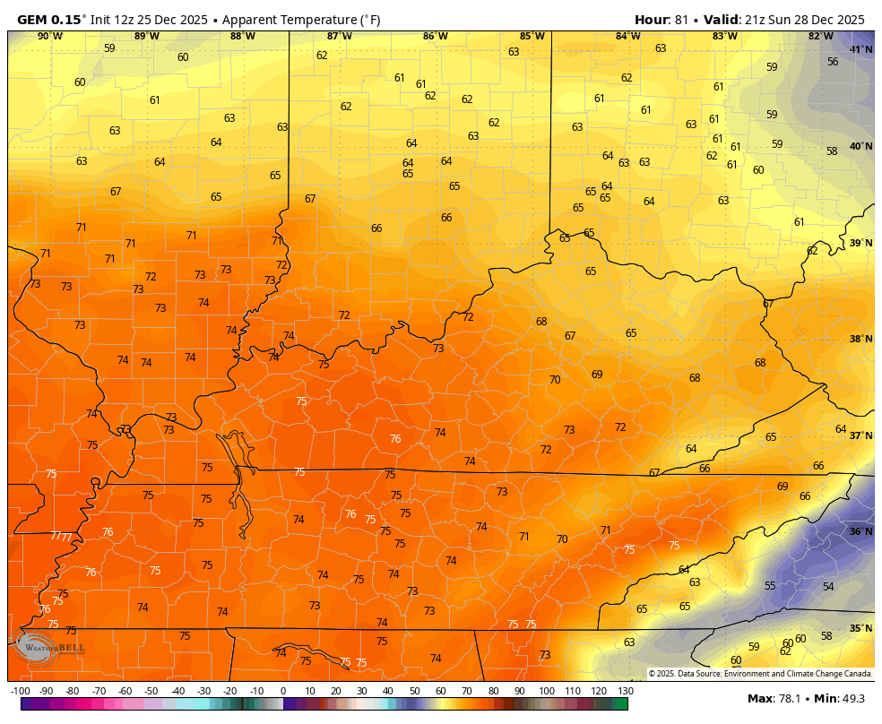
Ouch!!!
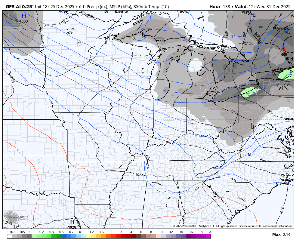
There’s a new model known as the GFS AI and it seems to do better than the actual GFS. It doesn’t show precipitation type right now, but you can see how the model suggests those snow showers showing up behind the arctic front on Monday…
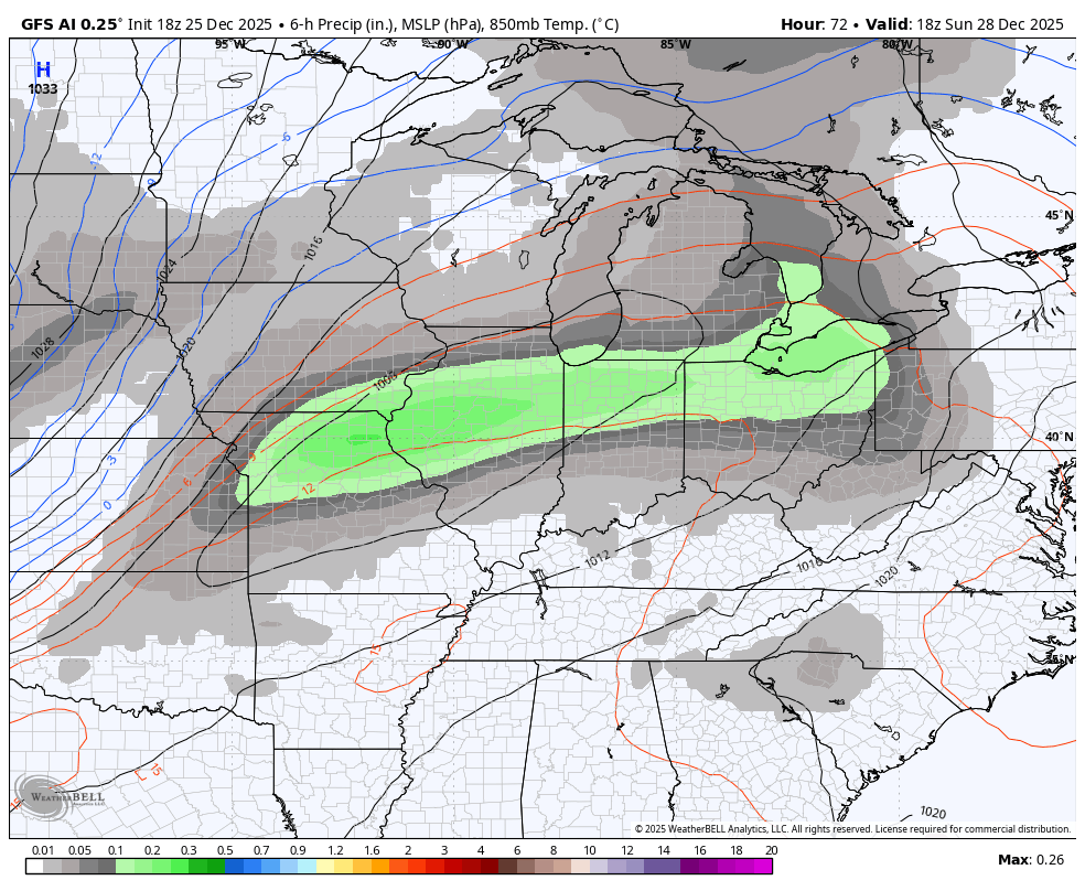
It’s also seeing the arctic front with a shot of light snow arriving to begin the New Year…
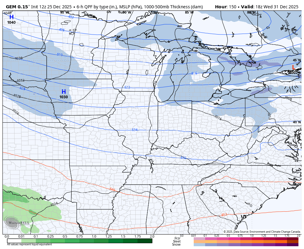
The Canadian has the arctic front still but doesn’t have the amount of snow showers as prior runs…
Your full update comes later tonight. I’ll also have a few updates on my Meteorologist Chris Bailey Facebook Page
Until then, here are your tracking tools for the day…


Make it a Merry Christmas and take care
