Good Friday, everyone. It’s another incredibly warm day across the Commonwealth with even warmer temps coming this weekend. That’s ahead of a major change with arctic air surging in here Sunday night and Monday.
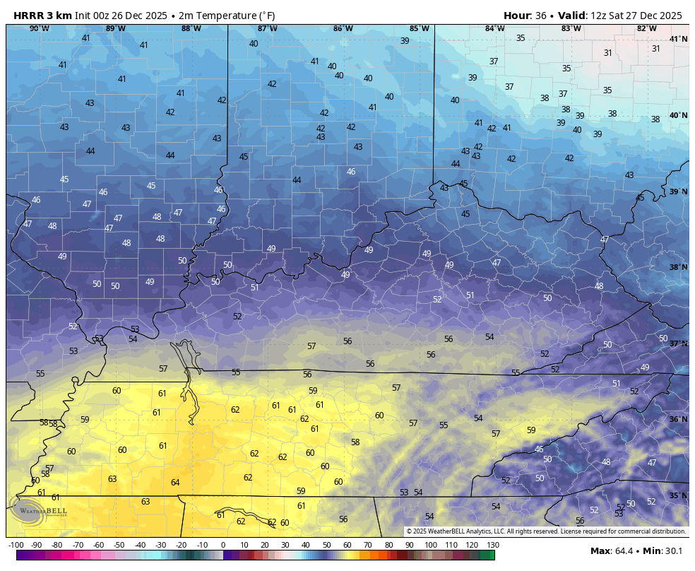
Temps out there today hit the 60s across most of Kentucky with a few showers on the move ahead of our boundary that sags southward through the region tonight. This knocks the temps down some on Saturday, especially across the northern half of the state…
That front heads back to the north on Sunday as a VERY warm southwest wind kicks in. This southwest wind will boost temps to near record or record highs around 70, if not a little better. This is going to be on of the warmest late December days on record.
Then, the arctic front arrives.
This boundary will have 40mph wind gusts along and ahead of it with showers and a few thunderstorms going up. Temps crash right behind the boundary with some snow then snow showers and flurries kicking in later Monday into Tuesday.
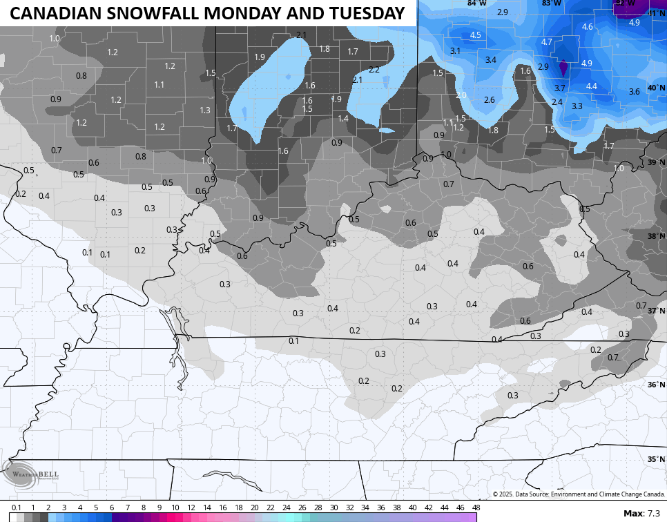
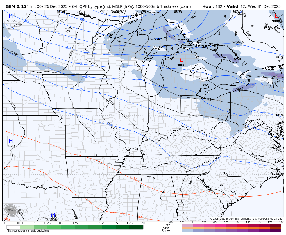
The Canadian continues to lead the way…

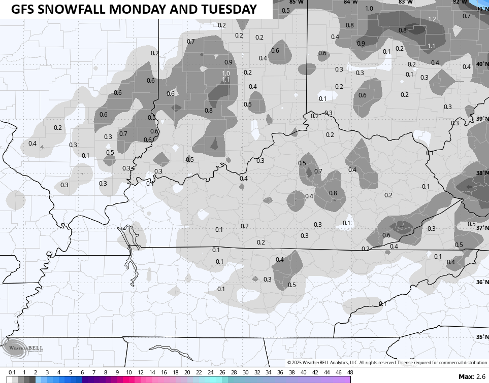
The GFS is finally seeing the potential for some flakes, but it’s still too progressive with it…

We even have the chance for some light stuff to stick on elevated surfaces and both models are showing this…
To think that happens less than 24 hours after likely record highs around 70 is pretty astounding.
To illustrate just how amazing of a temperature drop this is, take a look at this actual air temperature animation from the Canadian. This starts with 70 degree temps at 4pm Sunday and ends with temps dropping into the upper teens and low 20s Monday afternoon and evening…

What’s a 50 degree drop among friends?
If we add in the winds and look at the “Feels Like” temperature, that goes to more than 60 degree drop during the same time…
Incredible. Simply incredible.
The next surge of arctic air arrives New Year’s Eve into New Year’s Day and may very well bring a swath of light accumulating snow with it. Once again, the Canadian is the leader with the other models finally catching on…
The arctic air coming in behind this is going to be darn impressive to open up 2026. That’s some serious Barney…

This kicks off a pattern that likely turns into another prolonged period of harsh winter weather with the potential for a couple of significant winter storms. Another severe arctic outbreak or two appears possible, too.
Updates come your way later today. I’ll also have a few updates on my Meteorologist Chris Bailey Facebook Page
Until then, here are your tracking tools for the day…


Make it a fantastic Friday and take care
