Good Saturday, everyone. We have one of the wildest weather rides you’re ever going to see around here is coming up Sunday and Monday. This pattern is essentially squeezing all seasons into a 24 hour period and kicks off another flex from Old Man Winter.
Let’s break things down:
TODAY
- A big temp gradient sets up from north to south today.
- Temps may stay upper 40s and low 50s in the north.
- Southern and southwestern Kentucky may stay 60-65.
- Clouds are stubborn with some clearing as day wears on.
SUNDAY
- A strong southwest wind kicks in as our front goes back to the north.
- Temps surge toward record highs around 70.
- If we get any sun, temps hit 70-75 degrees.
- Sunday may be one of the all-time warmest late December days on record for Kentucky.
- A couple of showers may be floating around, especially in the north and west.
SUNDAY NIGHT
- Our arctic front sweeps quickly across the state from west to east.
- Winds along and ahead of this front may gust from 40mph-50mph at times.
- A squall line of showers and storms will be noted along and ahead of this front.
- There’s a low end threat for a few severe storms with this line, especially across the west and central.
- Temps drop 20-30 degrees in an hour or so as this front moves through any one location.
- Readings by morning are in the 20s across the west and central with a wind chill in the teens.
- Some snow showers and flurries will be possible behind this front.
MONDAY
- Temps continue to drop deeper into the 20s from west to east.
- Gusty winds give us a wind chill in the low and mid teens for much of the day.
- Single digit wind chills show up Monday evening.
- Monday afternoon and evening will feel 50 degrees or more colder than the same point on Sunday.
- A few snow showers and flurries will be possible into Monday night.
In terms of the actual cold front zipping through here, the future radar from the Hi Res NAM shows our thin squall line with the trailing snow showers. This animation starts at 6pm Sunday and ends at 7am Monday…
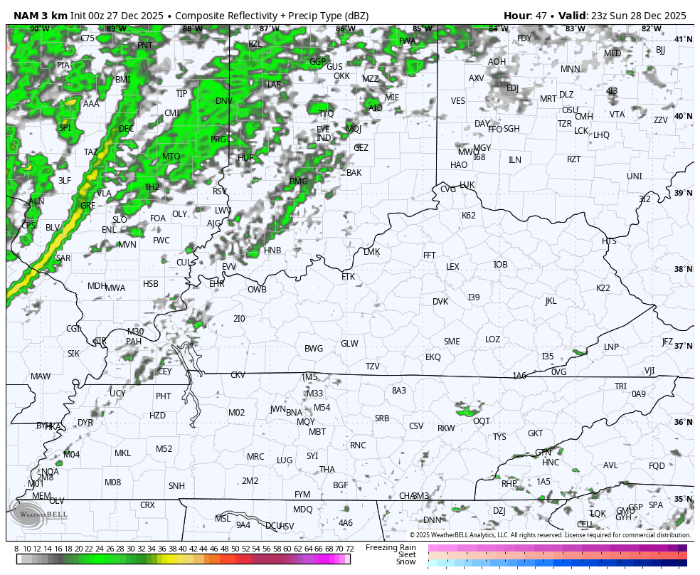
That line may produce a little bit of wind damage as it races across the state. For that reason, the Storm Prediction Center has a low-end Severe Storms Risk…

The dramatic temperature drop continues to look impressive. The Canadian takes us from 70-75 Sunday afternoon to around 20 by Monday evening…

Wind Chill temps are even wilder during this same time…
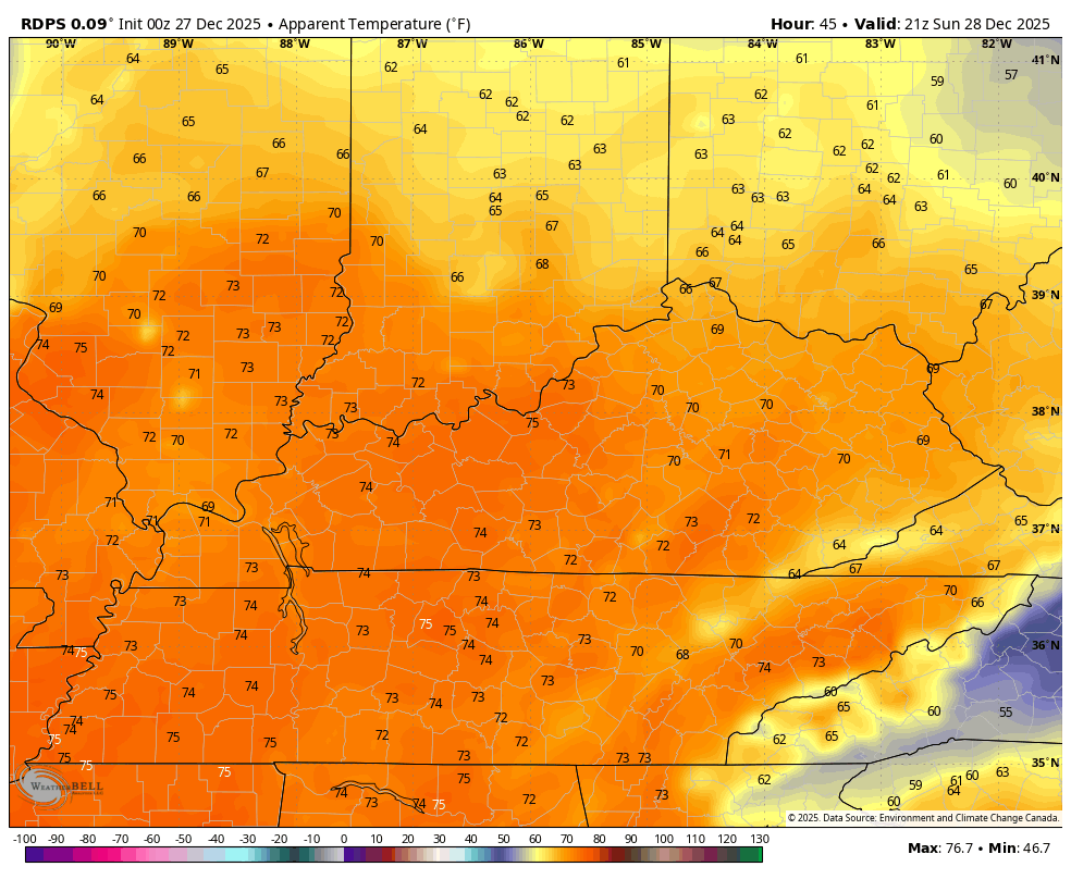
You can clearly see the “feels like” drop of more than 50 degrees in under 24 hours.
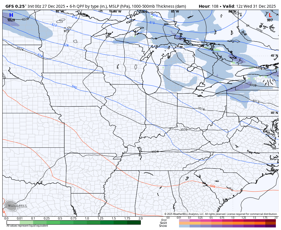
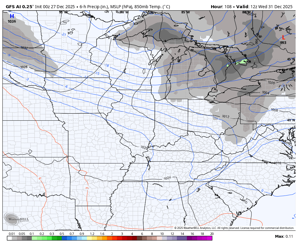
I continue to like the idea of a clipper moving in for New Year’s Day and the models show it then lose it then show it again. The GFS and GFS AI are seeing it pretty well…
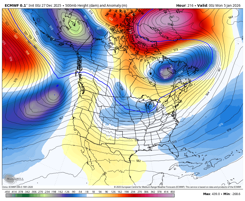
We continue to see the trend toward significant blocking going up in the high latitudes and that forces deep troughs into the country. Here’s the EURO from January 5-10…
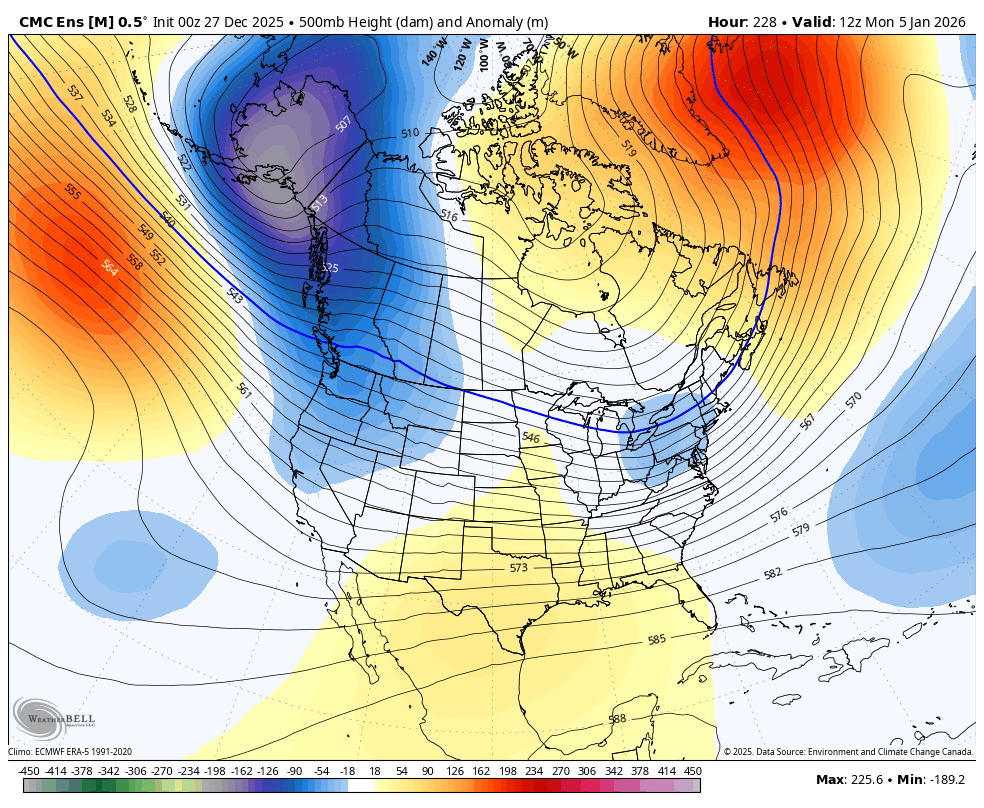
The Canadian Ensembles are seeing it…
Updates come your way later today. I’ll also have a few updates on my Meteorologist Chris Bailey Facebook Page
Until then, here are your tracking tools for the day…


Make it a great Saturday and take care.

Thanks Chris. Hope you and your Family, and everyone else had a Wonderful Christmas. Not liking the Spring weather in late December. It’s been a long time since I’ve seen it this warm during Christmas. The quick change back to Winter weather is going to be quite a shock to this old body of mine. Alberta Clippers can produce one to three inches of dry Snow in Louisville to Lexington, but South Central Kentucky remaining with a Snow flurry at best. It proved this earlier this month. The La Nina jet stream has not change from a few weeks back. I am worried about Severe weather, as just recently an EF-0 Tornado touch down just a few mile North from where I live. Scary !
It just really looks like BG and western KY are going to stay in the rain zone this year. It is weird to me how it is set up so solidly with all the previous systems and the future radars. And that snow line just won’t make it down south and west!
The reason is that we are in a La Nina, and only the Northeastern part of the State receives the light Snows from the Clipper Systems. Here in South Central Kentucky, we will have to wait on an El Nino. Then the Subtropical Jet Stream will be activated, and that increases our chances for major Snowstorms State wide.