Good evening, everyone. It’s another mild day that’s wrapping up across Kentucky with the warmest of the bunch still to come on Sunday. That’s the day we’ve been highlighting for widespread record high temps before the bottom falls out Sunday night and Monday as arctic air crashes in.
Overall, I have absolutely zero changes to anything I’ve been telling you for days now, so I’ll spare you ALL the details. Instead, let’s hit the high notes.
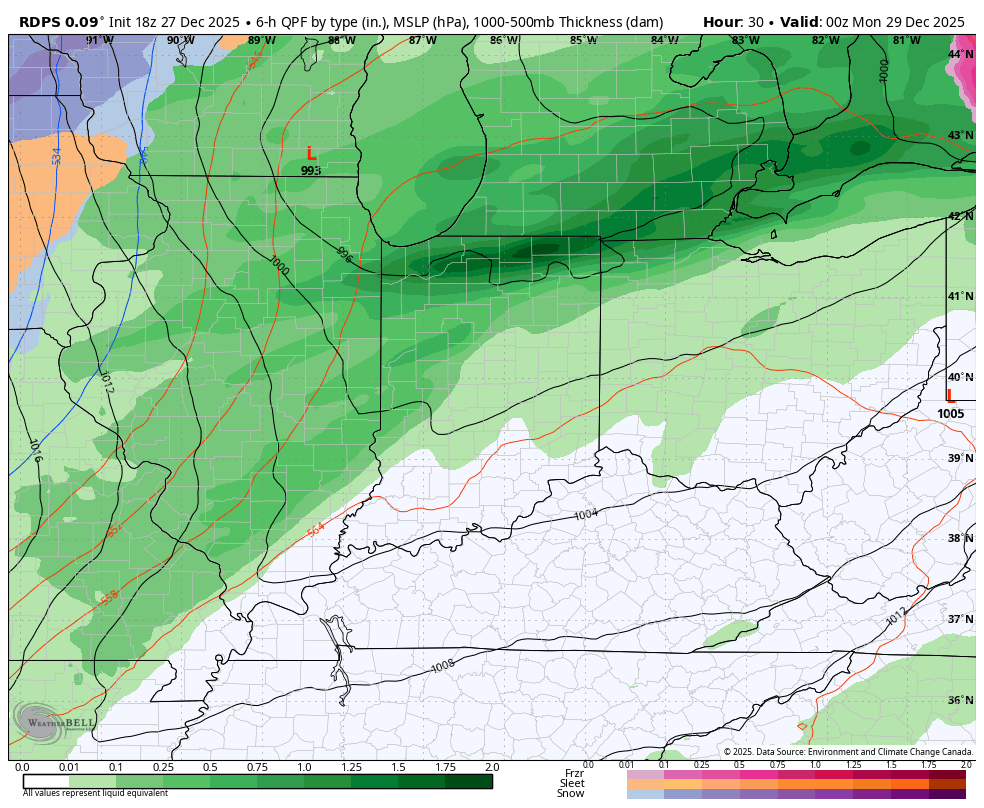
The high notes start with the highest temps of this incredibly warm week. Temps will likely hit 70 or better for most of Kentucky, setting records along the way…
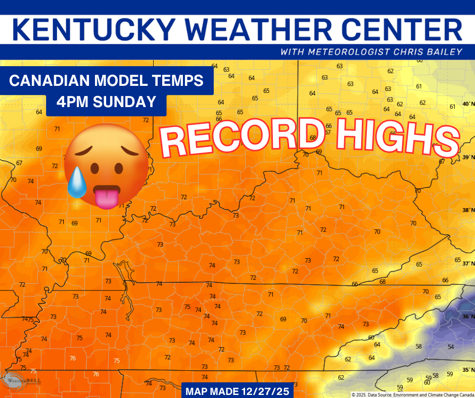
That map is for 4pm Sunday. As the arctic front slams through Sunday night, temps drop into the 20s by Monday morning with wind chills hitting the single digits in some areas…
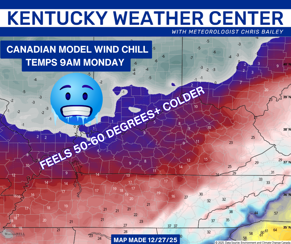
It will feel more than 50 to 60 degrees colder than what we had just hours before on Sunday. That’s pretty wicked and anyone saying it’s not has a screw or two loose. Don’t we all, though. ha
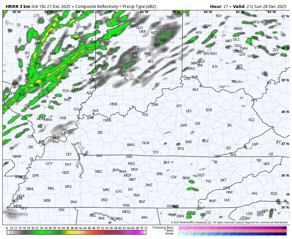
This arctic front will also have a line of showers and storms along and ahead of it as it races through Sunday evening into Sunday night…
Winds are going to be a big player and we will likely see 40mph to 50mph gusts Sunday night…
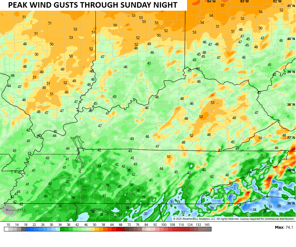
A widespread Wind Advisory should be issued for this event. Here’s hoping that happens, but after the last big wind event that caused all kinds of issues with no advisory… Who knows.
The Storm Prediction Center has scaled back the Marginal Risk for severe storms…

Local wind damage is possible along this entire line as it races through the entire state.
A few flurries and snow showers will be possible right behind this departing front then again with some wraparound action Monday night…
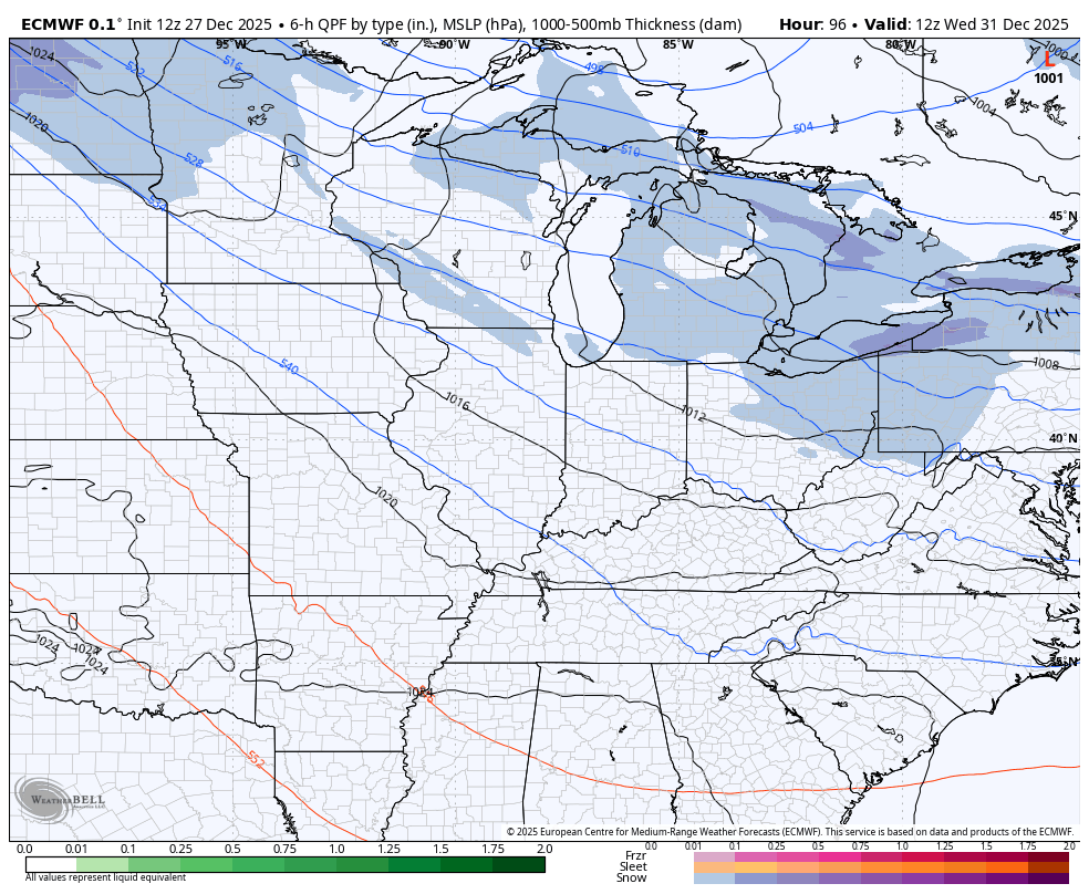
I still like the idea of a clipper bringing a swath of light snow in here on New Year’s Day, even though the models go back and forth on the idea.
Here’s the EURO showing it…
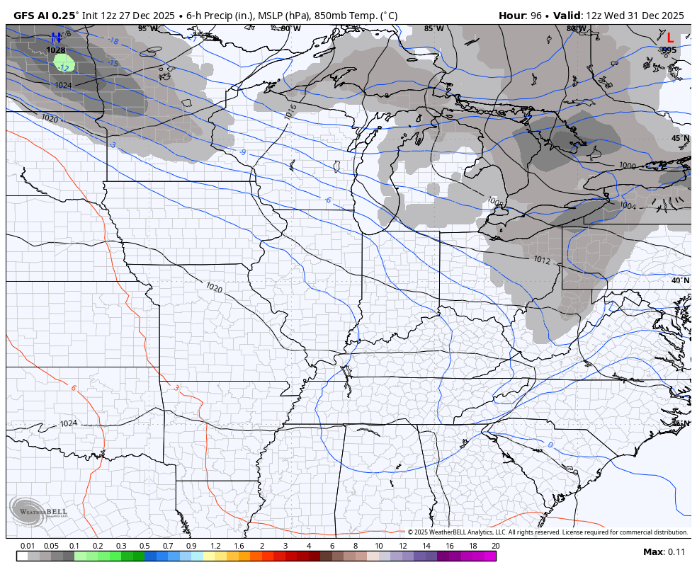
And the GFS AI that doesn’t show precipitation types…
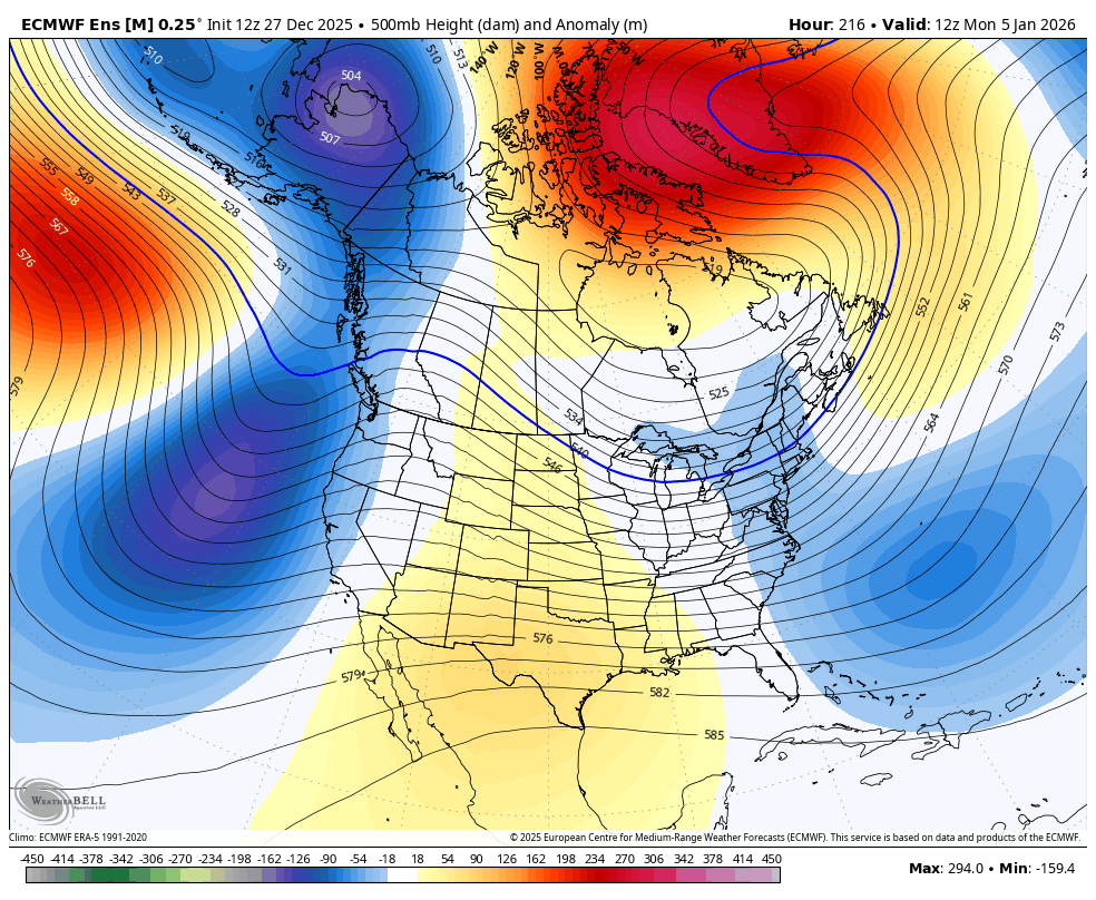
There’s a signal that’s been showing up for the first full week of January that’s getting my attention. Don’t take any specifics from any model, but the setup may very well pop a winter storm system in the eastern US…

The look on the EURO Ensembles for that week is pretty impressive with MASSIVE blocking showing up…
I’ll see you guys back here later tonight with a look at the EURO Weeklies that continue to trend toward another prolonged period of harsh winter weather. Have a great evening and take care.
