Good evening, everyone. Wow. That’s about all I can say about the current setup in our region as Mother Nature takes a serious walk on the wild side. Next up on the wild side is a wild ride with single digit wind chills surging in tonight and Monday morning, kicking off another harsh winter period.
To make the day even stranger, we had an earthquake today in central Kentucky…
Breaking News: A magnitude 3.2 earthquake just hit central Kentucky. The epicenter was between Lancaster and Richmond Kentucky. #kywx pic.twitter.com/oJsZ6D4Rh5
— Chris Bailey (@Kentuckyweather) December 28, 2025
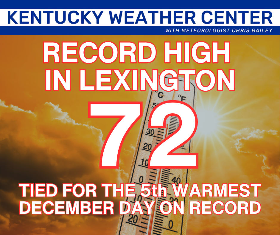
As this is happening, we are getting winds gusting to near 50mph with record highs falling across the entire region. This goes down as one of the warmest December days ever recorded around here…
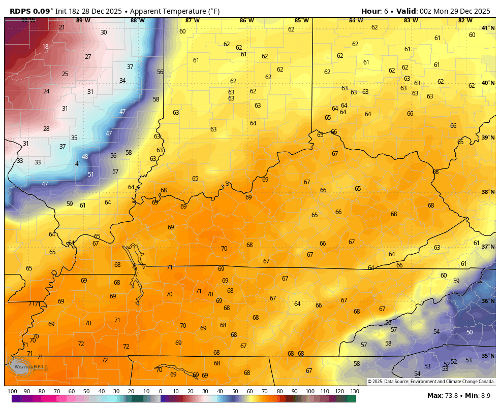
Temps are still super mild this evening as our arctic front powers in from the west. The temps tank behind this boundary and you can track them here…

With this active setup, we continue to run the risk for a few severe storms. There’s a Tornado Watch for a part of western Kentucky as a squall line of storms races in from the west. This line weakens the farther east it gets, but it’s still likely to produce 50mph+ wind gusts across the entire state.
Here’s the evening Severe Weather Outlook from the Storm Prediction Center…

The greatest Tornado Risk is to our northwest…

The Damaging Wind Outlook is only for thunderstorm winds…

Areas of wind damage will likely show up across the entire Commonwealth tonight with widespread gusts of 50mph or greater possible.
The cold air crashing in behind the front is every bit as dramatic as I’ve been pointing toward for about a week now. We go from 70-75 early this evening to a wind chill in the single digits by morning. This is still astounding to watch…
A few flurries and snow showers will be noted right behind the front, but the northwest wind will spit out snow showers and flurries starting late Monday through Monday night. The Canadian Models have had this for days and now the HRRR is seeing it…
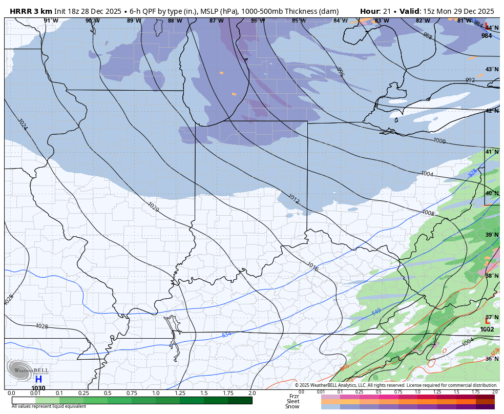
Some coatings will be possible in a few spots, especially in the east.
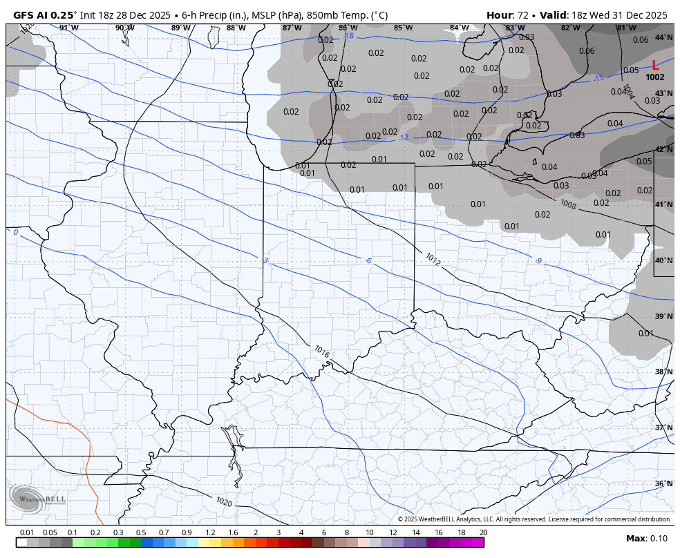
I like the clipper coming in New Year’s Eve and Day with a swath of light snow from northwest to southeast. The best chance to put some light snow on the ground is across the eastern half of the state.
The models go back and forth on this still, but the GFS AI seems to have a good handle on it…
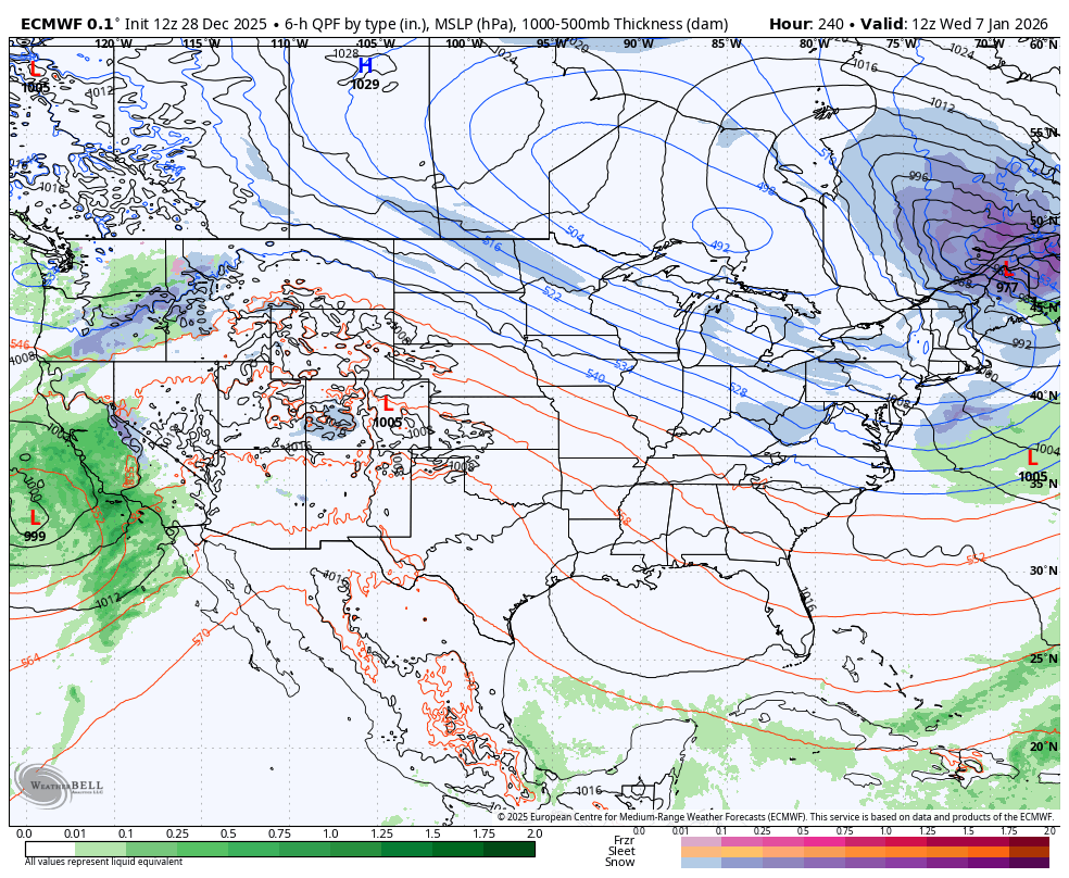
Our extreme pattern is about to swing the other way with my growing concern about another harsh period of winter weather for January. The off the charts blocking continues to show up in the high latitudes starting in the first full week of January. This will force some fun and games underneath that in the eastern half of the country and the EURO is seeing that…
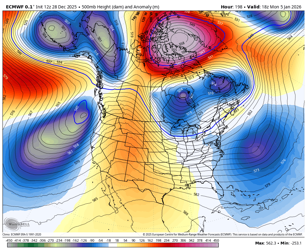
The surface maps will change dramatically from run to run, but the signal remains for a potential eastern US winter storm at some point during this time…
I may have another update this evening. If not I’ll be back with the full update later tonight and I’ll be putting out updates via my Meteorologist Chris Bailey Facebook Page . Until then, here are all the storm tracking tools you need to start the week…


Current watches

Possible Watch Areas

Make it a great Sunday and take care.
