Good evening, everyone. As expected, Old Man Winter is back in the Commonwealth and looks to start flexing more and more as we get into January. This flex may even bring some light snow in to parts of the state to start the New Year.
Before we look ahead, let’s look back at what amounts to an historic change, which also included a non weather related earthquake…
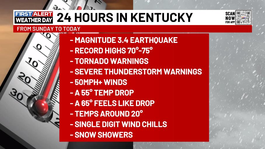
To think all of that happened in LESS than 24 hours is pretty astounding. Like… Wow!
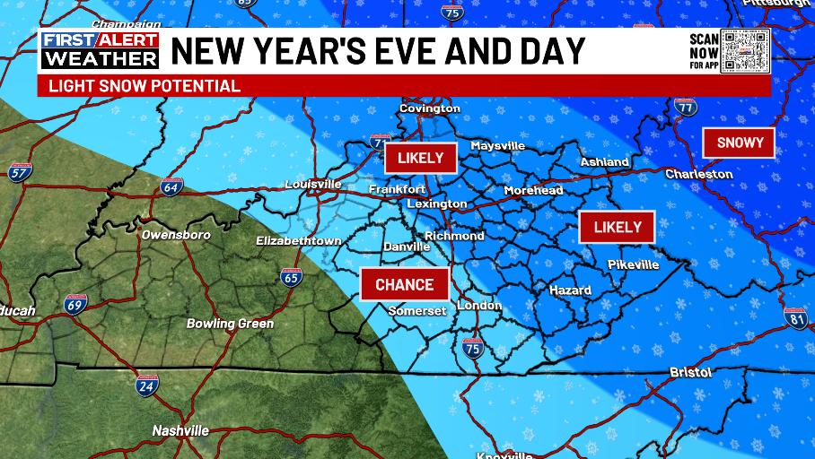
Wind chills tonight hang in the single digits with some snow showers and flurries. This may produce some hit and run light accumulations, especially in the east.
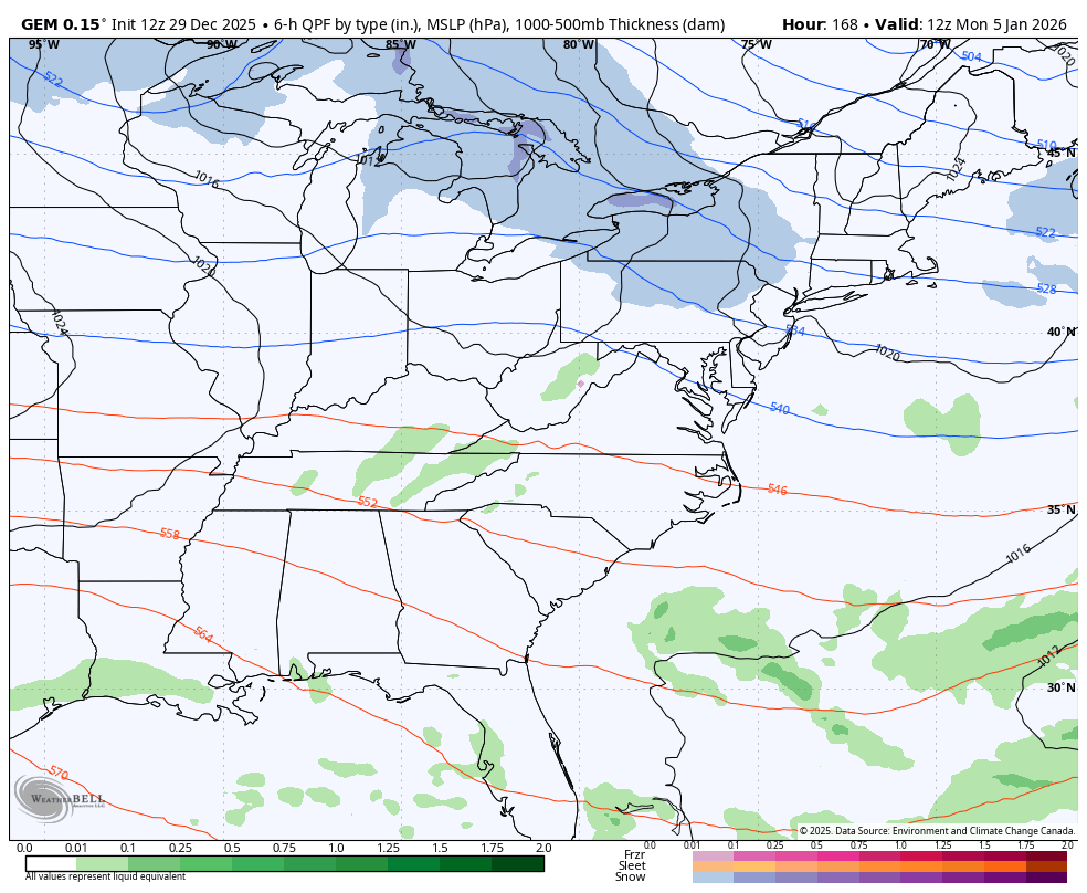
The clipper moving in New Year’s Eve and New Year’s Day will have a swath of light accumulating snow with it. Here’s the area I’m highlighting for the best chance at seeing some light stuff…
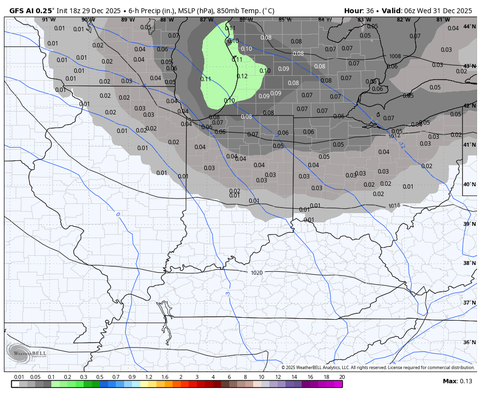
That may be preceded by a light snow system that brushes northern and northeastern Kentucky Tuesday night and early Wednesday. The GFS AI is seeing that and is a bit farther south with the New Year’s Eve and Day system…
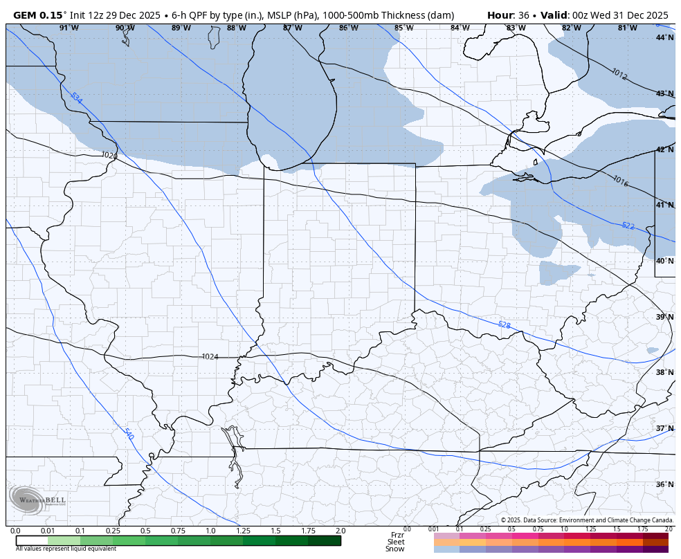
The Canadian Model has had the hottest hand of the winter and isn’t as far southwest…
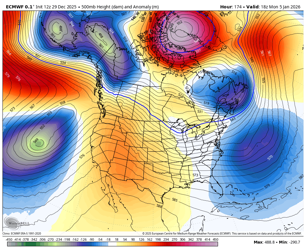
From there, we watch massive blocking going up in the high latitudes. This kind of blocking can cause some wild winter scenarios underneath it and the models continue to point toward some kind of cutoff deep lows in the east next wee.
Here’s the Canadian…
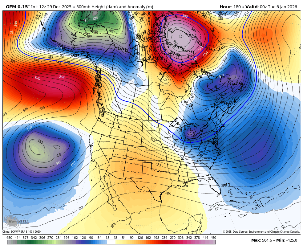
Details at the surface will change a lot from run to run, but the signal is there for an eastern US winter storm system. Here’s the Canadian seeing the signal…
The upper level look from the EURO sees these systems diving in right through the end of the 15 day run…
The EURO Weeklies continue to grow more and more harsh with each run. We will look at those later on.
I’ll be back here with that full update later tonight. I’ll also have a few updates on my Meteorologist Chris Bailey Facebook Page
Until then, here are your tracking tools for the day…


Make it a great evening and take care.

Unless the pattern changes, I dont forsee any snow chances here in Western ky . Like Schroeder said there’s been no flow of out of the gulf that would interact with the cold air to produce a snowy event across the state.