Good Tuesday, everyone. It’s another cold day across Kentucky as our wicked wind chills slowly ease up. I’m tracking two more light snow systems set to impact parts of Kentucky as before we get to 2026. Once into the new year, Old Man Winter has another harsh look for us.
Flurries and a few snow showers are out there this morning with some hit and run light accumulations. Wind chills are still in the single digits to start the day with afternoon wind chills in the teens with highs ranging from the upper 20s to mid 30s across the state.
A light snow maker is going to brush northern and northeastern Kentucky tonight and Wednesday morning. This has a chance to spit out light accumulations in these areas. That’s ahead of a stronger system dropping in for New Year’s Eve and early New Year’s Day.
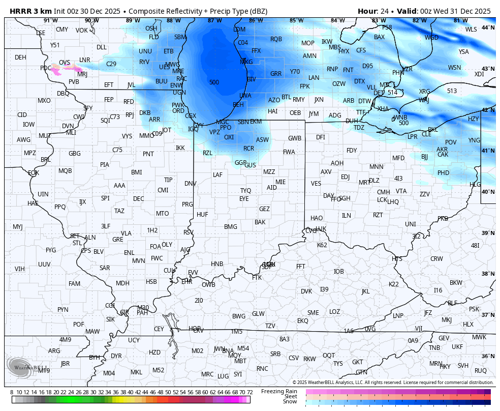
How far southwest can this system get. The HRRR only goes through 7pm New Year’s Eve but appears to be farther west with the approaching snow. The future radar shows this and the Tuesday night snow brush…
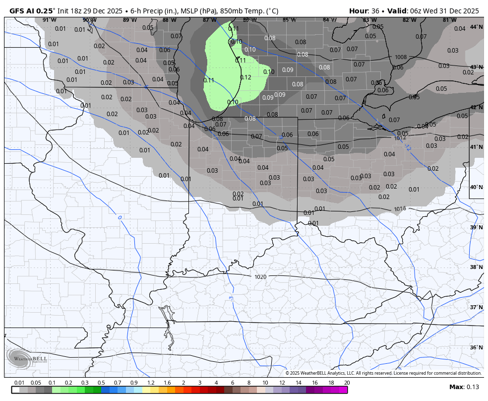
This matches up with what the GFS AI has been indicating for a while now. This animation shows the light snow brush in the northeast later tonight…
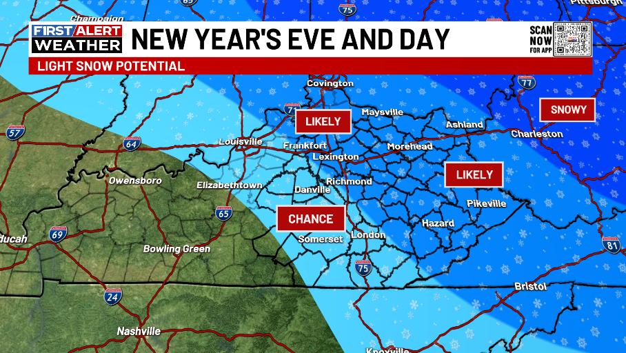
Here’s the area I continue to highlight for light accumulations for New Year’s Eve and Day…
I’ll put out a First Call for Snowfall later today, but it’s light.
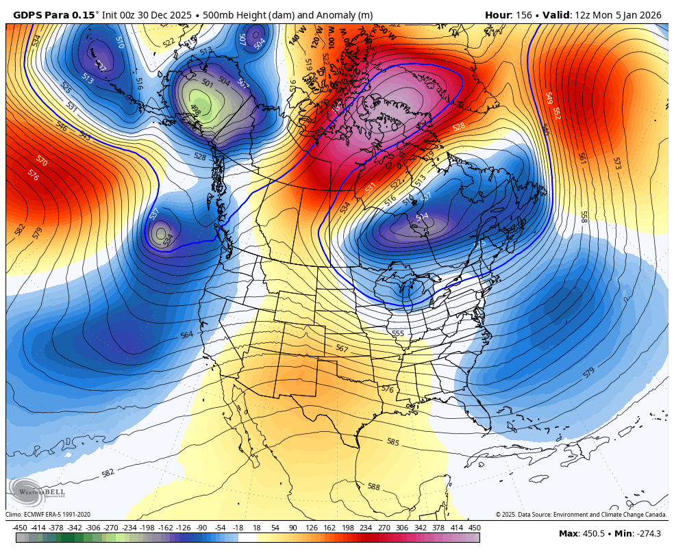
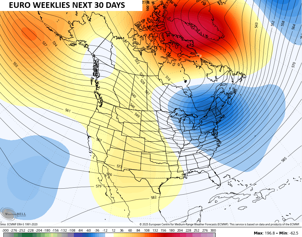
Temps should rebound for the upcoming weekend as we watch the blocking pattern setting up across Greenland and Canada. This forces a deep trough into the east next week and it’s a setup that will give the forecast models fits…
The EURO Weeklies continue to trend colder and snowier as we get closer to January. This comes as the model shows some hefty blocking in the high latitudes. As I’ve talked about, that sends deep troughs into the eastern half of the country.
The average of the 101 member EURO Weeklies are going more emphatic with this 30 day outlook…
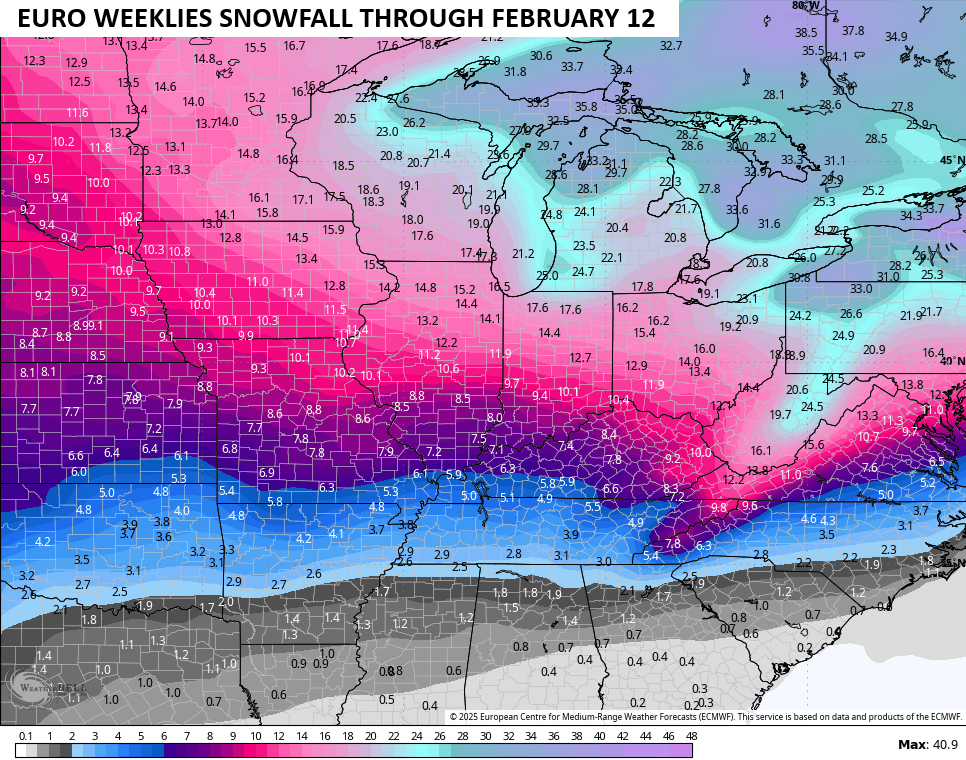
This setup can turn pretty snowy for much of the country right on into early February…
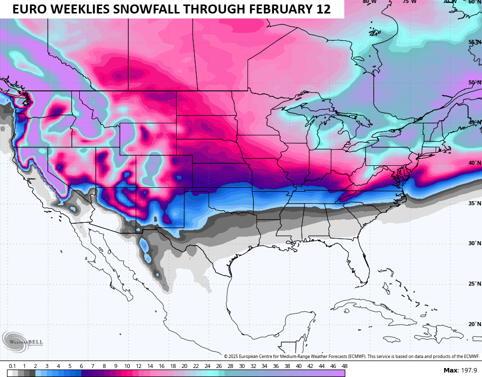
Here’s the average 10-1 ratio snowfall numbers from the 101 members for our region…
Buckle up, kiddos.
Another update or two comes your way later today. I’ll also have a few updates on my Meteorologist Chris Bailey Facebook Page
Until then, here are your tracking tools for the day…


Make it a terrific Tuesday and take care.

Had a pretty intense snow squall come through that left a coating of snow on the ground. Kind of surprising when the NWS was giving flurries at most for tonight.
Clipper Systems are just the negative component ( disturbances imbedded in the Polar Air M*a*s*s. ) It’s simple to understand, to make a complete Snowstorm, a positive component ( Gulf Low Pressure System ) needs to move Northward and merge with the Clipper System, which is moving Southeast. Then a Snowstorm, with moisture to work with is born. that’s the way weather works, and so is life on Earth, ( positive and a negative combine ) to make life. What we have this Winter is Low Pressure to our North and High Pressure to our South, and a negative PDO, which is called a La Nina reacting to the Atmosphere in the Pacific. The opposite is El Nino, ( High Pressure to our North and Low Pressure to our South, with a positive PDO to react with the Atmosphere in the Pacific. This scenario would bring a pronounce increase in heavy Snow events in our area of the CONUS, if the Systems form to our South. An ENSO / neutral means no reaction in the Atmosphere over the Pacific, if the PDO is 0.00. Any kind of weather could happen unexpectedly, like extremes in Temperature and Precipitation, and Severe Weather, as well as Drought.
Very Well explained! If I may add . A el nino enso does not always equal a positive pdo and vise versa . It does reinforce it . There have been some strange years with negitive pdo and el nino and positive pdo with el nina but it really takes everything to really line up correctly for some winter in our area which really hasnt occured for quite so time..like this one
I have ZERO belief that the EURO weeklies will verify.
Have they ever varified ? Those maps are there for enjoyment only. They can’t accurately predict Snow totals in any given area of the CONUS.
Correction to the above : verified, not varified. Can’t spell words like I use to years ago.