Good Wednesday and Happy New Year! We are starting the last day of the year with a touch of light snow in the northeast and we will end the last day of the year with a little snow. This clipper brings some light accumulations as we close out 2025 and begin 2026.
The light snow of this morning is mainly along the Ohio River from Covington to Ashland with some light accumulations.
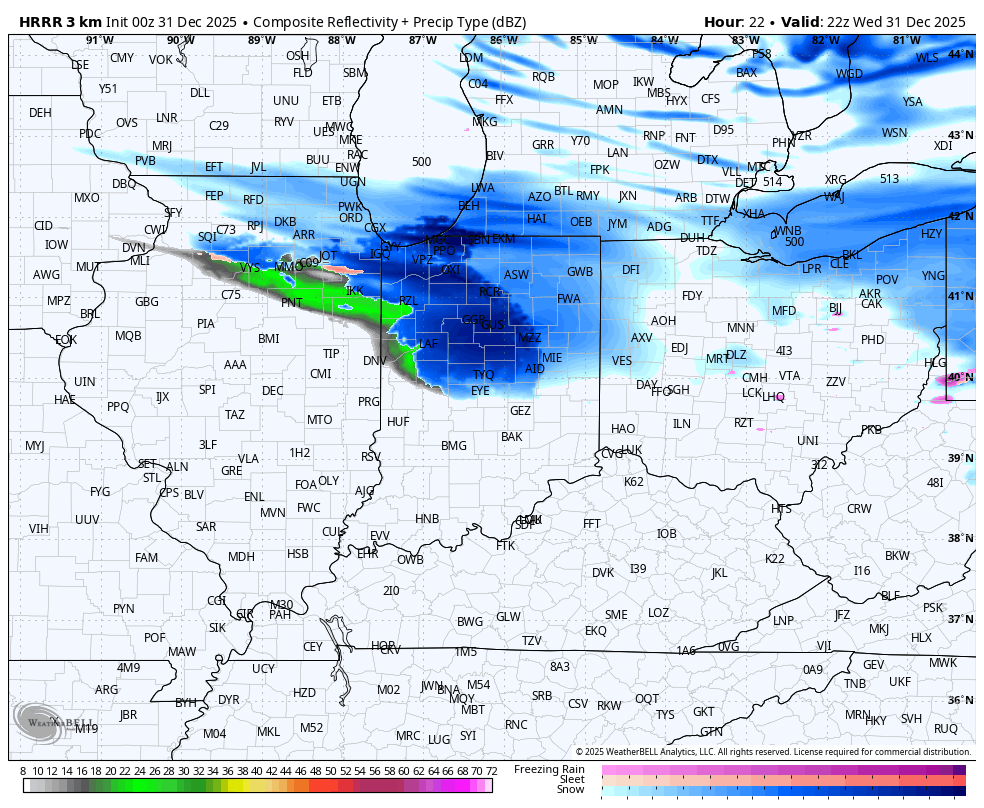
The second system zips in from northwest to southeast starting late this evening and continuing into very early New Year’s Day. A pretty stout line of snow showers and squalls looks to show up with the western extent of this clipper eastern Kentucky. You can clearly see this line on the future radar from the HRRR tonight…
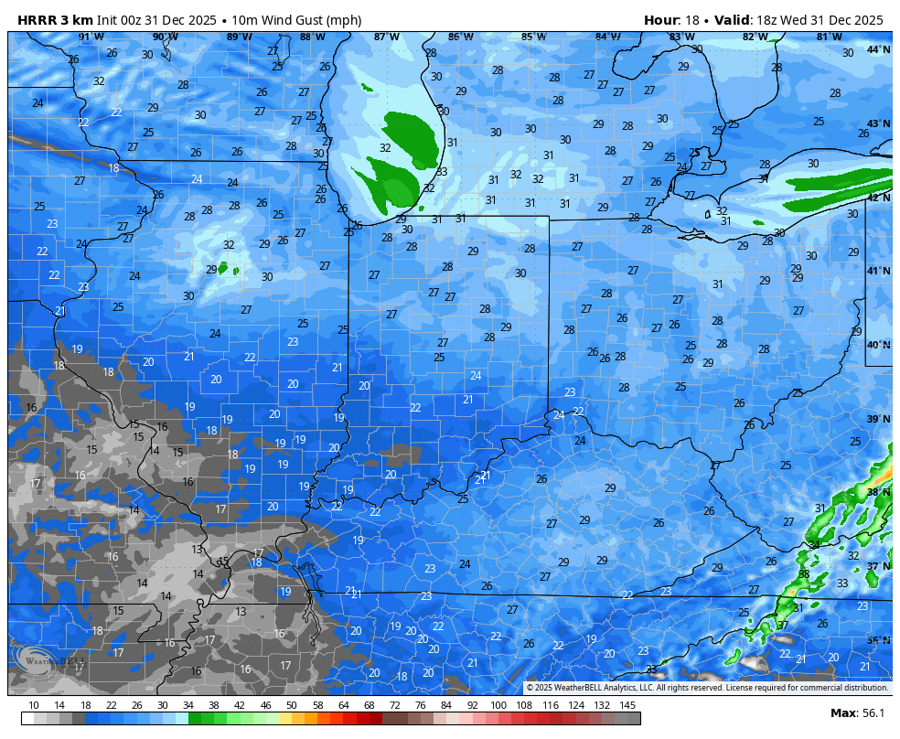
Gusty winds are with us through the day and will increase along that squall line of snow. Watch the hour-by-hour peak wind gusts from this afternoon through Thursday morning…
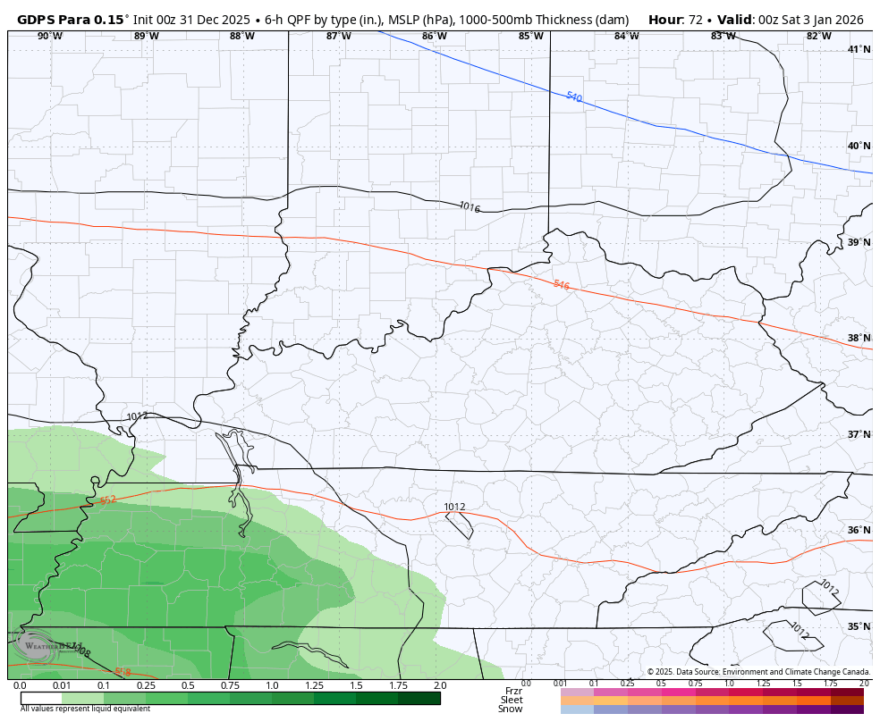
A southern system zips across the Tennessee Valley to start the weekend and may bring a light wintry mix from west to east across the state. The best chance is likely across the southern half of the state…
That’s something to keep an eye on.
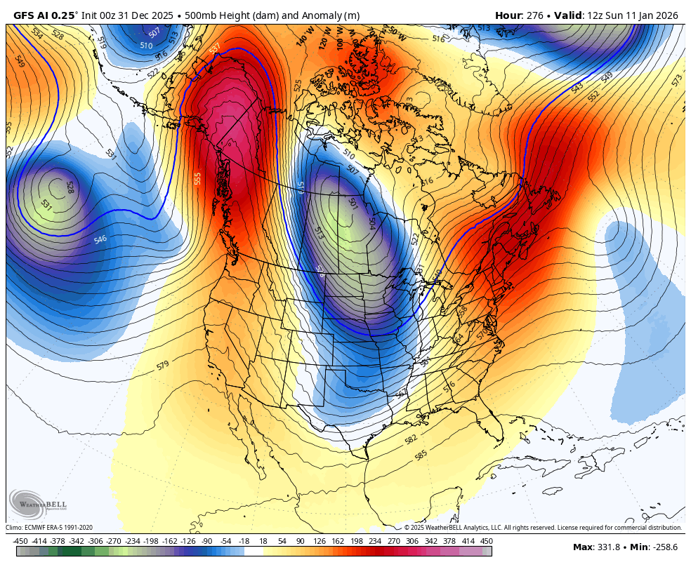
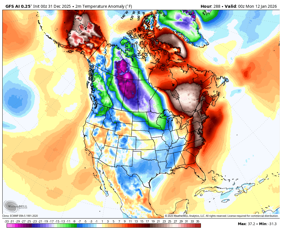
The pattern is seasonably cold this weekend but should turn milder into next week. This milder setup lingers just a little longer than I originally thought as the extensive blocking goes up in the high latitudes. This will send the jet stream diving into the eastern half of the country with blasts of arctic air and harsh winter weather…
It’s another case of Look Out Below…
Another update or two comes your way later today. I’ll also have a few updates on my Meteorologist Chris Bailey Facebook Page
Until then, here are your tracking tools for the day…


Make it a wonderful New Year’s Eve and take care.

Wishing All a Happy New Year ! I can’t believe, with all my health issues, that I made it to 2026. As for the weather, it continues to be ” uneventful. “
Happy New Year Shroeder!