Good evening, everyone. We’re putting the wraps on another seasonably cold day across Kentucky and we have one more ahead before things turn much milder for a bit. That milder is before the wilder as the Old Man is waiting in the wings.
Let’s jump straight to the active part of the forecast which is the first system rolling in Thursday and Friday. That system brings showers and thunderstorms into the state with winds that may crank to 40mph or greater. Temps ahead will spike toward 60 before they come crashing down over the weekend. That’s when some winter weather is possible with a more significant push of winter weather the folloing week.
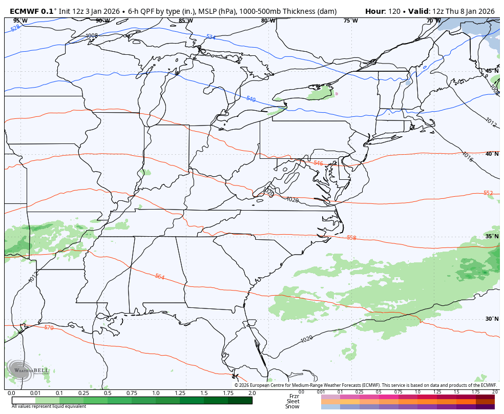
The EURO shows a big winter storm to start that new week but I don’t think it’s correct in how it’s developing it. The EURO struggles with energy coming from the southwest and it’s likely leaving behind too much energy. Here’s what it shows from Thursday into the following week…
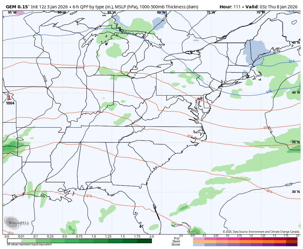
The Canadian doesn’t go out as far in time, but it’s likely clo0ser to reality in terms of the late week system into next weekend…
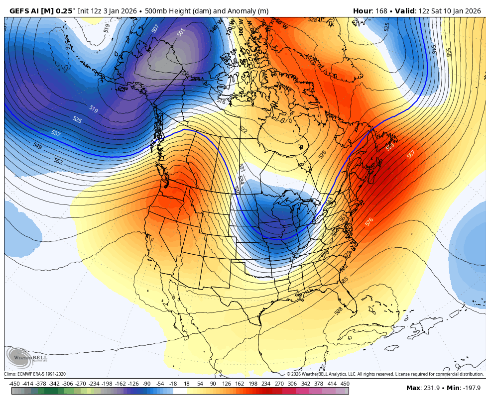
The GFS AI Ensembles have been doing well in the upper levels and I like how they expand that ridge along the west coast, leaving a deepening trough in the east. This animation starts next Saturday and goes through January 19th…
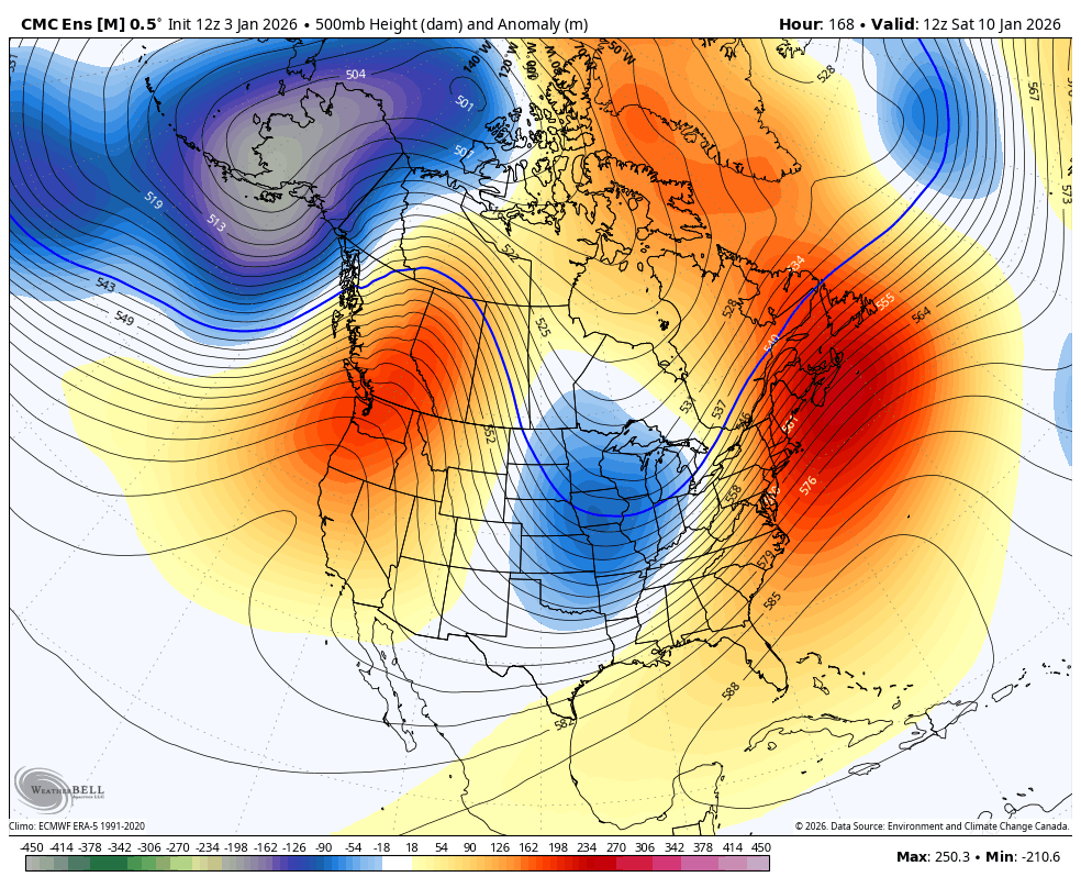
The Canadian Ensembles through the similar time are in pretty good agreement…
Enjoy the evening and take care.
