Good Sunday to one and all. It’s a seasonably cold day across Kentucky as a little bit of sunshine returns. The overall pattern is about to turn much milder for the week ahead, but Old Man Winter is lifting some weights, getting ready to flex by next weekend and beyond.
Temps today are largely in the 30s with some 40s in the south and west. A mix of sun and clouds will be noted once again.
Southwest winds crank on Monday, boosting temps into the 50s with some sun and clouds showing up again.
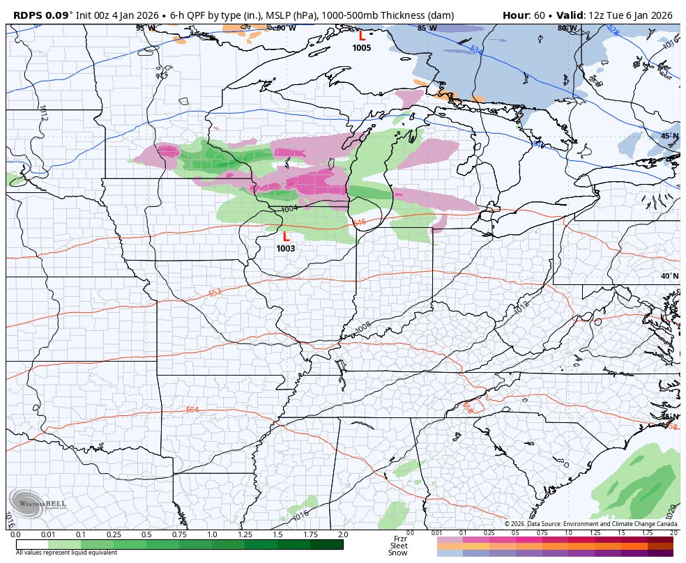
We do have a weak system crossing the Ohio Valley Tuesday into early Wednesday and this will bring an increase in clouds and the chance for a shower or two…
Winds are gusty with this system and will crank even more with the system coming in behind it later Thursday into Friday. 40mph or greater gusts will show up on a strong southwest wind flow that boosts temps to 60 or so.
This is ahead of a big blast of cold pushing in for the weekend, but exactly how we get there is up for debate as the models have some differences.
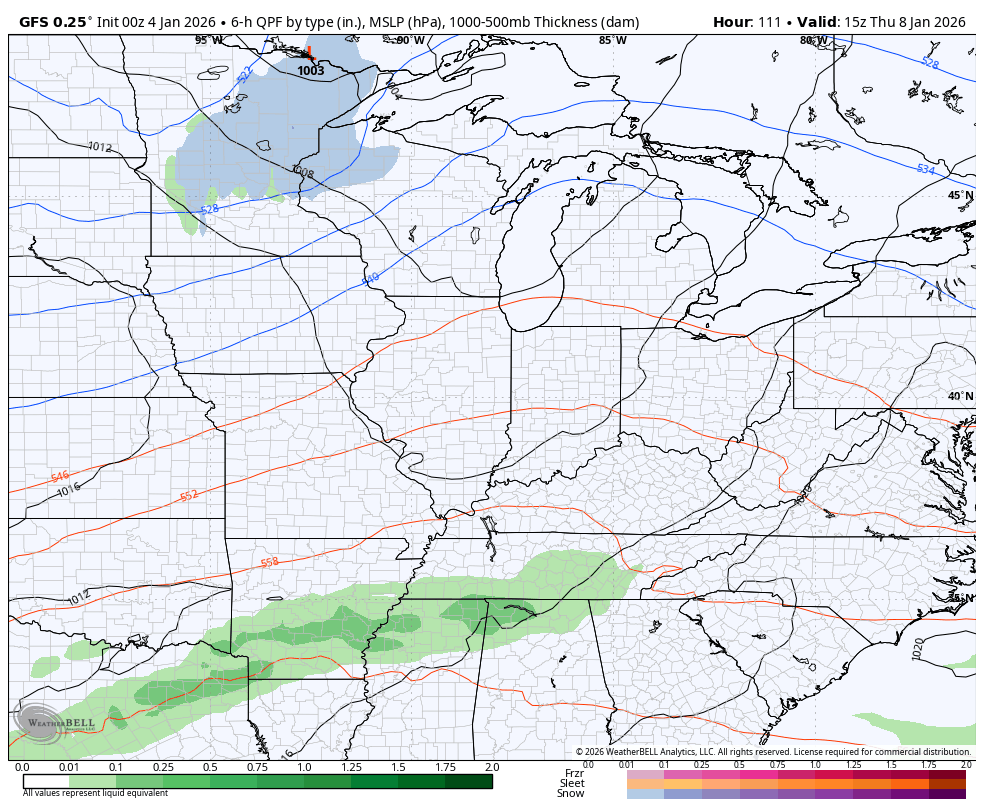
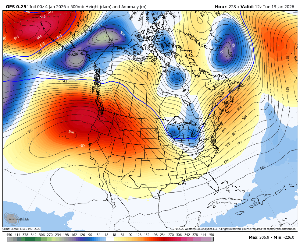
The GFS is sensing the colder, faster scenario. That leads the GFS to have a farther south scenario with a storm rolling right on top of us…
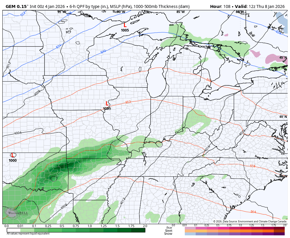
The Canadian Model has two storm systems rolling through with a clipper-like system behind it for the weekend…
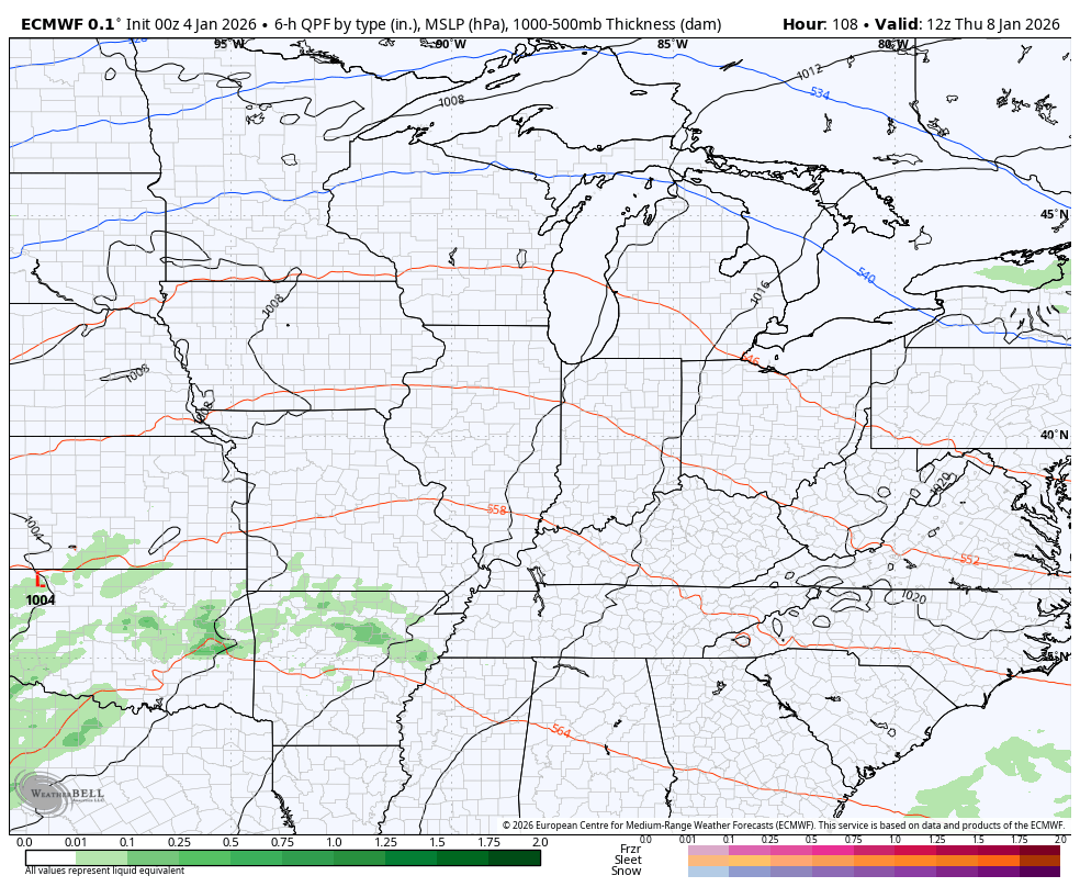
The EURO has something similar but is too slow and too far north and west with the main low. That said, it still gets us to the same solution with cold next weekend…
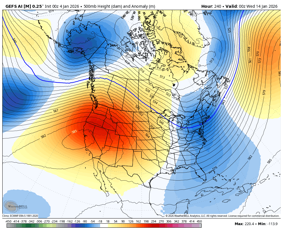
A major amplification of the jet stream is likely to take place a few days later as we get into the following week. That may very well unleash a major arctic air outbreak into the eastern half of the country at some point that week.
The models are seeing the blocking that leads to this big dip…
GFS
GFS AI Ensembles…
I’ll have updates later today so check back. Have a great Sunday and take care.

Thanks Chris. We may very well have a change, as the PDO is making progress towards ENSO / neutral. The December reading was posted this morning at a negative 1.01. What the change will be is not clear at this time, but it could mean that Severe Weather is in our future, or better yet, a decent Snowstorm could result, if the High Pressure to our South and East doesn’t amplify. If the High Pressure does amplify, it would push the phased jet stream well to our West, putting our area in the warm sector, and Severe Weather, as the Arctic Front moves toward the South and East. Hope this scenario doesn’t happen, and we end up with just light Snow or Snow flurries on the back side ?
Finally the PDO is making a run toward the positive side. Just a feeling i think we will see a el nino transition in the next month . MJO outlook seems to also want to move out of neutral toward 6/7 areas too.
Maybe we will finally receive an El Nino and a positive PDO for next Fall and Winter. It would make our Winter more interesting. The effects of the last El Nino some years back was cancelled by a negative PDO.
“As for the MJO forecast January 2026, points toward a dynamic Winter with potential shifts, favoring warmer conditions in the Southeast /West / Gulf Coast and colder in the Northern Plains / Great Lakes / Northeast, with MJO activity influencing these patterns, but models show mixed signals, sugguesting a uncertain but active Winter for the U.S. with colder shifts expected later in the month. ”
“ENSO / La Nina conditions were present in late 2025, transitioning towards ENSO / neutral by early 2026, impacting teleconnections. “
Arctic Air returning to the CONUS. Latest from the Climate Impact Company : )
https://climateimpactcompany.com/u-s-gas-power-report-signs-of-returning-cold-later-january-2/
Article on AI model verification report past 30 days : )
https://climateimpactcompany.com/operational-ai-model-verification-report-north-america-past-30-days-2-2/