Good evening, everyone. Milder winds are about to kick in ahead of a major pattern change coming later in the week. This change will bring another abrupt switch in our weather starting next weekend with a harsh winter pattern lurking.
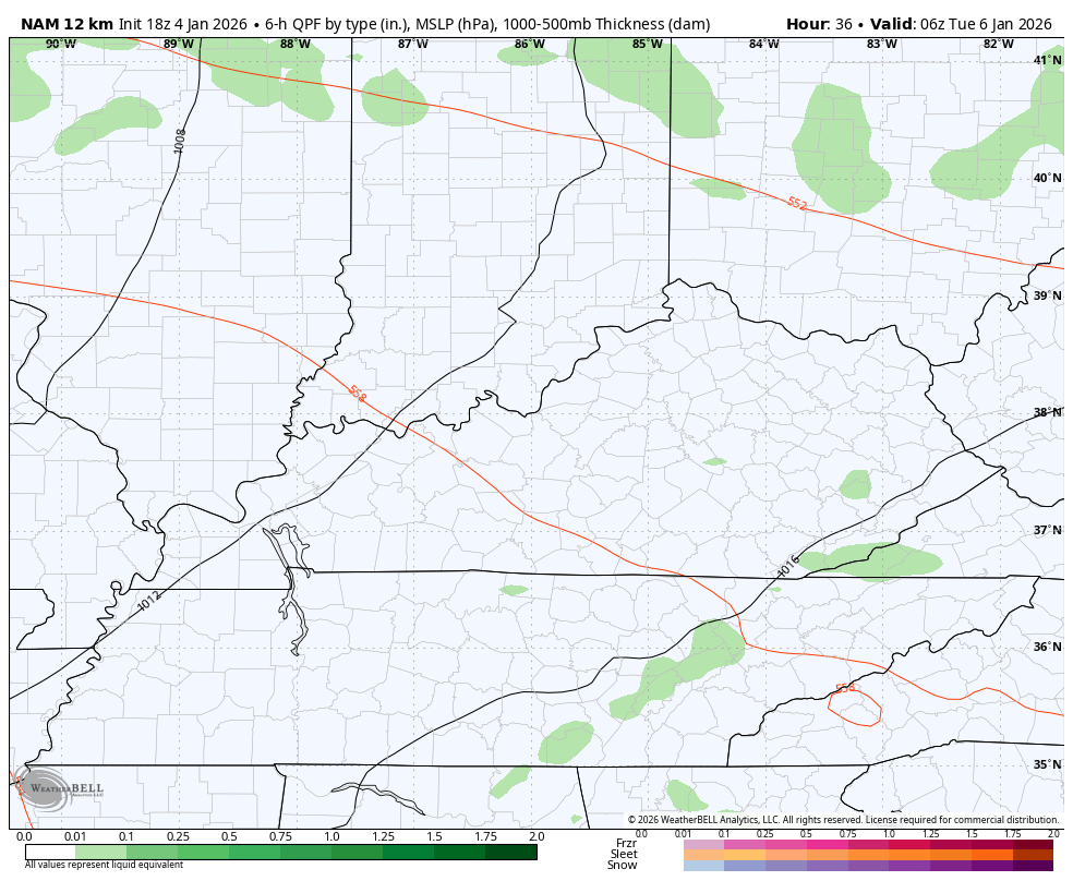
That southwest wind gusts up on Monday with temps surging into the 50s. This southwest wind is ahead of a weak disturbance rolling through the Ohio Valley on Tuesday. That looks to bring a few showers along for the ride.
You can see those on the NAM from late Tuesday into early Wednesday…
Temps should come down a bit for Wednesday before going the other way Thursday and Friday. That’s ahead of a potent storm system that rolls from the Mississippi Valley to the Great Lakes Friday into Saturday.
Temps hit the 60s ahead of this boundary as winds gust 40mph-50mph at times. Rounds of showers and strong thunderstorms develop and push across the region along and ahead of this storm. An arctic front then blasts through here Friday night and early Saturday with crashing temps. This will be followed by a disturbance dropping in from the northwest that can bring a period of light snow or snow showers.
The forecast models are all starting to look like one another finally, but there are still some questions.
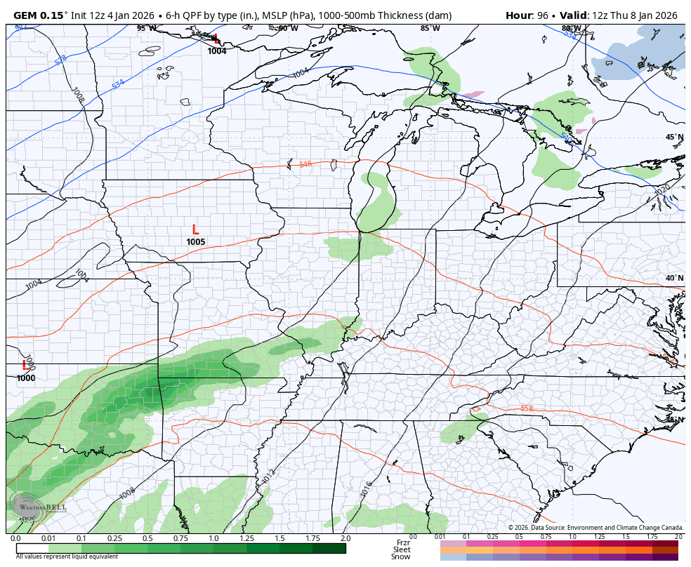
Here’s the Canadian Model with this whole setup…
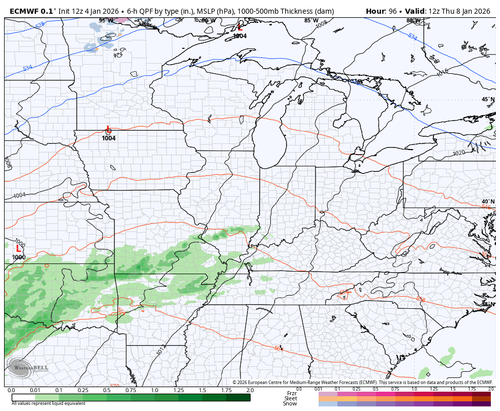
The EURO..
The GFS is fairly similar to that. I’m going to be watching to see if there is a second low that can pop with more of a winter threat by the end of the weekend. That trough digging into the region will try its best to spin something up.
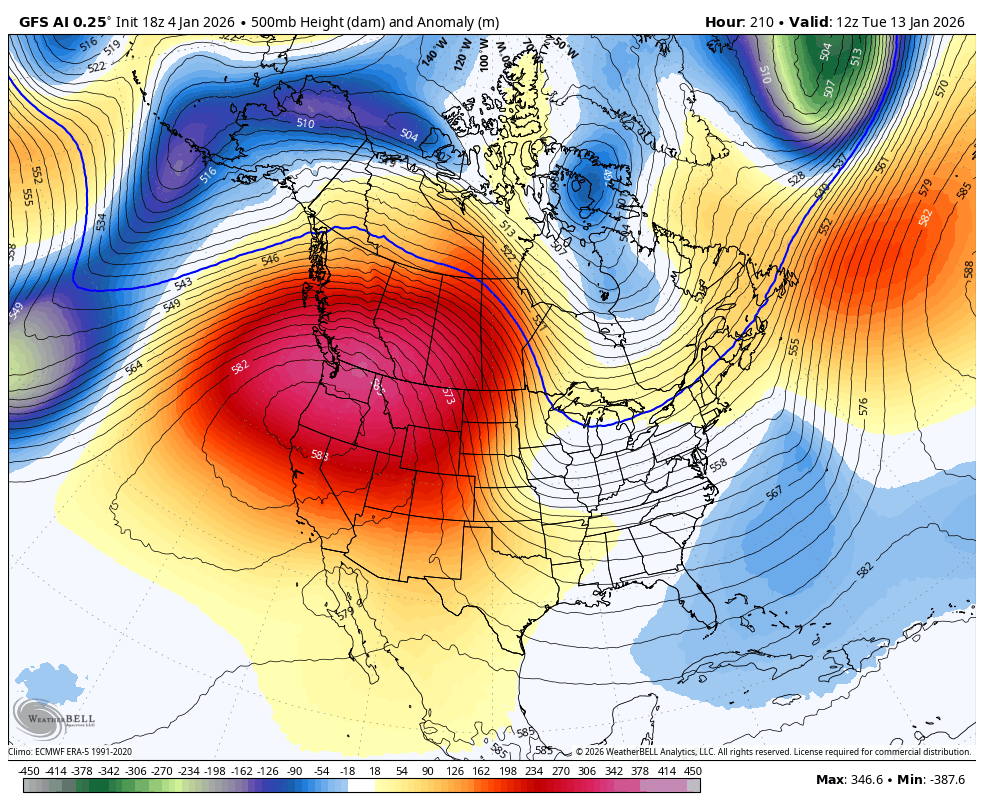
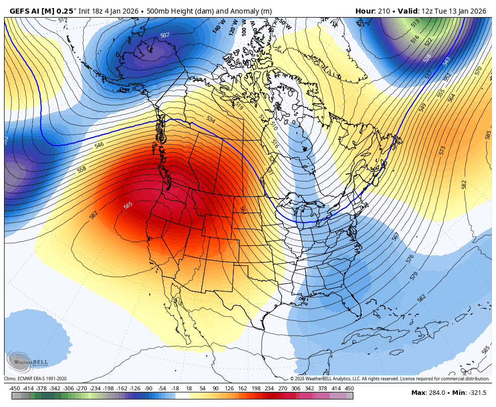
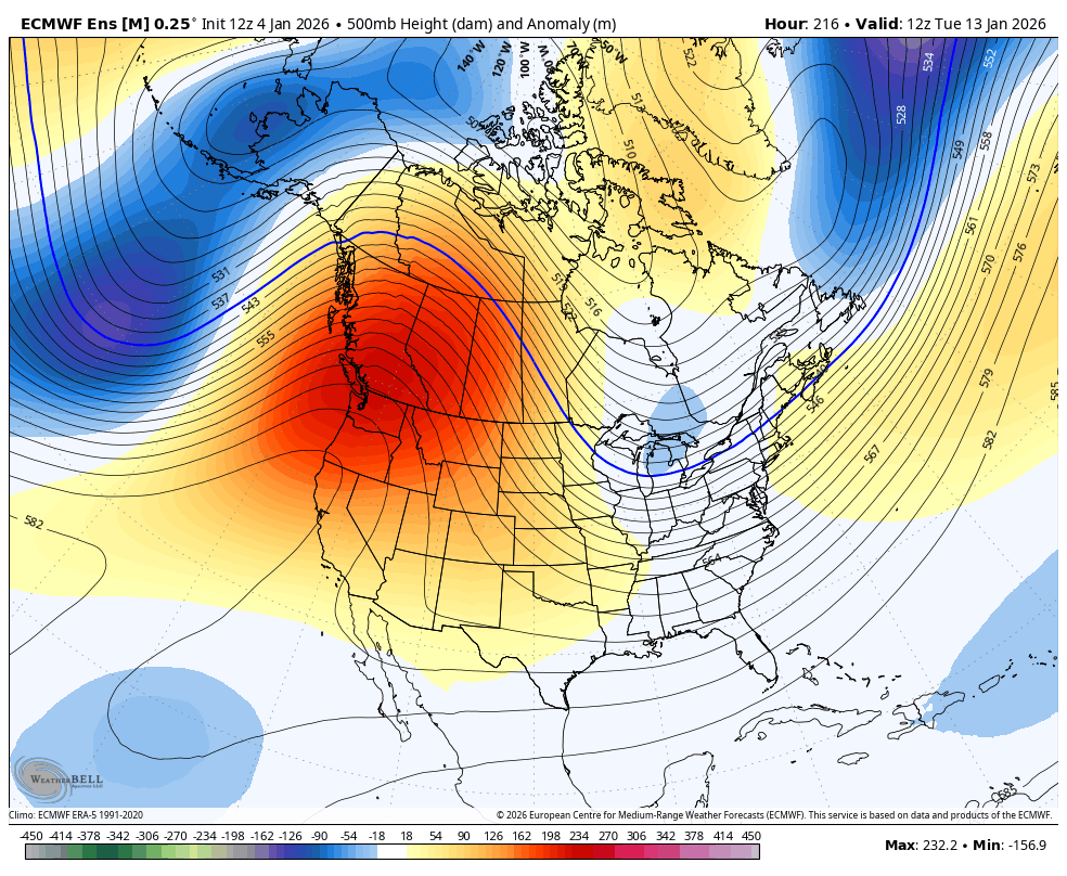
LOOK OUT BELOW! That’s still the theme of the medium range forecast models as a huge ridge goes up along the west coast, allowing the jet stream to take massive dips into the eastern US next week and into the following week.
The GFS AI is all over this…
The GFS AI Ensembles…
The EURO Ensembles…
I’ll see you guys back here for the full update later tonight. Enjoy the evening and take care.
