Good Monday, everyone. It’s the first full week of January and our weather pattern is turning much milder. This mild air is surging in ahead of a big late week storm system that has another wild pattern change behind it. Old Man Winter is about to go back to work.
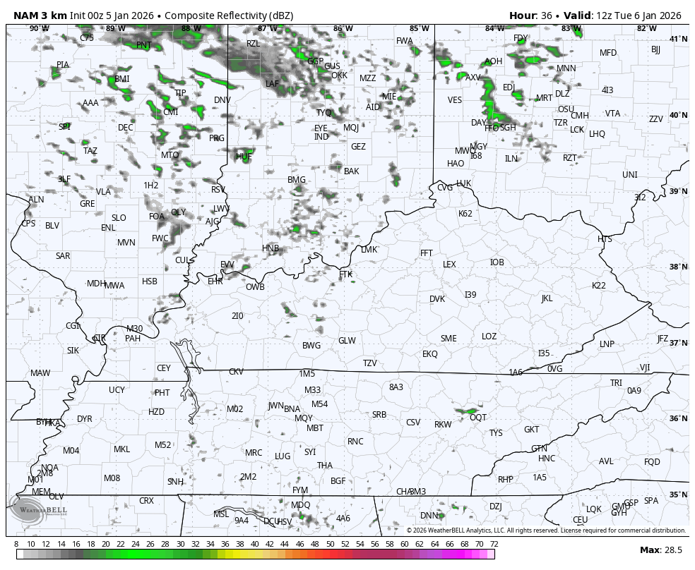
Winds are cranking from the southwest today as temps take off, reaching the 50s for most of te state. This southwest wind is ahead of a weak system moving through the Ohio Valley on Tuesday. That one brings clouds and a couple of widely scattered showers.
You can see this sparse action showing up on the Hi Res NAM Future Radar…
The end of the week into the weekend turns very active. Here’s a quick look at how things flip around…

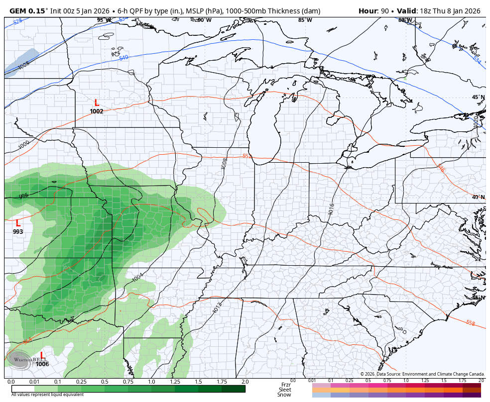
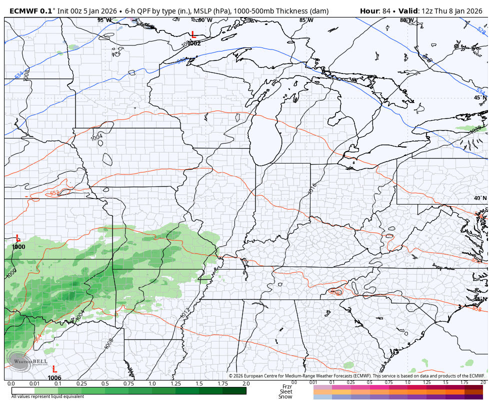
The setup features one low rolling toward the Great Lakes Thursday into Thursday night with the stronger low moving in similar fashion late Friday and early Saturday. Rounds of showers and storms, some strong, will be ahead of all this. A potent upper level low then spins in right behind this late Saturday and Sunday and may produce some snow, especially if it can spawn another low.
The Canadian is heading toward that idea…
The EURO is also getting closer to showing something like that…
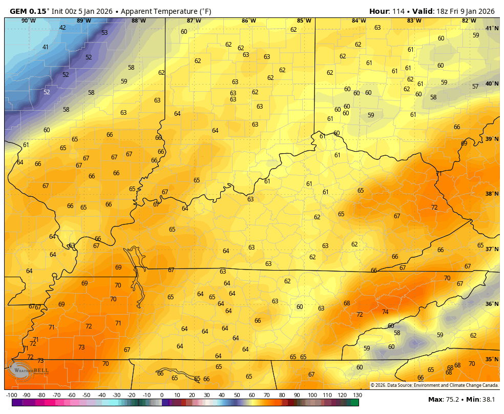
This will be another rude temperature change, but it won’t be as dramatic as the one we had in the closing days of December. Watch the feels like slide from 65-70 Friday afternoon to the low and mid teens late Saturday night and Sunday morning…
This eases us back into a winter pattern that sees additional big dips in the jet stream early next week. I continue to see an increasing threat for a harsh winter pattern developing for much of the country. I’ve been showing the Ensembles and how they have the look, but now the operational models are seeing the potential.
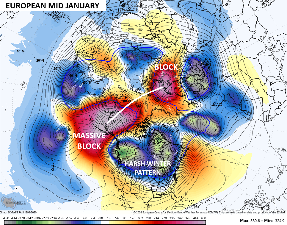
Granted this is still more than a week or so away, but we aren’t looking for details, just the blocking signatures. Those signatures are showing up and showing off on the latest EURO as it has a massive block going up across Alaska that extends through the North Pole and tries to connect to a block over Scandinavia. The end result would force some serious winter weather across much of Canada and the US…
The GFS at the same time has a similar overall look across the Northern Hemisphere…
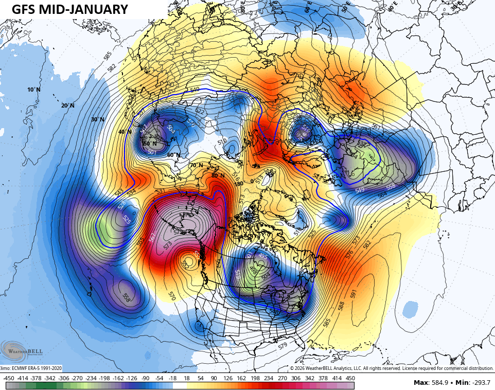
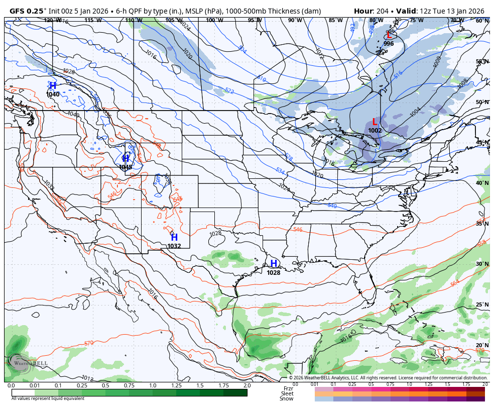
That would allow for an active storm track with ample arctic air to play with. The surface maps of models from this time are just for sun as the details change from run to run, but you can see the potential…
EURO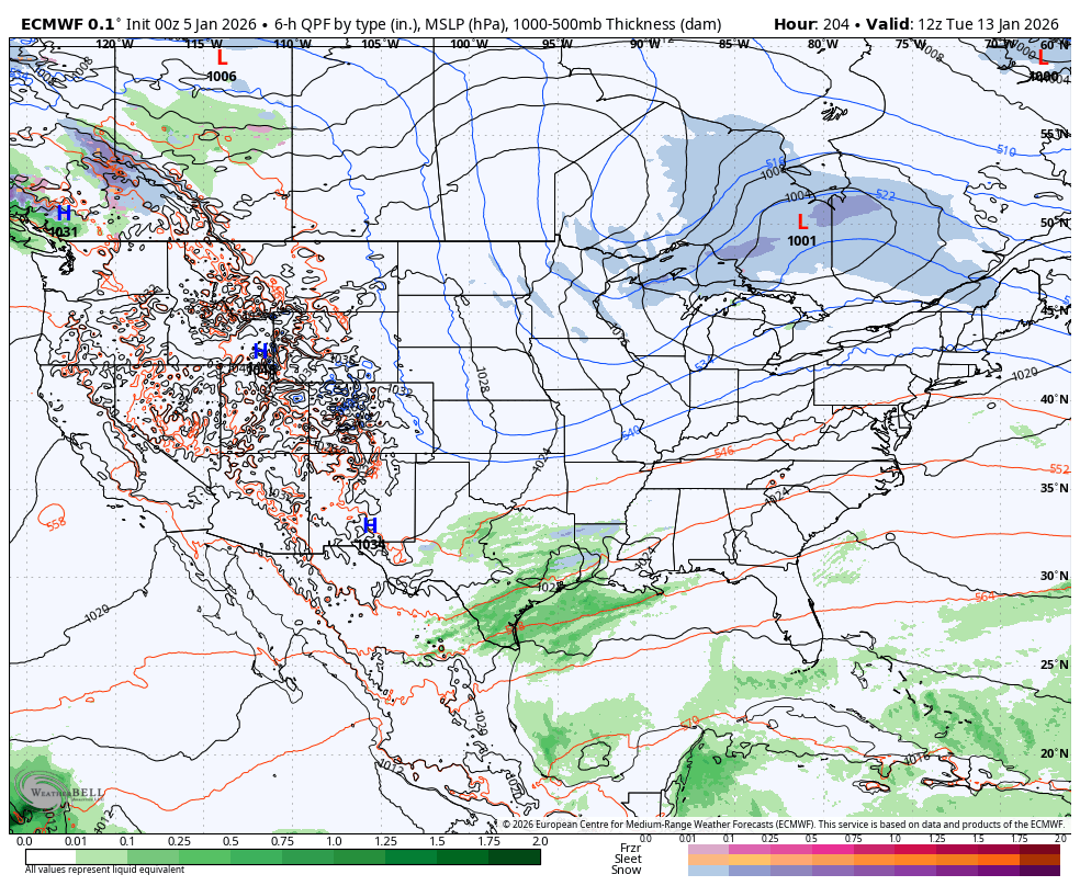
GFS
Again, this isn’t me just using the operational models to prove my point as the various ensembles have been showing this for a while and continue to trend VERY strongly toward a harsh pattern…

The possibility of getting a severely -EPO and -WPO at the same time is something I’m watching for. If that happens… Whoa boy. Some big winter weather events will be on the table.
Updates will come your way later today. I’ll also have a few updates on my Meteorologist Chris Bailey Facebook Page
Have a great Monday and take care.

I’ll believe it when I see it.
Thanks Chris. The East Pacific Oscillation and the West Pacific Oscillation can only go negative if the Pacific Decadal Oscillation turns strongly positive. ENSO / El Nino would come into play. This Scenario happened in the Fall and Winter 2014 – 2015. That Winter was Very Cold with Above Normal Snowfall throughout the Mid – West and Mid – South ( Kentucky. )
I have my doubts if that same occurrence will happen this Winter, as we are slowly phasing into ENSO / neutral for the next four months. We could have increase chances for Severe Weather, or we could have Above Normal Temperatures, like we are having this week, or a Brief Cold Period, with some Snow in a few areas of the State. In other words no prolonged Weather Type, only Short Periods of any given Weather Type.
Correction to the above Statement : The PDO doesn’t have to be Positive before the EPO and WPO turn Negative, but there’s More of a Reaction in the Atmosphere if the PDO is Positive.
Started out great if you’re a snow lover but January has hit the crapper..Really don’t see anything promising until maybe around the 20th if it don’t get can kicked..
Yeah, really has been an uneventful Winter so far, but I’ve seen this pattern before. For instance, in February 1960, we had a high temperature of 80 degrees. My Father took us kids out to dinner in his convertible. We really thought Spring was here. Around March 10 to the 15th. we had one of the deepest Snows ( up to three feet ) and temperatures below zero. What a change ! That’s when I got really interested in Meteorology, when I was 10 years old, growing up in South Central Indiana.
This article was released late this afternoon. It’s about the MJO, and it’s effect on our weather pattern. Looks wet for our area : )
https://climateimpactcompany.com/madden-julian-oscillation-activates-2-2/