Good evening, everyone. It’s a rather March-like evening out there and that’s a trend that looks to continue through the week. This is ahead of a big change moving in by the weekend and this unleashes a full-blown winter pattern.
Let’s focus on the late week change. The Storm Prediction Center now has the severe weather risk area across western Kentucky in the west for Friday…

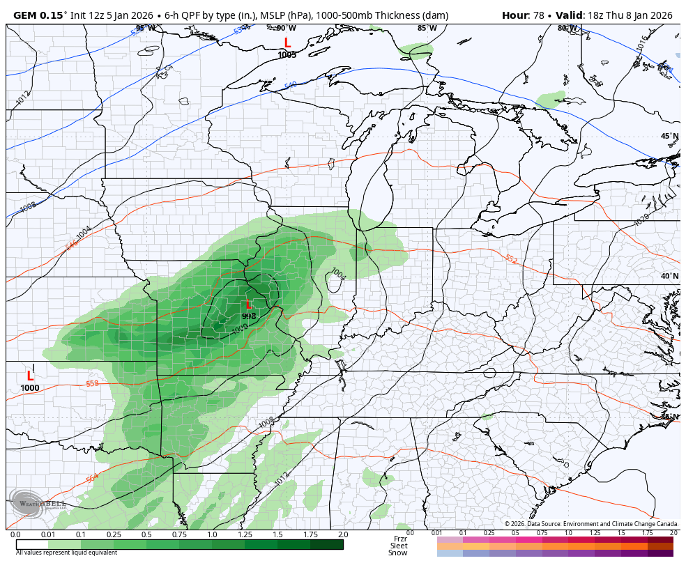
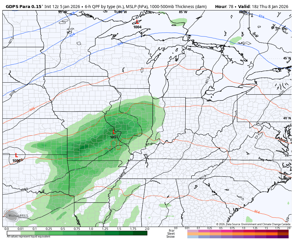
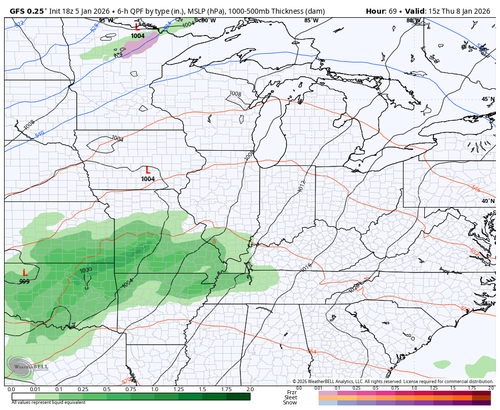
The forecast models continue to show one low rolling from the Mississippi Valley Thursday and early Friday with a more potent storm system arriving late Friday and Friday night. That has a big temp crash behind it with a shot of light snow and flurries arriving with an upper level system on Sunday.
Here’s the Canadian…
The parallel Canadian…
The GFS has finally come around to a similar look…
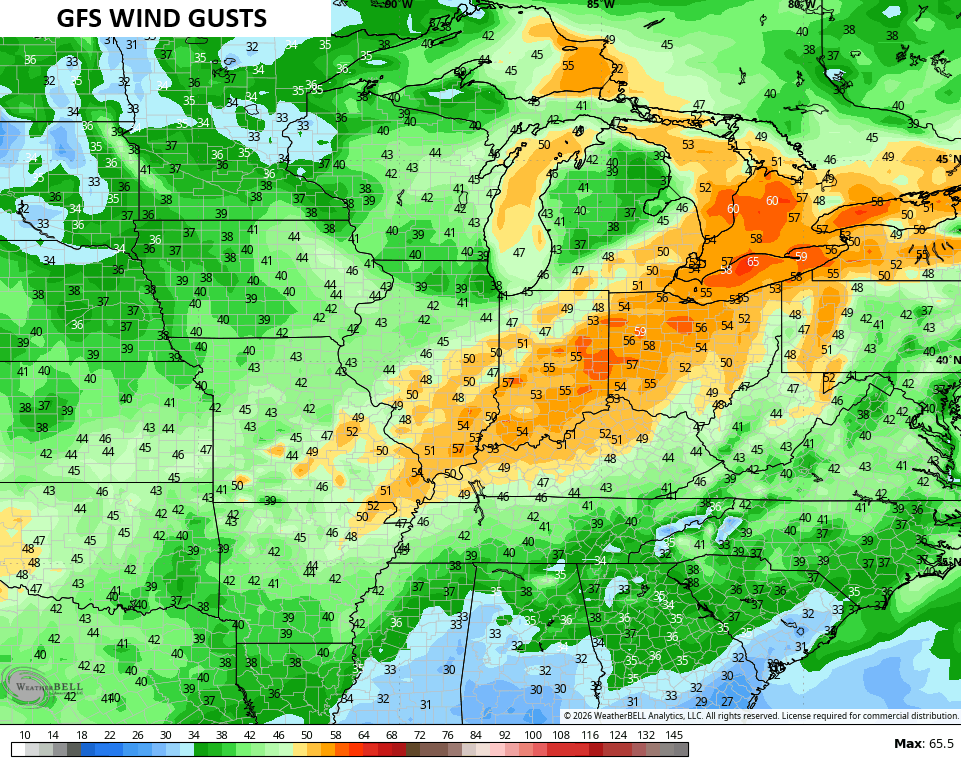
Wind gusts will be way up there and likely top 40mph at times. The GFS goes above and beyond that…
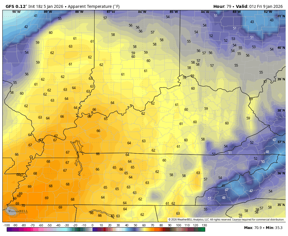
The GFS is also just now seeing the cold air coming behind this system. Temps go from deep into the 60s Friday to wind chills in the teens by Saturday night and Sunday morning…
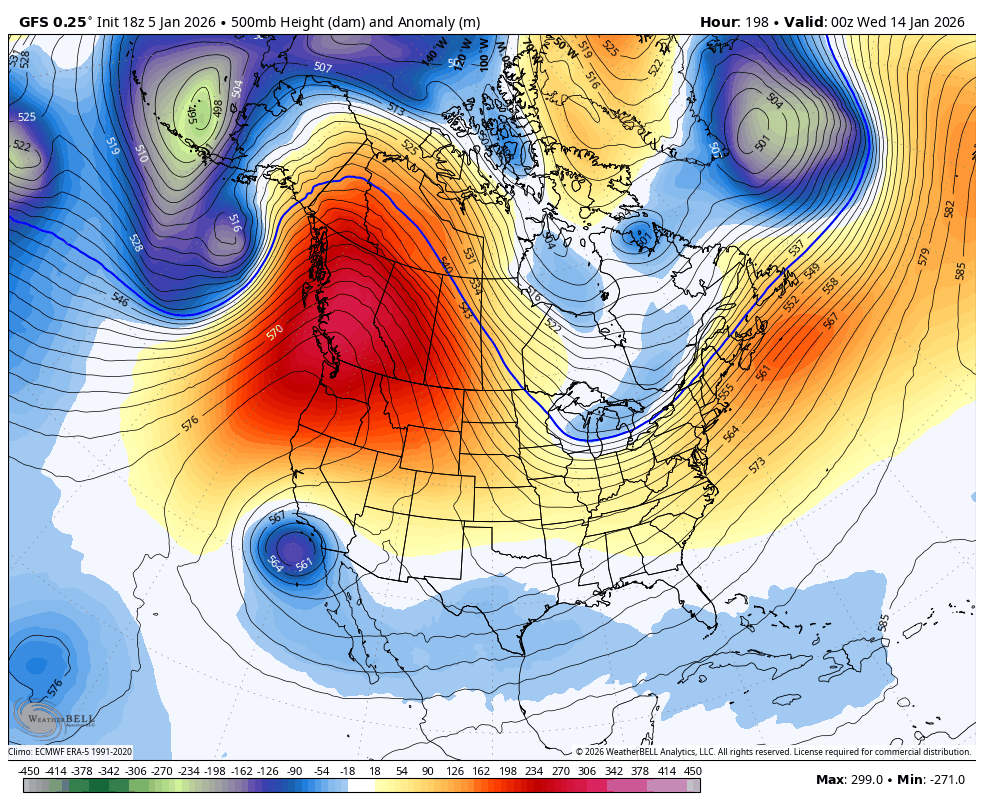
The forecast models continue to show a massive ridge going up the west coast to Alaska next week. This points toward DEEP troughs diving into the eastern half of the country. These troughs will bring arctic cold in here with the chance for a severe cold shot or two.
Here’s the GFS…
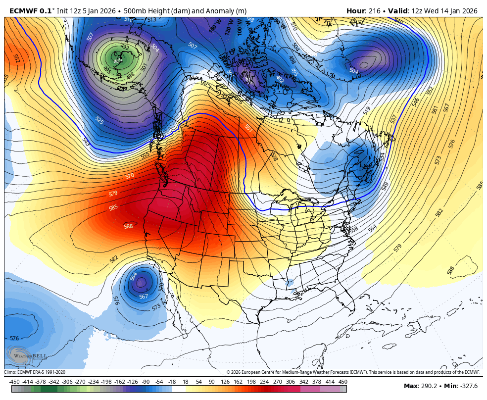
The EURO…
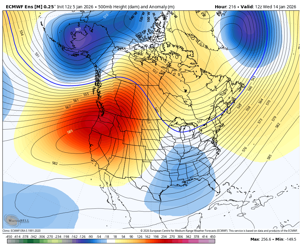
The EURO Ensembles…
That look should also feature several snowmakers rolling through our region. Bring it!
Enjoy the evening and take care.
