Good Tuesday, everyone. The weather pattern of the week continues to skew much warmer than normal, but that changes in a hurry this weekend as Old Man Winter rolls back into town. Once he settles in, he may get a little rowdy over the next few weeks.
Let’s start with today and hit the fast-forward button.
Highs today range from the upper 50s to middle 60s depending on where you are. Skies are mainly cloudy with some areas of sun showing up. There’s also the slightest chance for a few sprinkles or a light shower, but most stay dry.
Wednesday’s weather looks pretty calm with milder than normal temps.
Temps really take off on a strong southwest flow Thursday into Friday. This is ahead of two different lows that look to impact our region.
The first low moves from the Mississippi Valley Thursday into the Great Lakes Thursday night and early Friday. That brings showers and a few thunderstorms rumbling in from southwest to northeast.
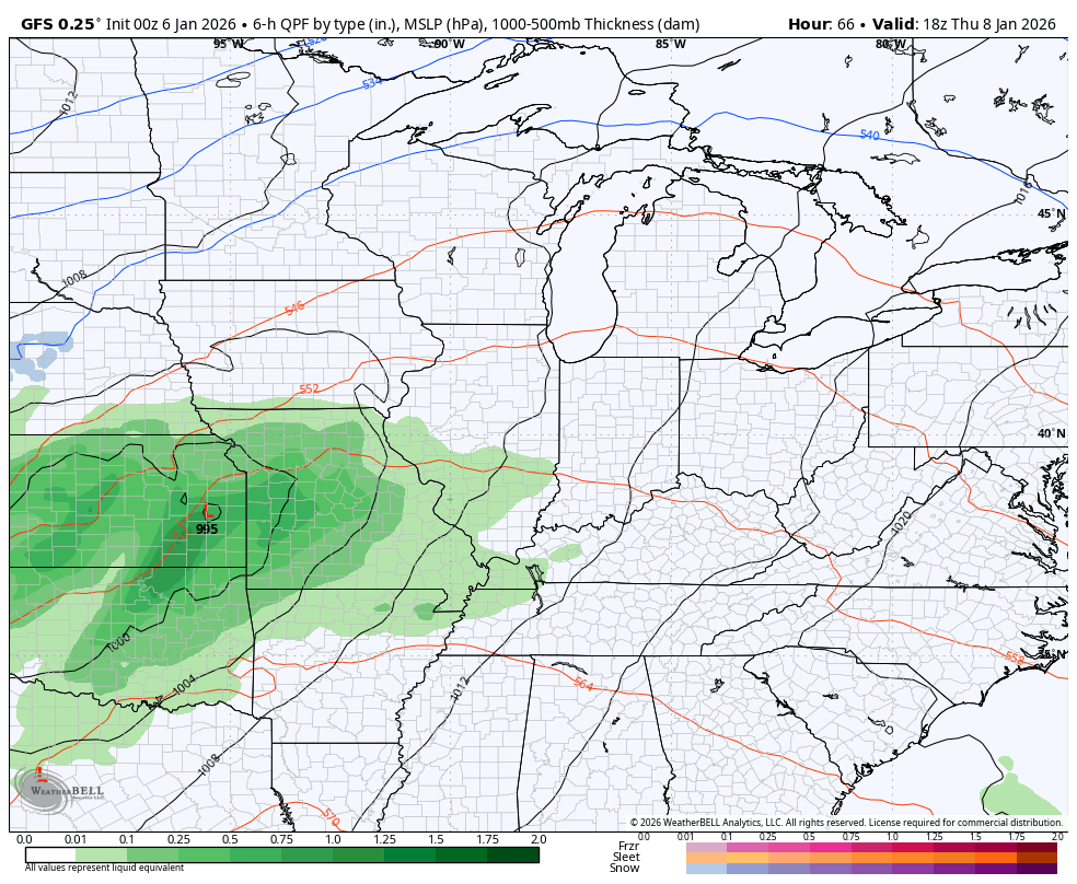
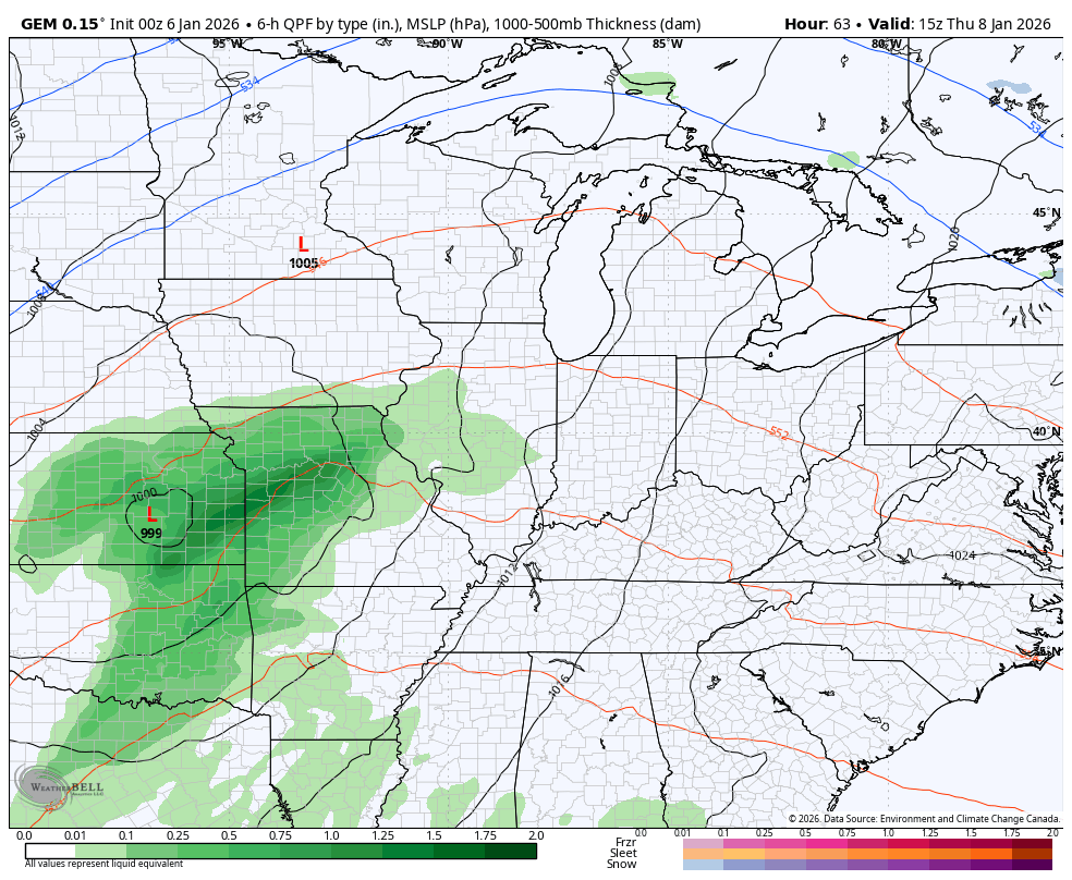
That system drags our cold front a little farther south into our region as another low develops along it. That low moves through the Ohio Valley Friday into early Saturday. Widespread showers and storms will be along and ahead of this and some of these storms may be strong or locally severe.
This is just outside of the traditional 3 day Severe Weather Outlook from the Storm Prediction Center, so the area of interest is more generalized. Here’s a look at the area they’re looking at for possible severe storms on Friday…

The models continue to handle this setup just a big differently from run to run and model to model.
The GFS jumps a bit more than most, but still has the general idea…
The Canadian is a little faster with the trough sweeping through on Sunday…
The EURO is a little slower…
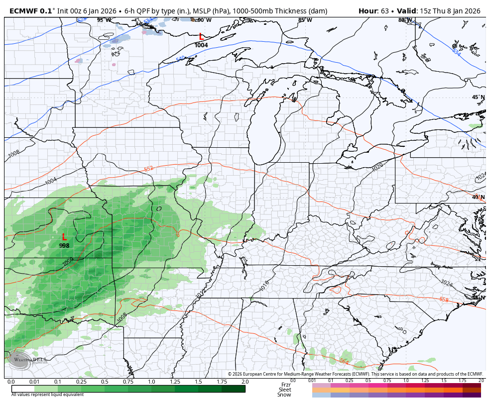
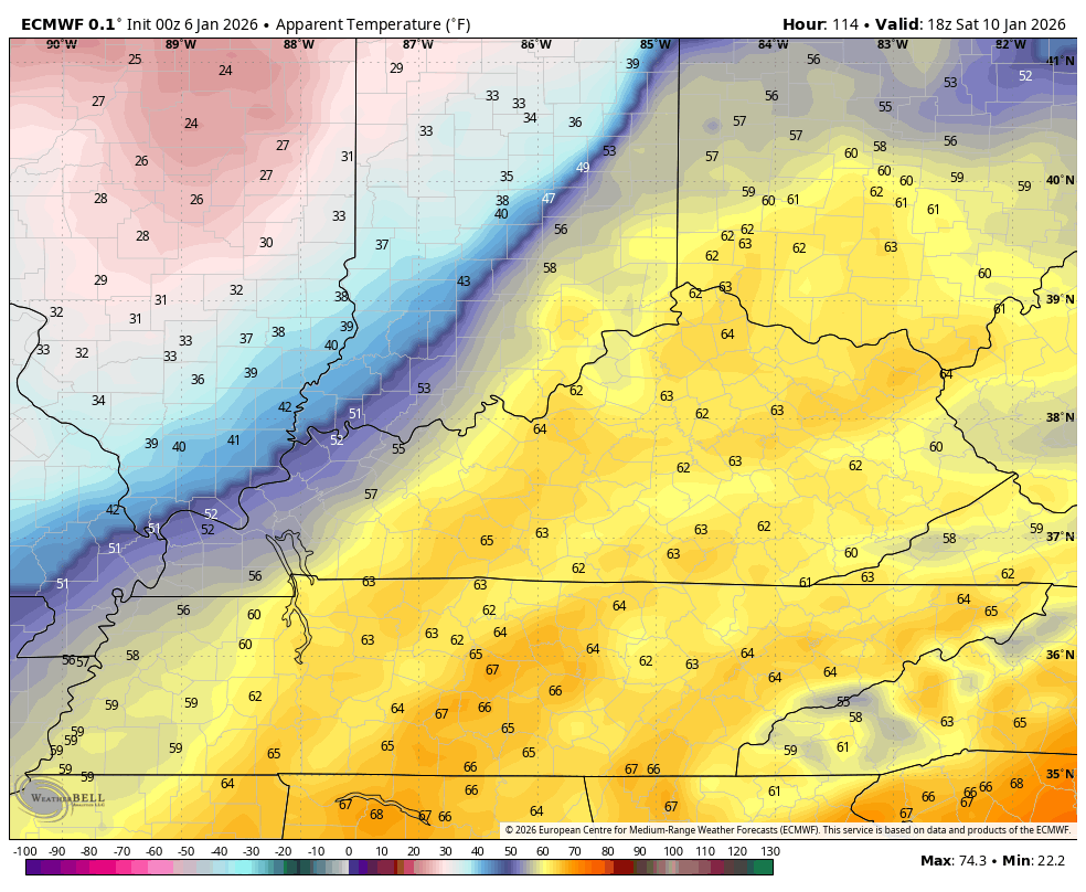
With that slower frontal passage on the EURO, it sets us up for an even more dramatic temp drop. Temps spike into the 60s ahead of this front early Saturday before crashing quickly from west to east. This animation starts at 1pm Saturday and ends at 7am Sunday and shows us going from the 60s to wind chills in the low and middle teens…
That’s pretty wild.
That system lifts out early next week before another trough dives in a few days later. That kicks off a series of deep troughs next week into the week after as true arctic air gets involved in the pattern. For fun, we look at how that cold may combine with an active storm track…
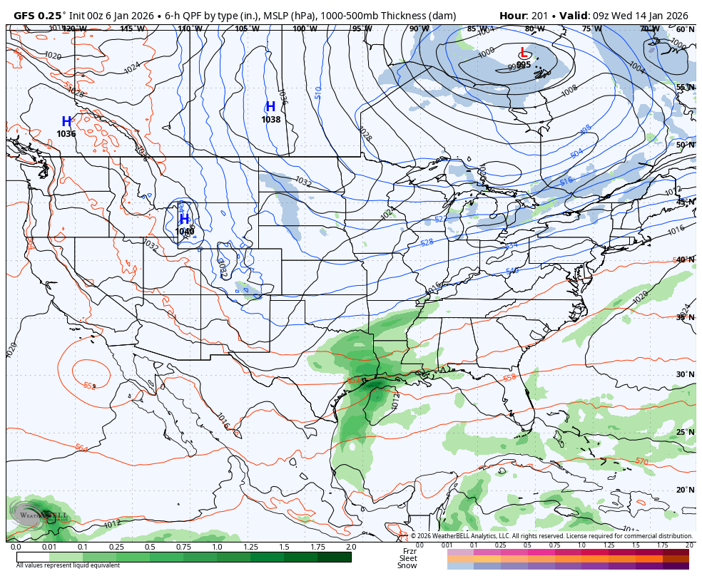
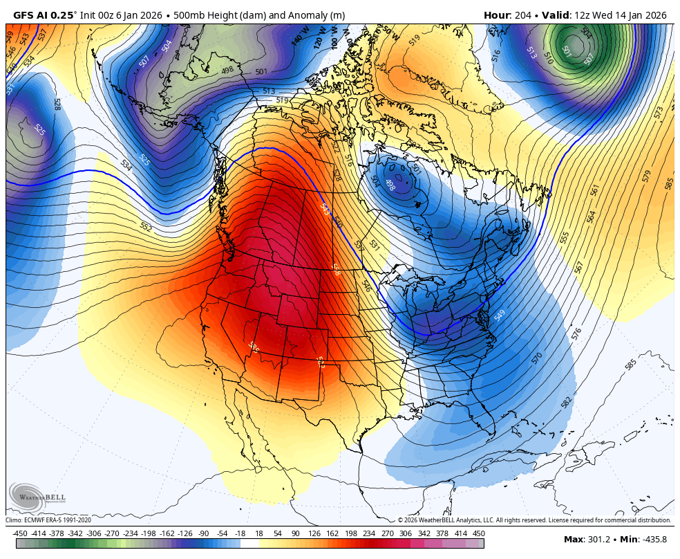
All of this comes as a massive ridge blows up along the west coast and extends toward Alaska. Just look at those troughs swinging in…
Another update or two comes your way later today. I’ll also have a few updates on my Meteorologist Chris Bailey Facebook Page


Make it a terrific Tuesday and take care.

Thanks Chris. With the Pacific Decadal Oscillation making a move towards the positive last month, would indicate a change in the overall weather pattern across the Continental U. S. What that change will be is still a ” waiting game. ” Could mean a period of Severe Weather, followed by Colder and Drier Weather, or could mean the Subtropical Jet Stream will combined with the Northern Jet Stream, giving our area an increasing chance of a decent Snowfall ? Hope not an Ice Storm ?
In the Pacific, the Kelvin Wave along with an activated MJO bringing Warmer Waters in Nino 3.4 will end this long – ongoing La Nina finally. She has been a very “Bad Girl ” for many years. Time for the ” Christ Child ” El Nino to take over.
We are projected to enter La Nada for a bit is seems.
We are projected to enter ENSO / neutral within the month, which would dictate a variety of weather events thereafter. Never heard the term La Nada. Seems like that would mean a very very weak La Nina ?
” An impactful influence on Global Climate by a strengthening convection phase (6 ) of the Madden Julian Oscillation ( MJO ) is forecast to develop during the next 2 weeks. ” Goodbye La Nina !
La Niña may be dying but there’s a lag before the Enso atmosphere changes..Until we see a almost dead STJ come to life then maybe we can say goodbye La Niña..Also looking at the PDO December makes 72 months straight months that it’s been in the negative..
We are getting close to ENSO / neutral, but we need a phase to ENSO / El Nino. You are correct in saying that we may not say goodbye to La Nina just yet. I will be surprised, if we continue this ongoing La Nina pattern, plus a negative PDO, and a weak subtropical jet stream for next Fall and Winter.