Good Wednesday to one and all. We have a front draped across the state, leading to a big temperature swing out there today. This boundary goes back to the north with VERY mild and VERY windy weather moving in. That’s ahead of a big time change from a potent storm system this weekend.
Areas of low clouds and some fog will be noted early today, and this may be stubborn. Areas dealing with the stubborn will be in the 40s while areas getting in on more sun reach the 50s and some low 60s. The best chance for that is in the south and west.
A strong southwest wind then kicks in for Thursday as temps hit the 60s for the entire state. This is ahead of the first storm system working from the Mississippi Valley into the Great Lakes Thursday night and this may bring a few strong to severe storms into western Kentucky.
This low-end risk is covered by the Storm Prediction Center…

This low drags a cold front into the region for Friday. That slams on the brakes as another low develops along it and moves right on top of us Friday night and Saturday. A few strong storms are possible again for some. Here’s the low-end Friday risk from the SPC…

In addition to the storms, we have to be on guard for heavy rains across areas of central and eastern Kentucky. A general 1″-3″ will be possible and this may cause some local high water issues to develop Friday night or early Saturday.
Cold air crashes in from west to east Saturday and Saturday night as an upper-level disturbance dives in from the northwest. This brings a period of light snow and flurries into central and eastern Kentucky.
The newest model runs are a little more optimistic about some Sunday snows.
The Canadian Model even puts a little snow on the ground. Here’s the latest from the model from Thursday through Sunday night…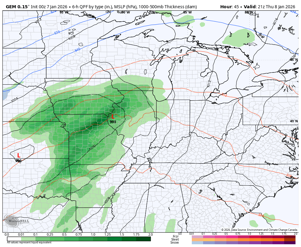
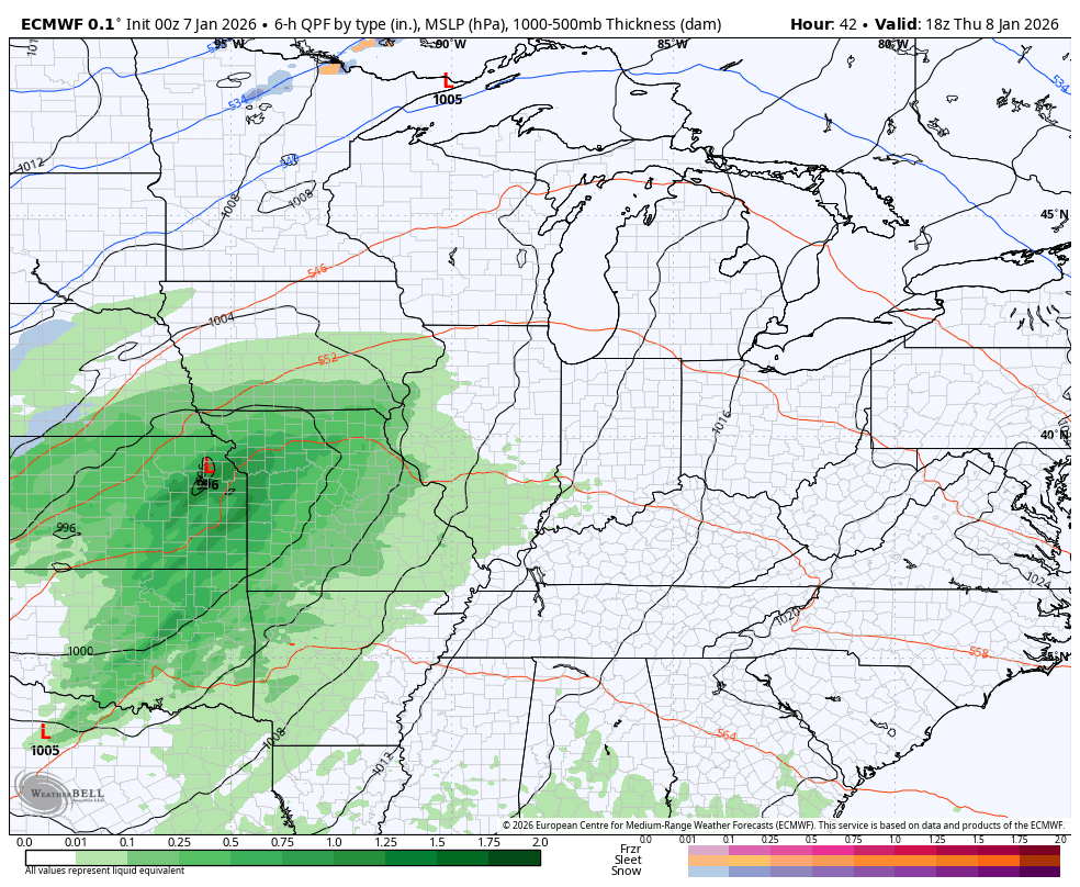
The EURO is trending in that direction with a stronger upper level system…
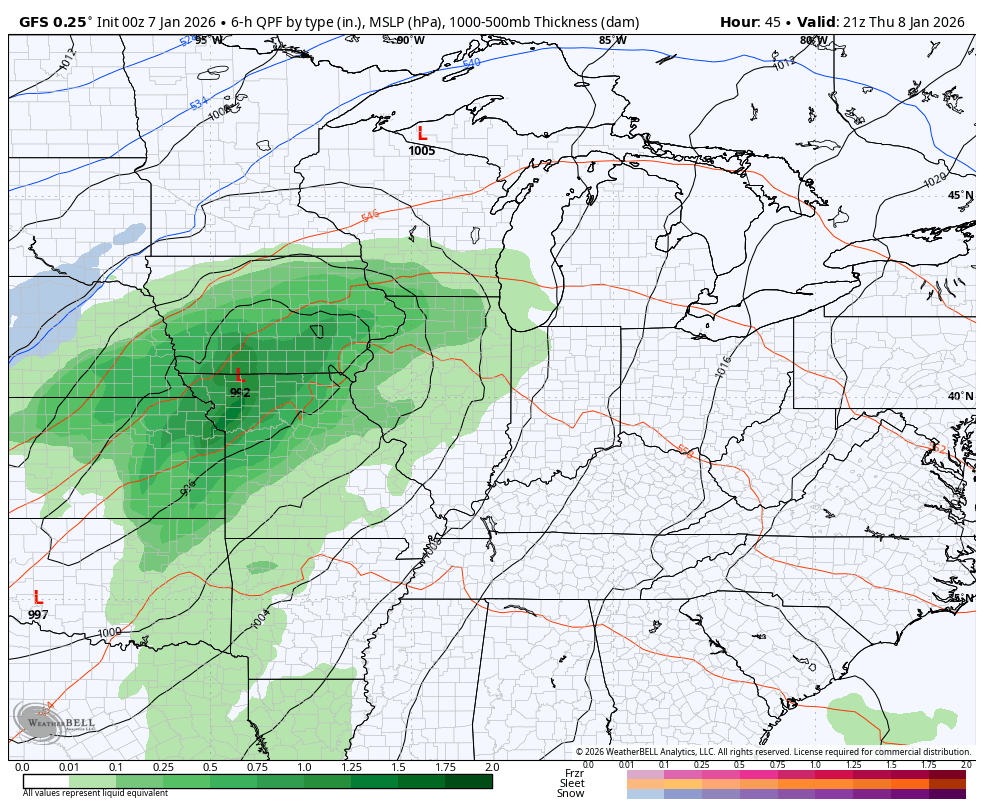
Here’s the GFS from Thursday evening through Sunday…
High temps may hit 70 in some areas on Friday…

Temps on Saturday will reach the 60s early in the day across central and eastern Kentucky. There’s a chance for a 70 in the east before the cold front sweeps in with temps that CRASH.
Check out this “feels like” temperature animation from Noon Saturday to Sunday morning…
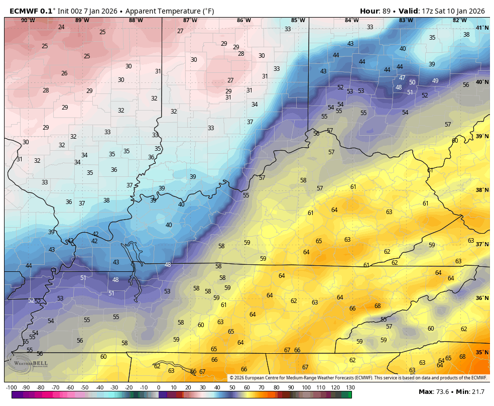
Yes, those are low and mid teens showing up just hours after temps were flirting with 70 degrees. Wow.
This is a warning shot from Old Man Winter. Massive blocking continues to show up next week, sending the jet stream taking huge dips into the eastern half of the country. This is pretty amazing to see next week into the following week…
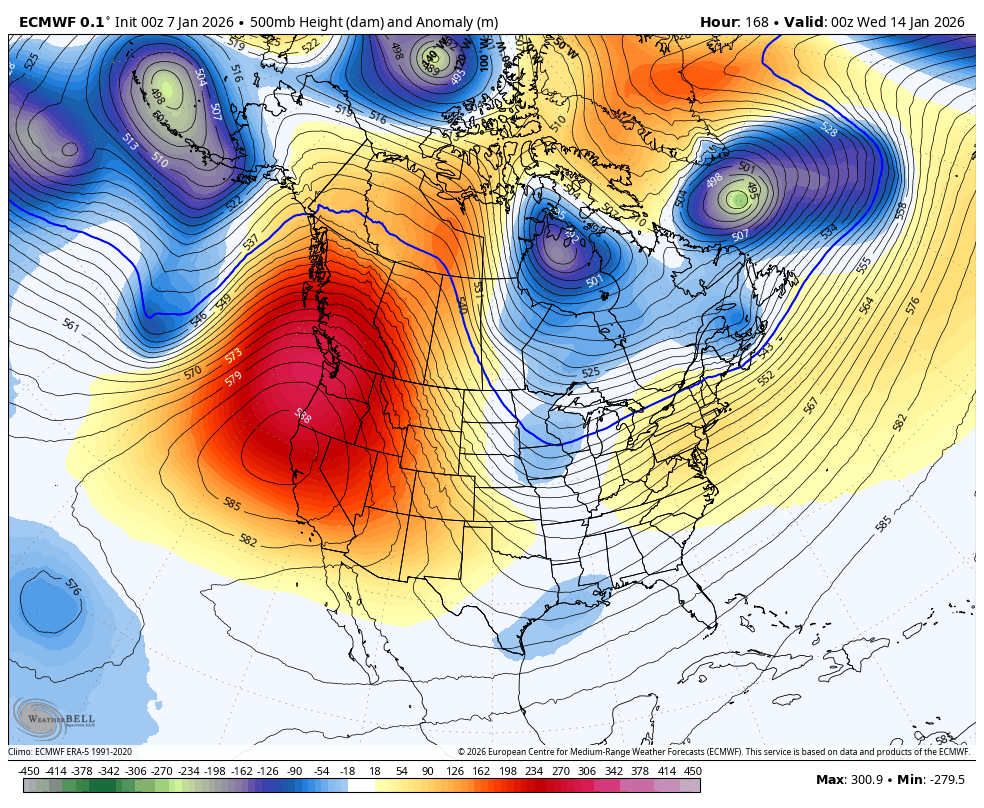
That’s a pattern that can send much of the country into the deep freeze as the Polar Vortex threatens to drop pretty far south at one point or another.
Another update or two comes your way later today. I’ll also have a few updates on my Meteorologist Chris Bailey Facebook Page


Make it a wonderful Wednesday and take care.

Thanks Chris. I would Really like to Read other Comments on the Winter So Far, and their Expectations, and Thoughts on how the Rest of the Winter Turns Out, as we Approach the Spring Season.
As the PDO finally heads for positive territory, coupled with the change of el nina to neutral to el nino
Im afraid we will see more Severe Weather in the Ohio valley then winter storms. There will be some hit and miss snow chances of course . Thats my take..
Thanks Ricvice, I agree that we will enter a very Stormy, late Winter and Spring. As for Winter weather, I believe that it will remain well to our North and Northeast. Clipper Systems may deposit some light Snows for Northern and Eastern Kentucky, and more accumulating Snows for the elevated areas of the State of West Virginia, and the States to our Northeast. South Central and Western Kentucky, maybe a few Snow Flurries. It would be rare, but we could have one of those heavy wet Snowstorm in the coming months. When I was living North of the Ohio River, we had maybe one or two every late Winter. I have live here in South Central Kentucky for 18 years, and have yet to experience one of those late Snowstorms. Last Cold and Snowy Winter was January 2015, a weak El Nino Winter, with a positive PDO.
This is what I worry about in the area of Kentucky I live in : )
https://fainstormshelters.com/what-is-dixie-alley-and-why-is-it-so-dangerous/
I don’t think much snow falls before winter ends.
There’s always a 50 / 50 chance, but so far this Winter, Snowfall is below normal State wide. You may be right Jeff.