Good evening, everyone. It’s full steam ahead toward a major pattern change in the coming days. This change means a wild weather ride is in store with heavy rain, strong storms, near record highs to end the week to light snow and wicked wind chills to end it.
Temps on Thursday surge into the 60s and may touch 70 in the west. Clouds will be noted as a gusty southwest wind kicks in. Most of the shower and storm action is to our west but some of that moves into western Kentucky during the evening.
That’s where the Storm Prediction Center has a low-end severe weather risk…

That risk area expands farther east a bit into Friday…

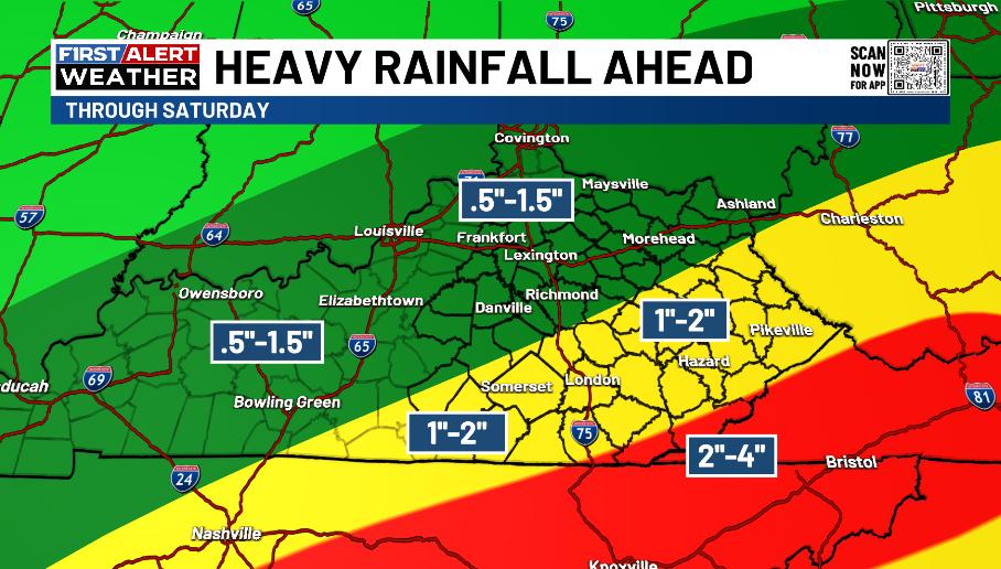
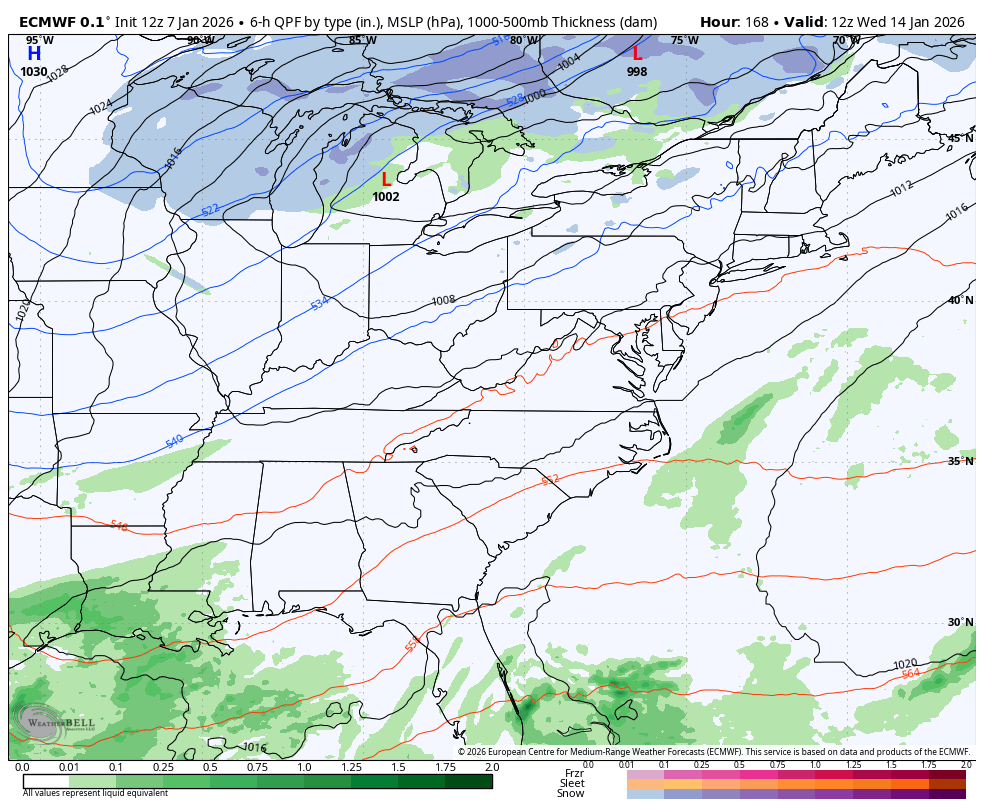
Showers and storms then increase again Friday night and Saturday with the heaviest rains targeting the east and southeast. Local high water issues will be possible as rain totals will be notably higher…
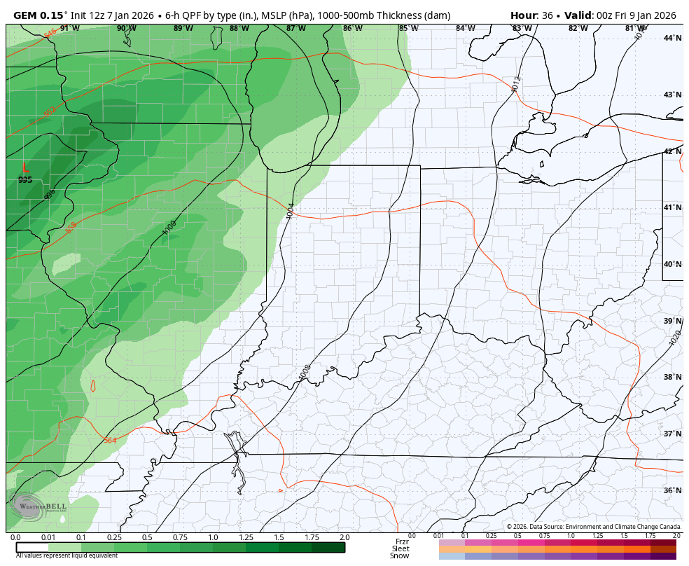
The upper level system dropping in here behind all this will produce a period of light snow and flurries. Here’s the Canadian from Thursday evening through Sunday…
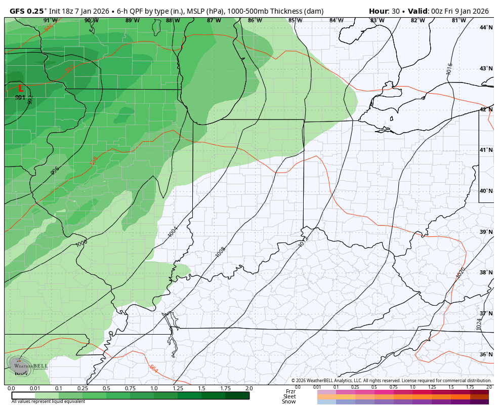
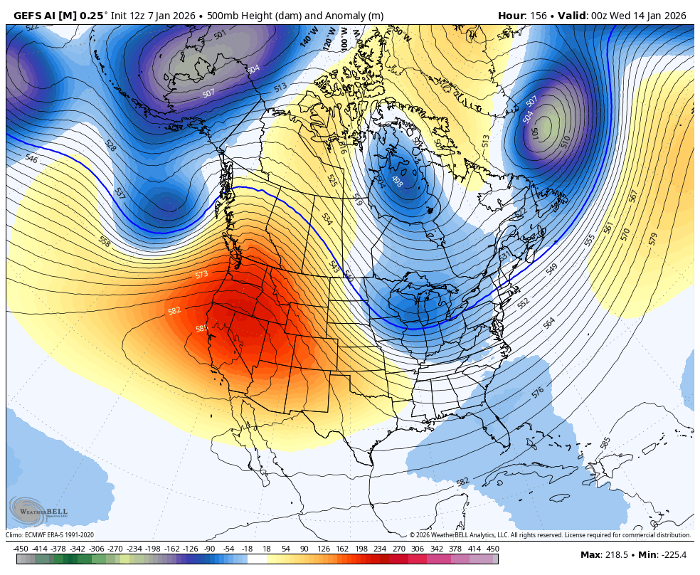
The GFS for the same period…
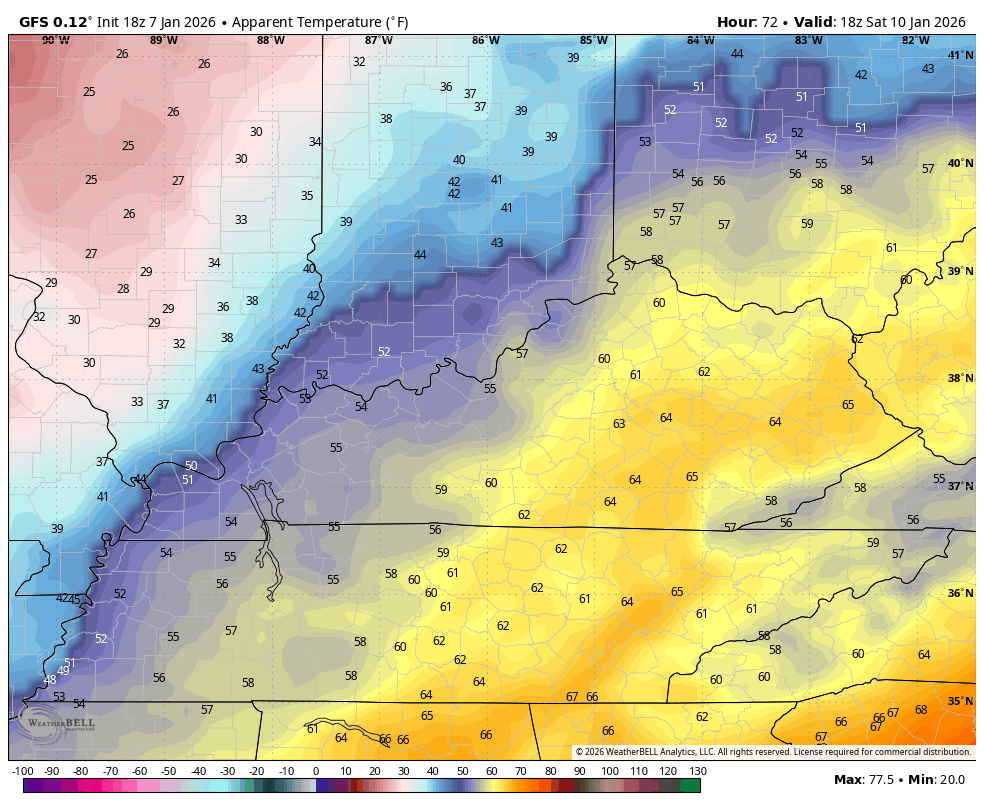
The feels like temp crashes into the teens by early Sunday and even the GFS is picking up on it. This animation starts Saturday afternoon and ends Sunday morning…
Next week will feature several systems dropping in from the northwest and we will need to be on guard for one of those trying to develop into something stronger like the Euro is showing…
This is a VERY potent look that continues to develop next week into the following week…
GFS AI Ensembles…
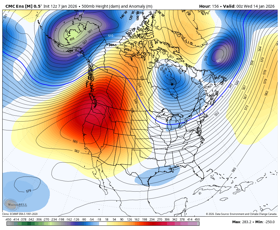
Canadian Ensembles…
I’ll have your full update later tonight. I’ll also have a few updates on my Meteorologist Chris Bailey Facebook Page


Make it a wonderful evening and take care.
