Good Thursday to one and all. Our weather is about to take another walk on the wild side as we hit the upcoming weekend. That wild ride brings in thunderstorms, gusty winds, a major temp crash and some light snow.
All of this is setting the stage for a rather harsh winter pattern to settle into much of the country next week into the following week.
Let’s begin with today with temps hitting the 60s across the entire state with the chance for a 70 in the west. Mostly cloudy skies will be noted on a gusty southwest wind ahead of a storm system passing to our west. This drags a cold front in from the west with some showers and storms overnight.
A few of the storms getting into far western Kentucky this evening may be strong or locally severe, though much of the action is to our west.
The Storm Prediction Center keeps the low-end risk for the far west…

That threat area focuses farther east on Friday, with the greatest threat showing up to our south and southwest. Still, the risk area extends into parts of the Bluegrass State…

Damaging wind will be the primary player with any strong or severe storm, isolated though they may be.
Friday’s temps look a tad cooler than before as that front has a little farther east push to it. Still, most areas reach the 60s with western and northern Kentucky dropping pretty quickly into the 50s behind the front Friday afternoon.
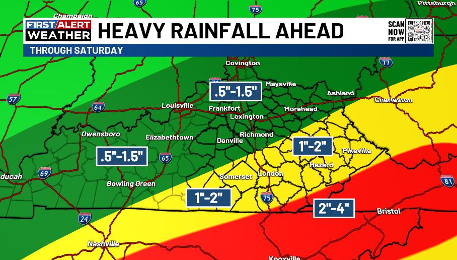
The front then hangs out right on top of us Friday night and early Saturday as another low pressure rolls northeastward along it. This brings widespread rain and some thunder to central and eastern Kentucky with higher totals in the southeast.
Here’s a look at how much rain may fall through Saturday…
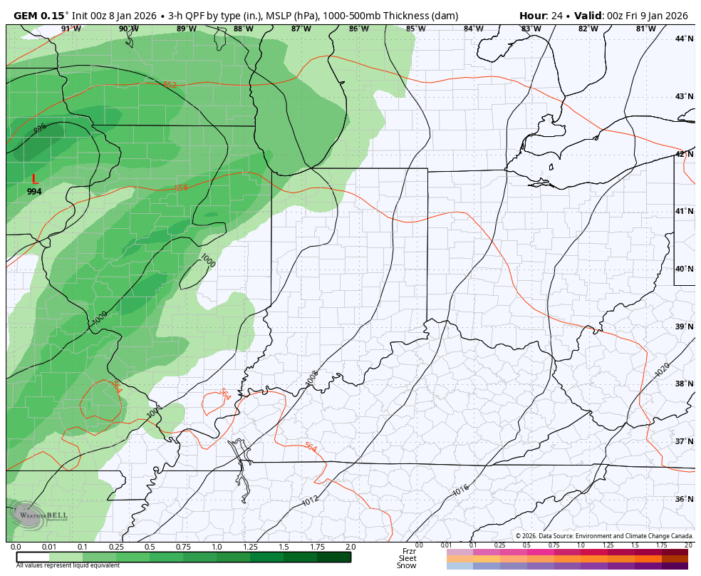
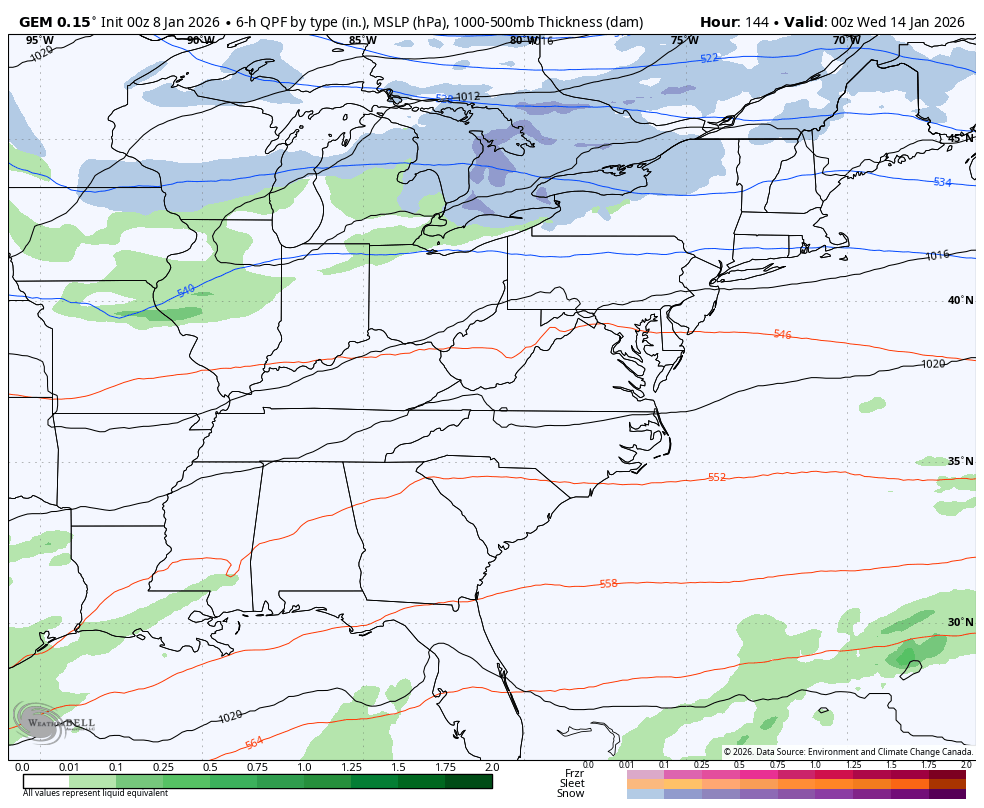
Cold air crashes in from the west on Saturday with an upper level system bringing some light snow and flurries to central and eastern Kentucky on Sunday. Here’s the Canadian Model showing everything we’ve been talking about from this evening through Sunday…
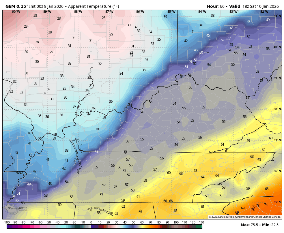
Wind chills reach the teens behind this front early Sunday. This wind chill animation starts at 1pm Saturday and ends at 10am Sunday…
The pattern that follows this will feature storm systems dropping in from the northwest next week into the following week. One or two of these systems will try to really develop as it dives through the base of the trough.
The operational models are seeing these systems, but it’s way too far out for them to give us any kind of details. The model runs vary greatly but they are seeing the potential…
GFS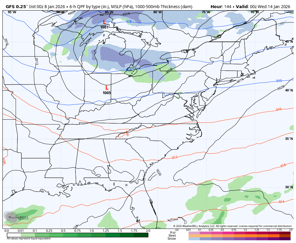
CANADIAN
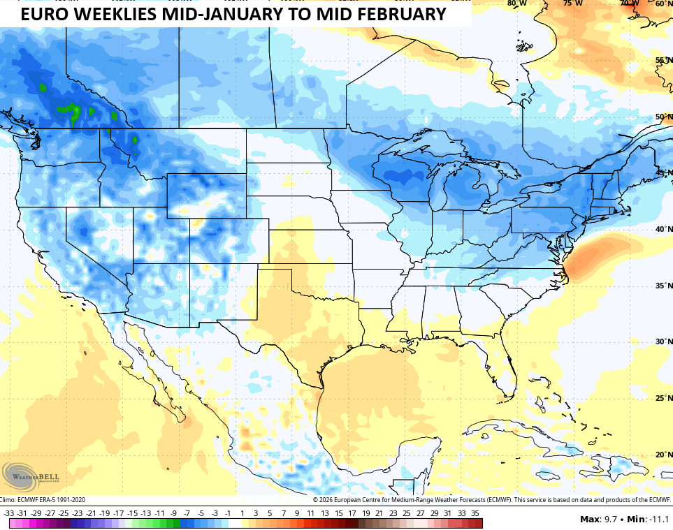
Looking farther down the road from the middle of January through the middle of February, we find the EURO Weeklies swinging back toward a colder than normal look…
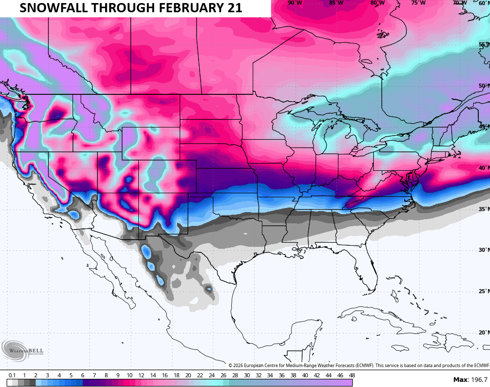
And a snowier than normal look…
The weeklies have shown some very wild run to run swings as even the longer term models are suffering right now.
I’ll have updates later today so check back. Until then, here are all the storm tracking tools you need to start the week…


Current watches

Possible Watch Areas

Make it a great Thursday and take care.
