Good evening, everyone. Rounds of showers and storms continue to target the region tonight through early Saturday and a few may be severe. All of this is ahead of a pattern change with Old Man Winter crashing back in on Sunday, with a bigger push a few days later.
Strong to severe storms are developing in a line to the west of Kentucky. This line moves into far western Kentucky later this evening and the Storm Prediction Center continues with a Marginal Risk for the far west…

As the storms rumble east overnight, so does the Marginal Risk for severe storms. The Storm Prediction Center has this risk fairly far east, along and south of Interstate 64…

The damaging wind threat is the main player, but the SPC has a low tornado risk in the south overnight…

Here’s the future radar from the HRRR showing this action. Our animation starts at 11 this evening and ends at 11am Friday…
With or without severe storms, winds are going to be a big player. Gusts of 40mph to 50mph will be possible.
Additional waves of showers and a few storms roll through late Friday into early Saturday with the greatest concentration in the east and southeast.
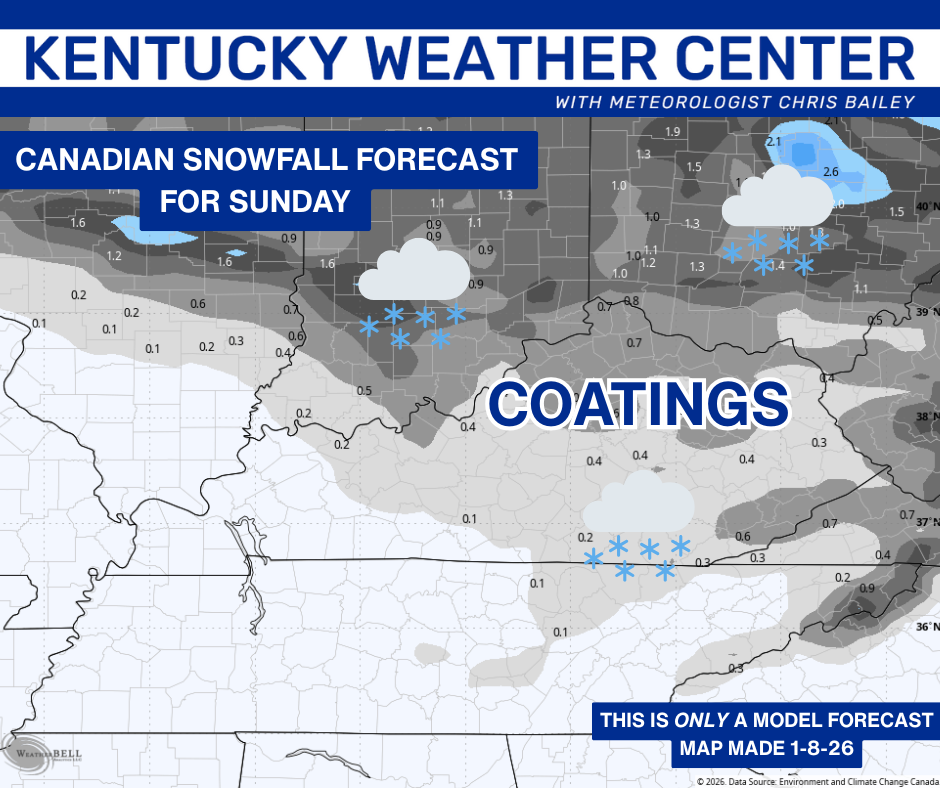
Mild temps tumble from west to east Saturday with bitterly cold wind chills in the teens by Sunday morning. At the same time, areas of light snow and flurries will be across central and eastern Kentucky. This may deliver a few coatings…
The pattern next week into early the following week features several systems dropping in from the northwest. One or two of these have the potential to turn into something bigger than the models currently show.
What they’re showing now is a pretty nice pattern for snow chances. This animation from the Canadian goes from Wednesday into next weekend…
The EURO is trying to do something similar into early the following week…
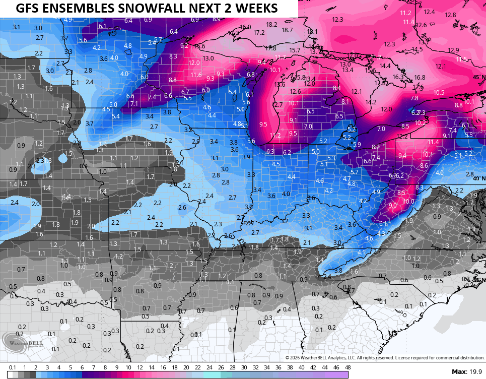
We now see all the Ensembles featuring a good snow signal and that hasn’t happened since back in early December. Here’s the next two weeks on the GFS Ensembles…
The main update comes your way later tonight. Until then, here are all the storm tracking tools you need to start the week…


Current watches

Possible Watch Areas

Make it a great evening and take care.
