Good Saturday, everyone. Rain is rolling across areas of the state today as we get set for a massive weather change blowing in tonight and Sunday. This brings Old Man Winter back into town with some flakes and frigid wind chills. This is ahead of a bigger pus of winter for the week ahead.
Today’s showers are rolling through the central and east with temps that are still fairly mild. That mild goes bye-bye from west to east later today as our cold front finally plowes through the region. This will be followed by an upper level system rolling over us on Sunday, touching off areas of light snow, snow showers and flurries.
The HRRR future radar starts at 7pm tonight and goes through 7pm Sunday. This gives us a good look at all this, including some nice snow streaks…
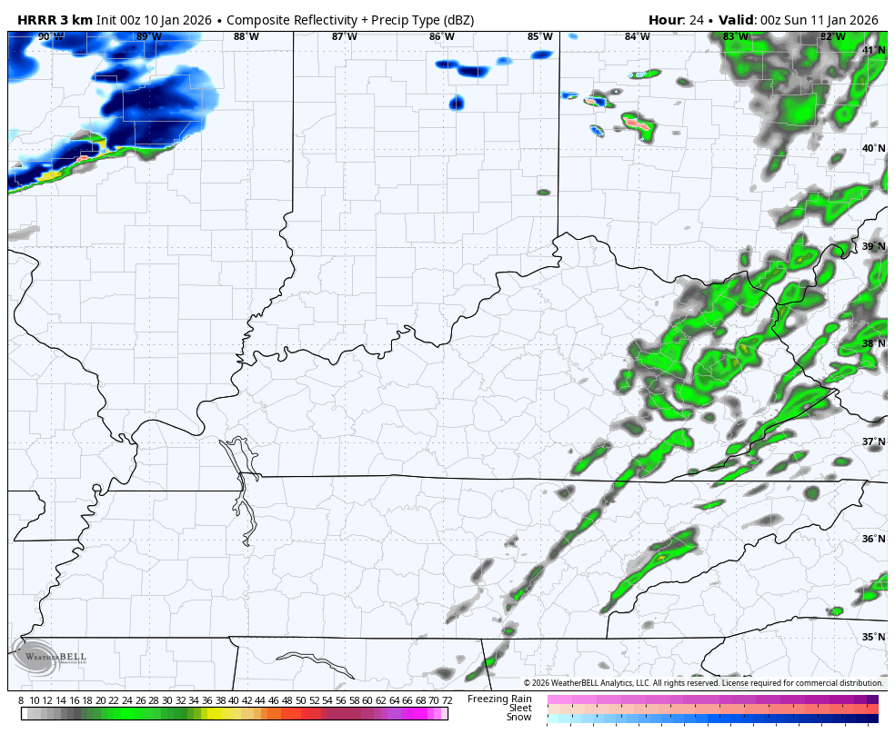
That particular model run is pretty excited about some light accumulations…
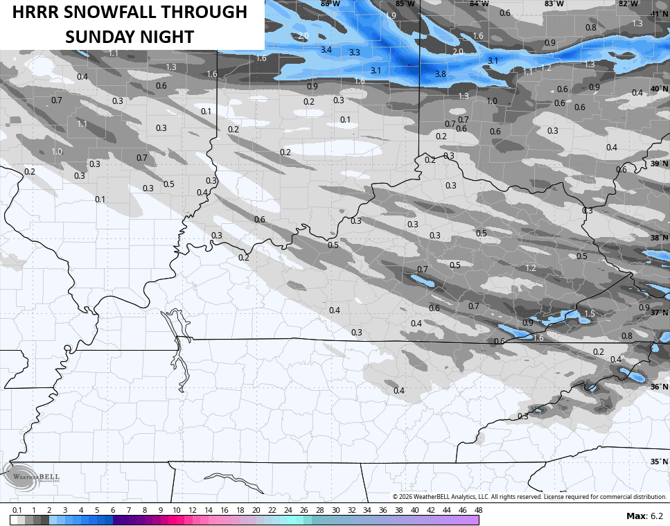
That’s probably too enthusiastic, but I digress.
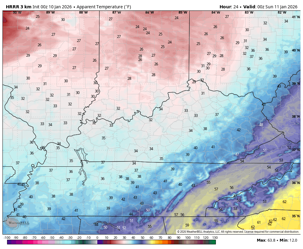
Temps tank from west to east and stay in the upper 20s and low 30s for highs on Sunday. Gusty winds make it feel so much colder with wind chills in the low and mid teens by Sunday morning…
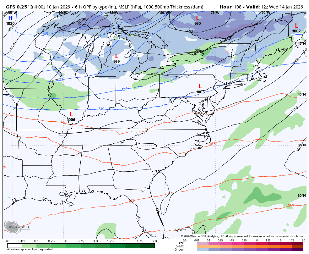
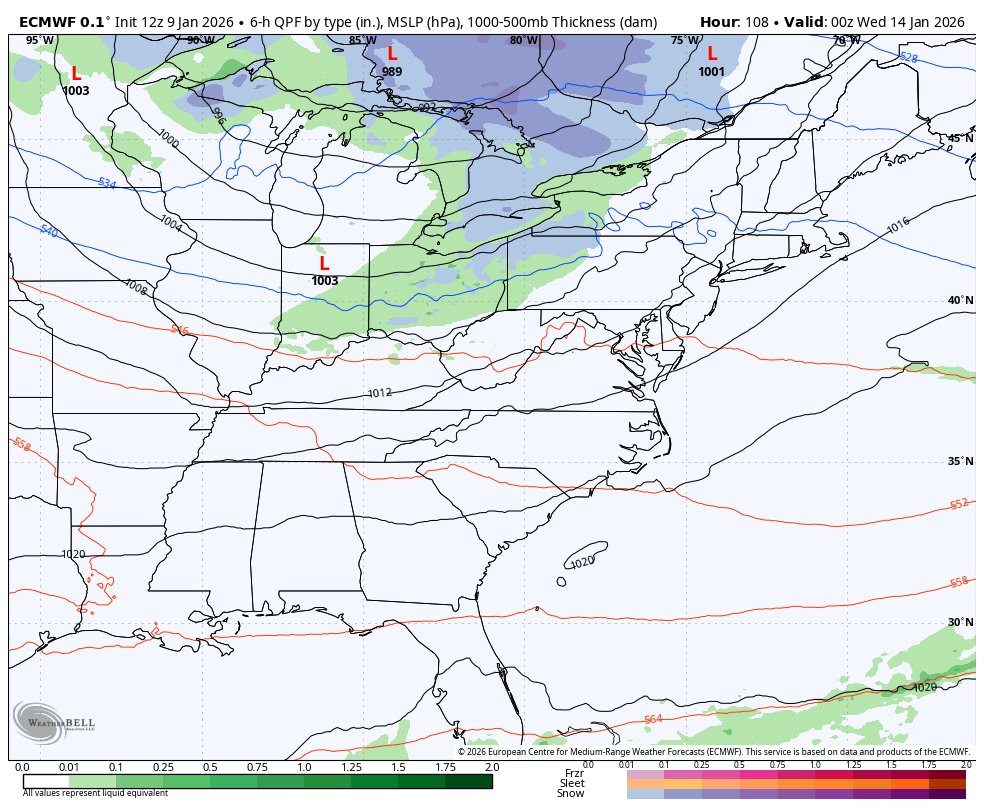
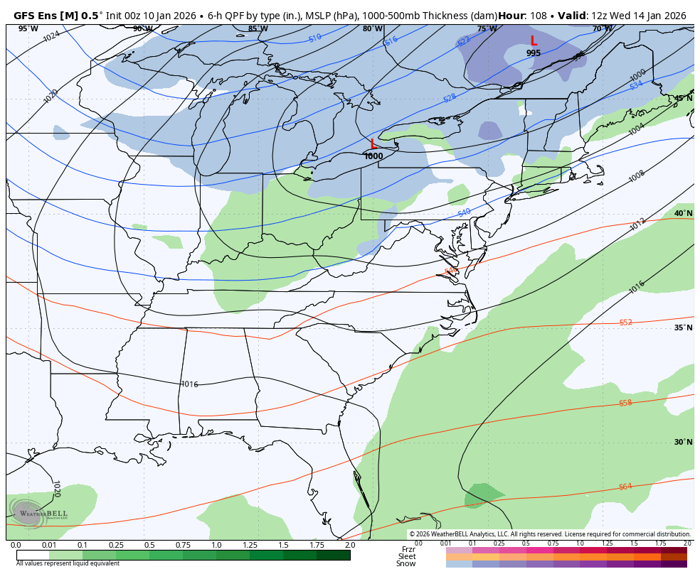
Two systems of interest continue to show up next week as the jet stream features a few big time dips into the eastern half of the state. The first system moves in with rain ahead of it and some snow behind it by Wednesday and Thursday. The chance is there for a bigger storm system to develop behind it is there by the end of next week into next weekend.
How much of an impact these systems have on our weather remains to be seen. The various forecast models continue to vary greatly from run to run, so don’t get attached to any one model run.
The latest GFS decided to blow up with first system and go light on the second…
The Canadian is wimpy with both…
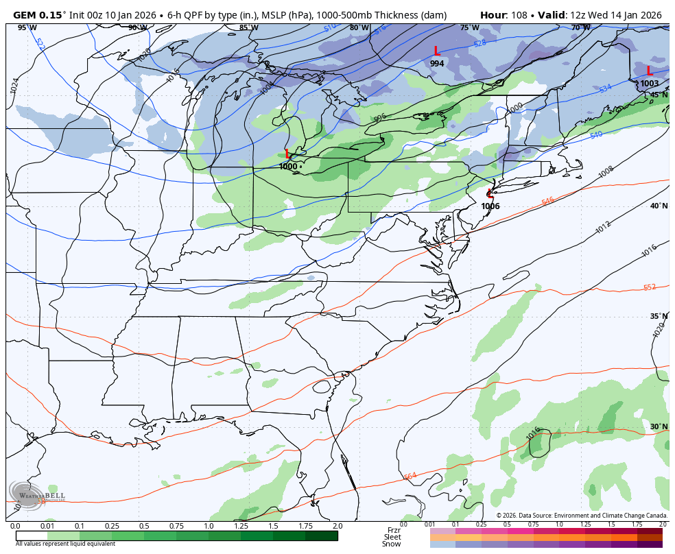
The latest run of the EURO is also on the wimpy side…
The GFS Ensembles seems to be a more reasonable outcome as it sees the potential for system two to be the one to watch…
Updates come later today. I’ll also have a few updates on my Meteorologist Chris Bailey Facebook Page . Until then, here are all the storm tracking tools you need to start the week…


Make it a great Saturday and take care.

Thanks Chris, and No Thanks to AI Generated Models.
Here is the link for the summary of the heavy rain, record-tying warmth, and very windy weather the Chicago Metro area experienced on Thursday and early Friday: https://weather.gov/lot/2026_01_08-09_RainWind
Thursday was the third-wettest day ever in the month of January for Chicago!
For the Bears/Packers playoff game tonight at Soldier Field, it’s going to be chilly and breezy with temps falling through the 20s during the course of the game, with a few snow showers. Go Bears!
Mike, we had around a half inch. Below normal since we had that frigid / dry Arctic Air in December. I notice on the Radar, that the rain has turned to Snow in the Chicago area. The temperature right now is 52 degrees here, after a high of 70 degrees yesterday. Don’t expect much more than a flake of Snow here in Maple.
Not really a Football Fan, because a lot of players get injured for life. Basketball and Baseball are my Sports. A long time ago my Father took me to a St. Louis ( which is really pronounced St. Louie ) Cardinal Game at the old Bush Stadium. One of the Players knocked the ball right out of the park. I think it was Roger Marris. Not sure.
Thanks for the Chicago weather link.
Interesting article : EDDI categories for December 31, 2025
D3 – D4 most susciptible to strengthening Drought / Flash Drought
( see Fig. 7 )
This awful weather pattern just won’t end. Here’s the Link : )
https://climateimpactcompany.com/u-s-soil-moisture-outlook-nw-hydro-u-s-drought-monitor-latest-eddi-and-cas-soil-moisture-outlook-2-2/