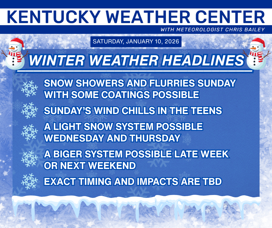
Good afternoon, everyone. Old Man Winter is just hours away from returning as periods of light snow and snow showers invade the region. This kicks off a setup featuring winter weather threats for the week ahead with two of those having some potential.
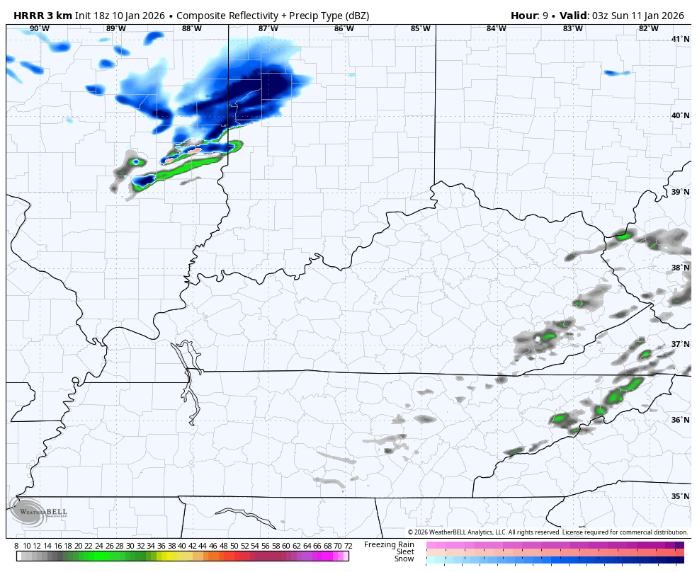
Let’s begin with the cold air streaming in this evening. Rain showers and rolling across central and eastern Kentucky ahead of our cold front with periods of snow showers and light snow coming in behind it tonight and Sunday.
Here’s the Future Radar from the HRRR showing this…
The Future Radar from the Hi Res NAM shows this as well…

Winds are going to be cranking with gusts of 30mph at times. That could mean a few snow squalls crank as well. Light accumulations are possible across central and eastern Kentucky with coatings showing up. I suppose the potential is there for a stripe or two to push up to 1″. Maybe.
Wind chills tank tonight and reach the low and middle teens by Sunday morning…

As mentioned, this kicks off a busy stretch of winter weather. Here’s a breakdown…
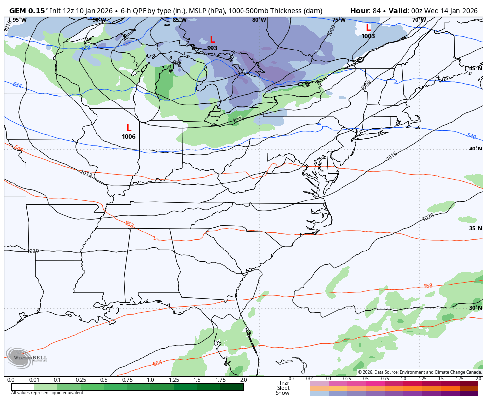
The models all have both of our systems, but they change how they handle them with each run. That’s to be expected and this will continue until we get closer to the first system that arrives late Tuesday into Wednesday. Once they models figure out how to handle that one, they should quickly figure out what happens with the storm system behind it.
The latest GFS is a double hit on our region as it blows up both systems into full-blown storms. Here’s the animation from Wednesday through next weekend…

The EURO is getting trending that way with the first system, but it’s likely leaving behind too much energy with the second system…

The Canadian is trying to get there but is more progressive as it shows 3 or 4 different clippers…
I’ll try to throw you another update later this evening. I’ll also have a few updates on my Meteorologist Chris Bailey Facebook Page
Until then, here are your tracking tools for the day…


Make it a great evening and take care.

Schroeder, looks like finally we may have the gulf moisture and jet stream for a snowmaker in our world if it plays out next weekend. We shall see
The Subtropical Jet Stream is Not active during La Nina Winters. Only in El Nino Winters, where we can have merging between the Northern Jet and the Southern Jet. Remember the weather pattern in January 1978. The year of the Blizzard. A weak El Nino plus a positive Pacific Decadal Oscillation resulted in that very Cold and Snowy Winter.