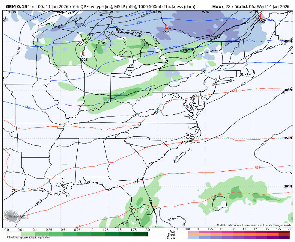
Good Sunday to one and all. Snow showers and flurries are making their way across central and eastern Kentucky today, ushering in a full-blown winter pattern. This return to winter kicks into high gear for the week ahead with two storm systems of interest.
Streaks of snow showers and areas of light snow are zipping from northwest to southeast across the state today. The greatest concentration is across central and eastern Kentucky. Within these streaks, some light accumulations may show up. With temps dipping below freezing, some slick spots are possible on bridges and overpasses.
Wind chills drop into the teens at times, giving us a slap back to reality that it’s still January.
Ok, let’s get into the week ahead because it continues to show potential.
The first system moving in Tuesday night through Thursday continues to trend stronger as we get closer. My focus right now is on the upper levels and the potent energy diving in from the northwest to southeast. The stronger this upper feature is, the better the shot at a stronger surface low to throw snow into our region.
The forecast models are just now beginning to see the strength of this system, but it’s still too early for any kind of details.
The track of this upper on the EURO and GFS is one that puts our region in the zone to watch for potential accumulating snows. Here’s what the EURO looks like with that upper level energy…
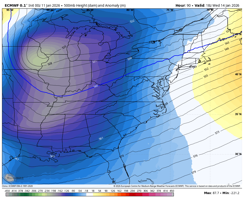
Taken verbatim, that’s a potent, but fast-mover that bowls quickly to the east. That energy would pop a surface low somewhere in the southern Appalachians but it would quickly zip eastward.
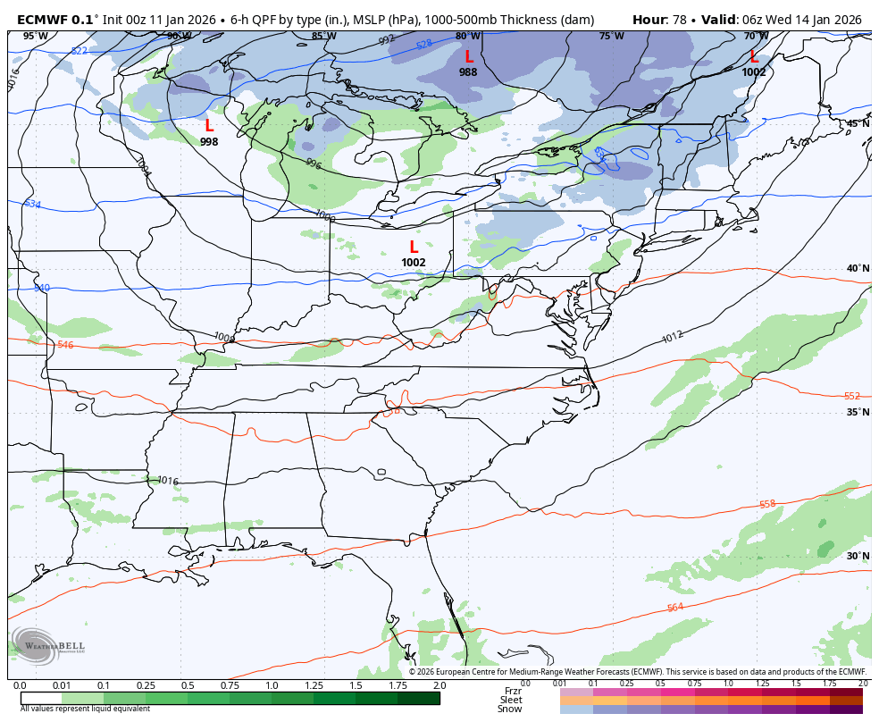
This shows up well at the surface on the EURO and you can also see the system coming in behind it by late Friday into next weekend…
That energy in the upper levels shows up as much more strung out instead of something consolidated…
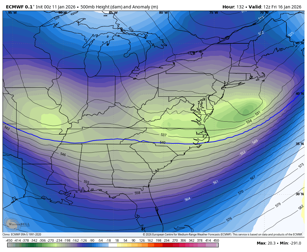
Still, it’s way early for that one and what happens with the first system will play a big factor in how that one plays out.
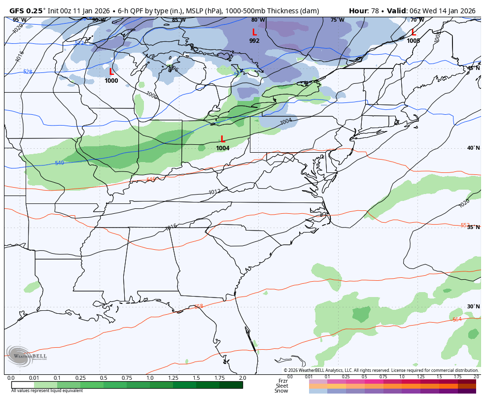
The GFS is similar overall to the EURO with both systems…
If you’re wanting snow from either of these systems, you actually like seeing the early model runs being a bit east. The old fashioned westward trend could wind up being at play with both systems as we get closer.
Now, we should note the Canadian continues to be more strung out and brings a series of clippers through here with accumuating snows…
BTW, the precipitation type algorithms on some of these model runs from that provider looks to be jacked up a bit.
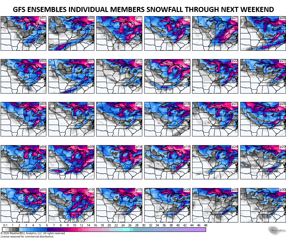
If we deep dive into the GFS Ensembles, we find several members showing some healthy snow swaths into our region, with only a few showing very little snowfall…
The average of the 30 members shown there looks like this across the east…
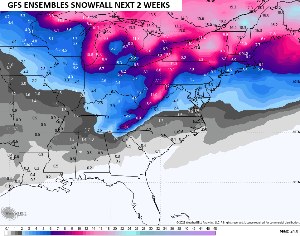
All of that is based on 10-1 snow ratio and that’s actually a nice snow signal. Notice it takes the chance for some flakes into the deep south? This type of colder than normal pattern can do those types of things…
That animation from the GFS Ensembles goes from January 15th to January 20th and is impressive considering some Barney colors are showing up in the average departure forecast.
We go back to 3 updates a day starting today, so y’all get ready. I’ll also have a few updates on my Meteorologist Chris Bailey Facebook Page
Until then, here are your tracking tools for the day…


Make it a wonderful Sunday and take care.

Snow flurry threats only in La Nina Winters. This has been a very Sad Winter for all the Snow Lovers out there. I hope next Fall and Winter, ENSO will phase into a weak El Nino, but the Pacific Decadal Oscillation will have to go way Positive, and the EPO, AO, and the NAO strongly Negative. This Scenario would give our area of the Country a Winter to remember in the way of Snowstorms State wide.
I’m not buying into the models hype.
I Was Wrong In An Earlier Post, In Saying That ( AI ) Weather Models Were Not Accurate. The New ( AI ) Weather Models Can Accurately Out Perform The Old Weather Models Without ( AI ) Influence. A Break Through In Future Weather Forecasting. Meteorology Becoming More Interesting.