Good afternoon, everyone. Snow showers and snow squalls are slowly winding down as frigid northwest winds continue to crank. This blast of winter leads us back into a full-blown winter pattern for the week ahead.
The streaks of snow showers and squalls caused lots of issues this morning with numerous accidents because of whiteout conditions that came along with 40mph-45mph wind gusts. These squalls also put down light accumulations that caused bridges and overpasses to ice up.
To my knowledge, not a single Snow Squall Warning was issued anywhere in central and eastern Kentucky. The NWS came up with this produce, a good one mind you, several years ago but out local offices just won’t issue them for some odd reason. It’s frustrating to say the least as this morning was exactly what they were designed for.
Looking toward the week ahead, we have two and maybe three systems to track.
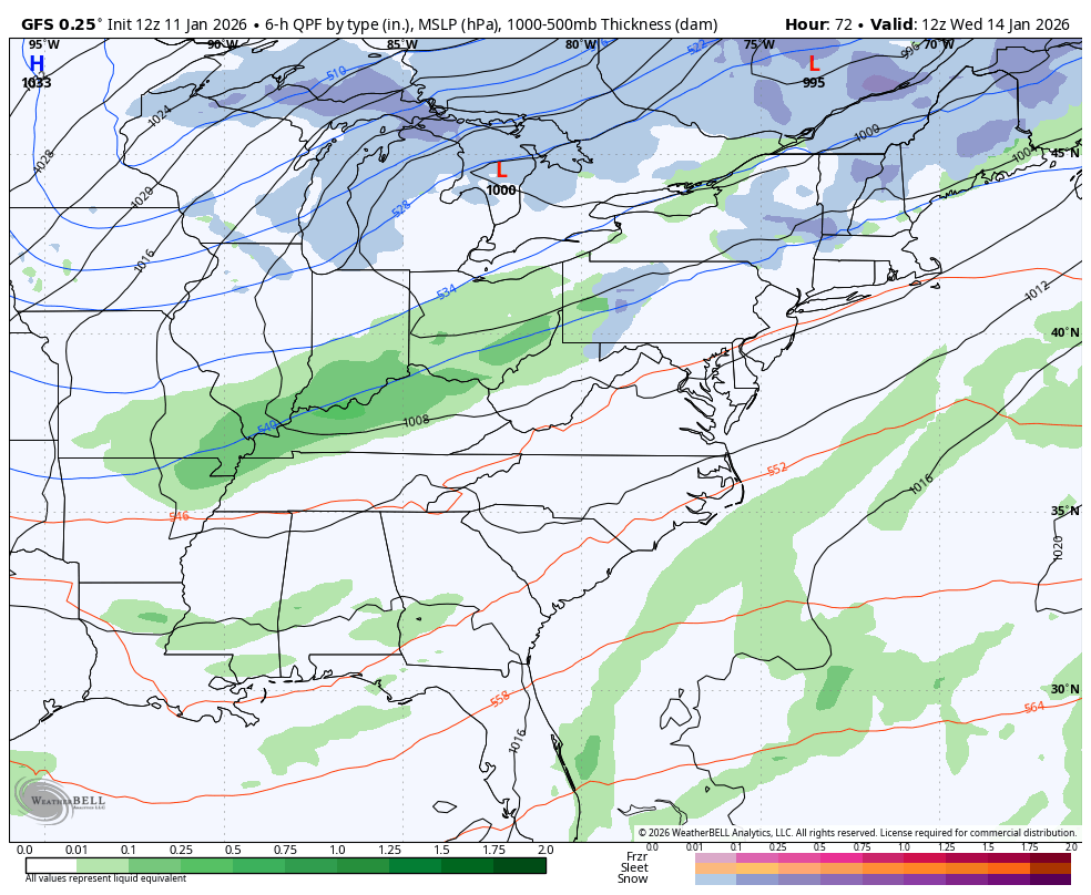
The GFS continues to be most aggressive. The first system swings in from northwest to southeast on Wednesday with rain changing to snow underneath a potent upper low dropping in. How long and how strong of a snow event depends on how deep that low is. That said, it’s likely to be zipping through here pretty quickly because another deep upper level disturbance follows it by the end of the week into the weekend.
There’s a lot going on in the upper levels so it’s a work in progress for the models to figure it all out.
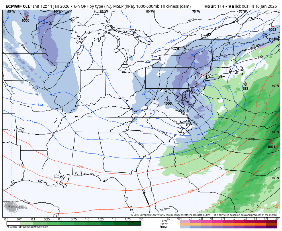
Here’s a look at the potent upper level systems showing up on the GFS…
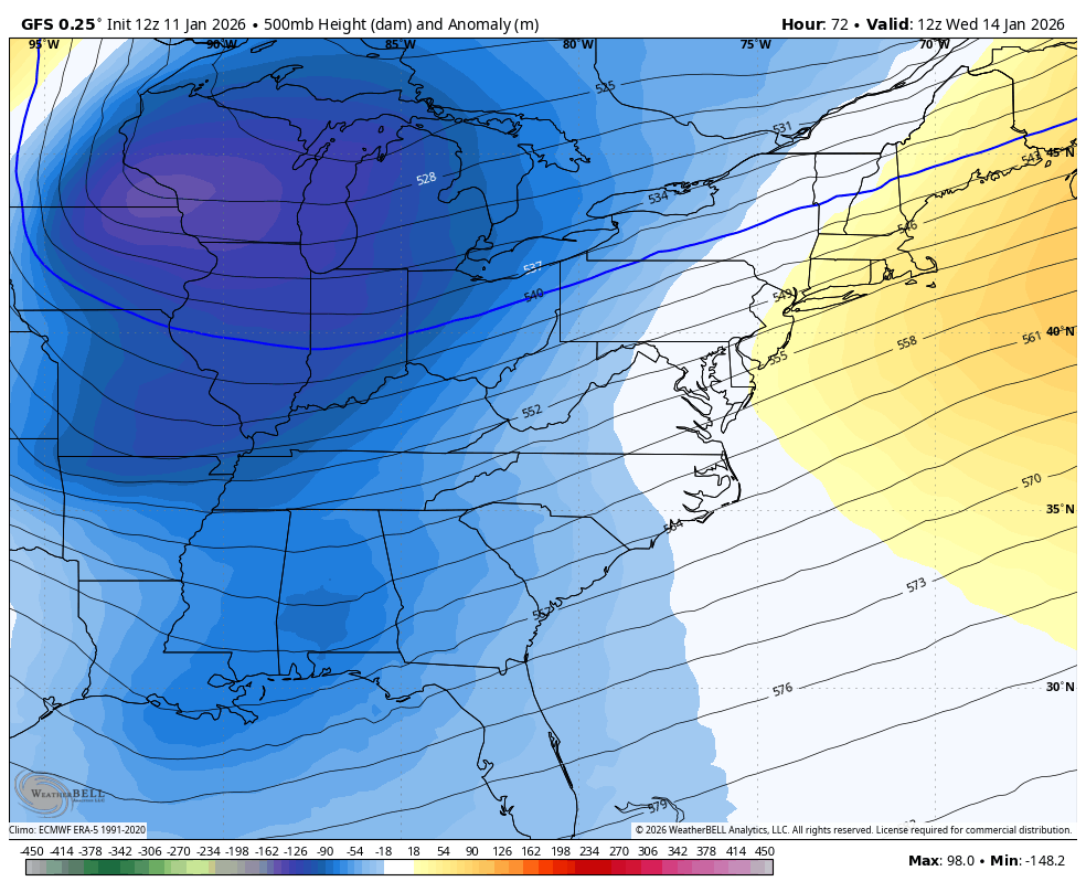
The GFS isn’t as strong with this initial system and I think that’s the correct route as it can only dig so much because of the one pushing it from the northwest. Still, it shows a nice snowfall for much of our region late Wednesday and Thursday…
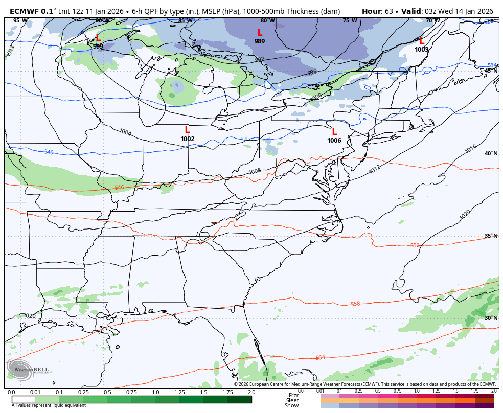
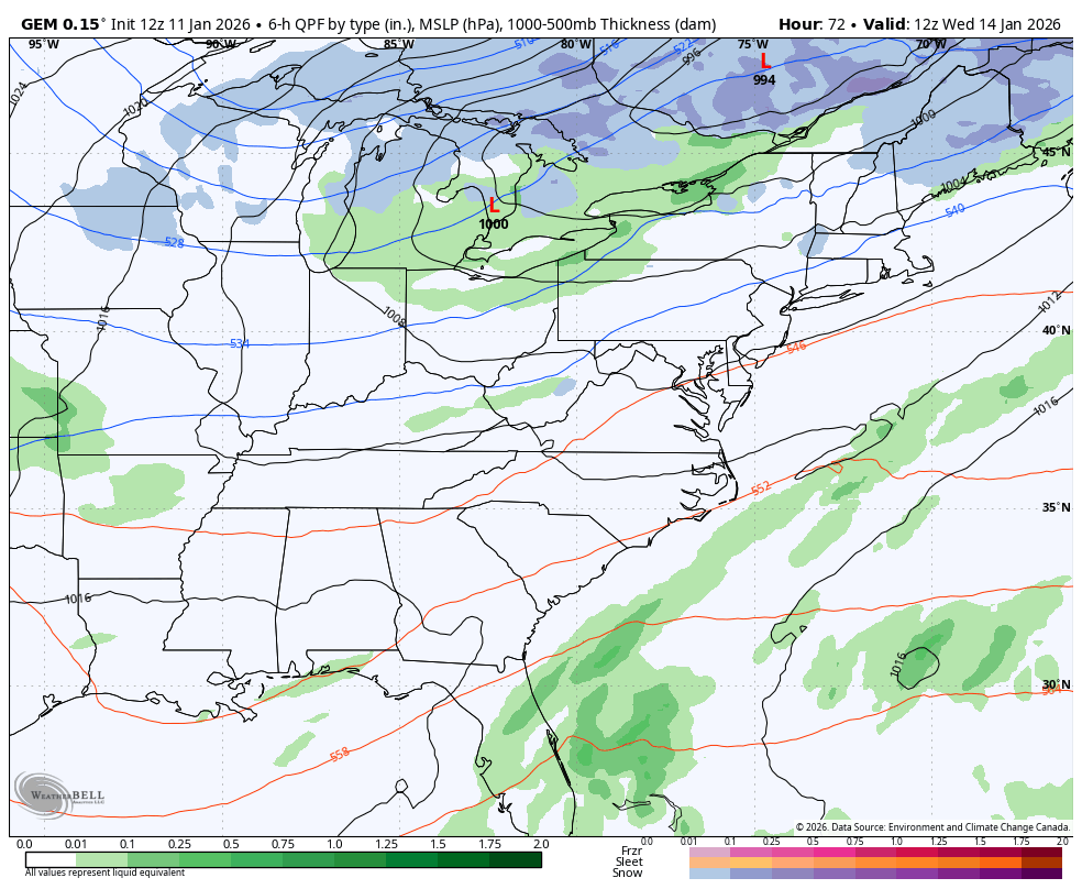
The EURO is pretty similar with this but is a bit weaker and faster…
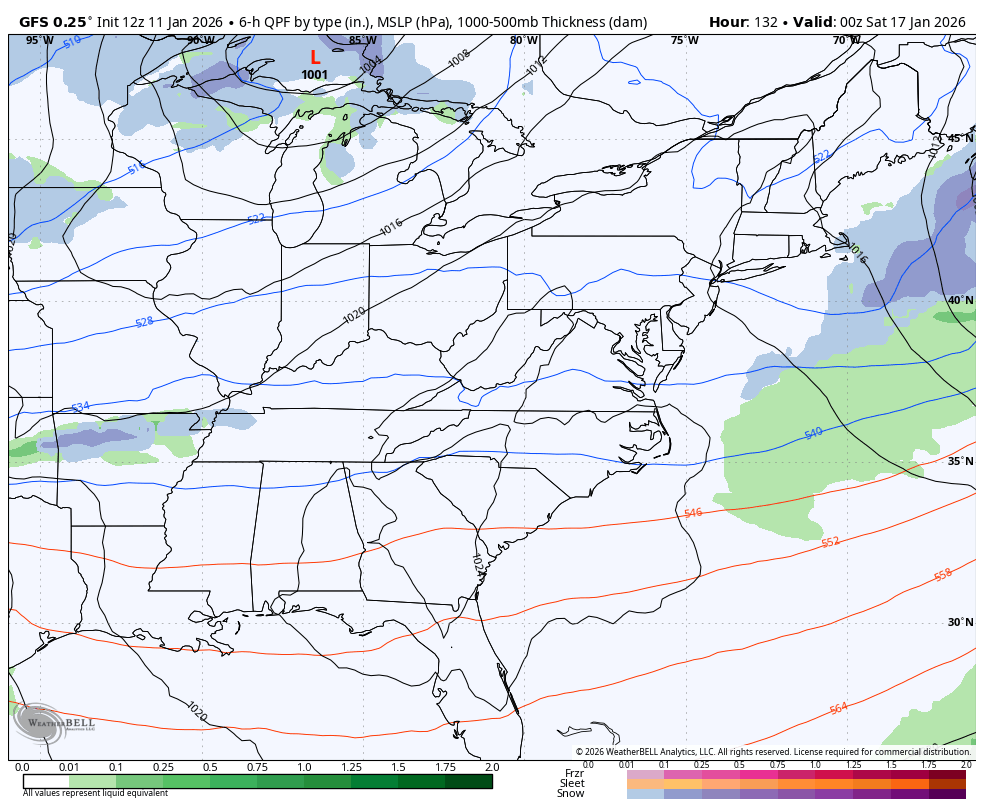
The GFS is also the stronger of the models with the second system by the weekend and is now seeing the clipper behind it…
The EURO is weaker with our second system but gives us a better look at the third one…
The Canadian isn’t shy about being the most progressive of all the models with these systems as it’s essentially clipper-mania with 4 such systems…
Another update comes your way this evening. I’ll also have a few updates on my Meteorologist Chris Bailey Facebook Page
Until then, here are your tracking tools for the day…


Make it a wonderful Sunday and take care.

Thanks Chris. I am Sorry, For Not Taking The Models And Various Maps You Display More Seriously. Won’t be Talking Them Down Anymore. Your Predictions In The Past 48 Hours Were Completely Accurate. Very Cold Wind Chill This Morning, With A Few Snow Flurries In West Central Kentucky. I Know That The Next Storm Is Too Far Off To Accurately Predict, But Would Be Nice To Have 1 to 3 Inches Of Snow On The Ground At The End Of The Week. We Shall See How This All Plays Out.
One More Issue : I Will Promise Not To Copy And Paste Articles Anymore. I will Read Your Thoughts On KWC, And Post Only With A Positive Mine. No More Negativity.
Good Afternoon Everyone.
Once again, south central Kentucky may see a flake or two, but nothing measurable. In fact, I’ve recorded only 0.10 inches of rain over the past 13 days.