Good afternoon, everyone. The sunshine sure looks and feels good out there today as we continue to focus on a pattern set to bring some snow to our region this week. My time is super limited for this update, so temper those expectations of a long-winded CB. ha
The system dropping in on Wednesday will be a rainmaker to start before a switch to light snow, then snow showers and flurries that last into Thursday.
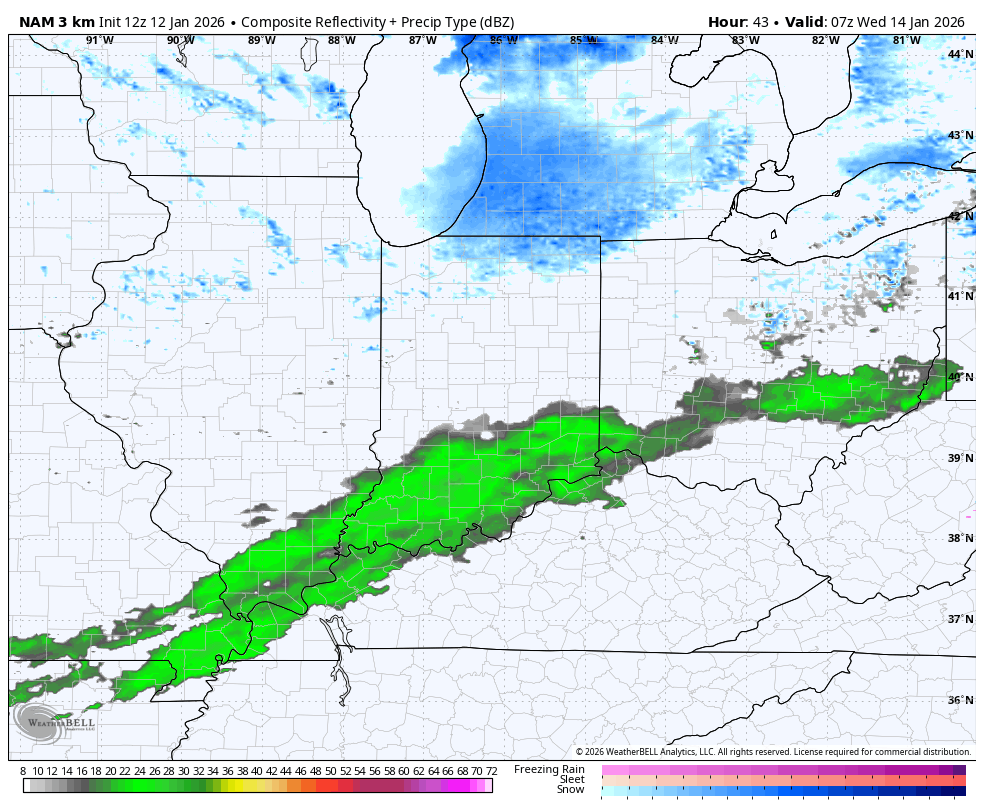
The Hi Res NAM only goes through 7pm Wednesday but it gives us a good look at the change to light snow. It also shows that northwest wind doing some work in kicking off snow showers and a few squalls. Check out that Lake Michigan snow plume getting aimed into the state at the end of the animation…
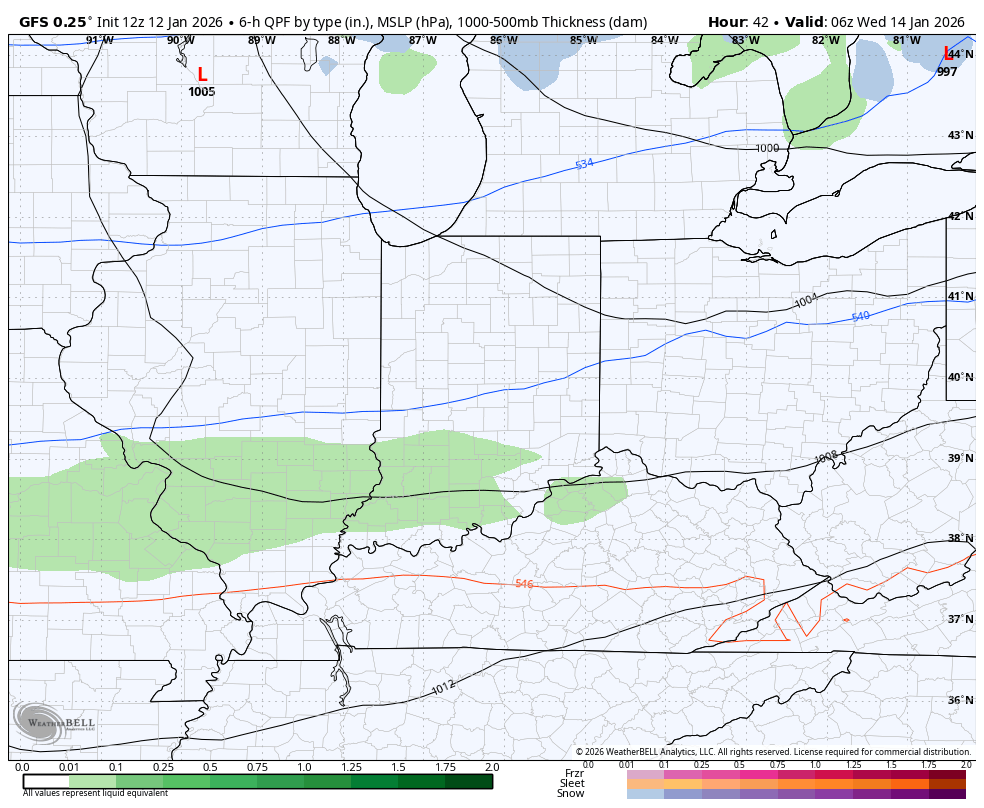
I’m fairly certain the forecast models “think” there’s more ice covering the Great Lakes than is the reality so they may not be seeing the full amount of Lake Effect snows farther downstream. The GFS is trying to show that plume reaching all the way into the southern Appalachian Mountains…
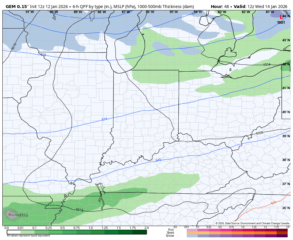
The Canadian is doing the same…
Wind chills hit the singles with this Wednesday night and Thursday.
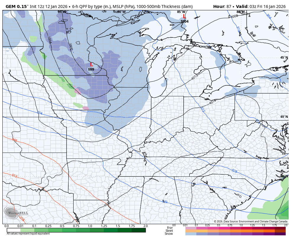
I have no changes to the setup from Friday through the weekend as a series of systems spin through here as arctic air takes over. The Canadian sees this well…
I’ll have the latest on WKYT-TV starting at 4pm today and with another update here on KWC this evening. Make it a magnificent Monday and take care.

Thanks For The Afternoon Udate Chris. By The Way, Lake Michigan Is Not Frozen Over. Open For Natural Snow Making.
Proof That Lake Michigan Is Not Frozen Over. Here’s A Web. Cam. That’s A Few Minutes Old : )
https://www.ventusky.com/webcam-644478893