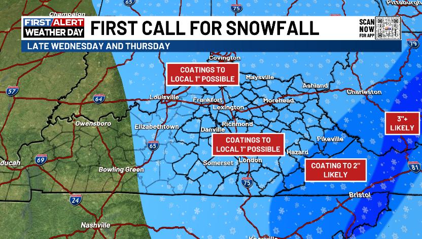
Good evening, everyone. I wanted to drop by for another quick update to the winter pattern taking shape. This includes a First Call for a Light Snowfall coming later Wednesday into early Thursday. This kicks off a busy winter pattern.
Here’s a quick rundown of Wednesday into Thursday…
- Rain and wind start Wednesday ahead of a cold front slamming through.
- This front slows down with a wave of low pressure along it late Wednesday afternoon and evening.
- As this is happening, it allows the cold air a better opportunity to catch the back of the rain shield and change it to snow.
- That may allow for a period of accumulating snow, especially in the east and southeast.
- Snow showers and snow squalls then develop on a strong northwest wind late Wednesday into early Thursday.
- Some pretty nice snow streaks can show up during this time, especially in the plume coming from Lake Michigan.
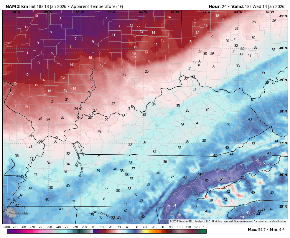
- With temps dropping into the 20s Wednesday evening and teens Thursday morning, slick roads will become an issue.
- Wind chills reach the single digits Wednesday evening and stay there into Thursday morning.
My First Call for Snowfall has a pretty wide area of coatings to up to an inch of snow with some higher amounts in the southeast…
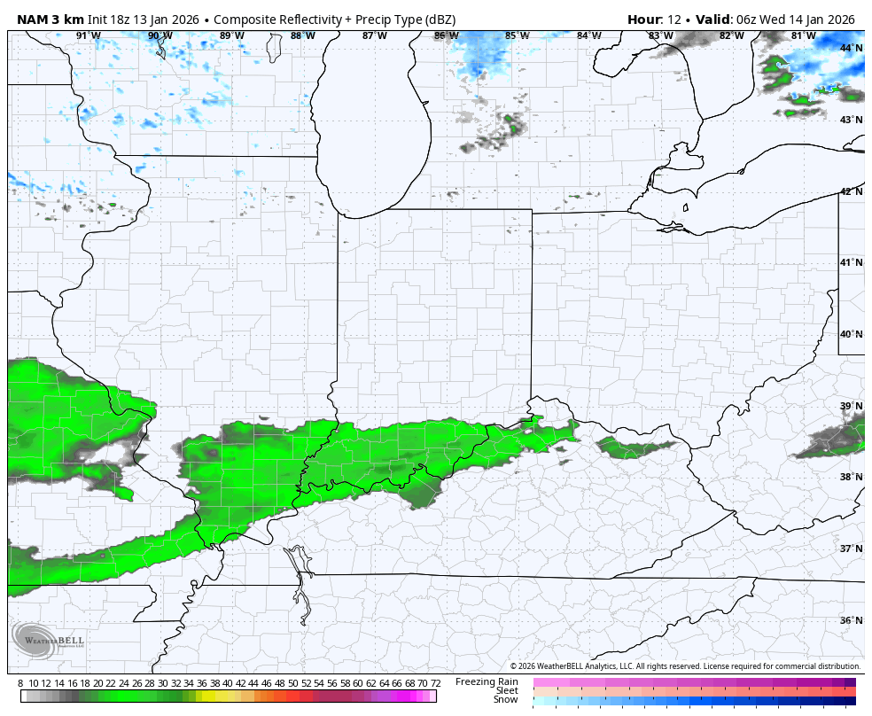
The late day forecast models are turning a littler snowier as they’re seeing this cold catching up to the rain shield and they’re also finally seeing Lake Michigan moisture.
The future radar from the Hi Res NAM…
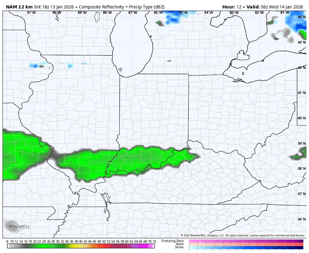
The future radar from the NAM…
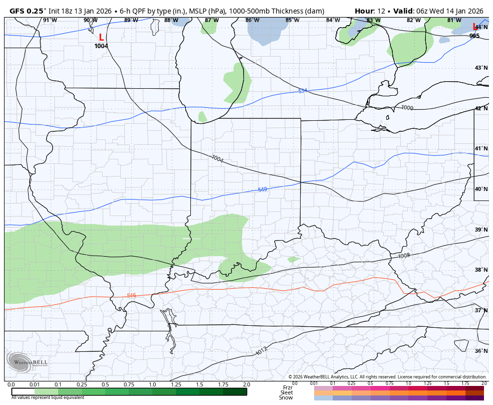
Even the GFS is now seeing this…
Bitterly cold wind chills will be noted with those wind chills reaching the singles by Wednesday evening and staying there into Thursday morning…
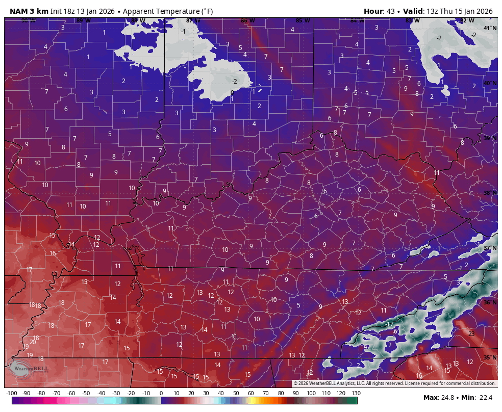
Thursday is frigid with wind chills staying in the teens…
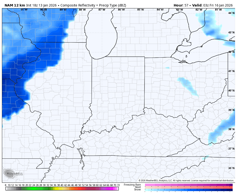
The next system zips in here coming late Thursday night and early Friday with a quick-hitting light snowmaker for some. That moves away very quickly with some melting during the afternoon. But the next system should bring some snow in here later Friday night and Saturday morning.
The future radar from the NAM only goes through 1am Saturday and shows the early Friday system and the start of the Saturday snows…
The latest comes your way tonight on WKYT News at 10pm on the CW Lexington and on WKYT at 11. Of course, we are always streaming on WKYT+. I’ll also have a few updates on my Meteorologist Chris Bailey Facebook Page
Until then, here are your tracking tools for the day…


Make it a terrific rest of your Tuesday and take care.
