Good Wednesday to one and all. Old Man Winter is crashing back into the region today as rain changes to some snow. Light accumulations kick off a rather active winter pattern with additional light snowmakers coming this weekend and early next week.
Here’s your breakdown of what’s going on with the system today and Thursday:
- Rain and wind start today just ahead of a cold front slamming through.
- This front slows down with a wave of low pressure along it late this afternoon and evening.
- As this is happening, it allows the cold air a better opportunity to catch the back of the rain shield and change it to snow.
- That may allow for a period of accumulating snow, especially in the east and southeast.
- Snow showers and snow squalls then develop on a strong northwest wind this evening into early Thursday.
- Some pretty nice snow streaks can show up during this time, especially in the plume coming from Lake Michigan.
- A few of these streaks may overachieve.
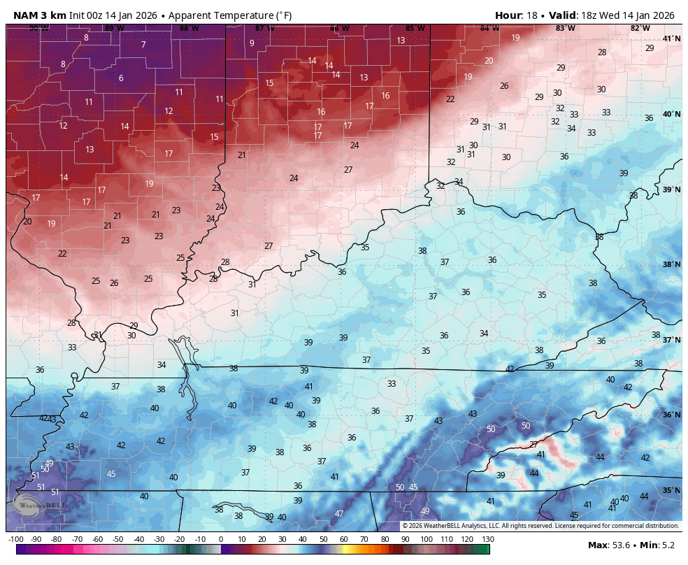
- With temps dropping into the 20s by this evening and into the teens Thursday morning, slick roads will become an issue.
- Some delays and cancellations are a good bet tomorrow.
- Wind chills reach the single digits Wednesday evening and stay there into Thursday morning.
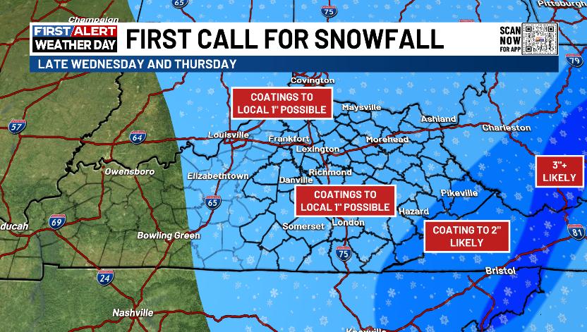
I’ve made no changes to the First Call for Snowfall but that area of up to 2″ may need to grow a little bit to the west…
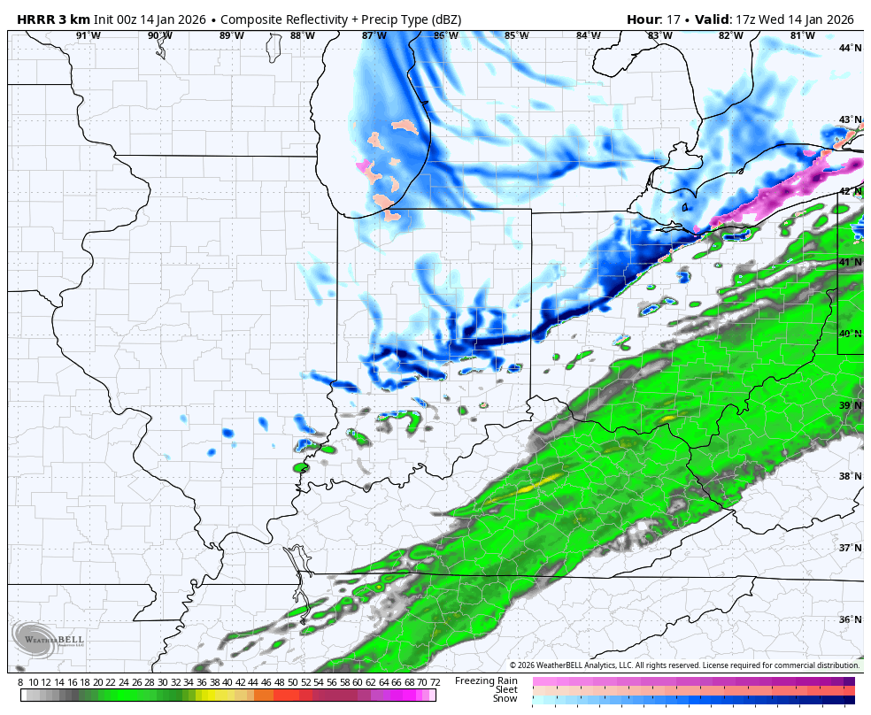
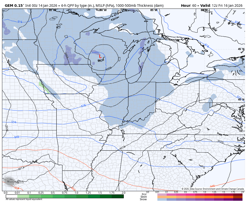
The future radar from the HRRR shows all of this well on the animation that starts at Noon today and goes through 7pm Thursday…
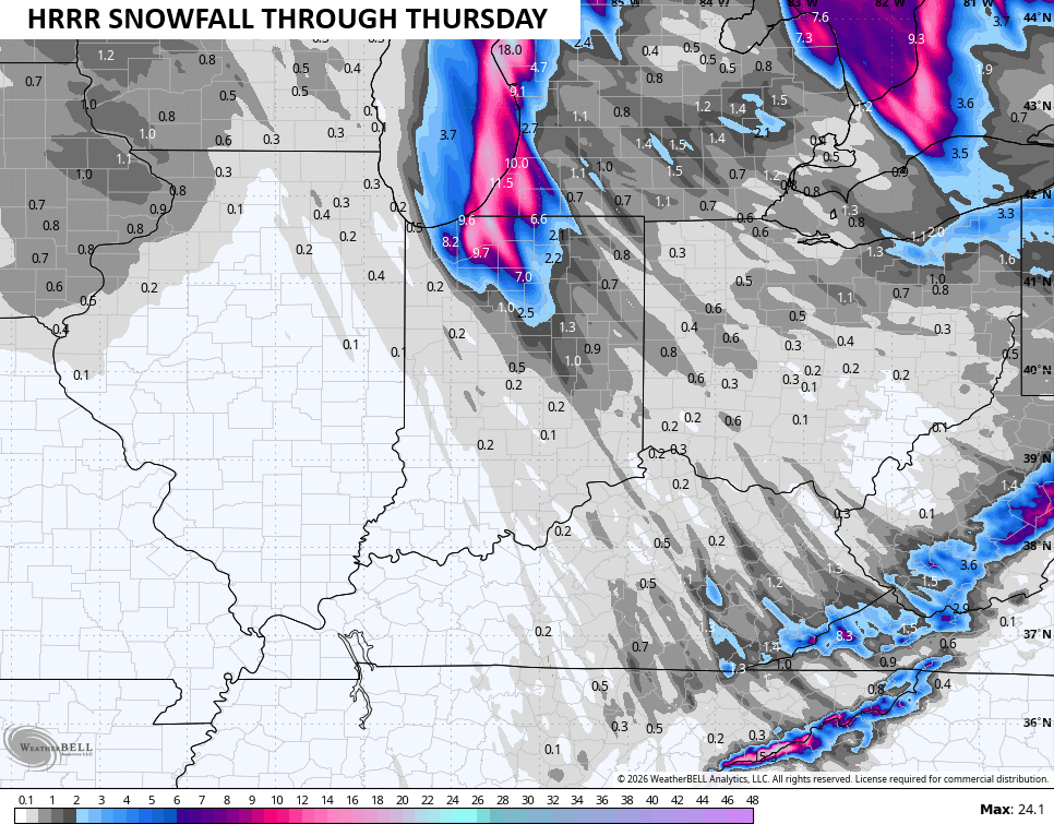
The snowfall map from that run of the HRRR shows the streaks of snow from those snow squalls…
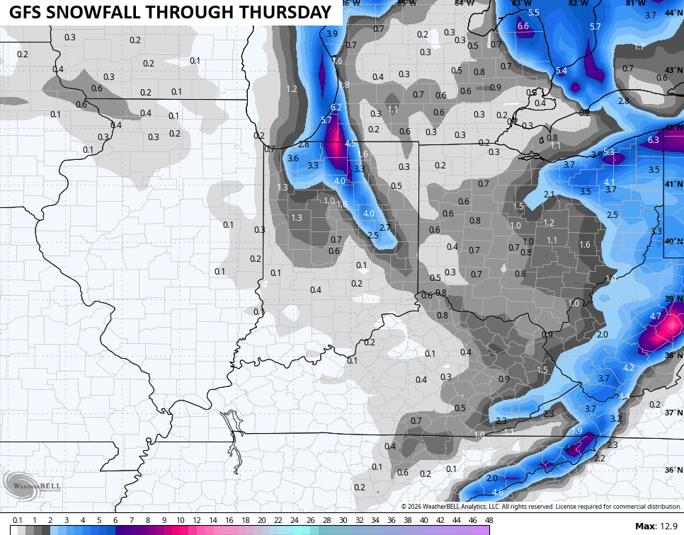
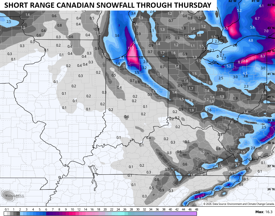
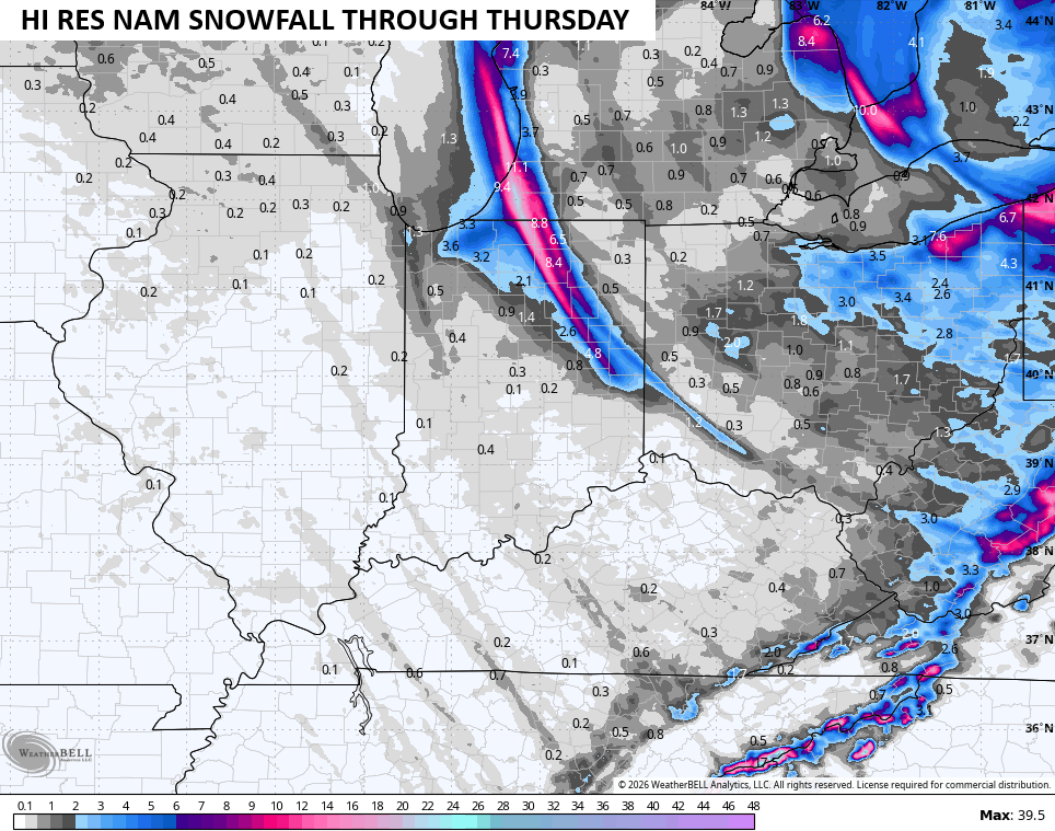
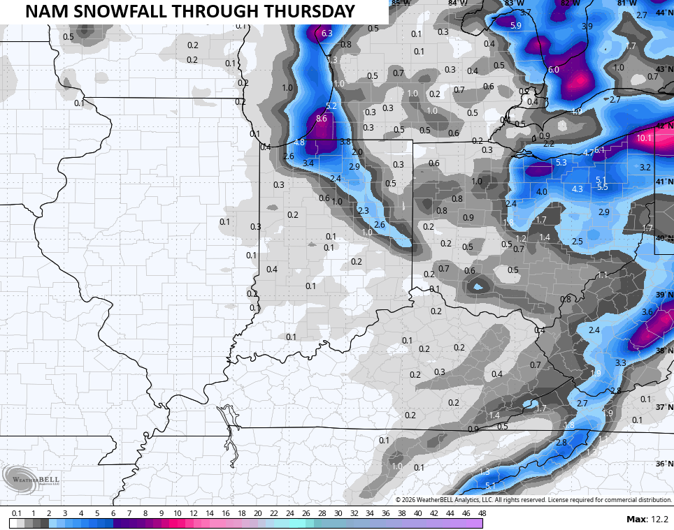
Other models are seeing a similar trend…
I hope we get some Winter Weather Advisories to go up. If they do, you will see them here…

Bitterly cold wind chills surge in here this evening and continue into Thursday. Wind chills drop deep into the single digits tonight and early Thursday…
The setup after this will feature a light snow system moving across parts of the region late Thursday night and Friday morning. Light accumulations will show up in some spots but that may melt away during the afternoon.
Another system sweeps across the region late Friday night and Saturday. This one has the best chance for a widespread light accumulating snowfall with a few more light systems trying to zip in in behind it into early next week.
The forecast models are pretty terrible with consistency and are drastically changing from run to run, especially the GFS and EURO. The Canadian is the steadiest of the bunch right now…
Another update or two comes your way later today. I’ll also have a few updates on my Meteorologist Chris Bailey Facebook Page
Until then, here are your tracking tools for the day…


Make it a wonderful Wednesday and take care.

Not really impressive.
Jeff, You Have A Better Chance Of Seeing A Decent Snow Than I Have Here In West Central Part Of The State. What We Been Having This Winter Is Just Traces Of Snow, Followed By Cold / Frigid Dry Air. La Nina Again !
Thanks Chris. If We Could Keep The Cold At The Surface Longer While The Moisture Is Present, Then The Whole State Would Have A Decent Snowstorm. The Reason Is, That When There’s Low Pressure In The Upper Levels Of The Atmosphere, And High Pressure At The Surface, The Later Doesn’t Happen. Just Described A La Nina Climate. The Opposite Would Be El Nino. Maybe That Will Happen Next Fall And Winter? Doubtful If ENSO / El Nino Will React With The Atmosphere Ever Again, As The PDO Continues Negative For A Record Number Of Years. Last Month’s Reading Of The PDO Was A Negative 1.01. Heading Towards ENSO / Neutral ?
December, 2025 Was The 5Th Warmest On Record In The U. S. A Negative Arctic Oscillation ( Presently Occurring ) Produces Cold – to – Frigid Weather Most Of Mid – Latitude Northern Hemisphere. Another description Of ENSO / La Nina. Some Scientist Are Starting To Agree, That La Nina Has Been Going On Too Long, And May Be Permanent For Decades ?
Schroeder..The PDO in December was 72 straight months being negative ..Impressive..I believe towards the end of January may be our best shot at a bigger snow..Looks like maybe a +PNA with a -AO..As always we’ll see..
I’m Hopping That The PDO Will Make It’s Move More Towards The Positive This January, Then We Will Have A Change, As High Pressure To Our South And East Will Weaken, And The Subtropical Jet Stream Will Be More Active. The Beginnings Of ENSO / El Nino. High Pressure In The Northern States, And Low Pressure In The Southern States. Afraid Of ENSO / Neutral, Because Severe Weather May Cause Tornado Outbreaks In Areas Of ” Dixie Alley. ”
The Various Teleconnections : The Arctic Oscillation Is Strongy Negative Now, And The Pacific North American Is Positive. The Eastern Pacific Oscillation Is Negative, Results In Arctic Outbreaks ( Possible Stratospheric Warming ) The North American Oscillation ( Precipitation Maker ) Is Also Presently Tanking.