Good afternoon, everyone. A cold rain is about to make the switch to some snow and then snow showers and squalls as temps crash this afternoon and evening. This is the first in a series of winter weather makers rolling through our region.
We do have a Winter Weather Advisory for far southeastern Kentucky through Thursday…

For our friends in southern West Virginia, I have no idea why you guys aren’t in that as well.
The area of the far southeast is the area I highlighted for up to 2″ of snow. The rest of central and eastern Kentucky falls under the coatings to local 1″ category and I still like that. Snow streaks show up and can overachieve in narrow corridors from northwest to southeast.
With temps dropping quickly through the 20s this evening, some slick spots will develop on area roads, especially bridges and overapsses.
Wind chills reach the single digits tonight into early Thursday.
Another light snow system zips across the state Thursday night and early Friday. This puts down some light accumulations that melt later in the day as temps rebound ahead of a more potent snow maker for the weekend.
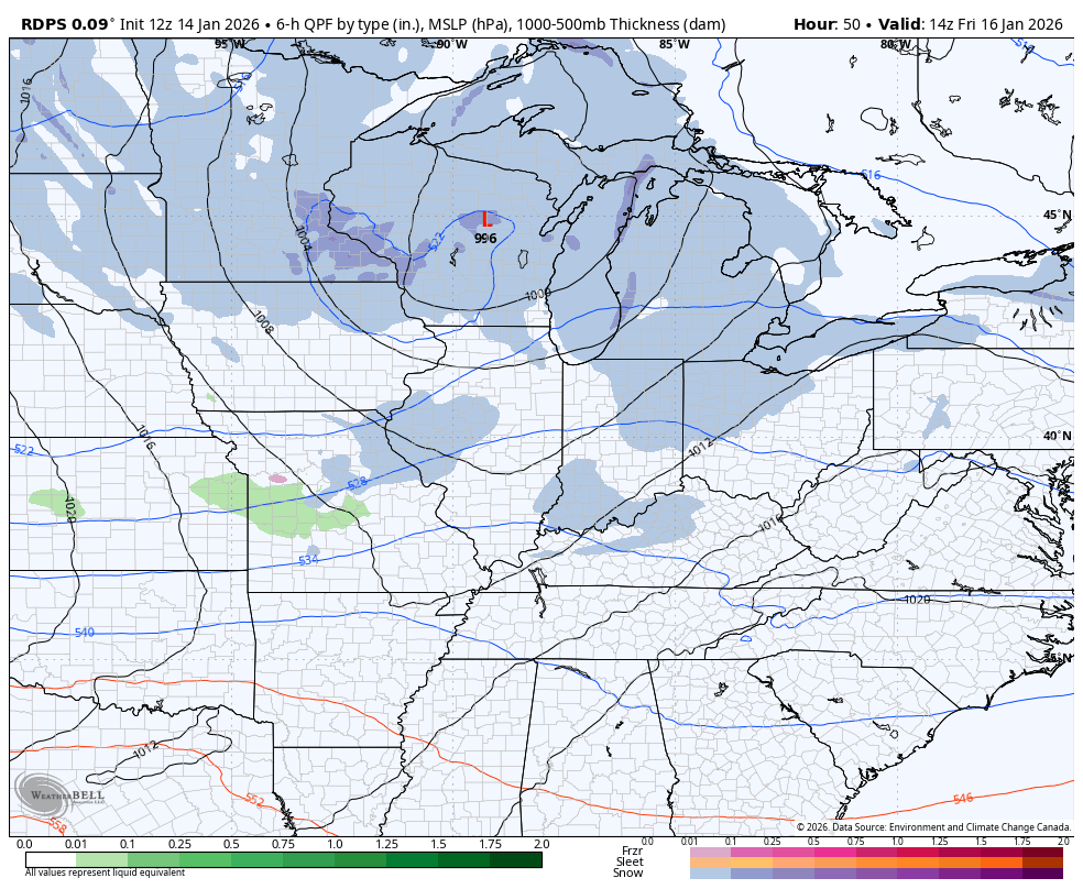
The trend is increasing for a light to moderate snowfall for much of the region from Friday night through Sunday. If you recall, this was something the models were originally showing a week ago before losing it. Well, they found it again as we get closer. Gee, that sounds familiar.
Here’s the Short Range Canadian that only goes through 7pm Saturday…
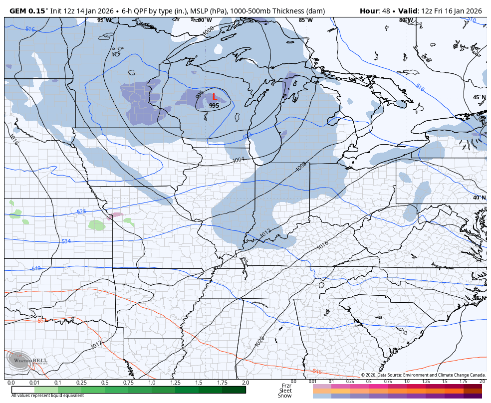
The regular Canadian takes us through the weekend into early next week with a weak system following that one up…
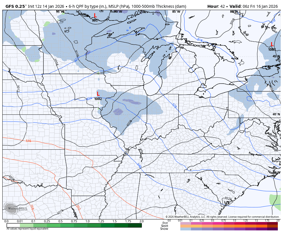
The GFS is also picking up on our Saturday system, but it’s taking that late Sunday/Monday system all the way to the southeastern seaboard with a snowstorm from FLORIDA to New York…
Bitterly cold temps and wind chills will be noted around here from late this weekend into early next week.
I’ll have the latest on WKYT-TV starting at 4pm and another update comes your way here on KWC later today.. I’ll also have a few updates on my Meteorologist Chris Bailey Facebook Page
Until then, here are your tracking tools for the day…


Make it a wonderful Wednesday and take care.

If You Look At The Radar, And See The Wide Separation Between Rain And Snow. That’s A Typical La Nina Pattern. Heavy Snow / Showers In Elevated Areas In The Southeast Kentucky Prompted The Winter Weather Advisory. Don’t Know Why West Virginia Hasn’t Issued The Same ? Lots Of Energy In This Clipper System. We May Have A Good Dusting Of Snow Here In West Central Kentucky ?
The less snow, the better.
Currently it’s 44.6°F at my PWS near Bowling Green, and 0.15 inches of rain has fallen since Midnight.
Akismet it up to its tricks again, not allowing me to post more than a sentence or two for several months. I’ve had it. This will be my last post.
That Happens To Me To Joe. I Just Keep Loging In, And That Seems To Solve The Problem. Please Don’t Quit Posting, As I Enjoy Reading All Your Post.
Come to WKY to escape the snow….we’re in a snow drought.
Russell, Our Part Of Kentucky Doesn’t Recieve La Nina’s Snows. It’s El Nino That Gives Us The Best Chances.
Strong – AO, Sneaky Cold And Snowy Surprises Possible January 17 – 19. Maybe A Nor’ Easter To Track ?