Good Thursday, everyone. Slick roads are a serious issue early today in much of central and eastern Kentucky after snow squalls did some work. Now we turn our attention toward two snow makers on the way later Tonight through Saturday. The one Friday night and Saturday is looking better and better.
Please use caution out there this morning if you’re traveling as many roads have a layer of snow and ice on them. These small events continue to be a big problem in our region and it’s time we start getting headlines of these. The NWS has got to find a way to get the attention of people for these kinds of small but high impact events.
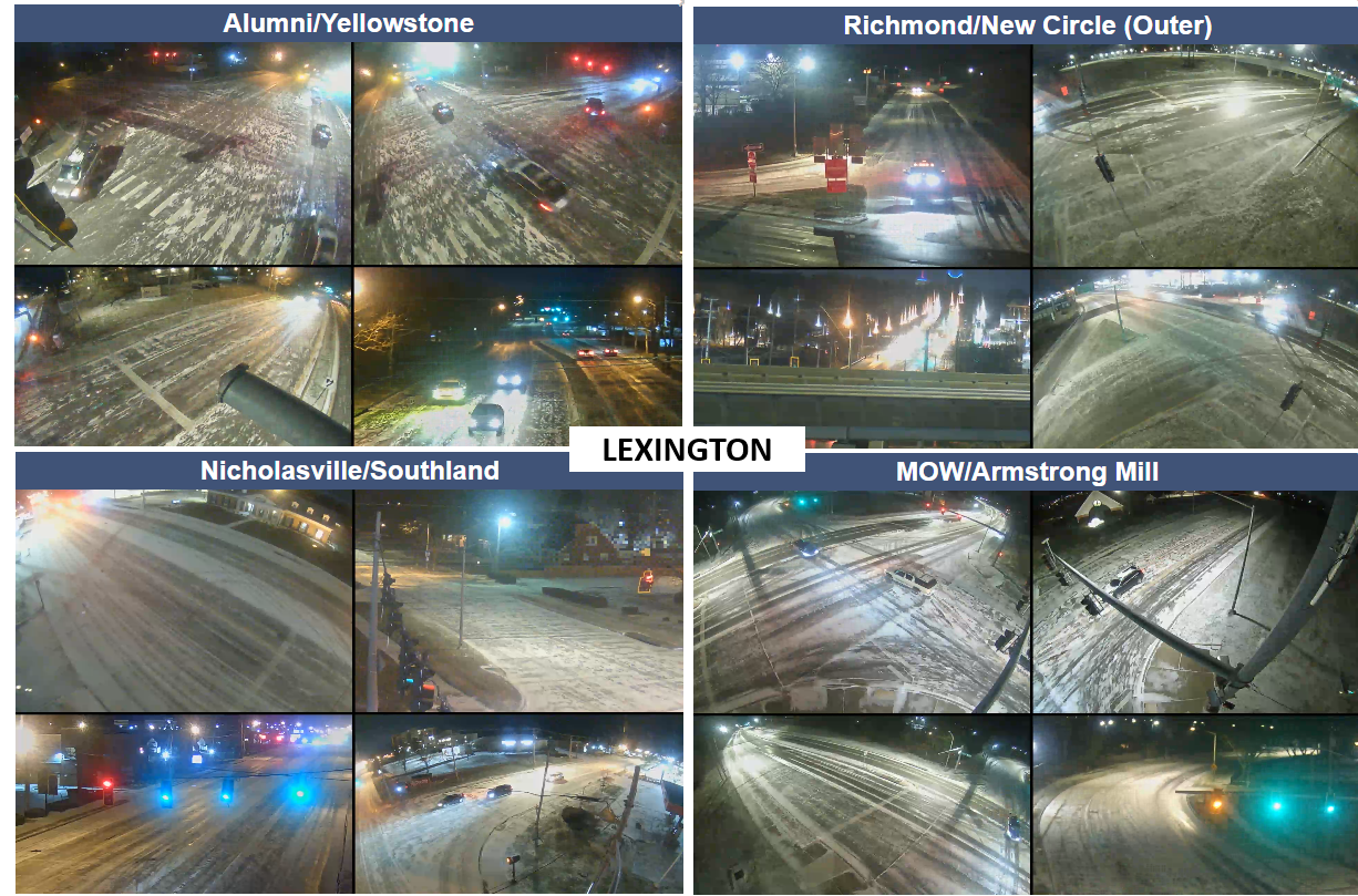
Here’s a sampling of what roads in Lexington looked like before midnight last night…
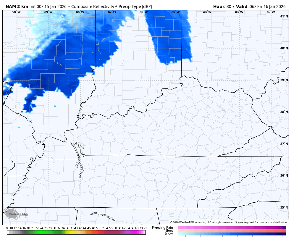
Now we turn our attention to a quick-hitting band of light snow moving in overnight and early Friday. This band of snow will diminish the farther east that it gets, but can put down light accumulations for some.
Here’s the Future Radar from the Hi Res NAM Thursday night through 1pm Friday…
This brings us to the increasing threat for a true snowfall for much of the region Friday night and Saturday. We have a cold front working into the state with a wave of low pressure developing along it across the Tennessee Valley. Where this low pops and how strong it gets will be the determining factor on who gets what and how much.
Once that passes by, an arctic front comes in behind it with a round of snow showers late Saturday and early Sunday.
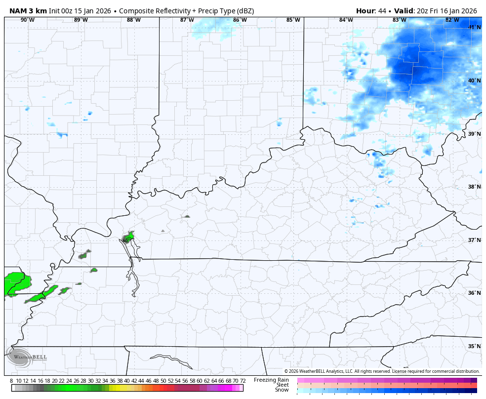
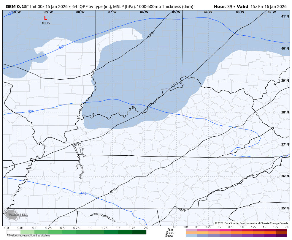
The NAM fam has been picking up on this potential better as we get closer. The Hi Res NAM only goes through 7am Saturday but has a nice band of snow…
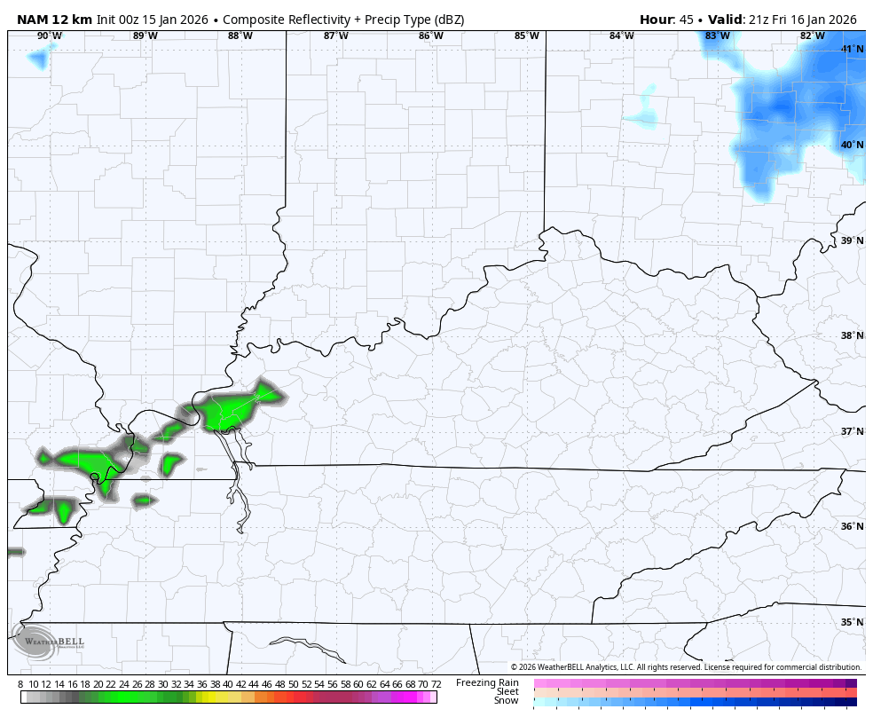
The NAM goes all the way through Saturday evening and has an even healthier band of snow with the light stuff following it up
The Canadian has been the model showing this all along and it continues to do so, but it has it more in waves of snow on this animation that start Friday afternoon and goes all the way through Sunday night…
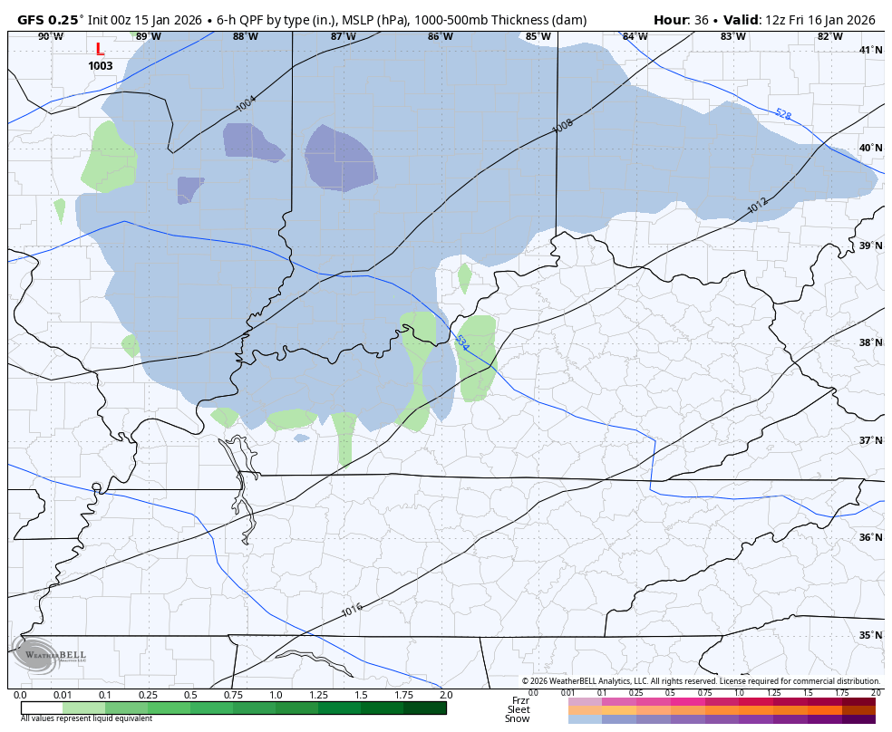
The GFS is also picking up on this setup much better than before…
The EURO is trying to figure all this out…

An impactful snow event is a good bet for much of the region, and I’ll be highlighting that with a map later today with a First Call for Snowfall to follow.
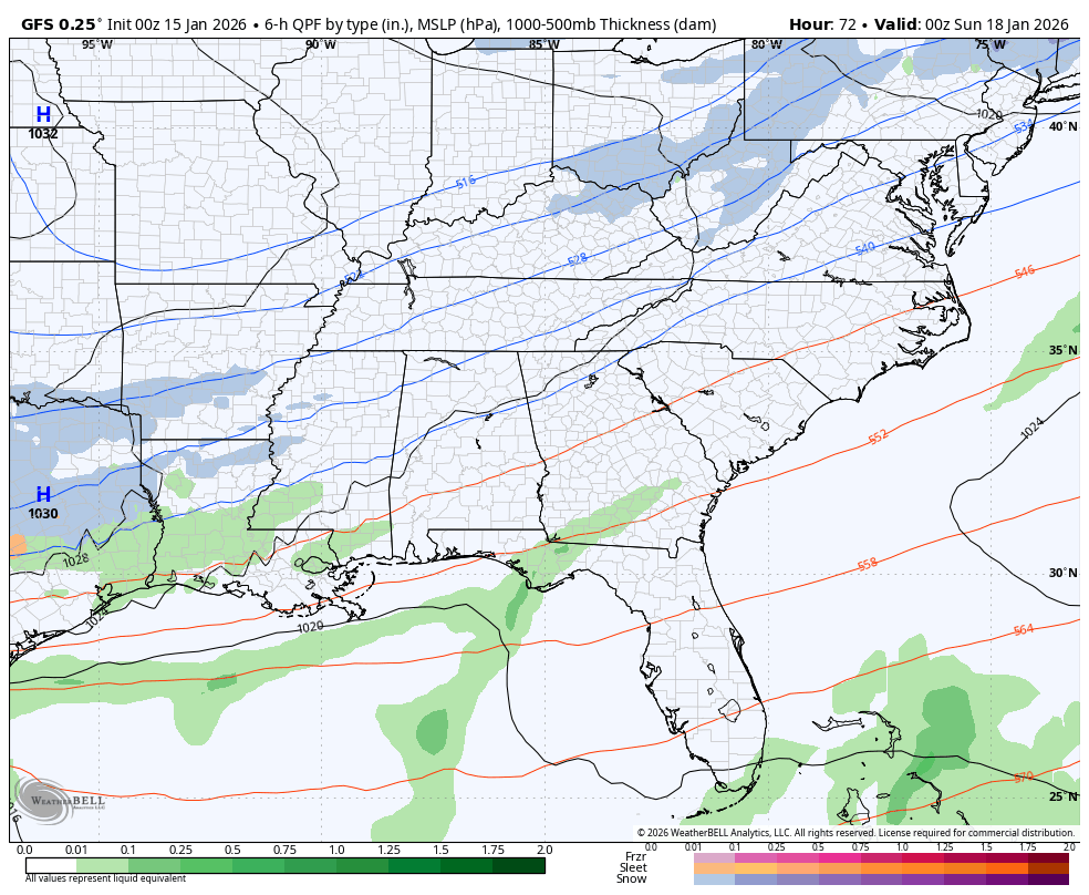
Bitterly cold air dives in late weekend into early next week and has a chance to produce a southeastern US snowstorm. The GFS has had this for a while and continues to show snow from the Gulf Coast through the Mid-Atlantic States. The latest run is a bit west and brushes the far southeastern corner of Kentucky…
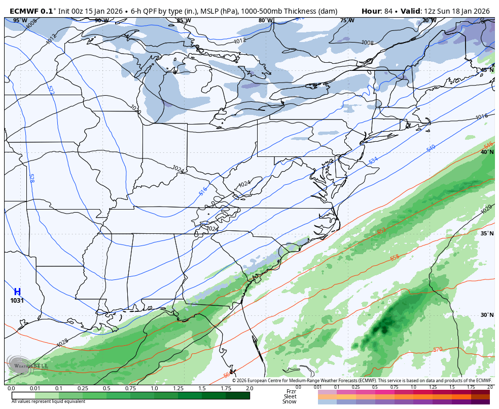
The EURO is weaker and farther southeast with this as it crushes it with arctic air…
The Canadian doesn’t really have much of a system, so let’s see how all this plays out over the next few days.
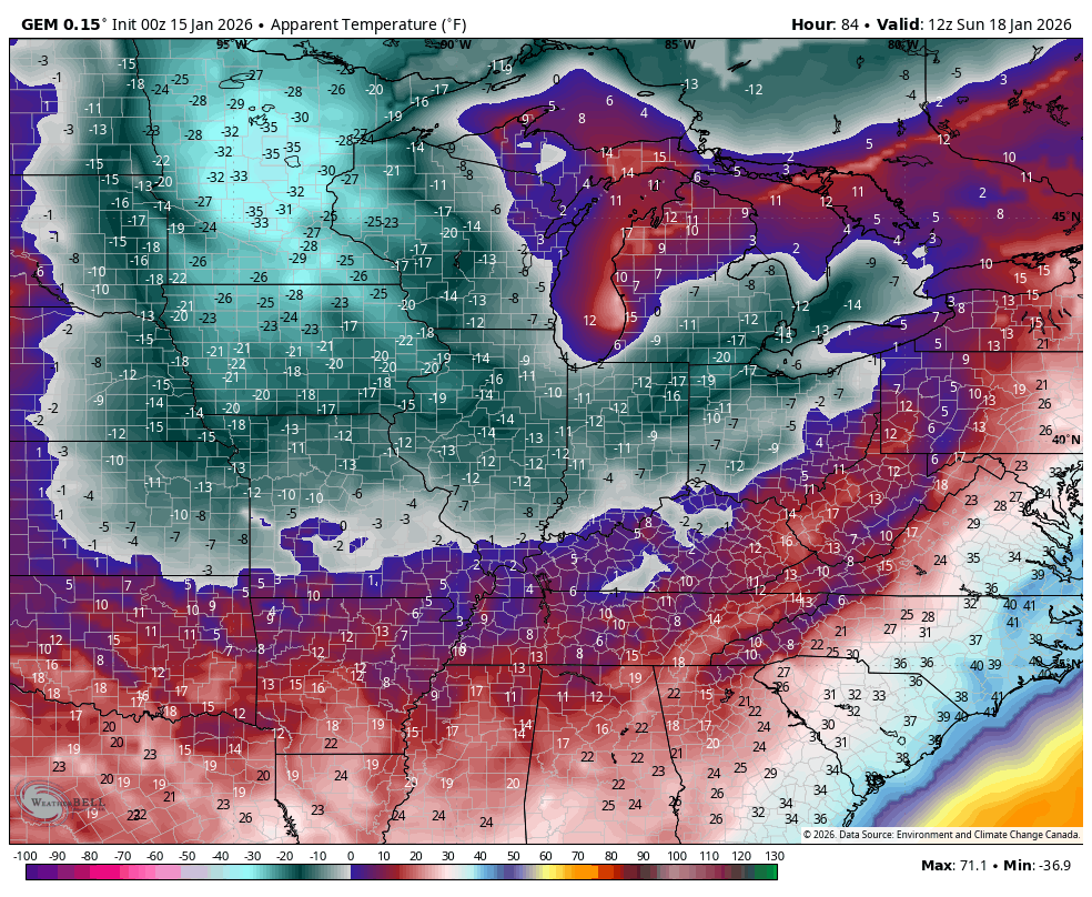
With the arctic air coming in Sunday through early next week, wind chills may drop below zero at times. The Canadian is brutal with the wind chills…
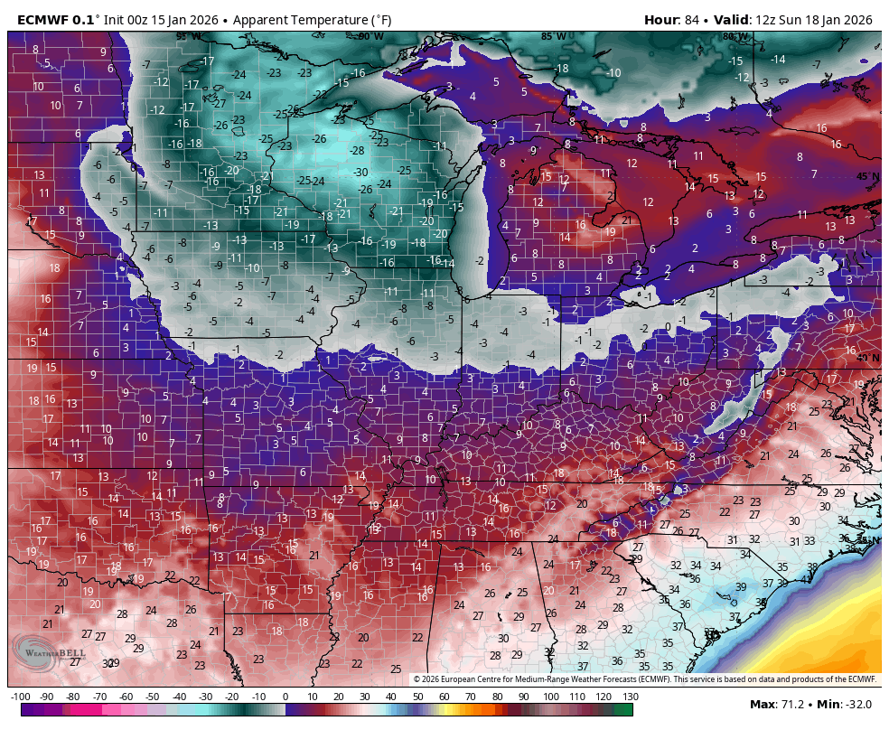
The EURO isn’t quite to those levels, but it’s not far…
Updates later today. I’ll also have a few updates on my Meteorologist Chris Bailey Facebook Page
Until then, here are your tracking tools for the day…


Make it a great Thursday and take care.

Less snow, the better
Thanks Chris. The High Pressure That’s Been Dominating Our Weather Pattern Here In West Central Kentucky Seems To Be Weakening. This Is A Change, Allowing The Subtropical Jet Stream To Activate. I Attribute This Change To The PDO Going Towards The Positive. The January Reading Of The PDO Will Be Interesting To See If I’m Correct.