Good evening, everyone. It’s full steam ahead toward a wintry weekend in the Commonwealth as two snow systems target the region. Neither of these are major but can cause some travel issues ahead of another surge of arctic cold.
The very light system moving into parts of north central Kentucky later tonight and early Friday can put down some hit and run coatings or light accumulations. Overall, I’m not too jazzed up about this system, but it may impact the morning commute in a few spots.
The NWS has a Winter Weather Advisory for this initial system along and north of Interstate 64 from the Lexington area west to the Louisville area…

The next system comes in behind that late Friday into early Saturday with periods of light snow and snow showers behind it later Saturday into Saturday night. Here’s my First Call for Snowfall for all this…
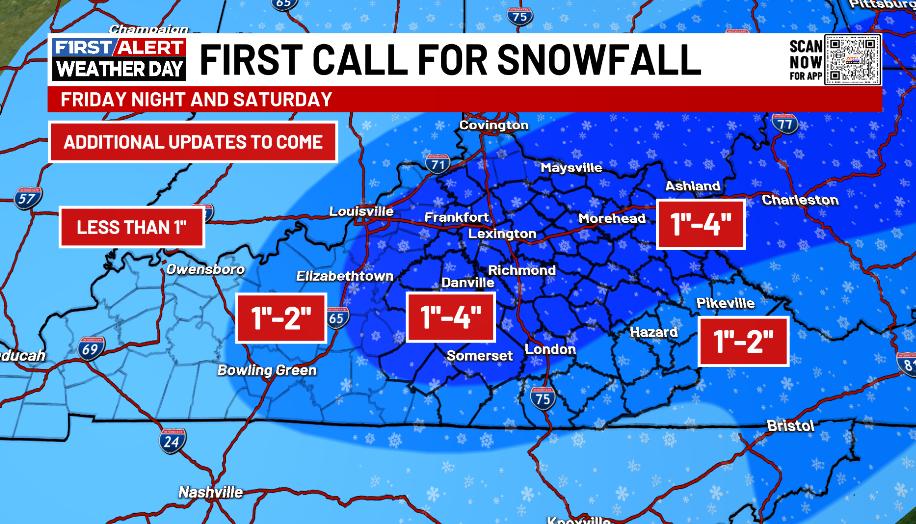
As I mentioned in prior posts, this may start as a little rain for some which would impact just how much snow falls in any one location with the best chance being in the south and southeast.
The latest from the NAM fam is noticeably colder with a much better snow signal…
NAM
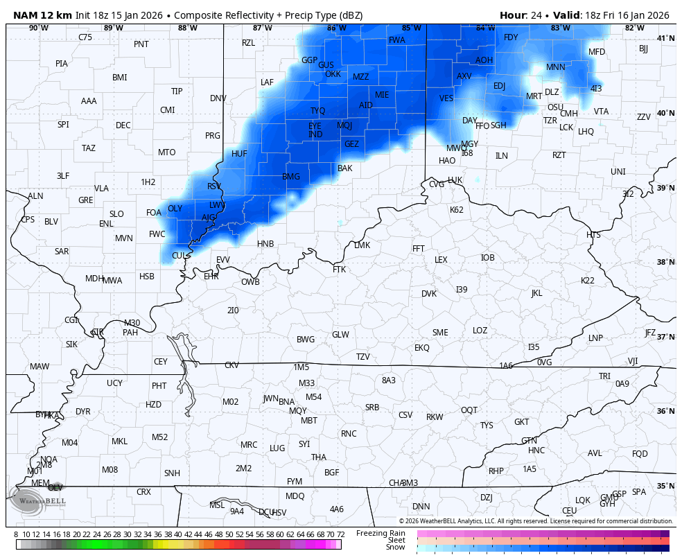
High Res NAM…

The GFS is similar…
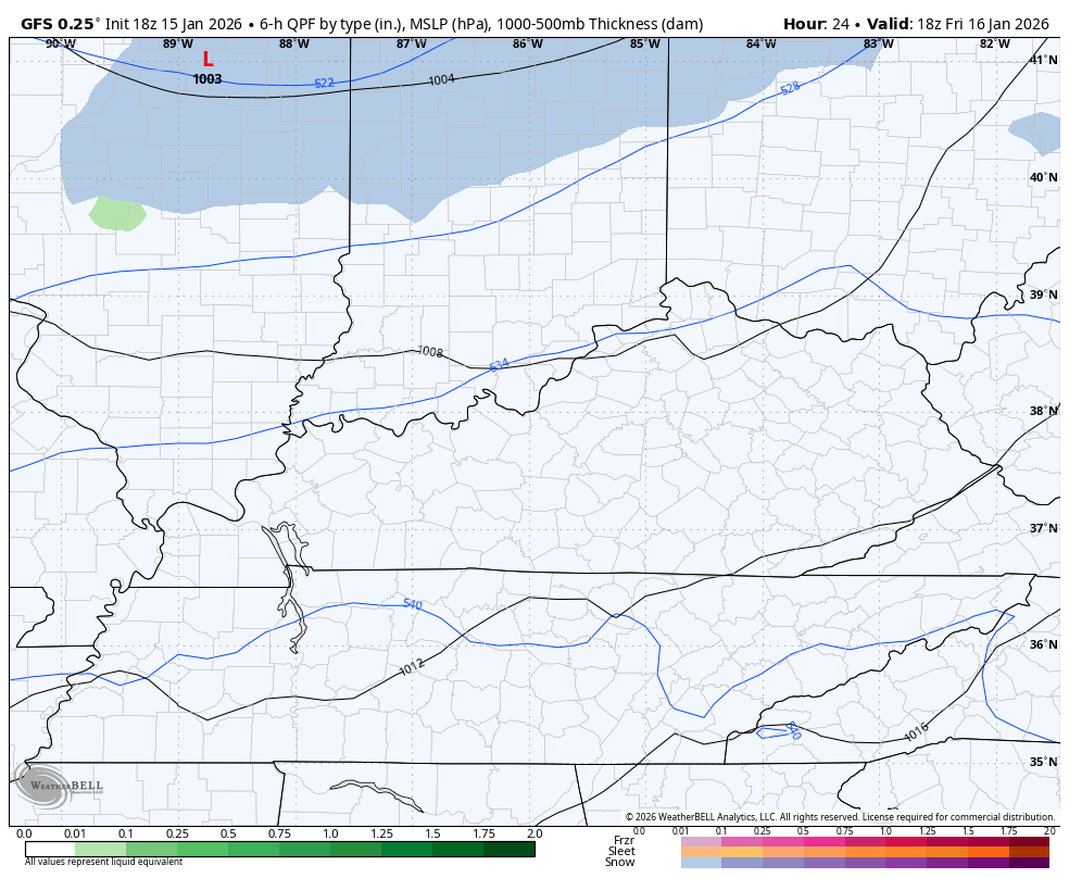
It’s interesting to see how the American Models trended straight to what the Canadian models have been saying for a while now.
The full update comes your way later tonight and I’ll have the latest on WKYT-TV at 10 on the CW Lexington and at 11 on WKYT. I’ll also have a few updates on my Meteorologist Chris Bailey Facebook Page
Until then, here are your tracking tools for the day…


Make it a great rest of your evening and take care.
