Good Friday, everyone. A little light snow is impacting parts of Kentucky this morning with a bigger system moving in by the evening. That one drops a widespread light snowfall ahead of another surge of arctic temps as winter starts to go into the tank.
Let’s break down this pattern from today through the MLK holiday weekend:
TODAY
- Light snow is out there across parts of north central Kentucky to start the day.
- This is pretty light, but it may have just enough to cause a few travel issues early on.
- Temps will be problematic today with a pretty big swing from north to south.
- A cold front approaches from the west this afternoon with a wave of low pressure developing on it.
- This will fire up snow, rain and a mix in the central and west before the afternoon is over.
TONIGHT
- That wave of low pressure zips by to our east.
- A southwest to northeast oriented swath of precipitation intensifies.
- Much of this early mix changes to snow with a decent band setting up in central and eastern Kentucky.
- Where does this set up? That’s the question of the day but it can throw down a few inches of snow by morning.
- The farther south and southeast you live, the rain/snow mix may cut down on your snowfall potential.
- Temps hang out in the upper 20s and low 30s much of the night, meaning slick roads are a good bet.
- Wind is also a big player with this system. Gusts of 30mph to 40mph will be possible through tonight.
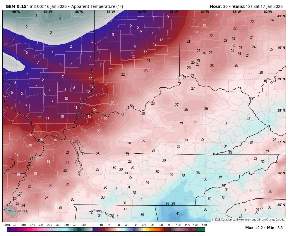
SATURDAY
- The early morning band of snow moves away very quickly.
- Periods of light snow and flurries take us through the rest of the day.
- Watch for some snow showers and even a few snow squalls to kick in.
- Additional light accumulations will be possible.
- Winds gust up as an arctic front approaches during the evening.
- That spits out some more snow showers and flurries into Saturday night.
- Wind chills drop quickly into the single digits Saturday night.
SUNDAY
- A few flurries of light snow showers will be possible.
- Arctic cold is the big story with highs generally 20-25
- Wind chills will be in the single digits much of the day.
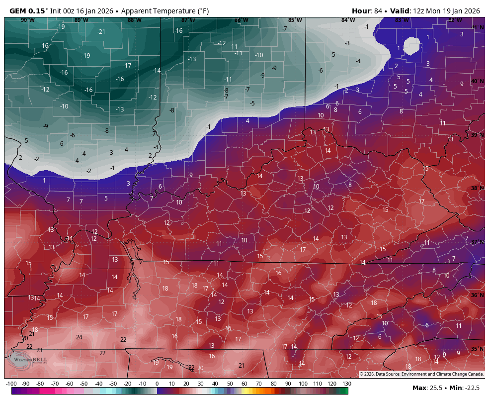
MLK DAY
- It’s a windy and very cold day.
- Highs range from the upper teens to middle 20s.
- Wind chills will be much lower and may flirt with zero at night.
- Mainly dry skies will be noted with just the chance for a few flakes showing up.
Winter Weather Advisories should be pretty widespread today…

The New Call For Snowfall opens up the area of 1″-4″ of snow…
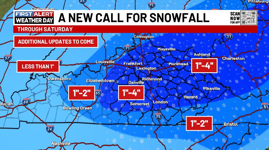
I’ll be fine tuning that through the day as we see exactly where that heavier snow band sets up.
Temperatures all Thursday night into this morning are well below what all models were forecasting and that’s likely to come into play today. It appears the American Models are closer to the temp reality as of this writing and that’s likely why they are showing more snow.
Here’s the future radar from the NAM starting this afternoon through Saturday night…
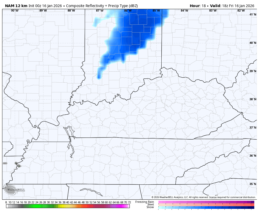
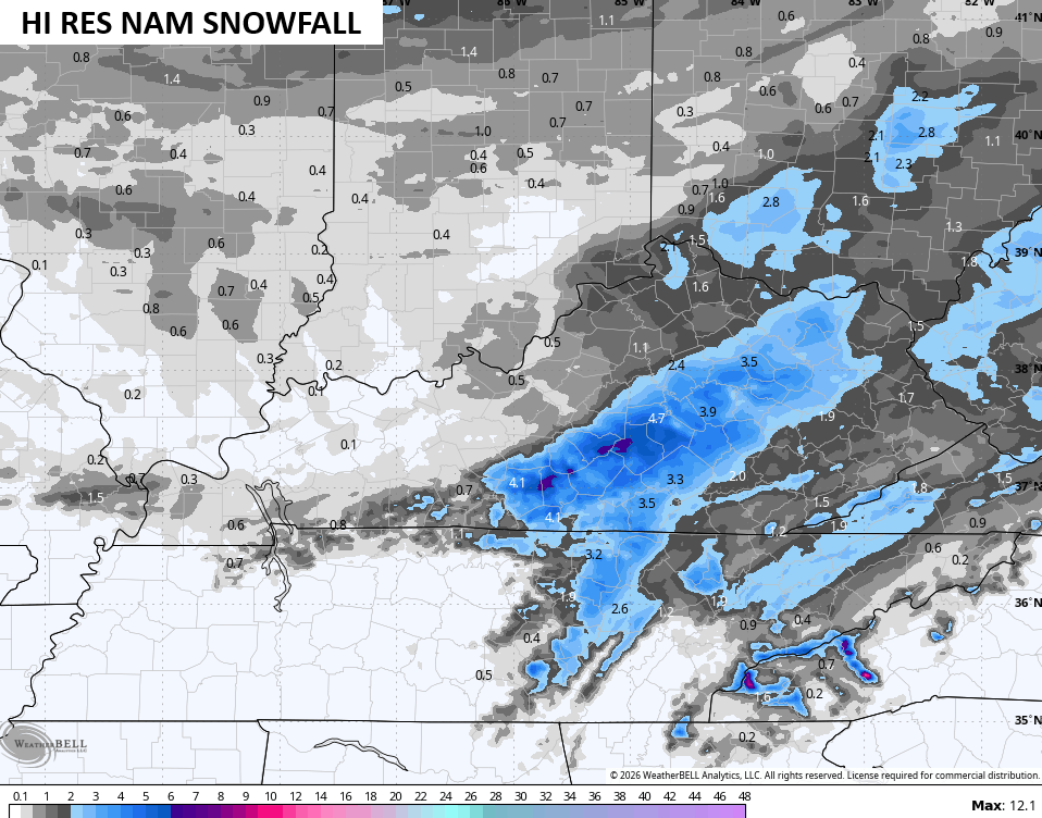
That’s a healthy band of snow with something similar showing up on the Hi Res NAM…
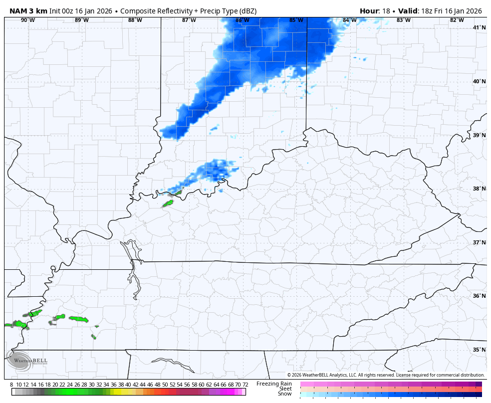
Check out those snow bursts and squalls zipping through the state Saturday evening and night!
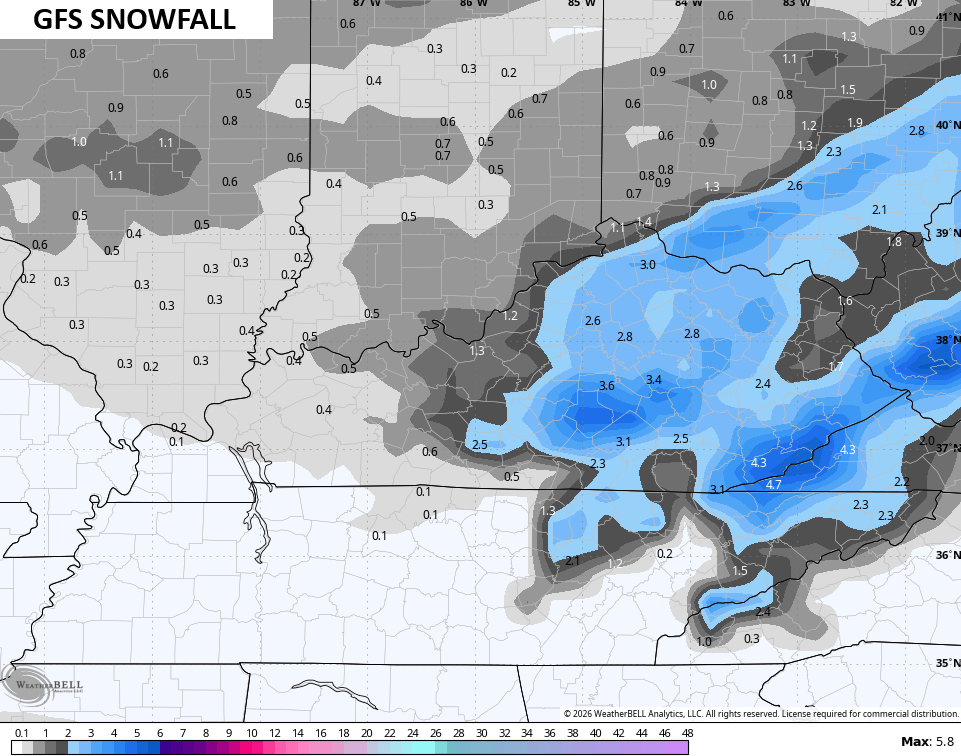
The GFS looks a lot like the NAM fam…
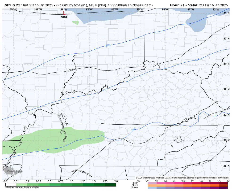
In terms of what the models are thinking for snowfall as of this writing, the GFS is a pretty solid hit…
The HI Res NAM has a more concentrated band…
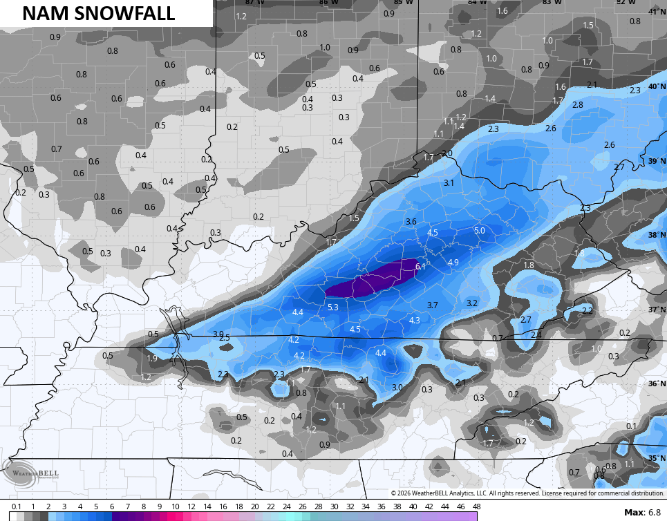
The NAM also suggests we push above warning criteria snows for some areas…
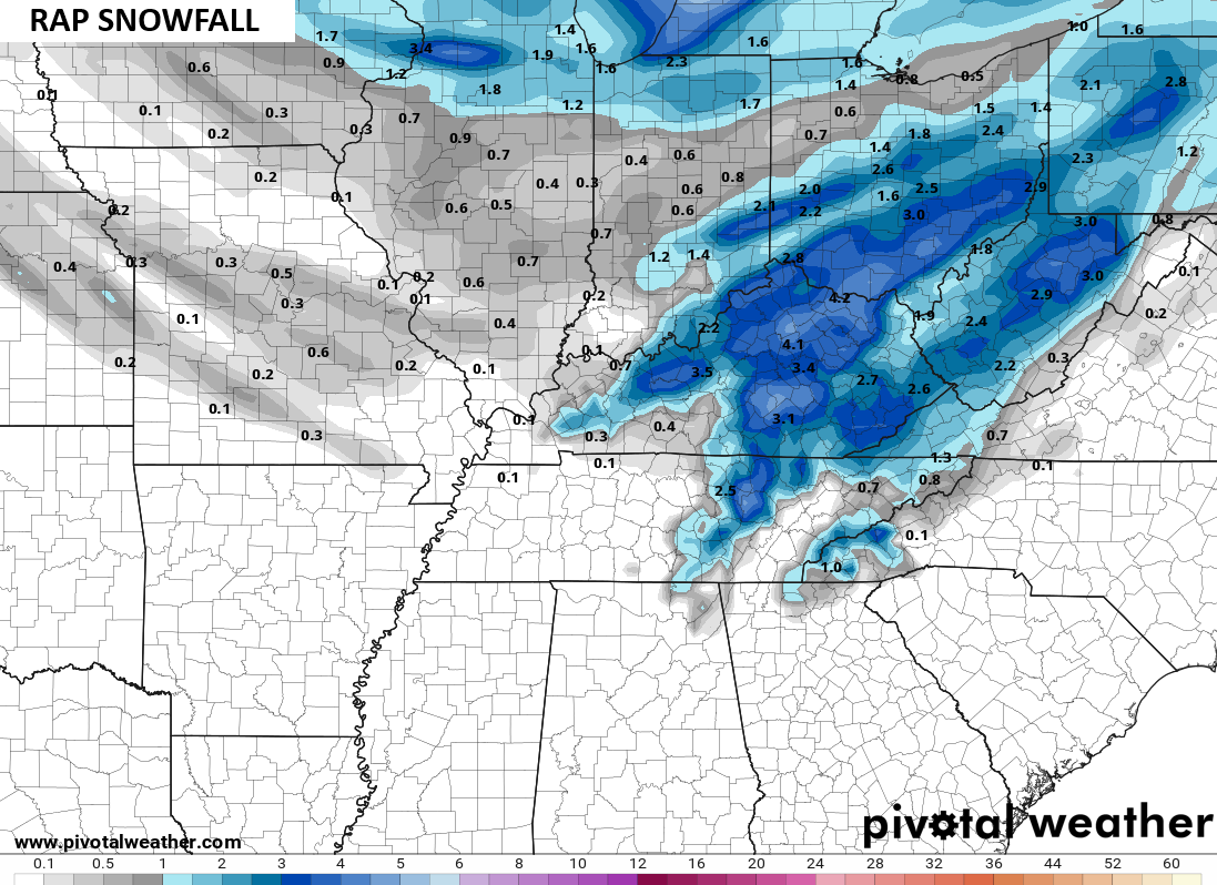
The RAP usually does pretty well with these setups from this time range and is also going into warning criteria…
I’m not ready to bite on those just yet because the Canadian Models aren’t quite as snowy. They see the rain lingering a little deeper across the south and southeast, cutting down totals…
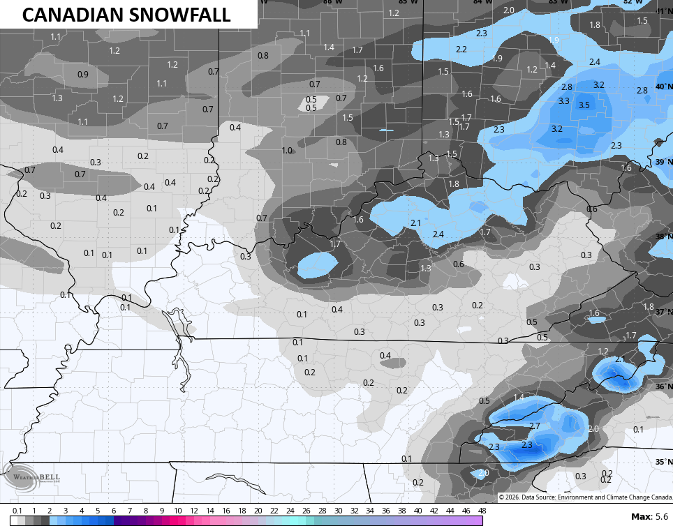
The EURO has been struggling mightily just to find this system, but its starting to see it. If you’re a snow lover, you don’t want the EURO to turn out to be the winner of this…
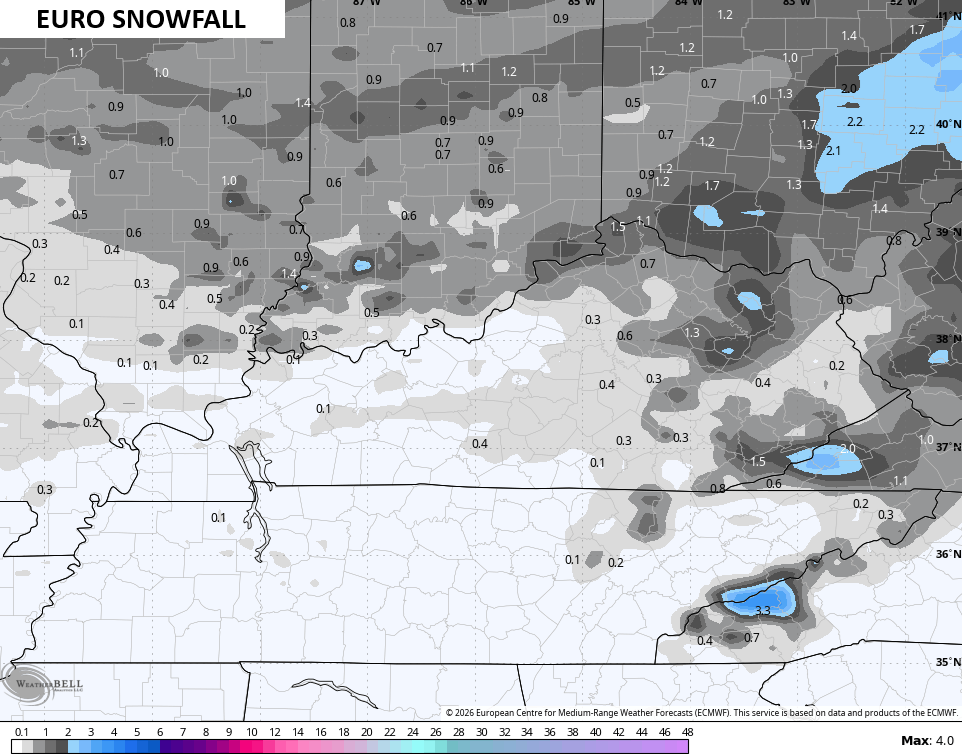
Now you can see why I haven’t gone fully toward what the American Models are suggesting, though my thinking is more in line with the ideas they have.
Wind chills and temps tank Saturday into early Sunday with wind chills going toward 0 to 5 in many areas by Sunday morning. This animation goes from 7am Saturday to 7am Sunday…
As even colder air sweeps in on MLK Day, those winds chills try to head toward negative numbers and really tank into Tuesday morning…
Several more systems drop in from the northwest for the middle and end of next week, so don’t be surprised if we aren’t talking about another system or two trying to turn into something bigger, like what we are seeing with this one.
The pattern is also loaded with bitterly cold shots through the rest of the month with February looking colder and snowier than I had in the winter forecast back in November.
Updates later today. I’ll also have a few updates on my Meteorologist Chris Bailey Facebook Page
Until then, here are your tracking tools for the day…


Make it a great Friday and take care.

Thanks Chris. I Agree, The Various Models Are Still Confused Over What May Happen In The Next 48 Hours. I Am Too. Yesterday, I Found Signals That A Major Change Is In The Making, But Now I Question That Scenario. We Will Just Have To Wait And See. Doesn’t Pay To Jump Ahead Too Quickly. I Was Hoping That A ” Winter Storm Watch ” Would Have Been Issued For late This Afternoon ( State Wide ) For Periods Of Heavy Snow. As We Advance Towards February, Maybe That Will Happen ?
Again looks like the snow drought will continue here in western ky.
Here In Maple, We Had About 2 ” So Far This Winter. Not Only A Snow Drought, But A Rain Drought.