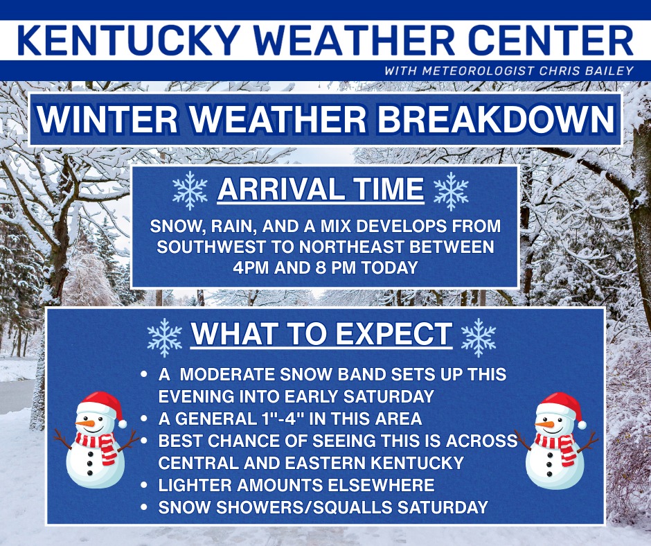
Good afternoon, everyone. Snow, rain and a wintry mix are about to develop and roll across the state with the greatest winter hit across the central and east. This is ahead of bitterly cold wind chills arriving late this weekend with more of the same heading into next week.
Today is a busy day for yours truly so let’s get right into it with a scaled down version of your headlines…
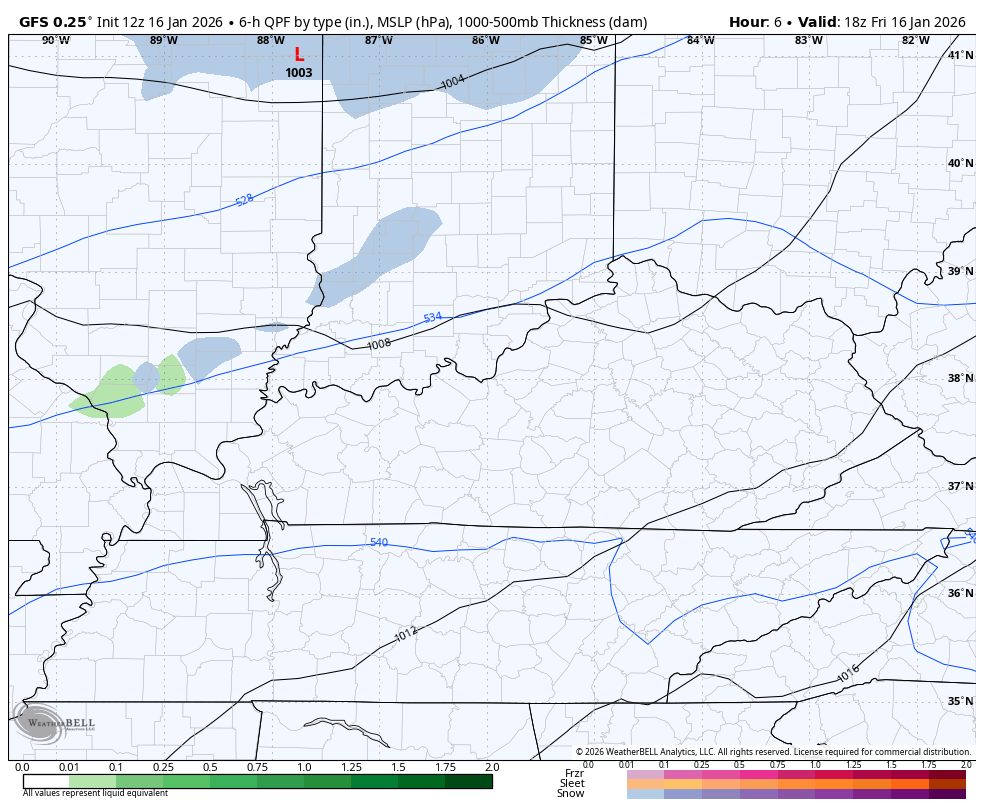
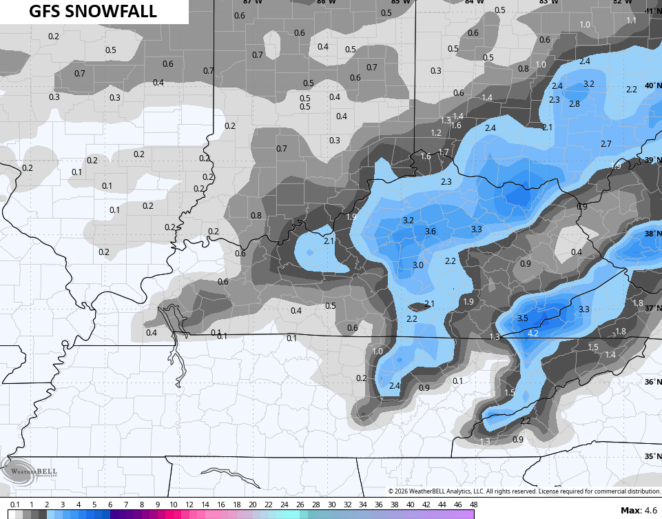
The GFS is probably closest to my thoughts right now and that’s a little spooky cause y’all know how much I love the GFS (insert eye roll here).
It shows our mix developing from southwest then going to that period of snow with areas of light snow, snow showers and snow squalls behind it into Saturday…
Notice how it holds a pocket of rain across an area of eastern and southeastern Kentucky. That’s something I’ve seen many times before and something for those areas to be on guard for as that would cut the totals. That’s exactly what the GFS is showing…
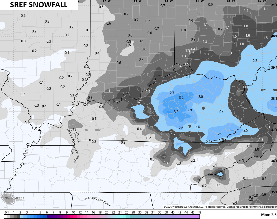
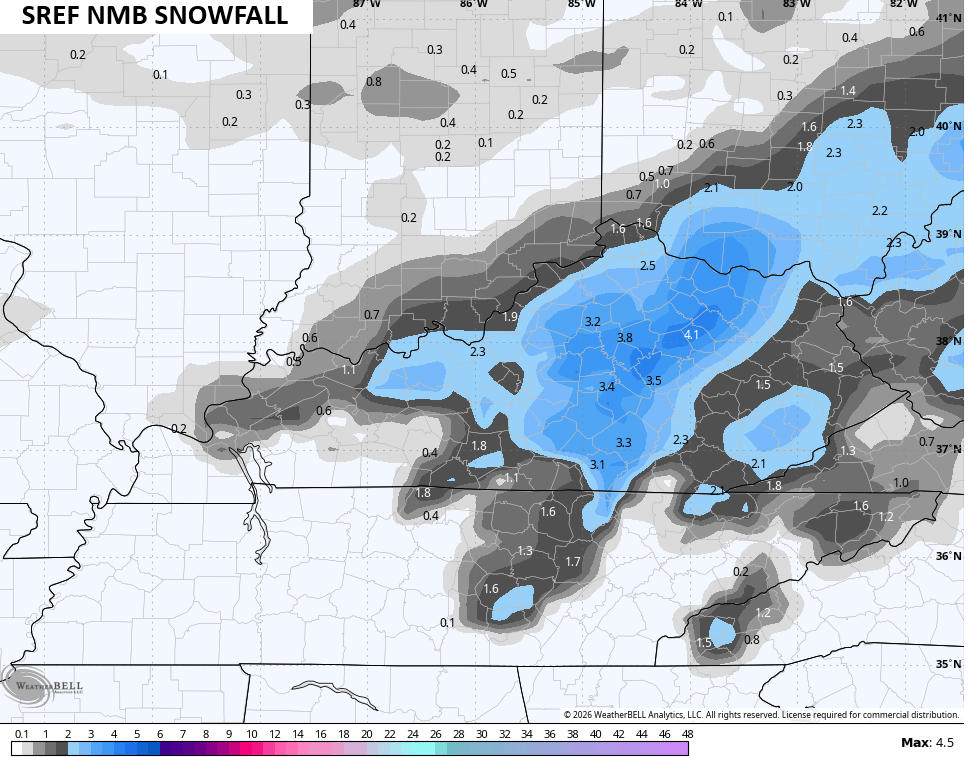
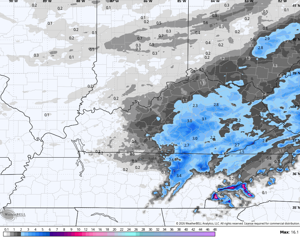
The average of the SREF is showing something like that too…
So is one of the single runs of the SREF…
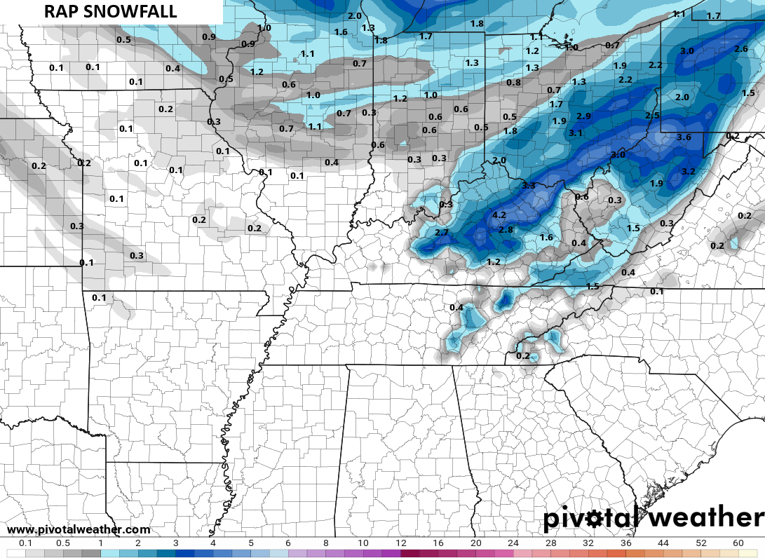
As is the RAP…
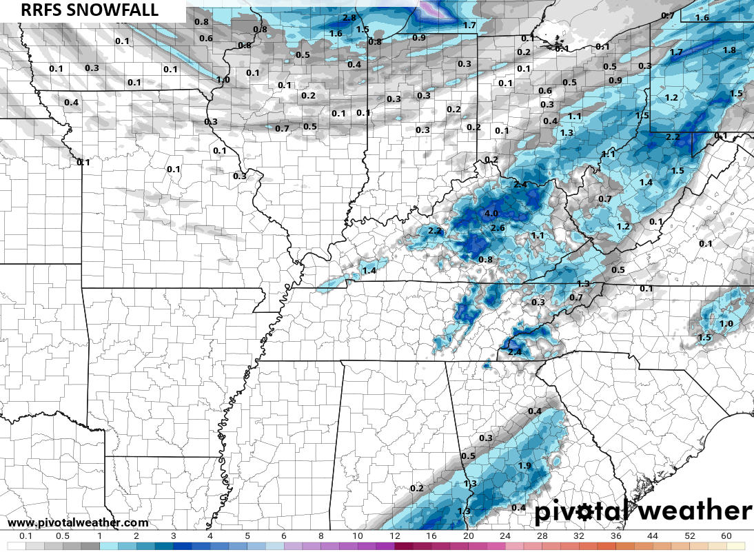
and the RRFS…
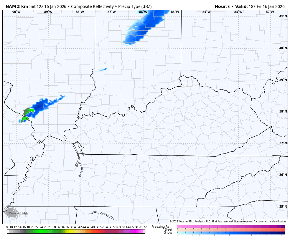
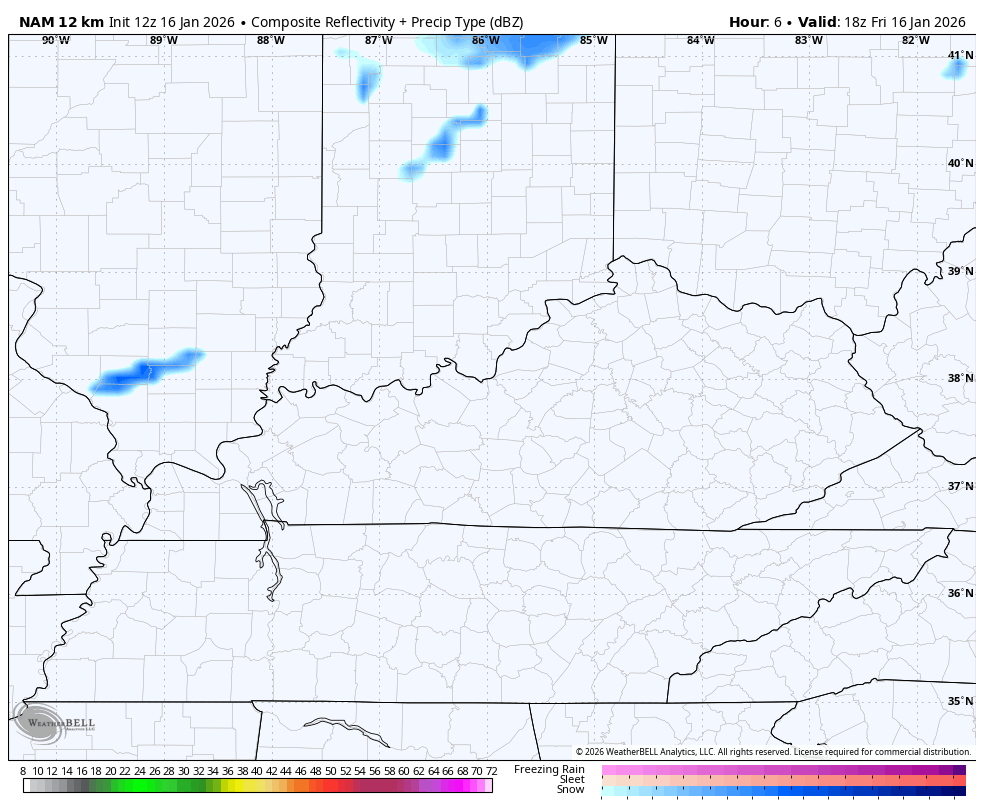
The NAM Fam is a bit farther south and east with the whole setup. Here’s the future radar from the Hi Res NAM…
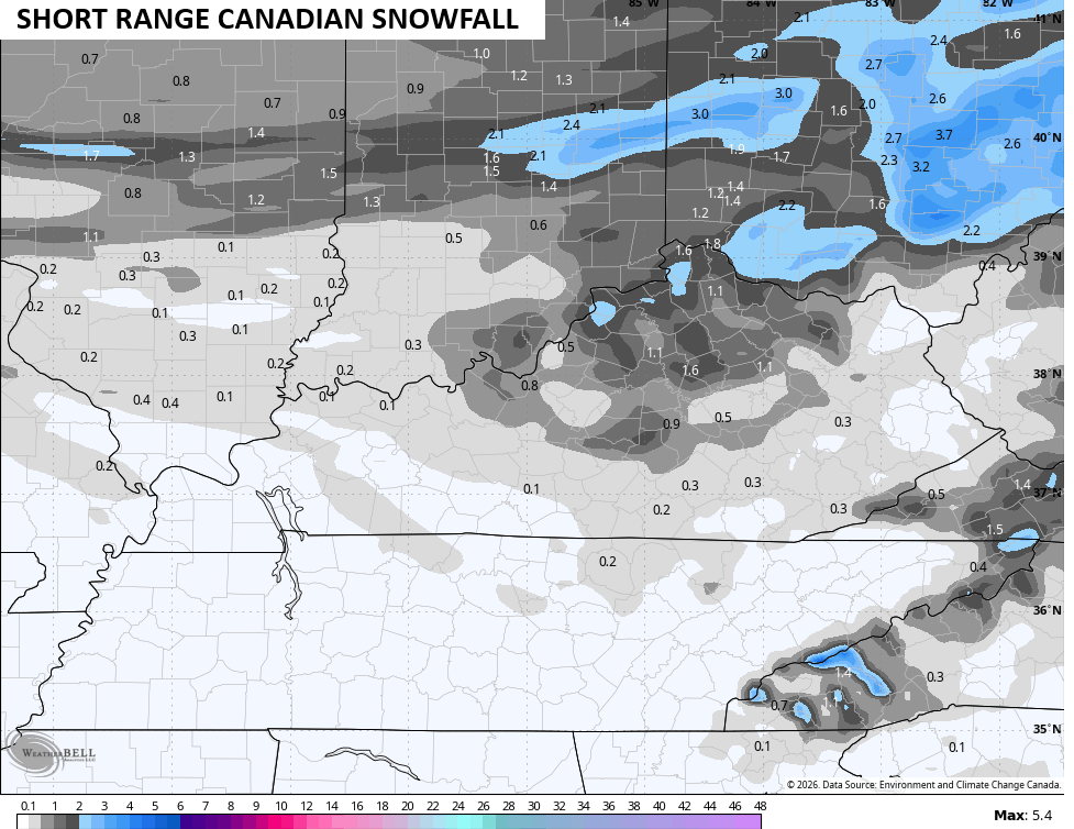
The snowfall map from that run…
The future radar from the NAM…
And the snow map from that run…

I think those are too far southeast, but even they see the chance for that warm air pocket in the east and southeast.
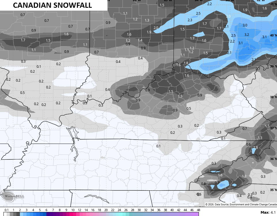
The Canadian Models have been the model of the winter, so far. If they are still the models of the winter, they’re seeing lighter amounts with the greatest concentration in the north…
So even the lightest forecast has a few inches, yet as of this writing, the NWS offices in our region have not issued a single Winter Weather Advisory. This coming after not having one during the snow squalls that shut down roads Wednesday night, but having one for an event that was never worthy of a headline early this morning.
I’m working on a New Call For Snowfall and will have it on WKYT-TV starting at 4pm and I’ll update that here this evening, as well. I’ll also have a few updates on my Meteorologist Chris Bailey Facebook Page
Until then, here are your tracking tools for the day…


Make it a great Friday and take care.

Snow Lovers In Kentucky Aren’t Going To Like The GFS Snow Accumulation Forecast : )
https://www.weatherstreet.com/models/gfs-acc-snow-forecast.php
The Above Changes With Every Run ( GFS ) Very Inaccurate. The Dominate Strong High Pressure Ridge To Our South And East ( Typical Of A La Nina Climate ) Is Keeping Deep Snows Out Of Kentucky. Light Snows And Snow Flurries Are Never Impressive In My Book
The cold air just don’ have staying power this winter. Has this moisture come through yesterday the whole state might have some snow.