Good afternoon, everyone. It’s all eyes on the big weekend prize that is a developing winter storm set to target our region and much of the country. Before that, though, we have a light snow system impacting us on Wednesday.
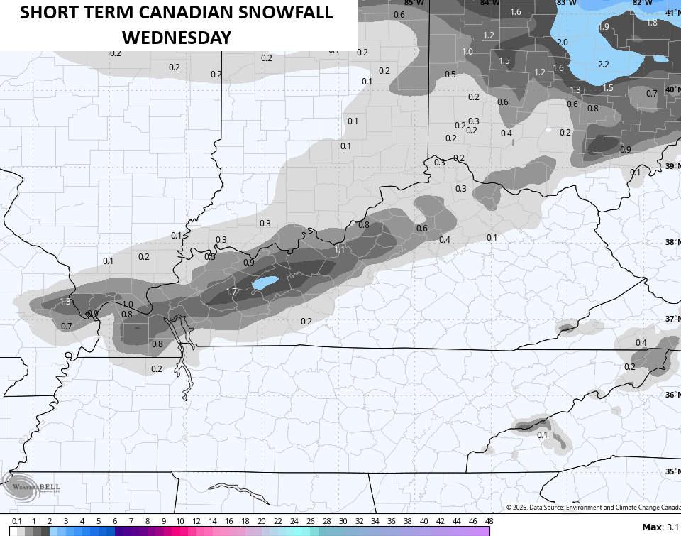
This has an increasing chance to put down a light snowfall for parts of the Commonwealth. The best chance of seeing this is in a swath from western Kentucky toward the Lexington metro and then north.
The Canadian has been fairly consistent on this area…
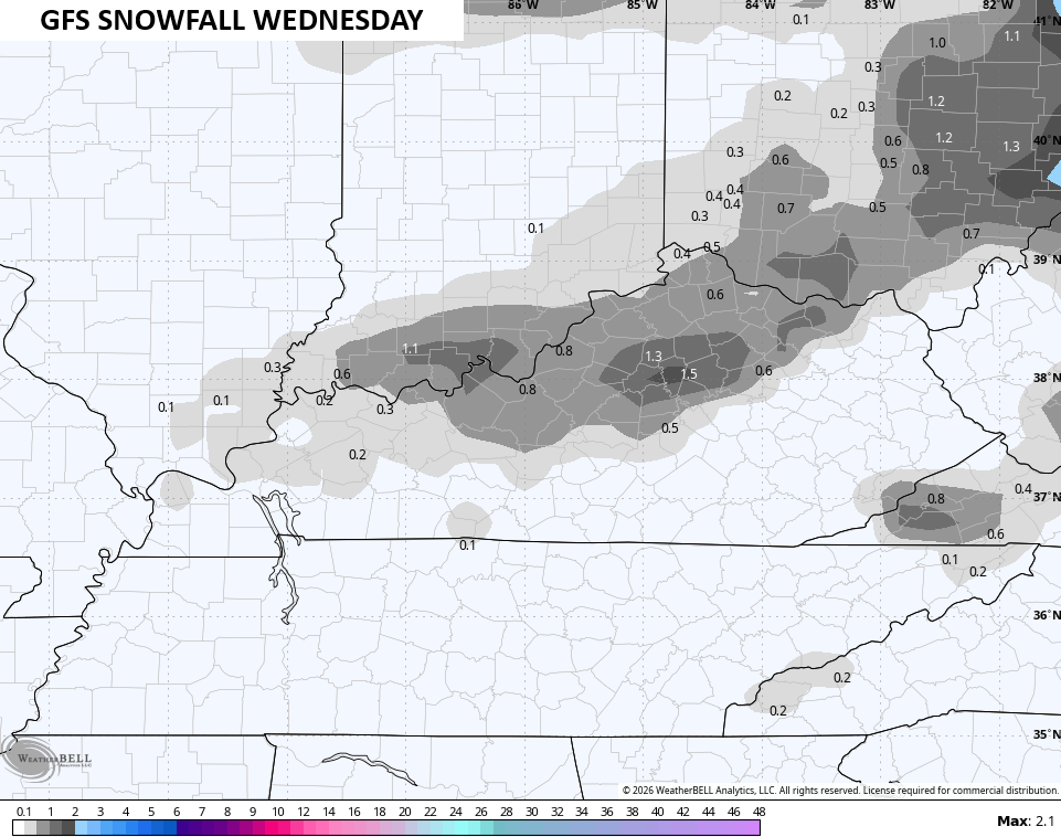
Even the poor GFS is seeing it now…
We will likely be upgrading to a Winter Storm THREAT later today and that may come today on WKYT-TV starting at 4pm. I have no changes to the overall idea about this massive winter storm for the weekend. It’s going to impact tens of millions of people from the southern Plains through our region and into the east and northeast. Yes, areas of the south get in on some of this.
The Canadian Model continues to be steady as she goes with this big hitting system with the main system Saturday and Monday with an upper level system bringing snow into Monday…
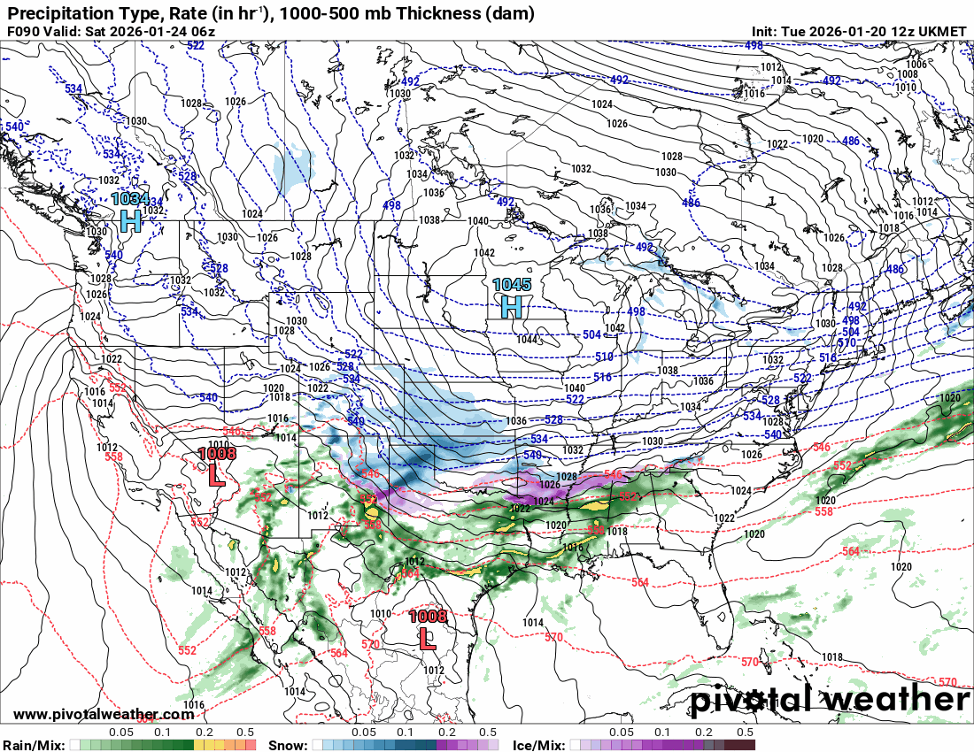
The UKMET agrees…
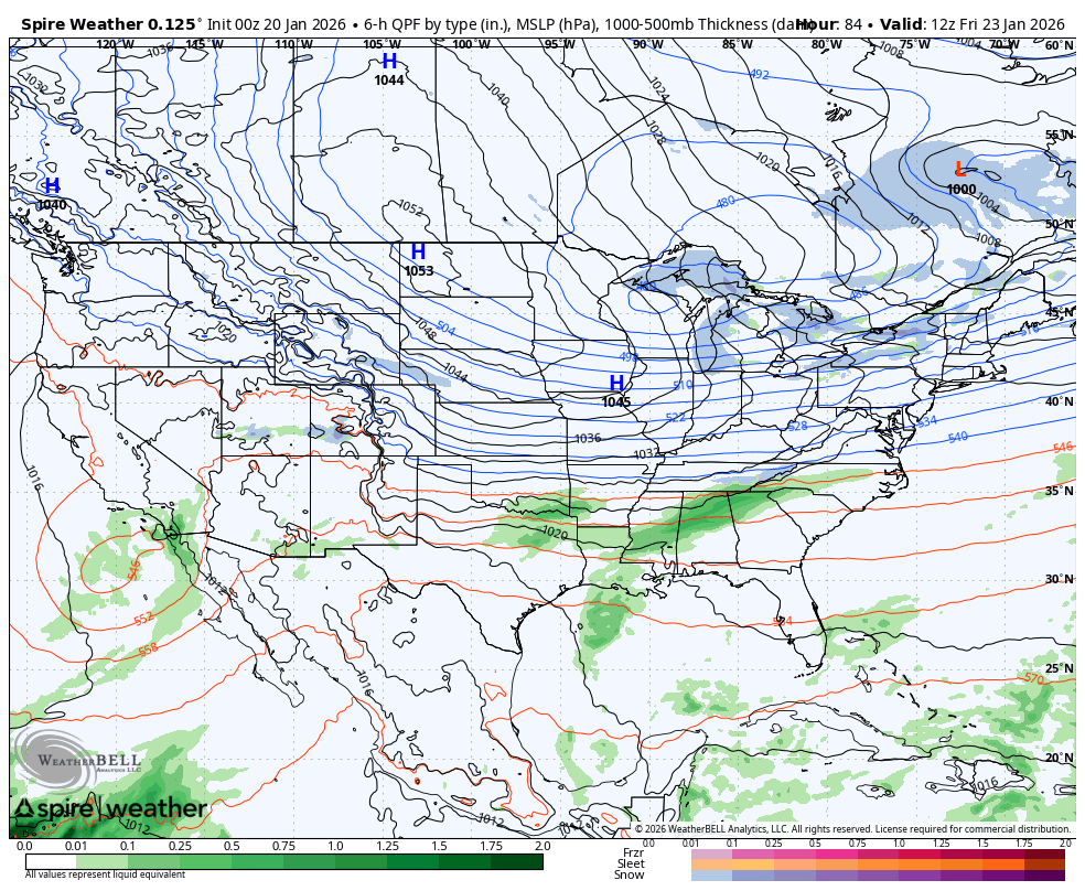
A relatively new model called SPIRE gives us a similar look…
The GFS is still the GFS. After trending strongly toward all other models with earlier runs, it became disjointed once again on the morning run…
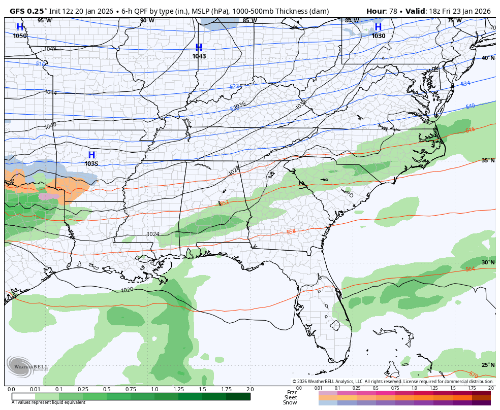
Now, contrast that run with the run just a few hours earlier…
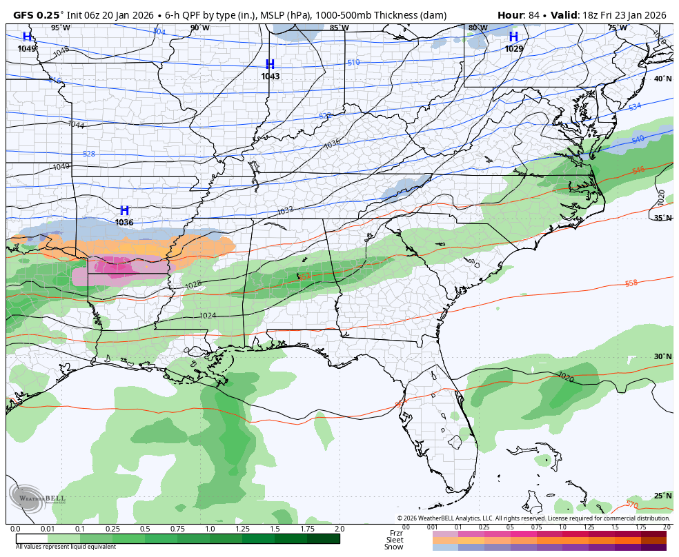
That run was certainly more realistic, but the GFS is going to GFS.
Several updates come your way today and I’m back on WKYT-TV starting at 4pm. I’ll also have a few updates on my Meteorologist Chris Bailey Facebook Page
Until then, here are your tracking tools for the day…


Make it a magnificent Monday and take care.
