Good evening, everyone. We have a Winter Weather Advisory for areas of central and western Kentucky tonight and early Wednesday. At the same time, we are now in full-blown Winter Weather THREAT mode for the weekend.
Let’s begin with the Winter Weather Advisory…

I could see this being expanded to include several more counties as a mix of light snow and light freezing rain moves in overnight and early Wednesday. The HRRR has a pretty concerning signal for light ice and light snow accumulations…
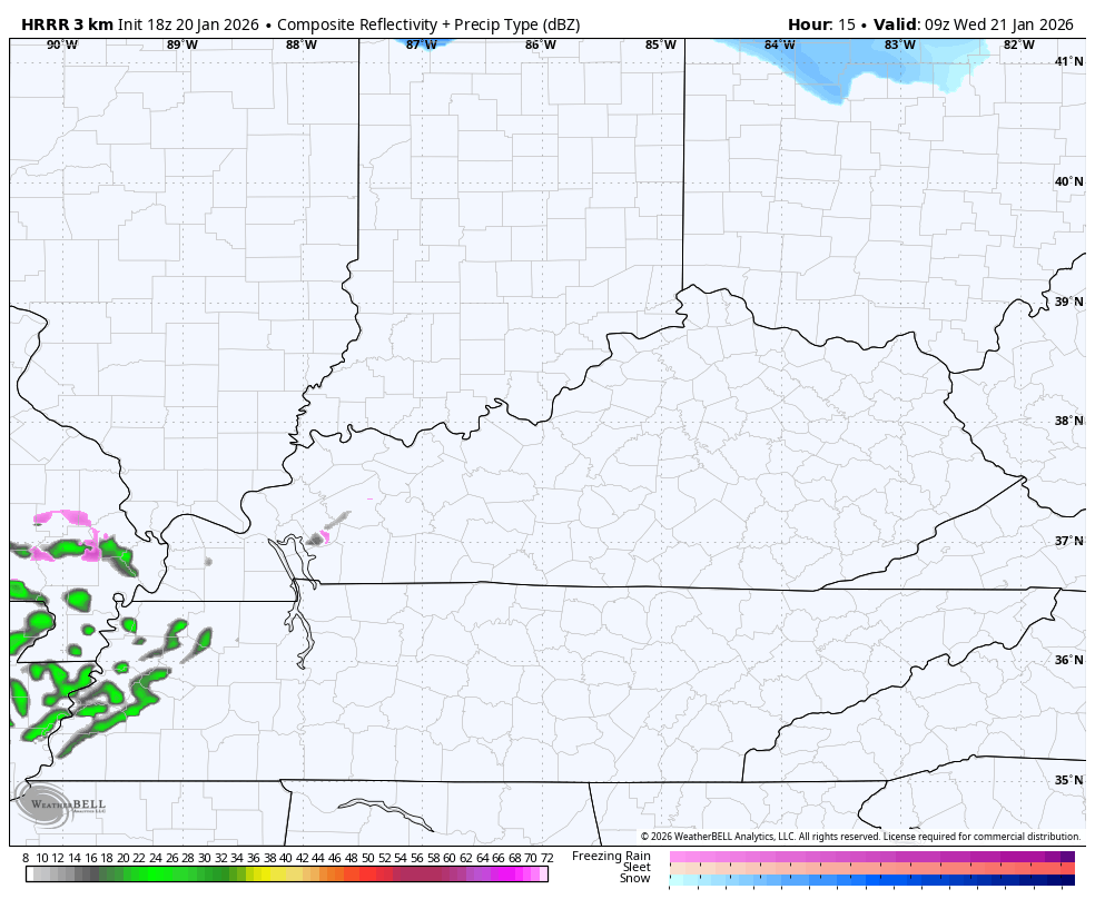
With road temps below freezing and a frozen ground, school delays and cancellations are VERY possible as the arrival time of this is just before the morning commute.
Ok, let’s get into the Winter Storm THREAT…
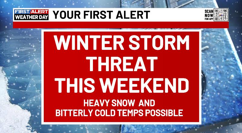
Here are some headlines…
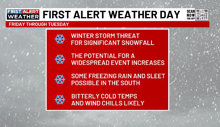
Folks, this has the chance to be a shutdown winter storm as it brings the rare combination of arctic air and a juicy winter storm.
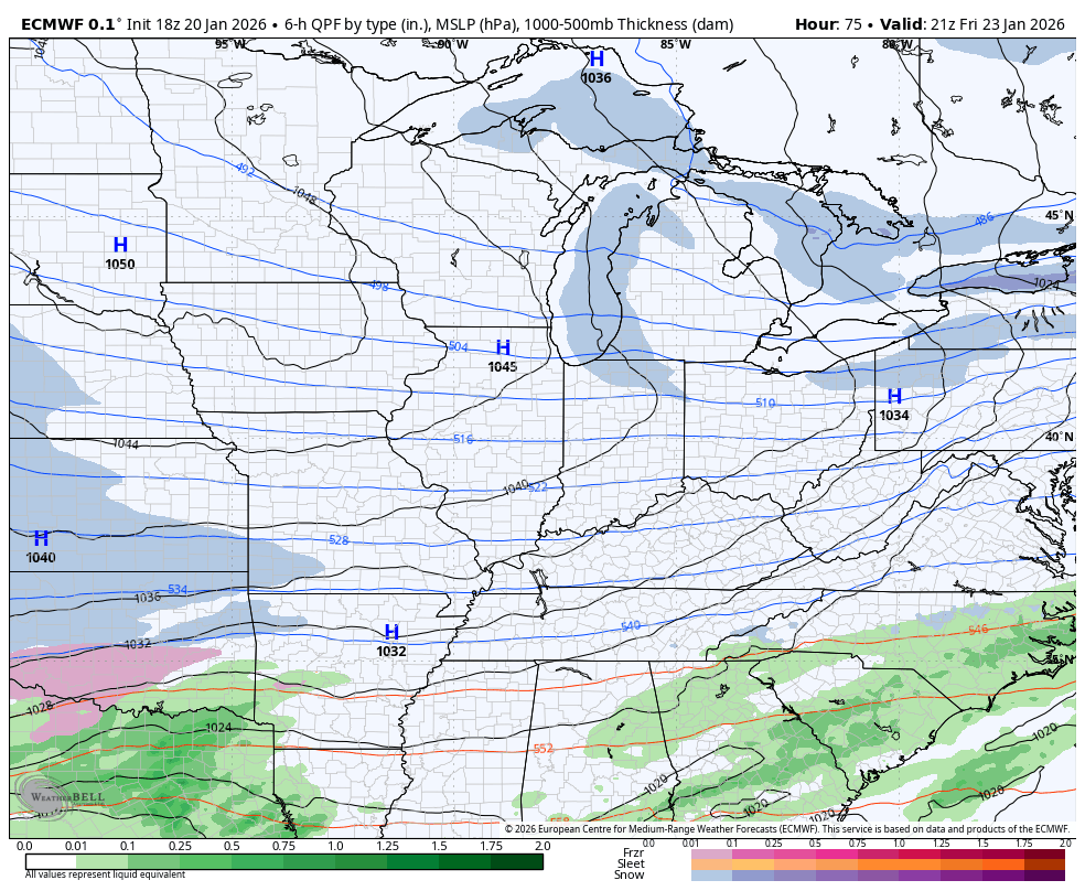
The EURO continues to be super amped up with this…
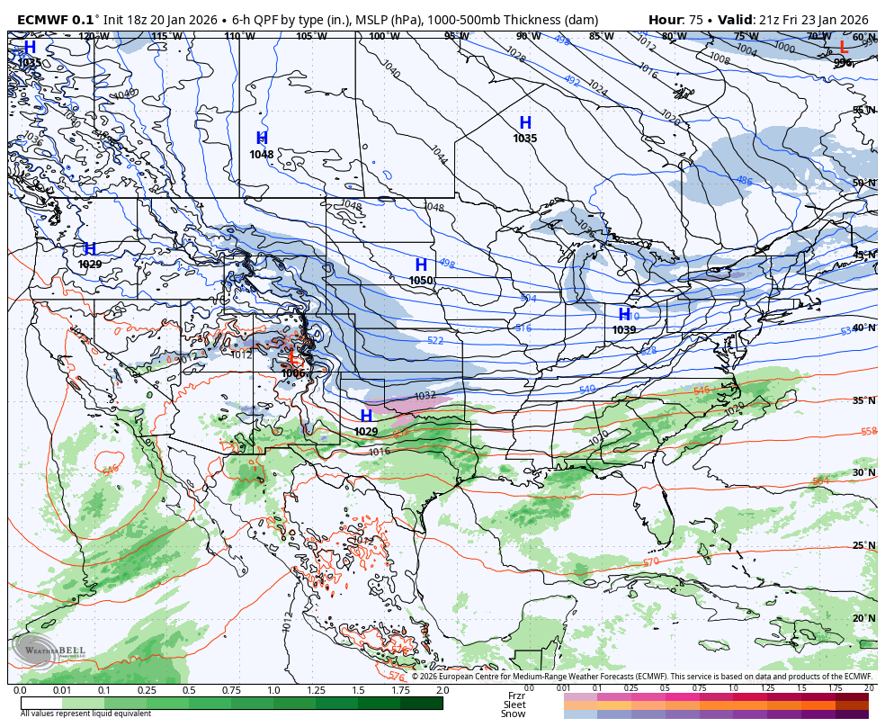
Here’s what that looks like up close and personal…
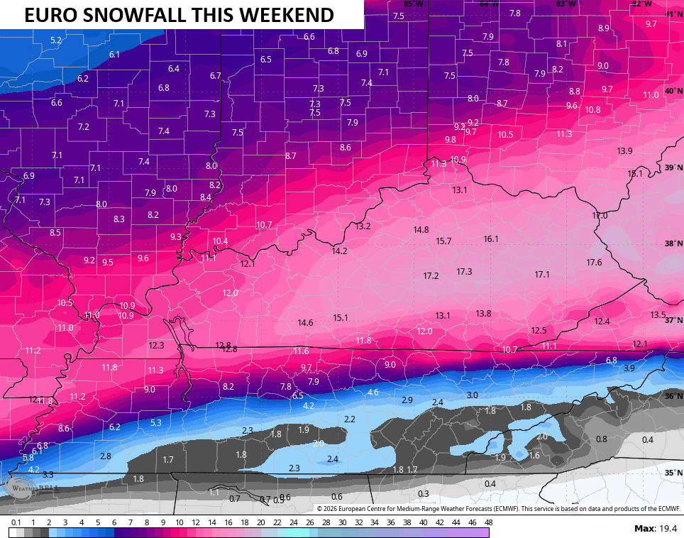
The snowfall map from that run of the EURO is as stout as you will ever see…
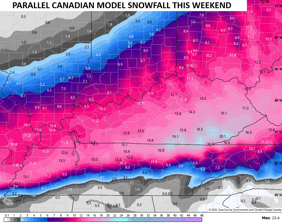
Again, that’s just one run of one model, but it has support. Among them, the Canadian family of models. The Parallel Canadian looks like this…
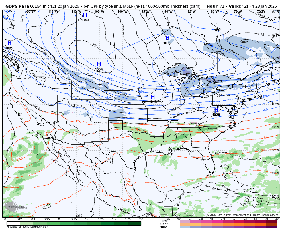
Here’s the up close and personal view…
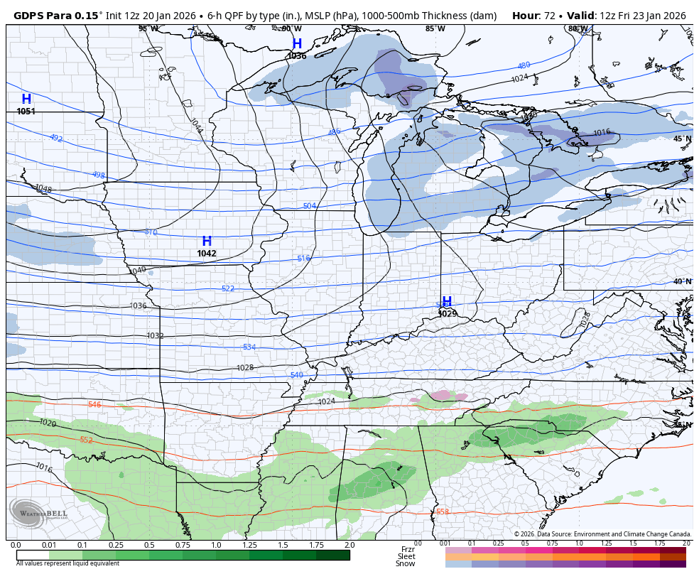
And the snow map from that run…
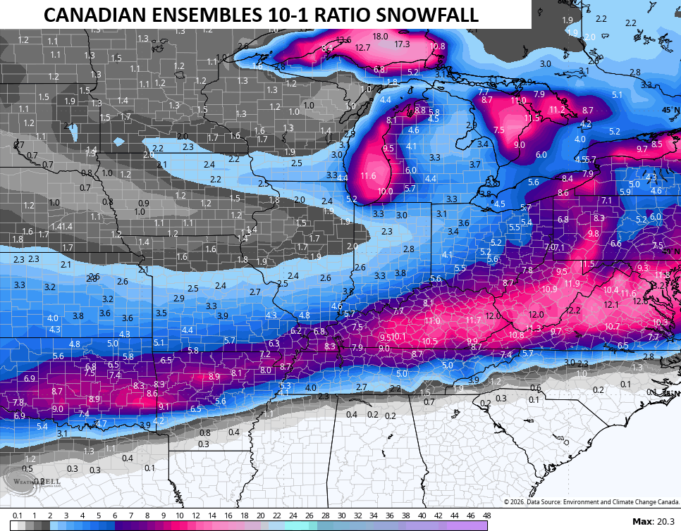
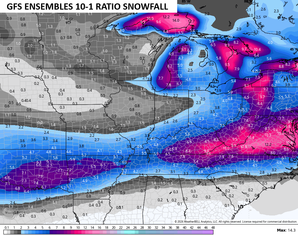
All of this has strong support from the Ensembles which only show snow ratios of 10-1. This will be a much higher ratio event so these forecast totals are on the light side, but it gives you an idea as to where the ensembles see the heaviest snows…
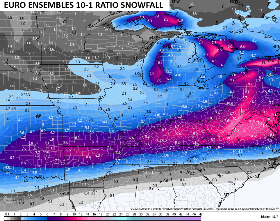
EURO ENSEMBLES
The GFS and GFS Ensembles are both coming back to the north and should eventually match up with most other models…
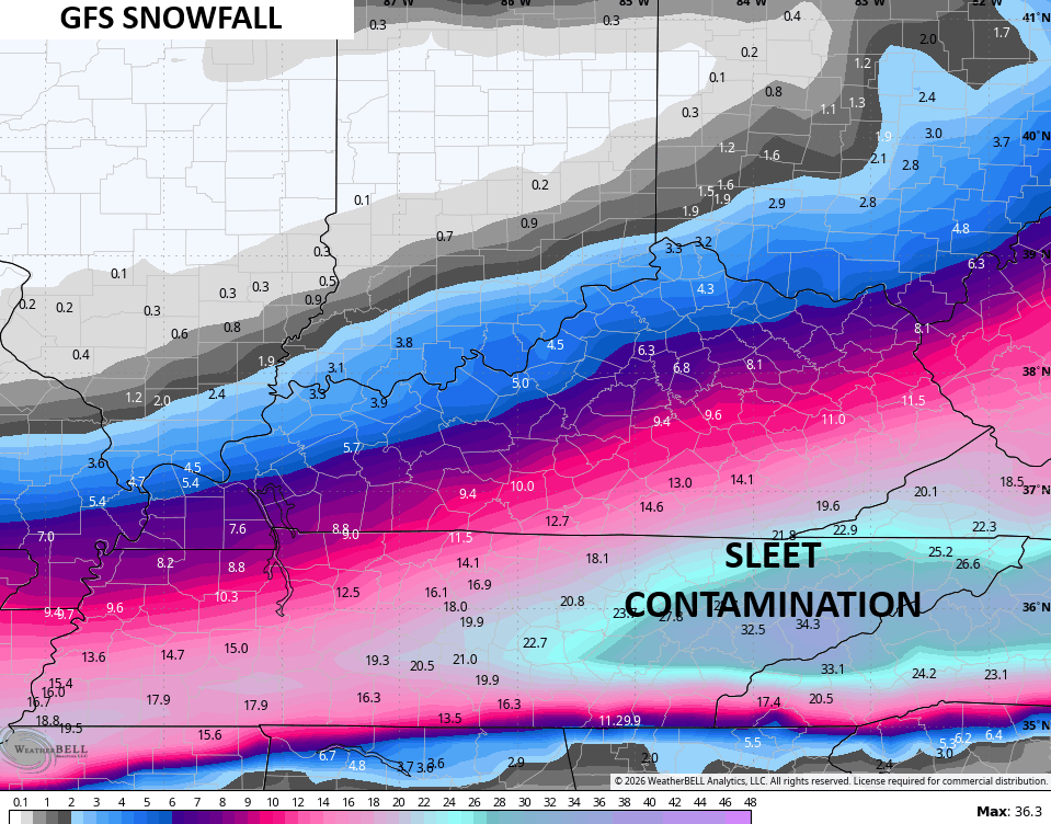
The snowfall run from that model has some issues down in Tennessee, but the trend is north…
The GFS Ensembles also came north…
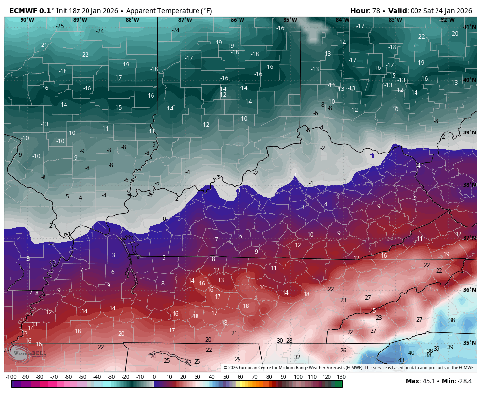
Bitterly cold temps and wind chills accompany this storm. These are the wind chill numbers from the EURO starting at 7pm Friday and ending Monday afternoon…
The full update comes your way tonight and I’ll have the latest on WKYT News starting at 10pm on the CW Lexington and at 11 on WKYT. I’ll also have a few updates on my Meteorologist Chris Bailey Facebook Page
Until then, here are your tracking tools for the day…


Make it a great evening and take care.

Never seen such DRAMA on X from this storm. People in NC/TN are freaking out because it’s trending north. I keep thinking back to Jan 1994 when I was living in Brevard NC. We were under WSW for heavy snows. What happened? KY got it all and we basically got NOTHING. I was so mad.
Mark, I won’t be mad at all if this storm misses us.
Reason for the jump north on the Euro it triple phased..Wild run..Brings ice to southern ky..If keeps trending north could be lights out for a long time with ice and snow..
https://images.weatherbell.com/model/ecmwf-deterministic/carolinas/total_snow_kuchera/1768932000/1769450400-pIqNDMktXho.png
https://images.weatherbell.com/model/ecmwf-deterministic/carolinas/frzr_total/1768932000/1769450400-O3jl7zItm68.png
Does that mean southeast Ky won’t get snow just ice I hope not???