Good Wednesday, everyone. A bit of a wintry mess is out there this morning and it’s creating some slick travel. This system quickly moves away today as we focus on what will likely be a major winter storm impacting Kentucky with snow, sleet and freezing rain this weekend.
Let’s begin with today’s action then get into the winter storm.
A wintry mix of light snow and light freezing rain is impacting parts of Kentucky, especially central Kentucky. With a frozen ground and road temps below freezing, please use caution if traveling this morning as just a light glaze would cause all kinds of issues.
Here’s a look at the Winter Weather Advisory out to start the day…

The trend for our winter storm continues to be concerning as we find the models bringing more and more of an icy signal to go along with a big snow signal. All along, I’ve been saying we get a lead low into the southern Appalachian Mountains that gives way to the main low developing underneath that and to the east.
The models are seeing this lead low more and more and many are now taking this lead low all the way into West Virginia. That kind of a track would eventually bring warmer air aloft, bringing more sleet and freezing rain into the picture for some, not all.
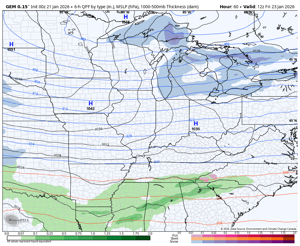
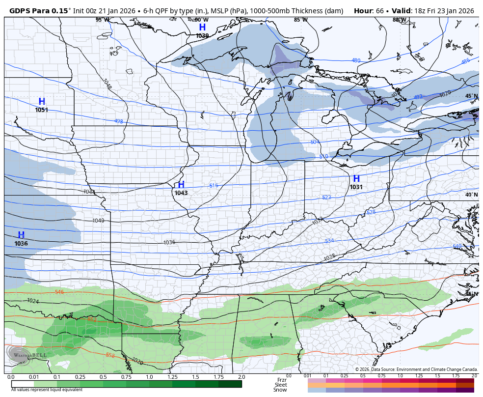
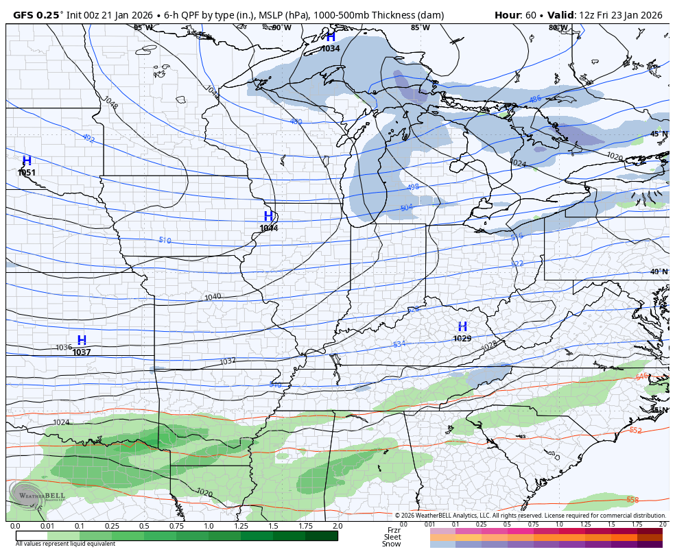
The latest Canadian Model brings a tremendous amount of precipitation into the region with heavy snow starting out areawide before going over to sleet and freezing rain across parts of the south and east then everyone ends as snow.
Here’s how the overnight run looks from the Canadian…
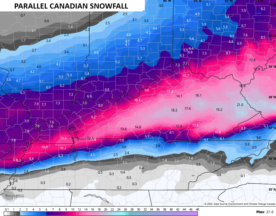
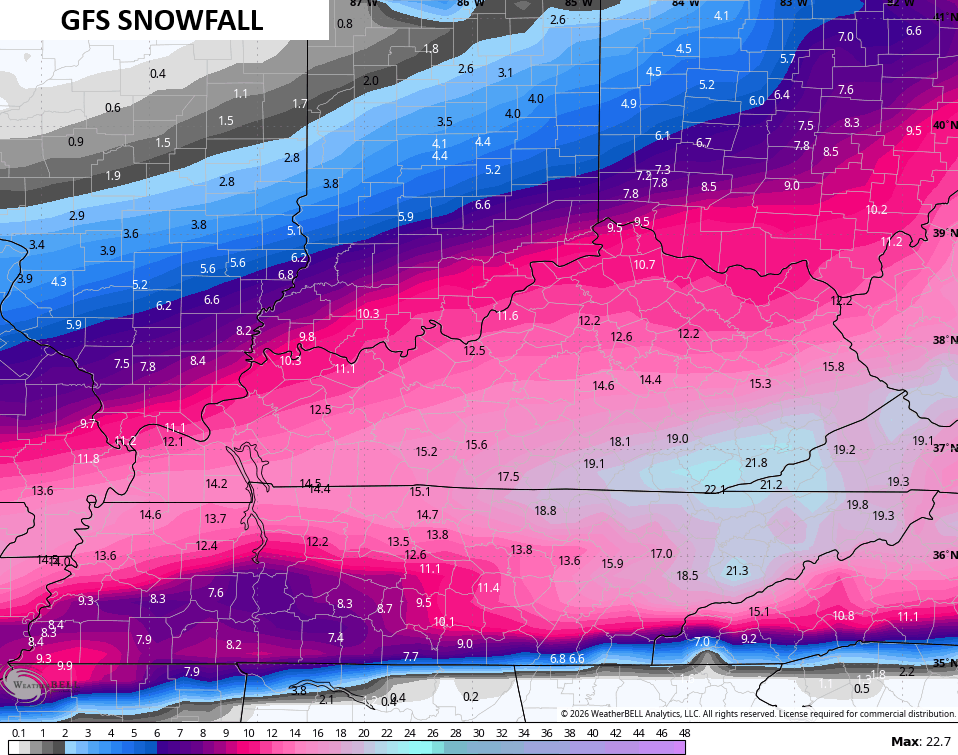
Here’s the snowfall from that run…
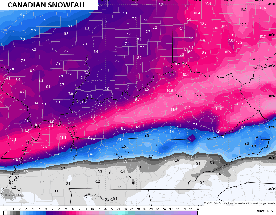
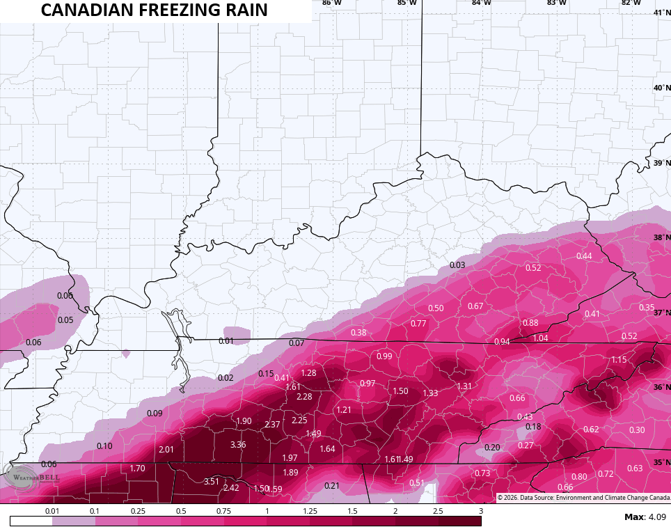
I don’t believe this much sleet falls, but it is giving us a good signal across the south…
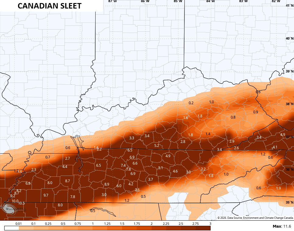
I think it’s overdoing the sleet and underdoing the amount of snow and freezing rain…
The Parallel Canadian has a similar overall look but is snowier…
That’s a major snow maker to say the least…
The sleet line is farther south with a ton of it in southern Kentucky…
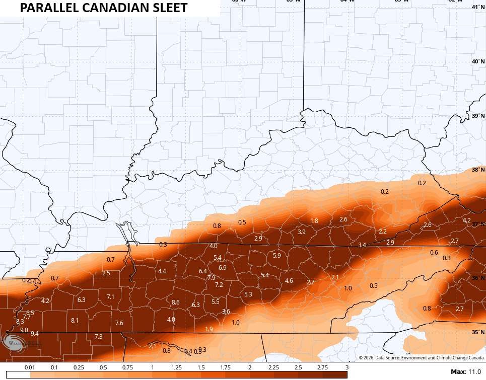
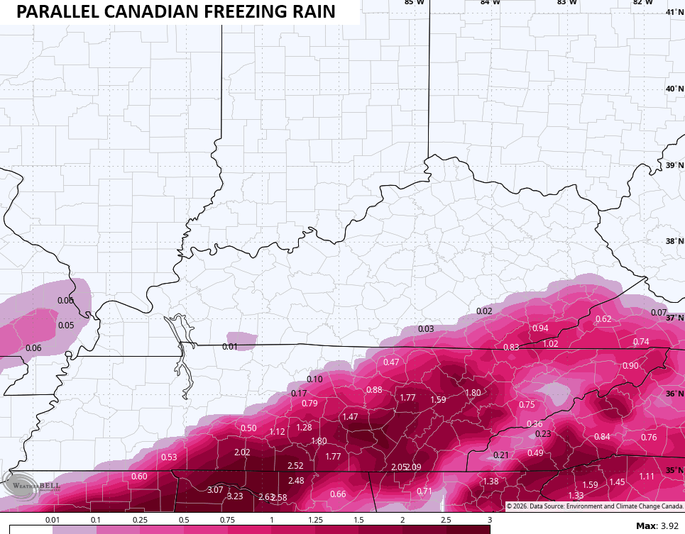
It does have less freezing rain, but I suspect the sleet is overdone and the freezing rain is underdone…
The EURO is now the strongest and farthest north of the bunch. While possible, the EURO can sometimes throw us these overamped up systems and I THINK that’s what’s happening here. This is just an amazing amount of overall moisture, no matter the form it takes…
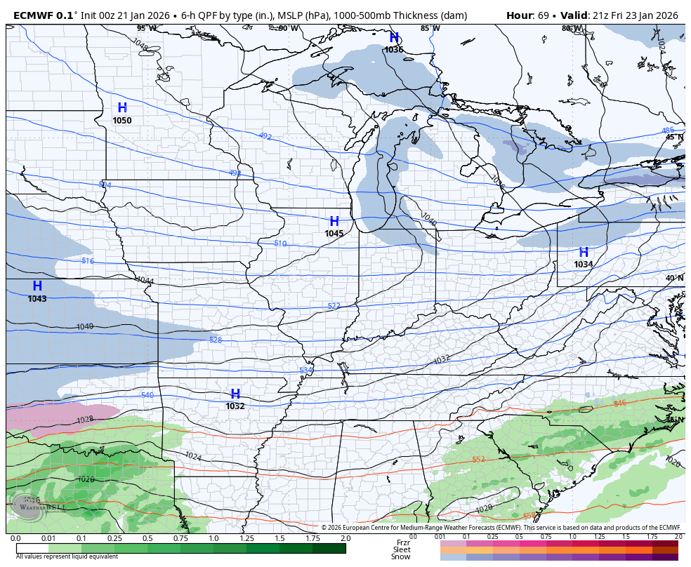
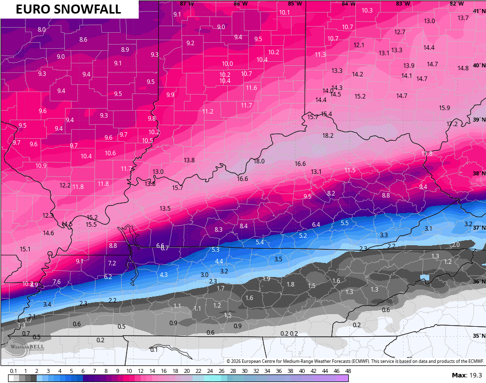
The EURO Snowfall map from that run is certainly excited…
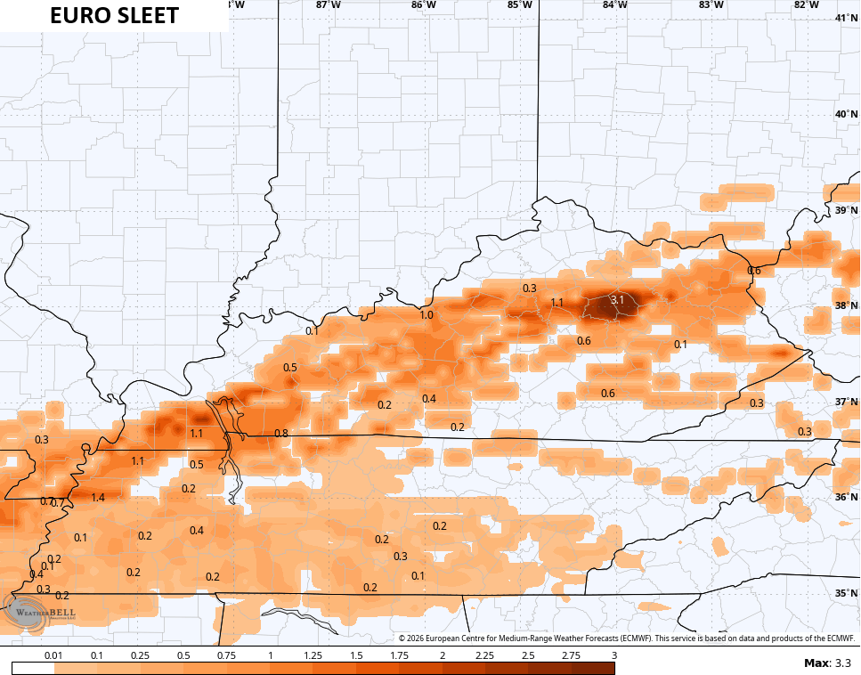
The sleet is a little jazzed up and north of the Canadian family…
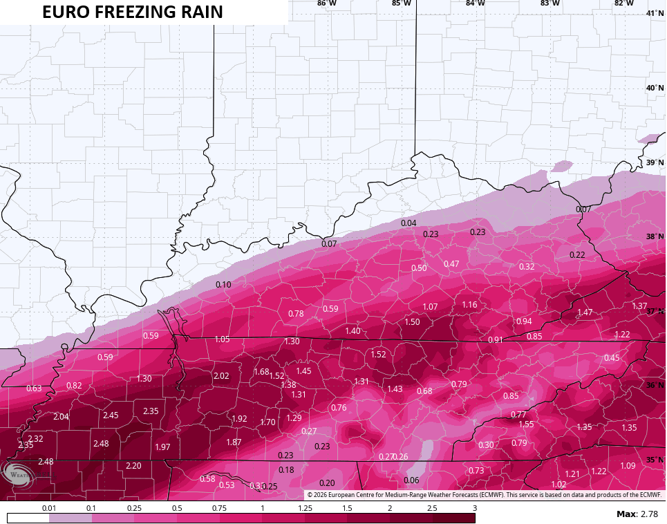
The amount of freezing rain would be a devastating hit, especially since it would be falling on several inches of snow…
The GFS continues to be north and is actually the solution most of Kentucky would want as it’s pretty much all snow…
That probably comes north a little more to be honest.
Here’s the snow map from that run…
Moral of the story is we have the potential for a true shutdown winter storm for Kentucky and surrounding states. This has a chance to be one of the more widespread winter storms to ever hit our region.
Multiple updates come your way later today, so check back. I’ll also have a few updates on my Meteorologist Chris Bailey Facebook Page
Until then, here are your tracking tools for the day…


Make it a great day and take care.

bailey you f##4443 UP a wet dream, really ice storm what im seeing.
You’re a clown.
Even the weather channel has bullseye for most of ky for a foot or so.
Hope so Im seeing where its just gona be 3-5 inches or more than 5 inches. Hopefully its more than that.
Our NWS here in Paducah has put out winter storm watch for our area saying could exceed 5 inches or more. Just like everybody can’t pin point exact amounts until the day gets closer
It’s selfish to root for big snow.
And its selfish to root for heat. 2 way street
Incorrect take
I agree. He’s always the negative one. Just ignore him.
https://www.wpc.ncep.noaa.gov/wwd/wso/index.php?id=LWX
Who knows at this point..Hate to see the ice though creeping in..
Thanks Chris. Great And Well Detailed Blog This Morning. We Had Some Light Snow Earlier, But Now the Barometer Is Rising, And Looks Like We May Have Some Sun For This Afternoon. The Current Temperature Is 36 Degrees, But I’m Sure The Temperature In The Upper Levels Of The Atmosphere Is Well Above Freezing. Which Started The Freezing Rain Event EarlierThis Morning. Glad That Potential Event Is Over.
Now We Focus On What May Be The ” Storm Of The Century.” Every Century Has Had One Listed. The ” Blizzard Of 1978 ” Was The First And Only Blizzard I Ever Experience. The One That Occurred In 1917 Was Another One I Read About. The Deepest Snow I Ever Saw Occurred In March 1960. A Three Foot Accumulation Of Heavy Wet Snow Up In South Central Indiana. A Lot Of Fun for A 9 Year Old Boy.
The Storm That Is Predicted For Saturday Night Or Sunday Definitely Will Have A Lot Of Cold / Arctic Air To Work With, But How Much Moisture Will It Have When It Phases With The Subtropical Jet Stream ? Every Major Snowstorm I’ve Seen Before It started, The Air Was Calm, Surface Temperature Was Between 25 To 28 Degrees, And Somewhat Humid.
Confidence Is HigherThis Morning, That the Main Precipitation Type Will Be Snow, But Where The Phased Low Pressure’s Track Is Still In Question. We Will Know What Has Happened This Coming Sunday Evening For Sure.
https://climateimpactcompany.com/early-u-s-notes-winter-storm-update-for-weekend-2/
Apologies Jeff I just want one good snow before spring
Three states – Arkansas, Tennessee, and Kentucky – are under Winter Storm Watches for the whole state. Twenty states total are under a Winter Storm Watch. for at least parts of those states. It’s rare for a WSW to be so broad in nature.
The winter storm watches come as far north as Southern IL. We here in the Chicago Metro area won’t be getting much snow, just brutal and extreme cold beginning Thursday night. An Extreme Cold Watch has been issued for Northern and Central IL for Thursday night/Friday morning.