Good evening, everyone. It’s all eyes on a major winter storm set to impact our weather this weekend with heavy snow, sleet and freezing rain. Throw in brutally cold temps and wind chills and this is a dangerous period ahead of us.
The Winter Storm Watch that’s out is for the entire state and surrounding areas this weekend…

I really have no changes to my earlier thoughts as all winter weather precip types show up this weekend. How much of each is the issue I’ll be tackling over the next two days, but here’s a look at my general Winter Storm Impact…
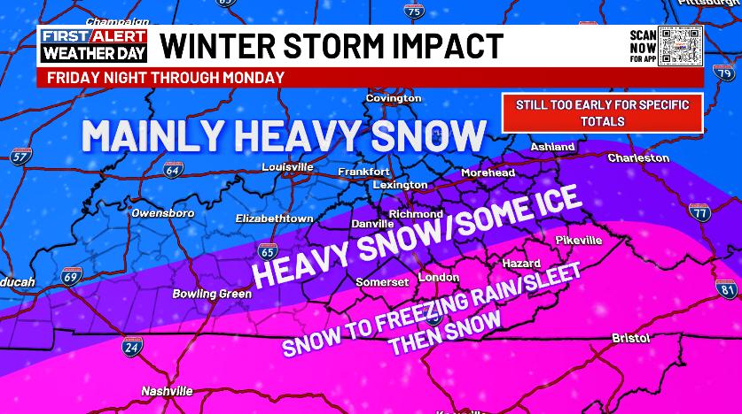
Double digit snow totals are likely for some areas. Exactly where will be known in the next day or so.
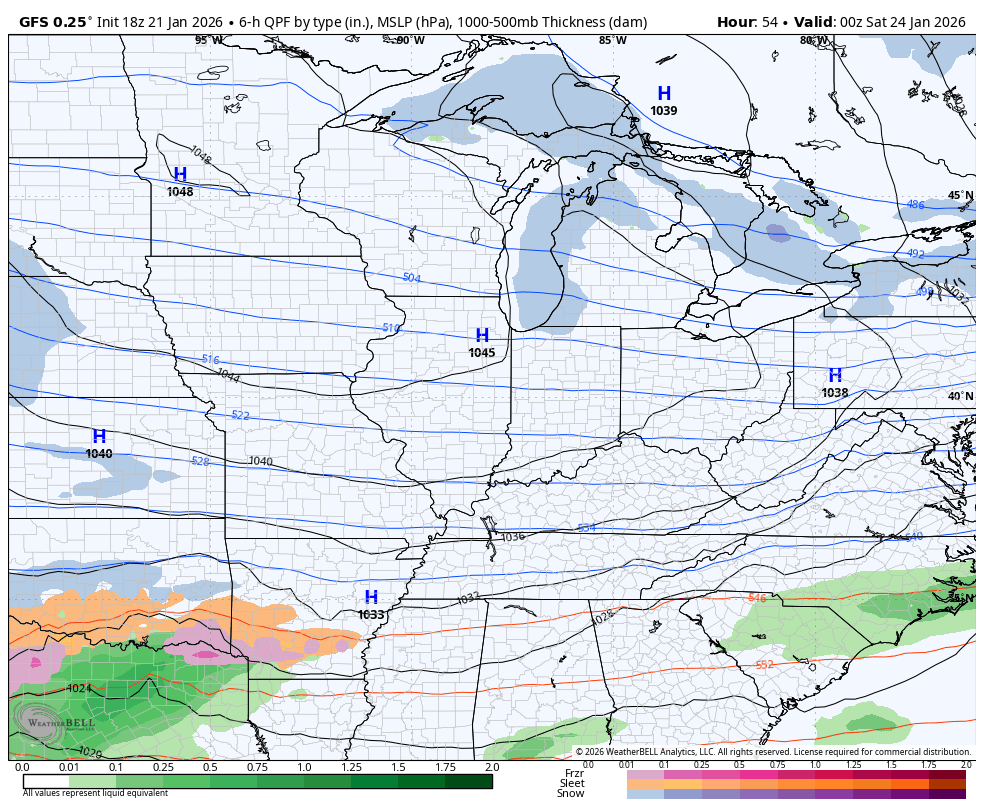
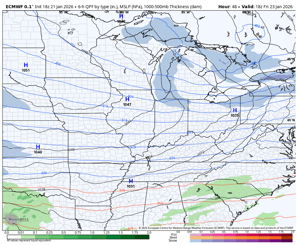
The late day forecast models are pretty much what you would expect for each model. The GFS is colder and farther south, but this is likely the bias of the model coming into play…
I’m good with more snow than ice and no one would argue with that. Freezing rain is the absolute last thing any of us want, but that’s certainly a possibility. The new EYRO is showing this across the south and southeast and even has a brief moment of plain rain in the southeast…
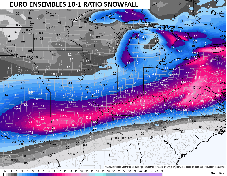
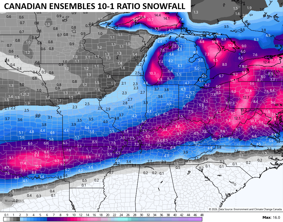
I like to look at the Ensembles at times like this to get more of a smoothed look at what they’re thinking. The core of the greatest snowfall cuts right across Kentucky on the EURO Ensembles…
The same for the Canadian Ensembles…
During these times, I also like to throw out what the NWS is focusing on. Here’s a look at their afternoon briefing slides…


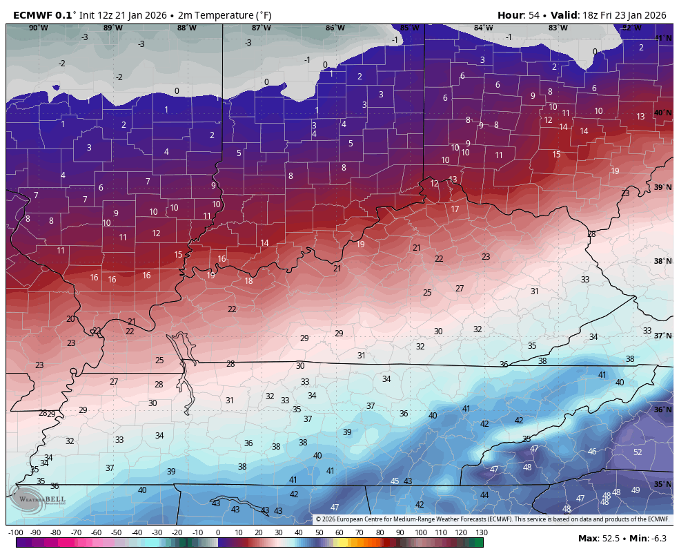
Brutally cold temps and wind chills show up behind the Friday arctic front. Look at the actual temps from the EURO starting at 1pm Friday and ending at 7am Saturday…
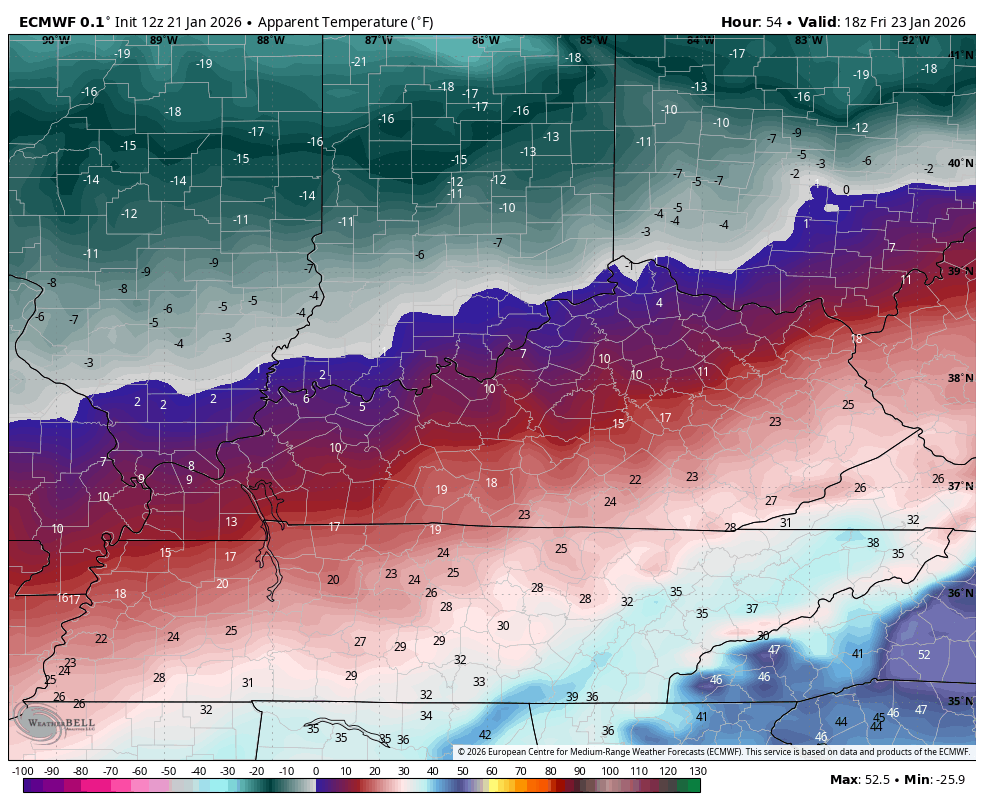
Wind chills during that time are brutal…
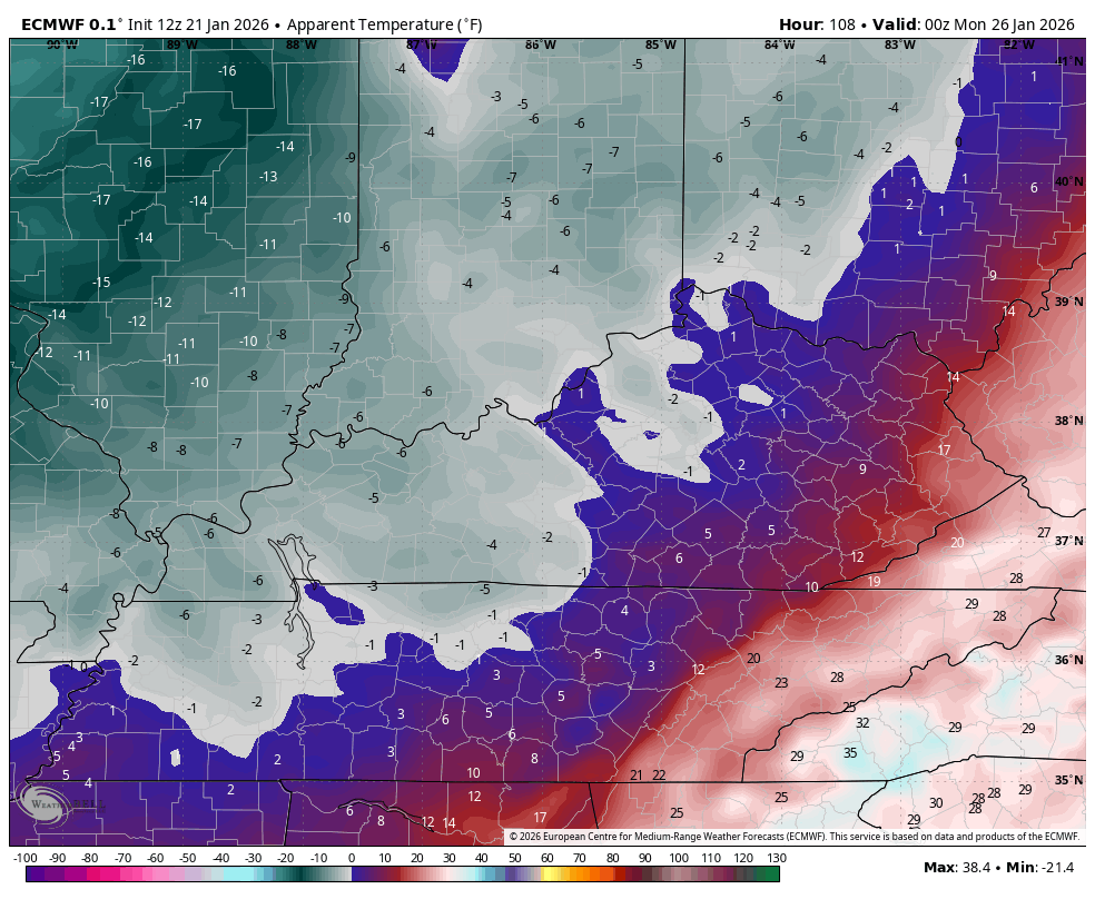
Below zero temps are likely behind this storm on Monday and Tuesday. Wind chills will be beyond brutal…
The latest comes your way tonight on WKYT and with the full KWC Update later tonight. I’ll also have a few updates on my Meteorologist Chris Bailey Facebook Page
Until then, here are your tracking tools for the day…


Make it a great evening and take care.

OK, so what phases are we currently in… aren’t they called teleconnections or something? It would be interesting to know
Mark , The Teleconnections Are The EPO, AO, And The NAO. At The Present All Are In The Negative, Especially The AO, Which Is Strongly Negative. I’m Tired, Going To Bed. Good Night Everyone.
If it’s going to be that brutally cold, then how in the world are we going to end up with the infamous “warm wedge” yet again cutting across southeastern Kentucky into the Kanawha Valley? I realize there are different layers of air aloft, etc. but I am not ready to buy into this warmer solution for my area yet. LET IT SNOWA! JUST SAY NO TO ICE!
I have the same question but isn’t it suppose to warm to 40 Sunday at least it says that tonight for southeast Ky for Sunday I think sat is cold enough to stay snow but the warm air at least in my forecast says high 40 Sunday so I guess that’s how it the warm air sneaks in on us Sunday but I too am doubting it getting that warm Saturday is only suppose to be high 25 so I think Sunday is the problem day I think that’s the day the warm air wins out for a little while then I think that night it goes back to snow.
Hey Crystal, long time no see. Our high for Sunday near Lexington is 14! No 40s to be seen on our local forecast. So crazy!
Hey Chell I know but in my area Sunday now says high 39 in my area Saturday says high 25 so hopefully I get some snow Saturday warmer air always creeps in in my neck of the woods very frustrating for snow lovers good talking to you