Good Thursday, everyone. A MAJOR winter storm is on track to blast the Bluegrass state this weekend. Significant amounts of snow, sleet and freezing rain are likely with bitterly cold temps coming along for the ride.
Before we get to the breakdown, we continue with a Winter Storm Watch for the entire state from Friday night through Monday morning. Surrounding states are under this same watch…

While it’s still early for exact totals, I continue to highlight the areas where different precipitation types will be noted…
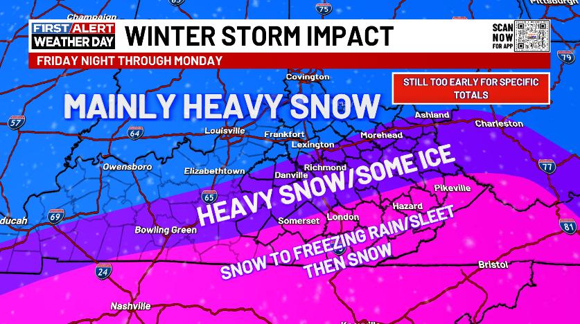
I’m pretty comfortable with that idea right now and will have a First Call for Ice and Snowfall later today.
Here’s the breakdown:
SATURDAY
- Light to moderate snow arrives in western and southern Kentucky during the morning.
- Snow expands across the rest of the state during the afternoon.
- Moderate to heavy snow covers the whole commonwealth by late afternoon.
- Several inches of snow will show up for some during this time.
- Bitterly cold temps mean the fluff factor will be very high.
- Wind chills will be well below zero to start the day with generally single digit wind chills most of the day.
SATURDAY NIGHT
- Heavy snow continues for much of the state.
- Several more inches of snow will be likely for areas staying all snow.
- Sleet and freezing rain try to lift northward out of Tennessee into southern Kentucky.
- The warm nose of air upstairs may lift all the way into areas of eastern Kentucky, meaning a switch to sleet and freezing rain for a time.
- How far north the ice line gets will a tough call.
- Significant amounts of sleet and freezing rain will be possible where this occurs.
SUNDAY
- Heavy snow keeps rolling for many areas as our low presses to the east.
- The freezing rain and sleet lines will still be a tough call.
- Several more inches of snow will be likely for areas staying all snow or mostly snow.
SUNDAY NIGHT
- Moderate to heavy snows pull away.
- Light snow is rather common across much of central and eastern Kentucky.
- Snow accumulations of double digits are more than possible for many areas.
- For any one location, the more sleet and/or freezing rain you have, the lower the snow totals.
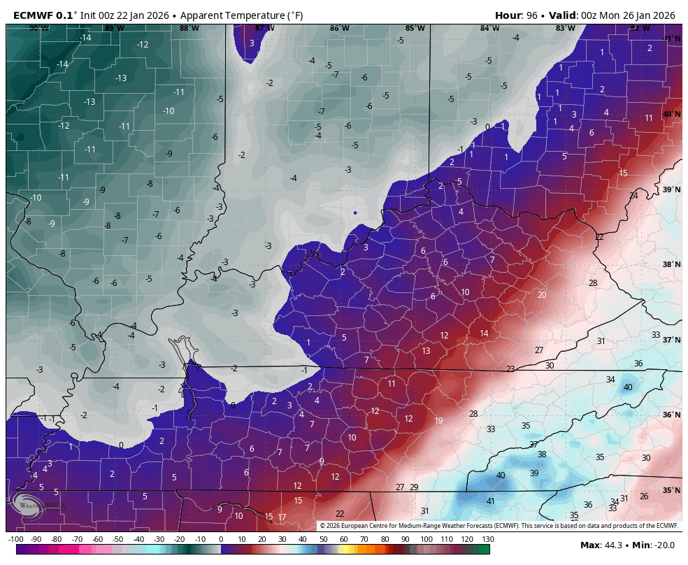
- Bitterly cold temps surge back in and may go below zero by Monday morning.
- Wind chills reach -10 to -15.
MONDAY
- Some light snow and flurries will be possible across central and eastern Kentucky.
- The big story now turns to the brutal cold. Temps may not get out of the single digits through the day.
- Lows again go below zero Monday night and Tuesday morning.
- Wind chills may reach -20 to -25.
THIS IS A DANGEROUS WINTER STORM. THIS IS A DANGEROUSLY COLD AIR MASS.
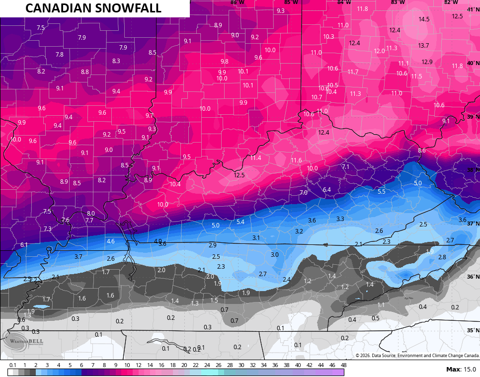
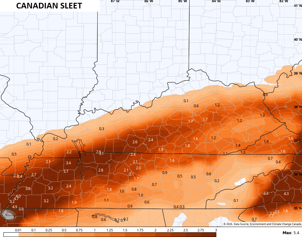
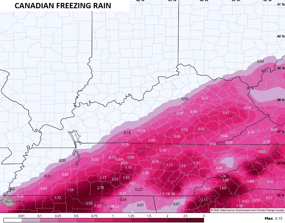
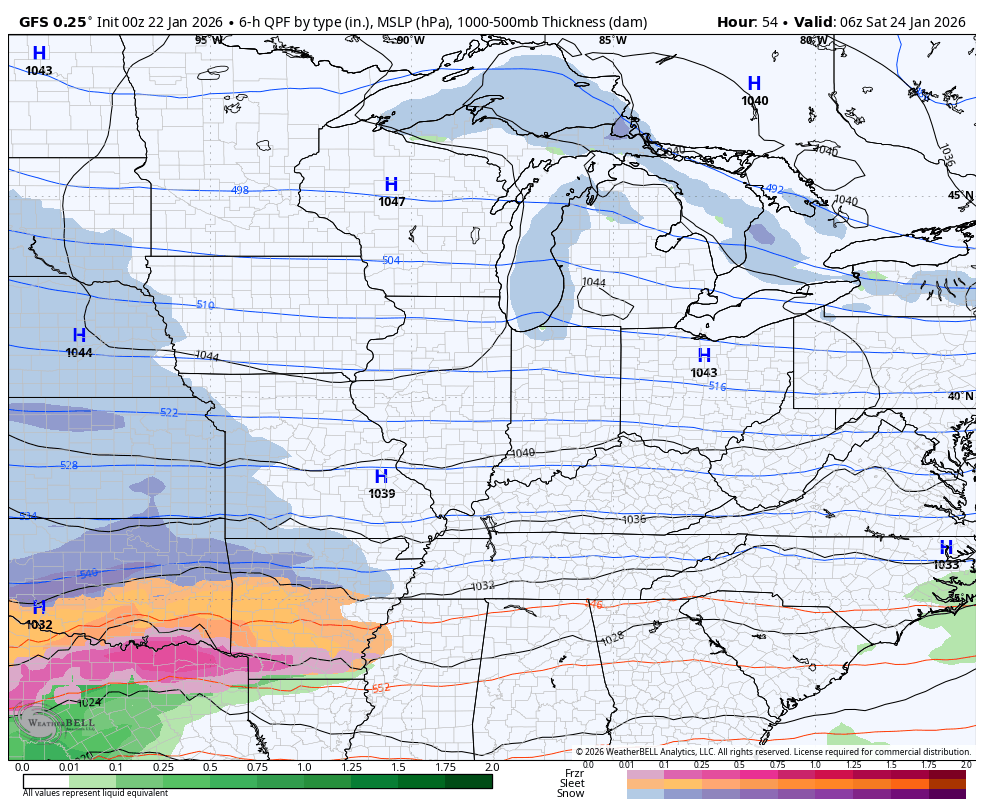
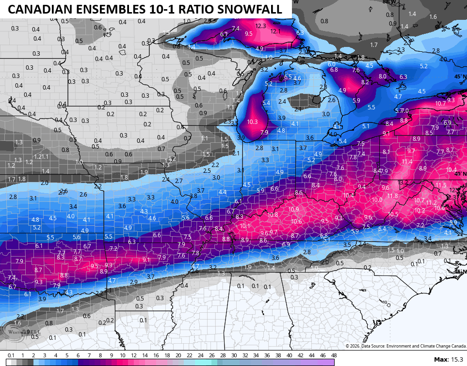
As far as the models go, the Canadian continues to nasty with a snowstorm to an ice storm for some, then back to snow. It’s doing so by tracking the lead low all the way through eastern Kentucky into West Virginia…
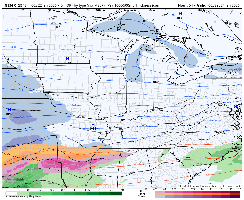
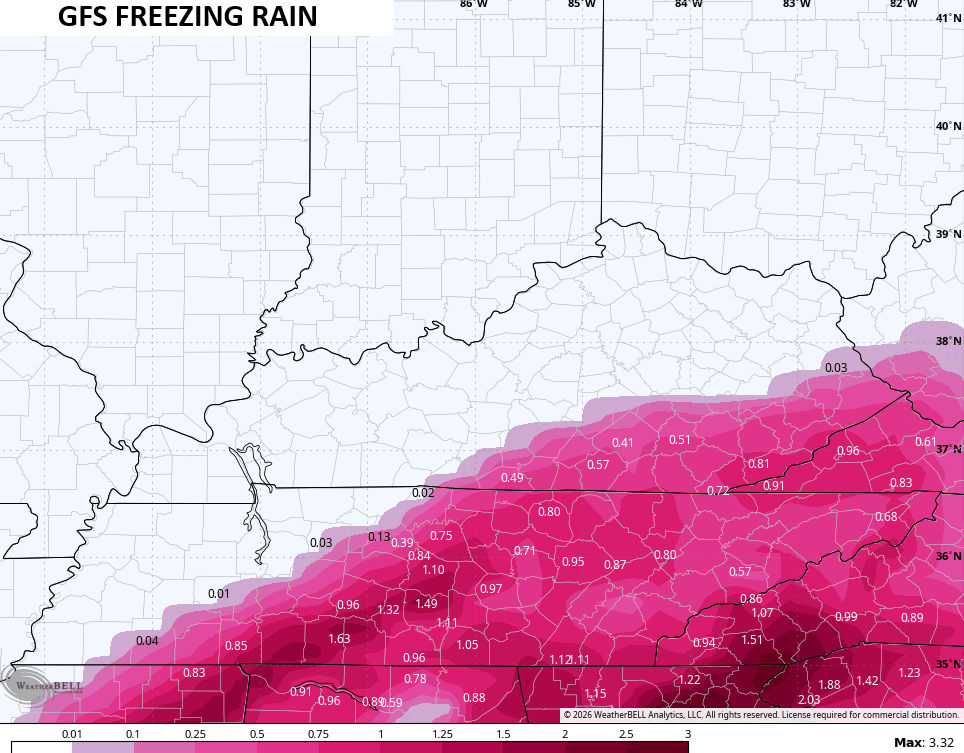
Given the fact the model is spitting out so much sleet and freezing rain, the snowfall map is still crazy high…
The sleet is substantial…
The freezing rain across the southeast is concerning as this much ice would result in serious issues…
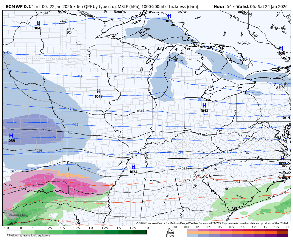
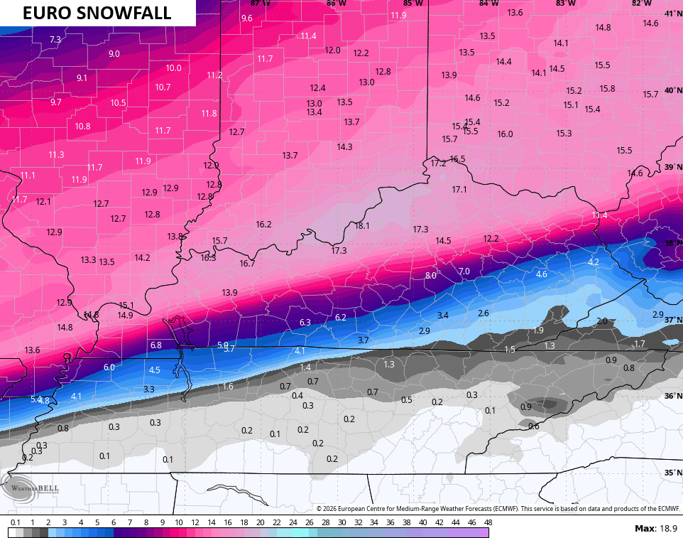
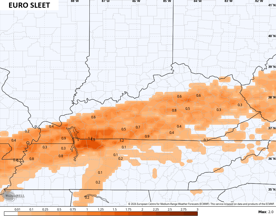
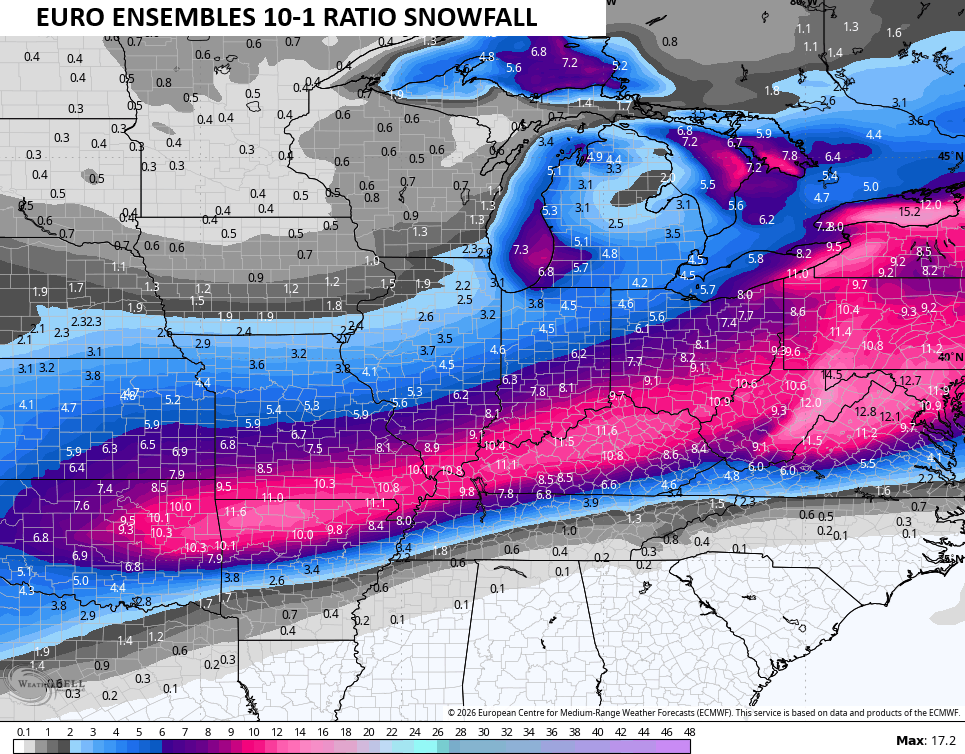
The Euro isn’t quite as strong as the Canadian with that lead low, but it still drops the hammer with a massive snowstorm and an ice storm…
The snowfall map from that run of the EURO is intense to say the least…
The sleet line creeps north to Interstate 64…
So does the freezing rain line, with a full blown ice storm in the south and southeast…
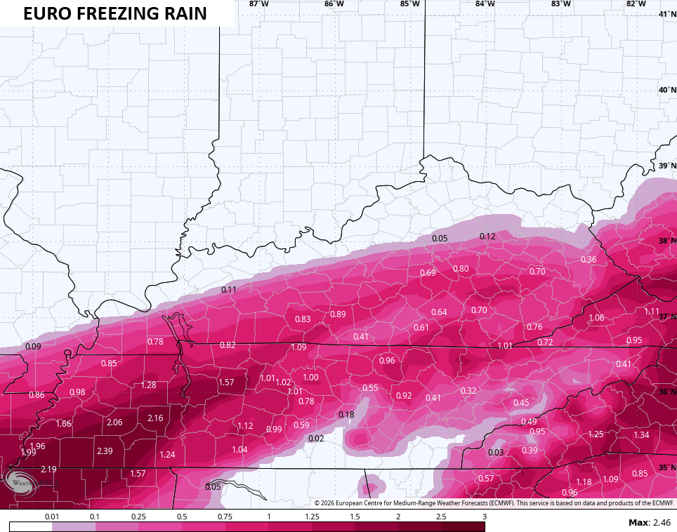
As I keep preaching, we want NO part of freezing rain with this storm. The amount of moisture it will produce is crazy high.
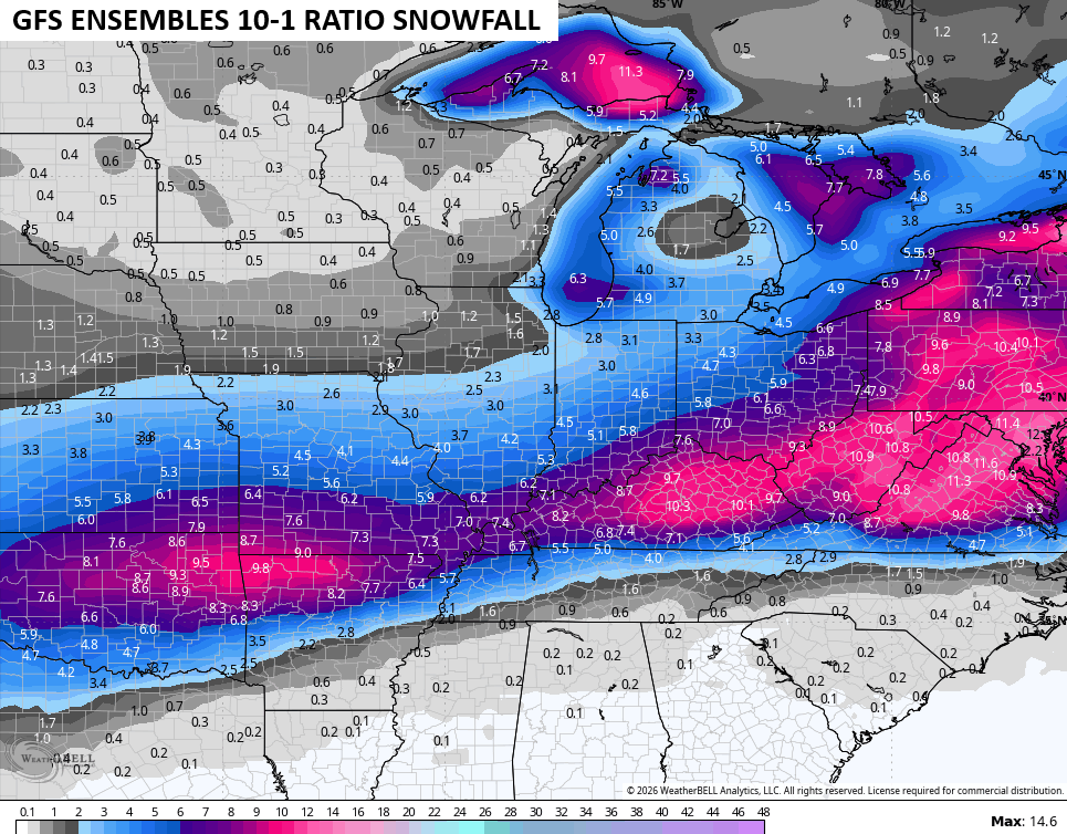
The latest GFS is more in line with reality in terms of the overall features of this storm. It’s not as strong with the lead low as the Canadian/EURO models and that allows it to fade more to the east. As that happens, the model spits out insane snow amounts…
The snowfall map from that run of the GFS is stupid high…
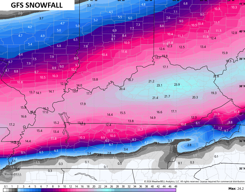
I cannot even come close to endorsing something like that at this moment. Still… It’s noted.
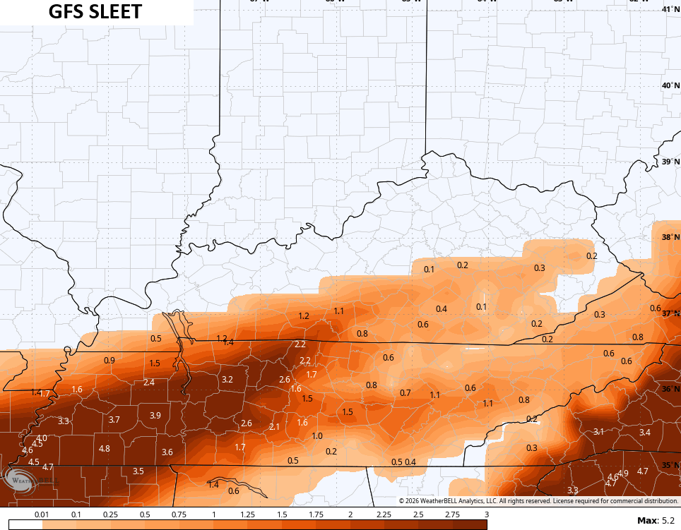
The model is seeing a little more sleet in the south…
And is also seeing the potential for significant freezing rain in the southeast…
As far as the Ensembles go, they continue to paint a major winter storm hit…
The other aspect of this setup that we cannot ignore is the dangerously cold temps and wind chills Sunday night through Tuesday morning. Lows will likely dip below zero…
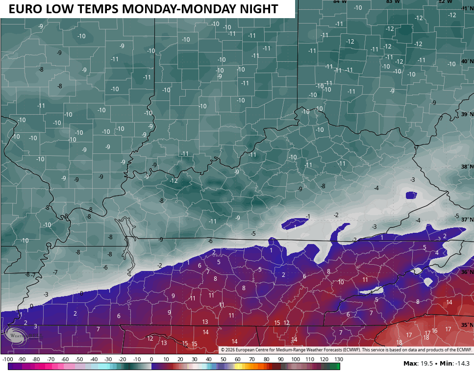
Wind chills go even lower…
The absolute worst-case scenario is this winter storm knocks out power with that type of cold coming in right behind it.
Additional updates come your way as usual today, so check back. I’ll also have a few updates on my Meteorologist Chris Bailey Facebook Page
Until then, here are your tracking tools for the day…


Make it a great Thursday and take care.

Truly disgusting
This storm will go down in the record books for many in the Southern US. There will be a ton of precipitation pulled in from the Gulf with snow ratios along the Ohio River into Indiana being15-18 to one. The ice secretion will top one inch for some. Stay safe KWC counterparts.
I know this one hasn’t even hit yet, but looking into next weekend it won’t be a rinse and repeat, but snow on snow with no melting taking place.
Looks more and more like 1998 here in Louisville, long event ended up with 18 inches over whole weekend.
Storm Hasn’t Even Formed Yet. All We Have Gotten So Far Is Speculation BS. I’m Hoping Now That The Southeast Ridge Will Be Strong Enough To Knock This Impending Storm Way North Where It Belongs In A La Nina Winter. That’s My Speculation BS. Here’s More BS From The Climate Impact Company : )
https://climateimpactcompany.com/u-s-early-notes-gigantic-storm-ahead-increased-risk-of-wider-ice-storm-especially-mid-atlantic-states-2/