Good afternoon, everyone. We are upgrading to a Winter Storm ALERT for this major winter storm coming in late Friday night through early Monday. This has the potential to be a shutdown storm for much of Kentucky and surrounding areas.
The headlines…
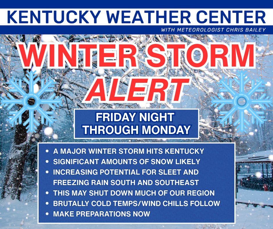
A Winter Storm Watch continues for the entire state and surrounding states…

My overall theme for this storm remains the same as of now…
I’ll have the First Call for Snowfall coming this afternoon at 4pm on WKYT.
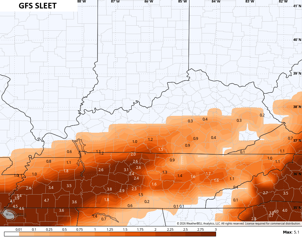
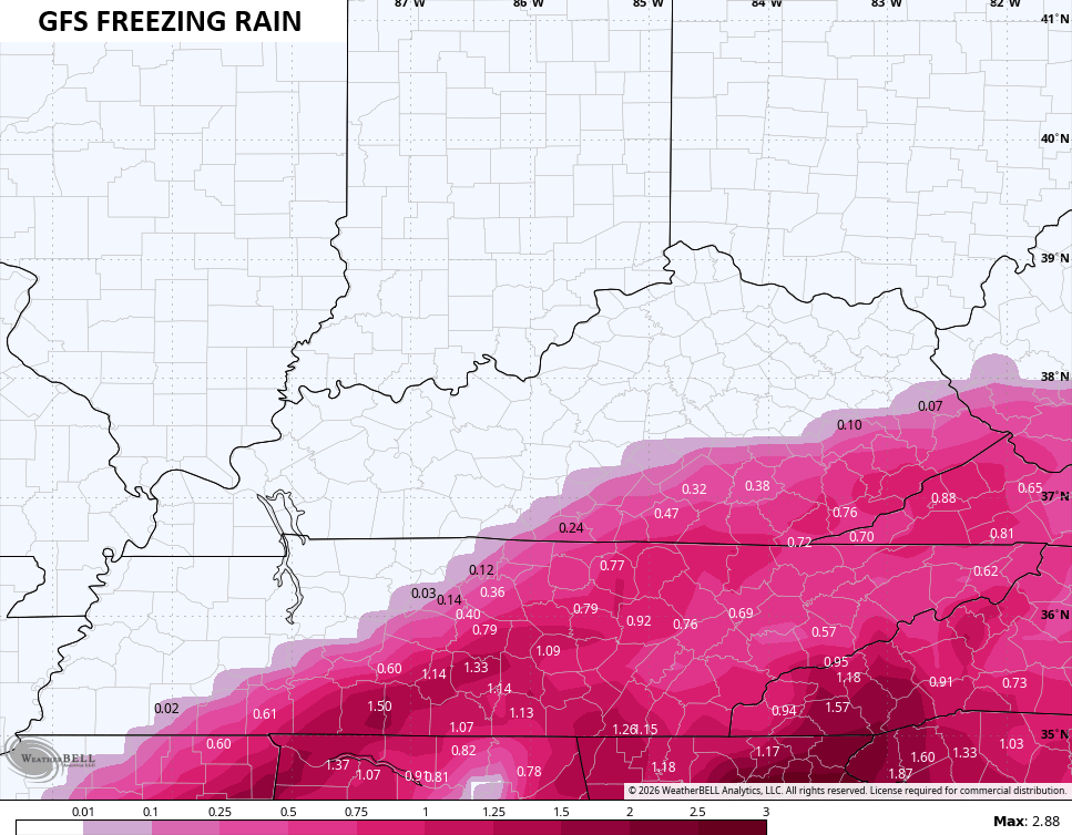
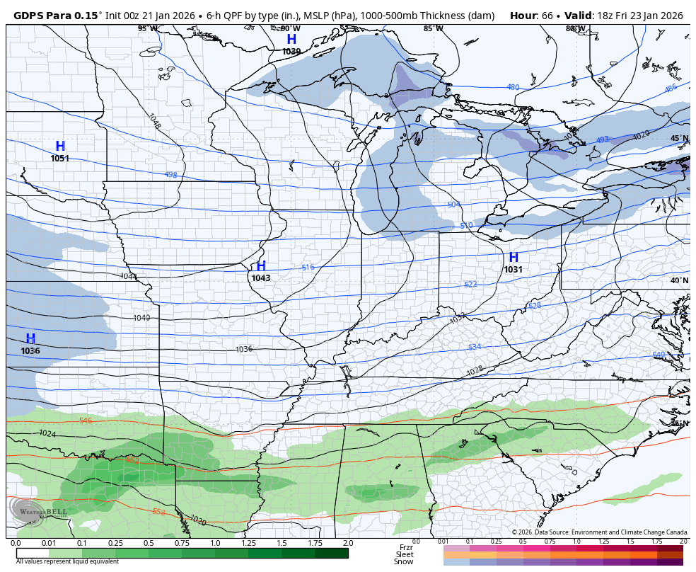
The latest GFS is just a flat out monster storm…
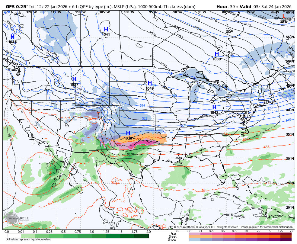
That is an insanely prolonged winter storm that would cause major, major issues as it’s loaded with moisture. That’s one of the most moisture laden winter storm systems I’ve ever seen on a forecast model
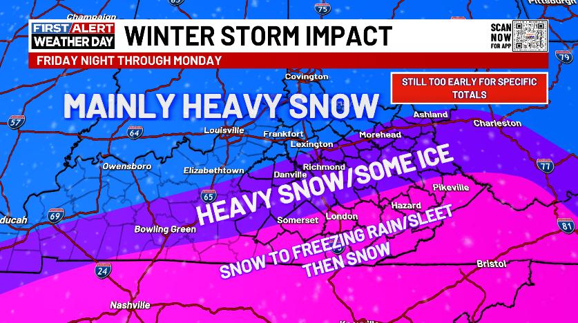
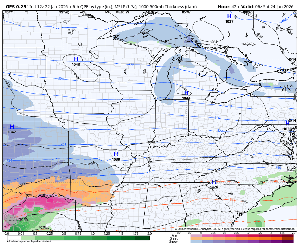
That shows with the snowfall forecast…
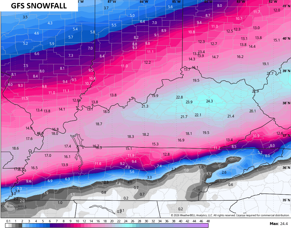
It cut down on the sleet potential and that’s why it has such massive snow totals…
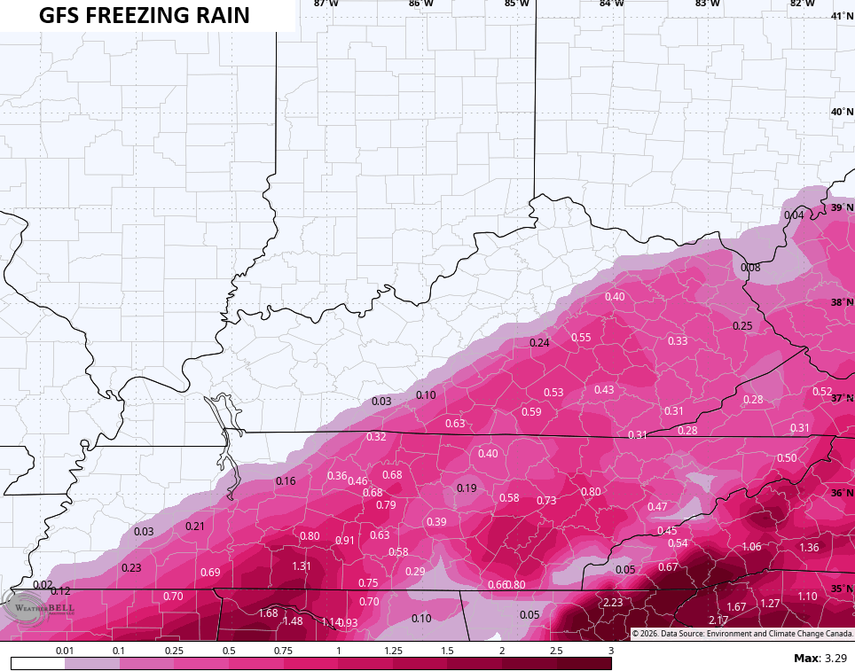
It is still putting down an ice storm across the southeast…
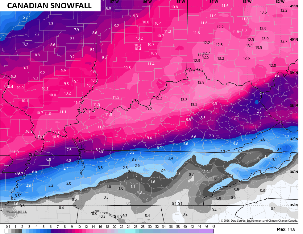
The Canadian Model isn’t as slow as the Canadian, but it’s massive…
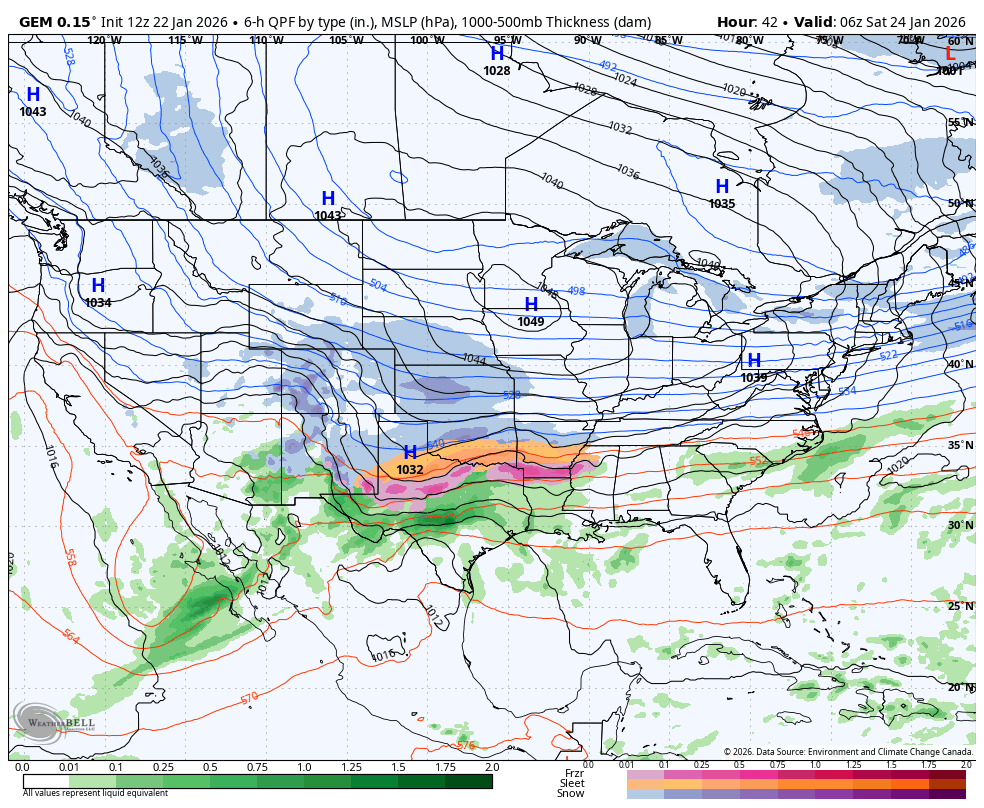
Here’s the Canadian Model snowfall…
The sleet is down a bit…
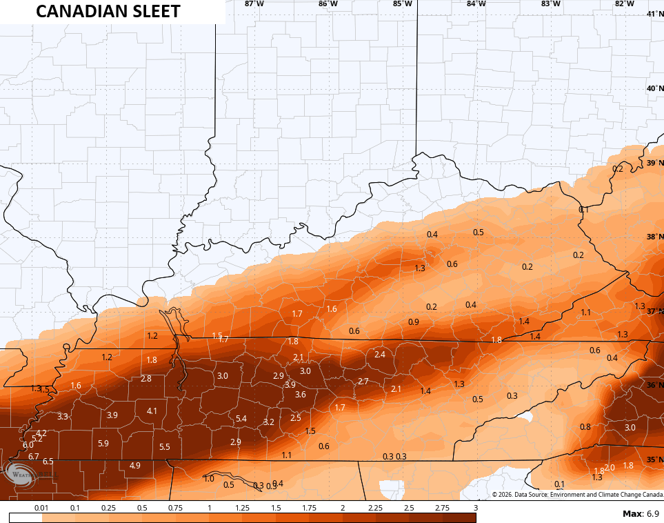
It continues with a big ice hit in the southeast…
Additional updates come your way later today and I’ll have the latest on WKYT-TV starting at 4pm. I’ll also have a few updates on my Meteorologist Chris Bailey Facebook Page
Until then, here are your tracking tools for the day…


Make it a great day and take care.

Wonder if it will be upgraded to a winter storm warning later on….
They just put winter storm warning out here in far western ky. Im sure the rest of state will get it before day is over
Wow, the predicted snowfall amounts for KY are crazy! Even the more conservative Canadian computer model shows much of the state getting at least a foot of snow.
Hope all you guys can stay safe this weekend!
Mike, Latest Predicted Snowfall Totals for Taylor, County 1 To 3. ” Ice Will Be A Problem, Maybe As Bad As The Ice Storm In January 2009. No Power for Months. All Snow Where I Grew Up In Indiana. I Wish I Never Moved Here. I Don’t Have A Generator For The Heat Pumps Either. Probably Will Freeze To Death.
Bring it on end the snow drought
First world problems
Chris’s first call for snow might just amaze some individuals. The amount of precipitation that this storm is pulling from the Gulf is more than I have ever seen. Let’s just hope no early phasing and the cold air wins out.
The Blizzard Of 1978, Had Tons Of Moisture To Work With. We Had 15 ” Of Snow ( No Ice ) In A Matter Of Hours. Winds Up To 50 mph, with Gust To 65 mph. We Didn’t Have A Power Outage Either. The Next Morning, The Temperature Was -5 Degrees, But Very beautiful Snow, with Clear Blue Skies.
Still No Clue, As To How This Storm May Play Out. The Snow Total Has Really Decrease In My Area. It went From 10 To 15 ” to 1 to 3 “( Ice Will Cut Down The Snow Total, And Take Out the Power. ) All I Can Get Out Of The Forecast Is The Temperatures Will Be Extremely Frigid. Maybe Below Zero ? It Really Has Been A Horrible, And Depressing Winter. Hoping the Groundhog Doesn’t See His Shadow On February 2nd. An Early Spring It Will Be.
I was 9 in Louisville and remember that storm very well.
Wherever you are stay safe and hopefully everyone stays ice free.